

Sagadahoc County
MEGenWeb

The Denver Post, Friday, 1 Dec 2000
By David Brown, The Washington Post
POPHAM BEACH, Maine - Occasionally when twins are born prematurely and under
difficult circumstances, one dies, the other lives, and it's never clear why. Chance
and circumstance seem to favor one. The other is lost, and its history remains
forever brief and mysterious.
Post-Elizabethan England gave birth to such
a set of twins - two American colonies - in 1607. One was named Jamestown. It
survived; its descendants are alive today. The other was named Popham. It was
abandoned, its remains were buried and forgotten.
You can read about
Jamestown, the famous colony in Virginia, in any American history textbook. Some
day, that may also be true of its lost twin, the Popham Colony, whose grave has
been found and is being meticulously unearthed in Maine.
The remnant of
the Popham Colony, on a bluff where the Kennebec River enters the Atlantic
Ocean, is one of the most important archaeological sites ever found in the
United States.
It is undisturbed, and consequently can tell its whole
story to researchers capable of reading its stained soil and broken artifacts.
Equally significant, it's a record of failure. Because the colony lasted only 13
months - August 1607 to September 1608 - the site is uncontaminated by the
material of long-term settlement. What remains is a time-capsule from the dawn
of English-speaking America.
Jamestown struggled through Indian attack,
attempted mutiny and starvation before becoming, after a dozen years, a
prosperous settlement of 5,000 people. Popham Colony suffered few of those
initial depredations, but fell victim to an unexpected twist of fate.
Its
first leader died. The man who succeeded him inherited the family title and
lands when his older brother died in England during the colony's first year.
When the heir heard the news, he returned home without delay, and the rest of
the settlers went with him.
Something other than the Popham Colony's mere
preservation makes the site so informative. It comes with a feature unique among
the first English settlements: a map.
Drawn seven weeks after arrival by
a man named John Hunt (who was probably a military cartographer), the map shows
a modified star fort fitted to a headland. It has a "scale of feet & Paces."
Each building is located, labeled and sketched in profile (or "elevation," in
architectural terms).
The Hunt map is the only record of what buildings
in early English colonies actually looked like. It provides an unprecedentged
visual picture of an era in American history whose only remnants are underground
and in pieces. But is it accurate? In this season's dig, the excavators found
the "footprint" of the house occupied by the colony's second-in-command. It's
the second structure located, and was exactly where the Hunt map said it would
be.
"I now believe it's a perfectly reliable guide to the archaeology of
the site," said Jeffrey P. Brain, the researcher in charge of the project. "It
is a document that every archaeologist would kill for."
The Hunt map
shows 18 buildings. How many were actually erected - and how many were wishful
thinking - is a question whose answer will be revealed with painful slowness as
the Popham Colony site is excavated over the next five years.
"It's a
no-brainer that this site is nationally significant. It's of just absolutely
supreme importance," said Robert Bradley, an archaeologist with the Maine
Historic Preservation Commission, which is funding the dig with a grant from the
U.S. Department of the Interior.
Apart from what it may add to the
history of colonial America, the Popham Colony site reveals a more general
truth: Much of America's European past is only now being found, 400 years after
the fact.
The Popham Colony's story begins with a charter from James I to
the Virginia Company, allowing it to settle the east coast of North America. The
company was divided into two ventures - the London Company, which had the rights
to the southern coast (roughly Cape Fear to the Potomac River), and the Plymouth
Company, which had the northern coast (Long Island to New Brunswick). Whichever
company established a successful colony in its own zone could then move to claim
the zone between.
The colony was named after its main financial backer,
Sir John Popham, the Lord Chief Justice of England. His nephew, George Popham,
was the leader and had the title "president." Second to him, named "admiral,"
was Raleigh Gilbert, a relative of the maritime adventurer Sir Walter Ralegh
(who spelled his name differently from many of his kinsmen and descendants).
About 100 colonists sailed from Plymouth, England, on May 31, 1607, aboard
two ships, Gift of God and Mary and John. They took formal possession of the
Kennebec River site on Aug. 19.
There followed a flurry of construction
of what the colonists called Fort St. George. They erected enough buildings to
store supplies and house the 45 people who stayed for the winter. The rest
returned to England on the two ships in October and December.
George
Popham died of unknown causes the following February, and Raleigh Gilbert
assumed command. A resupply ship in the spring found "all things in good
forwardness." The colonists had finished building a sailing ship, which they
named Virginia of Sagadahoc (Sagadahoc being the Indian name for the Kennebec).
They had traded for furs with the natives,and gathered sarsaparilla root for
sale back home as a medicinal.
In the fall, however, a ship brought news
that Raleigh Gilbert's brother John, who had no children, had died. Raleigh was
John's heir, and it didn't take the admiral long to calculate where his best
prospects lay. He folded the colony's tent and everyone headed home.
The
Popham Colony became a footnote in history, although it was never entirely
forgotten.
In the early 1990s, Brain, an archaeologist with the Peabody
Essex Museum in Salem, Mass., learned of the site while vacationing nearby. He
had spent most of his career at Harvard and done most of his digging at Indian
sites in the Mississippi Valley. Like most Americans, he knew nothing of the
Popham Colony. But after a little research, he became convinced it deserved
another, closer look.
In 1994, he and some assistants dug for several
weeks, finally coming across a few artifacts from the 1600s and a single "post
mold" - the pulverized, underground end of a wooden post. Brain thought it might
be a remnant of the storehouse, the fort's largest structure, but further
digging that season failed to find another post mold, so he wasn't certain.
Because of funding problems, excavation didn't resume until 1997. By then,
Brain had made a crucial deduction. To best fit the site's topography, the Hunt
map needed to be rotated 20 degrees to the east of magnetic north. Brain
theorized the single post mold he'd found might be one of the nine on each side
of the storehouse as depicted on Hunt's map.
When he returned to the
field, he drew a line through the post mold in the proper orientation and began
to dig. Soon, the excavators found five more, right where the map said they'd
be.
"It was probably the most exciting moment I've had in archaeology,"
Brain said of unearthing the first predicted one. "To be able to have a
hypothesis and confirm it so precisely. It was a eureka moment."
Since
then, the team has found more than a thousand artifacts. Shards of North Devon
ceramic from England and salt-glazed Bellarmine stoneware from Germany. Pieces
of bottle glass. Fragments of plate armor. Buttons. The most unusual item is a
caulking iron, which looks like a small hatchet head and is used for sealing the
joints in ship hulls.
Popham Beach, one of the finest and longest sandy beaches in Maine, is
located at the tip of the Phippsburg peninsula near Bath, and, for most of us
born and raised in the area, Popham Beach means three miles of beautiful sandy
beach for great swimming; natural rock outcroppings and tidal pools for
interesting explorations; and an old, crumbling fort on the banks of the
Kennebec River. For others, Popham Beach means archaeological history, a
settlement colony, and military fortifications.
Popham Beach is known to
history buffs as the location of the first colony in America, established in
1607, 13 years before the Pilgrims landed at Plymouth, making it the site of the
earliest English colony in New England. The peninsula on the eastern side of the
southern part, that bears on its northeastern point the lofty granite walls of
Fort Popham, still bears the marks of its occupancy by Popham's colony in 1607.
Popham Beach is also home to three historical forts:
Fort St. George (or
Fort Sagadahoc) (1607 - 1608), a British fort from 1744, a Patriot fort from
1775, and an American Battery on Hunnewell's Point (1808 - 1814), is a six-gun
work with a brick magazine and barracks. The earliest of the three forts, it is
currently providing archeologists a multitude of knowledge regarding this first
settlement, often referred to as "Jamestown's Lost Twin" or "The Lost Colony."
Fort Popham (1861-1918) (State Historic Site),
dominates the tip of Hunnewell Point and is an ante bellum, unfinished stone
fort guarding the entrance to the Kennebec River. Construction of Fort Popham,
built during the Civil War in 1860 and never finished, was abandoned in 1869. An
unnamed battery (1899 - 1910) protecting an underwater minefield has been
located here. Fort Popham is located two miles further down Route 209 through
the village of Popham Beach. It sits on the banks of the Kennebec River where it
broadens into Atkins Bay, and offers views of Georgetown across the river.
Fort Baldwin (1905-1928) represents an earlier coast defense of the Kennebec
River, built during World War I as an observatory used to spot periscopes of
enemy submarines, it sits atop nearby Sabino Hill. Also located at Sabino Head
were Battery Hardman (1908 - 1917), Battery Hawley (1908 - 1924), Battery Cogan
(1908 - 1924), and an unnamed battery of four 155mm guns from WWII (two on
Battery Hawley and two next to Battery Hawley) Observation towers were built
here and at Small Point for World War II and were used for Battery 102/Steele on
Peaks Island. The tower at Small Point still exists.
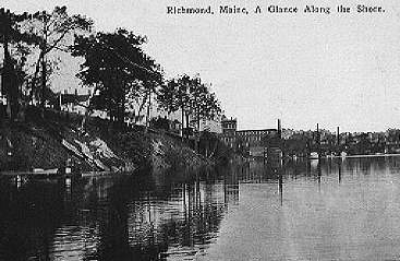
A Glance Along the Shore
Pre-1915
Submitted by Maynard Dixon
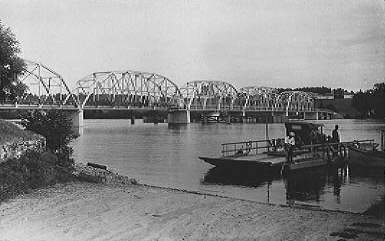
Maine Kennebec Bridge
The bridge connecting Dresden and Richmond.
Also shown is the ferry that was the old method of crossing the river.
Submitted by Maynard Dixon
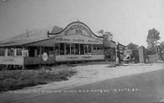
Checkered Inn
A dine & dance place back in the 1930-40s, located on Rte 201.
The Checkered Inn was known for their steaks, chops, salads and chicken dinners.
You could also fill up with gas and Socony Motor Oil.
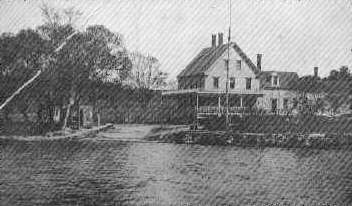
Densmore House
Early 1900s photo.
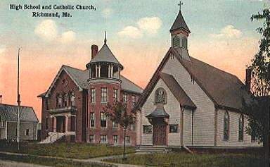
High School and Catholic Church
The high school (on the left) was in use from 1910 to 1928 when it burned down.
Submitted by Maynard Dixon
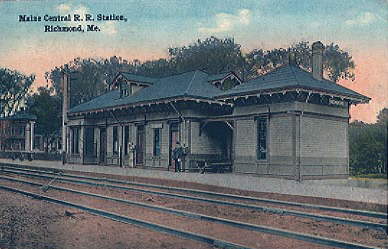
Maine Central Rail Road Station
Pre-1915.
Submitted by Maynard Dixon
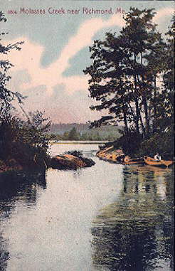
Molasses Creek
Submitted by Maynard Dixon
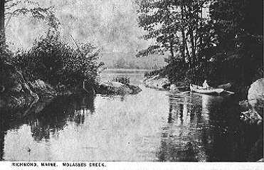
Molasses Creek
Submitted by Maynard Dixon
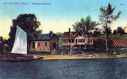
Richmond Ferry
This is the landing of the old “Parks’ Ferry”, later called the Richmond-Dresden Ferry.
Submitted by Maynard Dixon
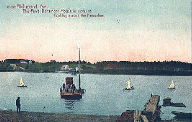
Richmond Ferry 2
Densmore House in the distance looking across the Kennebec.
Submitted by Maynard Dixon
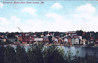
Richmond From Swan Island
Submitted by Maynard Dixon
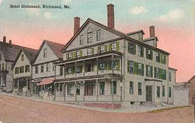
Hotel Richmond
Published by Wm. Slom of Richmond. The sign on the right-hand side says
“Star Theater Moving Pictures”
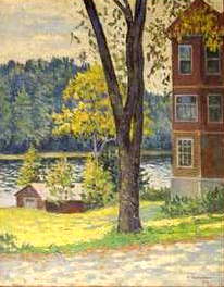
Richmond Oil Painting
By Nancy ?? (Russian)
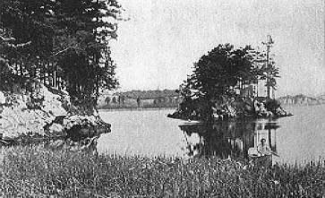
Spaulding’s Island
Submitted by Maynard Dixon
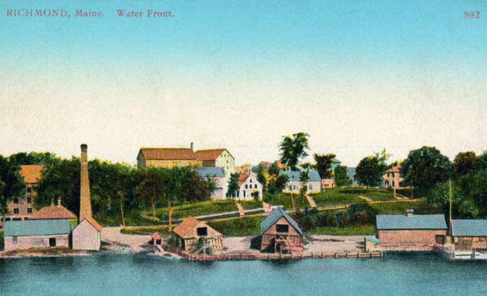
Water Front
Early 1900s photo
Copyright © 1996- The USGenWeb® Project, MEGenWeb, Sagadahoc County

This page was last updated
07/12/2026