
History
Native Americans
The Sevier complex or variant of the Fremont culture encompassed Juab County and extended roughly east of Garrison, Nevada, to Ephraim and the Wasatch Plateau and Mountains, and from Garrison and Kanosh on the south to Grantsville and Tooele on the north.
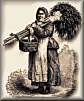
The Western Numic (Goshute) peoples either displaced or absorbed the preexisting Fremont culture and became the dominant group in the area by 1,000 A.D. Whether speaking individually or collectively, the Goshutes refer to each other as Newe (the People), and they consider themselves connected to an ancient common ancestry.
Through the centuries the Goshute developed a culture that adapted and thrived in the desert. They constructed wickiups or brush shelters; gathered seasonal seeds, pine nuts, grasses, and roots; collected insects, larvae, and small reptiles; and hunted antelope, deer, rabbits and other small mammals. They stored nuts and dried meats to survive the winter months.
In 1855 settlements at Tooele, Grantsville, and Ibapah, as well as the Overland Stage and Pony Express stations at various locations in the Goshute territory, caused computation for the few resources in the fragile desert environment. This computation then lead to the Goshute responding by attacking the stations and farms and killing the inhabitants and livestock. The U. S. army, and locals, forced the Goshutes, after killing many, to sign the treaty of 1863.
The treaty was signed on 13 October 1863. Signing for the Goshutes were Tabby, Adaseim, Tintsa-pa-gin, and Harry-nup, while James Duane Doty, Indian Commissioner, and Brigadier-General Patrick E. Connor signed for the United States. The treaty was ratified in 1864 and announced by President Lincoln on 17 January 1865.1
Between 1864 and 1912 the U.S. undertook efforts to remove the Goshutes to the Uintah Basin, Idaho, Nevada, and Oklahoma, but when these attempts failed, the Goshutes received reservation land in their native Utah.
The Skull Valley Reservation was created in 1912,The Skull Valley Band of Goshute is located on a reservation of 17,920 acres in east-central Tooele County, at Skull Valley, Utah. Tribal membership is 127. The Confederated Tribes of the Goshute Reservation is located approximately seventy miles southeast of Wendover, Utah/Nevada, at the base of the Deep Creek Mountains. the Deep Creek Reservation was formed in 1914, and tribal membership is 409. The reservation covers approximately 112,870 acres in White Pine County, Nevada, and Juab and Tooele counties, Utah.
European Settlement
On 27th2 September 1776 the Dominguez-Escalante expedition crossed the county at the eastern end, from north to south, passing through Mona, and near present Nephi. Jedediah S. Smith traversed the western end of the county in 1826 and via Fish Springs in 1827. In 1843-44 John C. Fremont journeyed through the county's eastern end on his way north. Government explorers John W. Gunnison and J. H. Simpson traveled in the area in 1853 and 1859 respectively. Gunnison visited the southeast portion of the county while Simpson located the route later used by the Pony Express and transcontinental telegraph.
The first settlement in Juab Valley occurred in 1851 when a group of Mormon settlers arrived near Salt Creek to live by farming. This settlement became present-day Nephi.
In 1852 the legislative assembly created Juab County, which extended as a narrow strip to what was then the western boundary of Utah Territory (now the western boundary of Nevada). Juab County, Utah was created on the 3rd of March 1853 as an original county from Utah Territory. The western portion was reduced in 1854 and 1856 to form counties in Nevada, and several other changes in Juab's borders have been made over the years.
Cities and Towns:
- Callao (4,390 ft)
- Goshute (6,150 ft)
- Eureka (6,442 ft),city Incorporated Area
- Levan (5,350 ft),town Incorporated Area
- Mona,city Incorporated Area
- Nephi ,(County Seat) city Incorporated Area
- Rocky Ridge, town Incorporated Area
Ghost Towns
Ghosttowns.com- Diamond
- Fitch
- Jericho
- Knightsville
- Mammoth
- Mills
- Silver City (6,200 ft)
In 1869 prospectors discovered precious metals in the Tintic region. The finds changed the economic and industrial destiny of Juab County. The towns of Diamond, Silver City, Mammoth, and especially Eureka became the main areas of the Tintic Mining District. By 1899, Tintic had become one of country's most important mining districts.
Sources:
- Utah History Encyclopedia
- A HISTORY OF Juab County, Pearl D. Wilson, 1999
Utah State Historical Society,Juab County Commission
Last Modified & links checked .
