

Mecklenburg County
VAGenWeb

 Hudson's Mill (demolished), Meherrin River, above Dix's Bridge, county
road #621 [Section 8 of 1870 Map, marked "Hutson's Mill" at upper right corner]
36° 46' 54"N, 78° 03' 01"W (NAD27)
Forksville quad
Hudson's Mill (demolished), Meherrin River, above Dix's Bridge, county
road #621 [Section 8 of 1870 Map, marked "Hutson's Mill" at upper right corner]
36° 46' 54"N, 78° 03' 01"W (NAD27)
Forksville quad
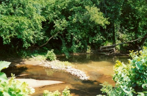
Hudson's Mill dam was situated on the Meherrin River a few yards upstream from the mouth of Stony Creek, near the Brunswick County line. Gilmer's 1864 maps (Mecklenburg/Lunenburg) incorrectly label the site Hutson's Mill. Records show that in 1865 John P. Hudson, presumably the mill's owner, applied for an exemption from military service. The dam for the mill is seldom seen except at extreme low-water conditions, as in the summer of 2002 when this photograph was made.
Contributed by June Banks Evans
Source: Life by the Roaring Roanoke, Susan Bracey, 1977, p.289
Copyright © 1996 - The USGenWeb® Project, VAGenWeb, Mecklenburg County

This page was last updated
07/23/2026