Return to the VAGenWeb Project Charlotte CountyHome Page

JoLee Gregory Spears

This page was updated April 20, 2008

Return to the main J. F. Gilmer Confederate Map

Use your broswer's "back" button to return to the previous page

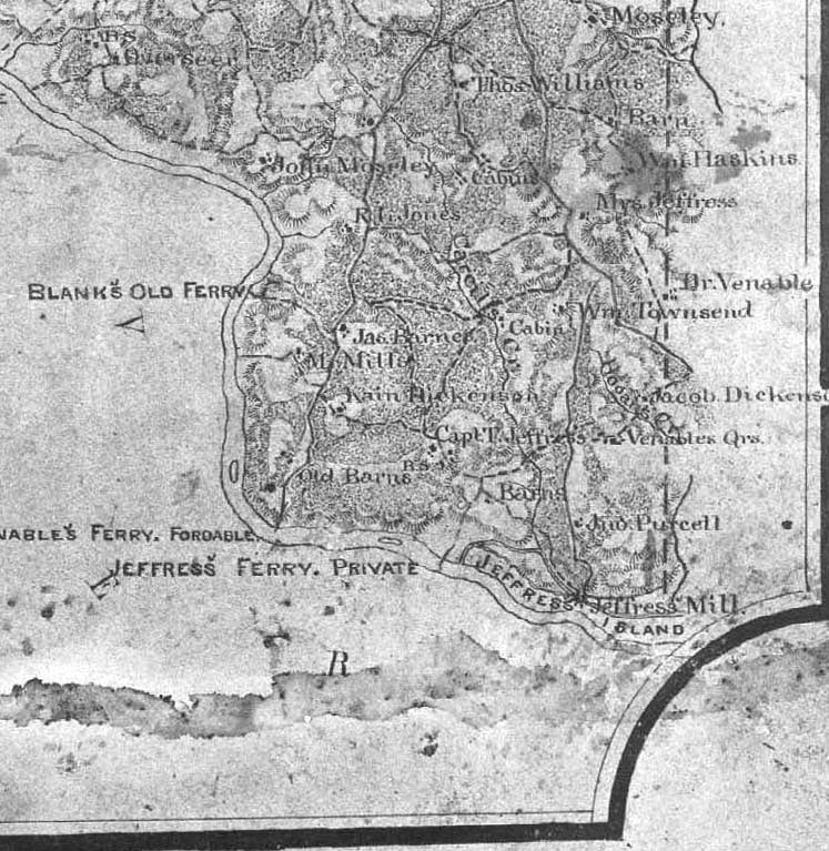
J. F. Gilmer Confederate Map Charlotte County
Courtesy of the Virginia Historical Society

Section Twenty-five
(Click on arrows for adjoining sections)

Index of Names in Section Twenty-five

  • Corrections and additions to Index of Names needed
  • If you know of present-day exact locations of any of the homesites, please let JoLee Spears know.
  • Report to me any broken links.
— JoLee

Index of Section 25
B.S. 25
Barn 25 Barnes, Jas. 25 Barns 25 Blank's Old Ferry 24,25 Cabin 25 Cabins 25 Cargill's Cr 25 Dickens, Jacob 25 Dickenson, Kain 25 Haskins, Wm? 25 Hogan's Cr 25 Jeffress, Capt. T. 25 Jeffress, Mrs. 25 36°44'34"N,78°38'03"W id'd by Dallas Tohill Jeffress' Ferr. Private 25 Jeffress Island 25 Jeffress' Mill 25 Jones, R? 25 Mills, Mr. 25 Moseley 25 Moseley, John 25 Old Barns 25 Overseer 25 Purcell, Jno 25 Roanoke Riv 12,13,16,17,18,19,24,25 Townsend, Wm. 25 Venable, Dr. 25 Venable's Ferry. Fordable 24,25 Venables Qrs. 25 Williams, Thos. 25

Updated April 20, 2008