
Return to the Charlotte Co., VA Home Page
(This page was last updated
)
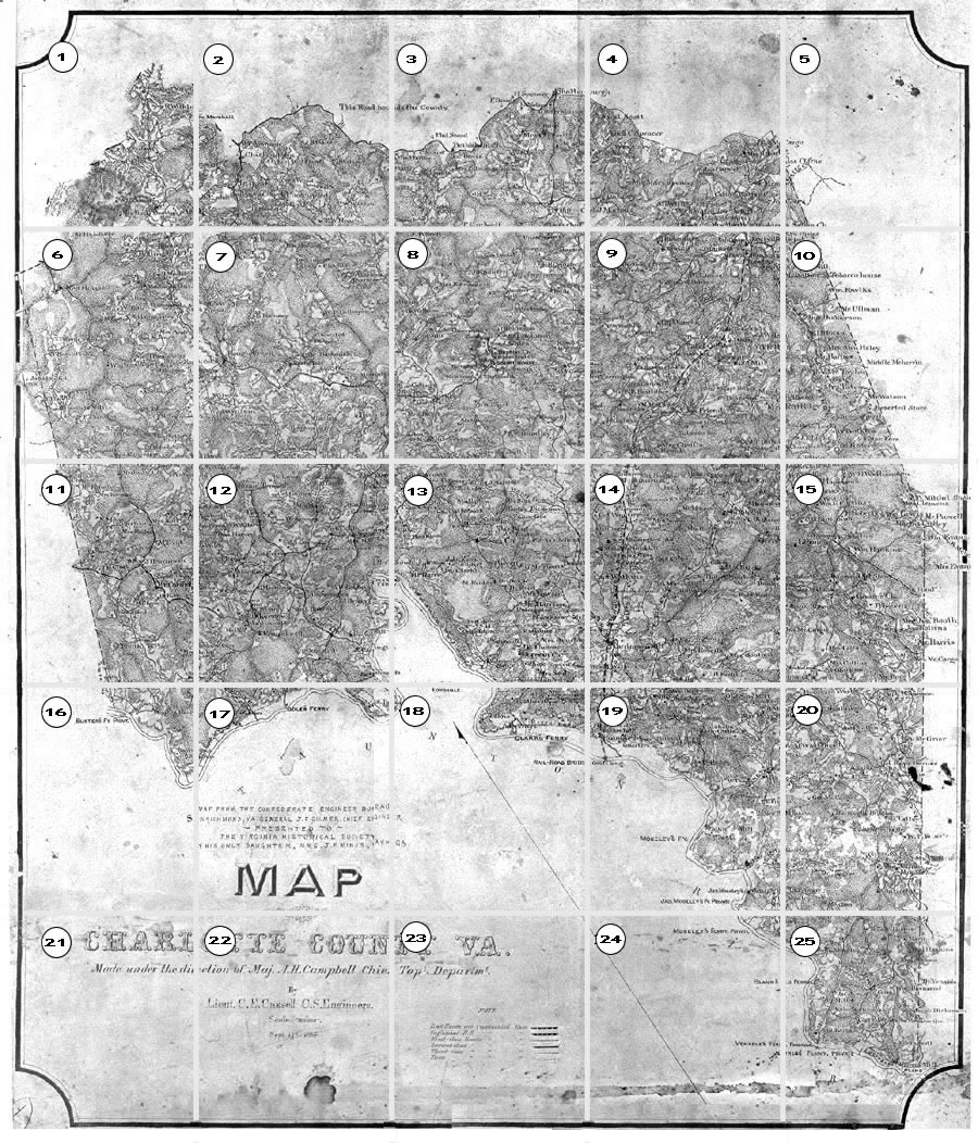
1864 J. F. Gilmer Map of Charlotte Co., VA
| The Virginia Historical Society,
owner of the 1864 J. F. Gilmer Map of Charlotte County, has consented
for the map to be used at the VAGenWeb Project Charlotte County web site. The
Charlotte map and other Civil War maps are available at the Virginia
Historical Society Museum Shop. Click here to see more of the Virginia Historical Society's Collections. Links to interesting articles: Confederate Mapping |
Related links:
|
See Section 8 for Charlotte Court House
Indices of Features below
| Bridges & Ferries | Churches | Mills | Populated Places & P.O.'s |
Roads | Stores & Businesses | Streams | Misc. Other |
Corrections and additions welcomed — JoLee Gregory Spears