This is a Dawson County NEGenWeb Project web page
and is presented as part of the
MARDOS Memorial Library Collection.
|
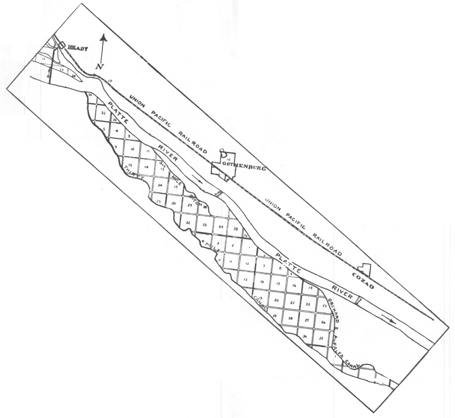
The Thirty Mile Canal leaves the south bank of the Platte River at a point about ten miles west of Gothenburg and flows southeast a distance of thirty-three miles, waste waters returning to the Platte ten miles east of Cozad. The tract varies in width from two to four miles. 15,000 acres have water rights under the canal and the canal was built of sufficient capacity to water 10,000 additional acres. |
ProgramDedication of The Thirty Mile Canal - July 13th, 1928Music -- By the combined Gothenburg and Cozad High School Bands and the Union Pacific Shop Band of North Platte, Neb. R. F. WILLIS, Chief of the Bureau of Irrigation and Drainage, State of Nebraska. F. W. ROBINSON, Vice-President of the Union Pacific Railroad System. Ex.-Gov. SAMUEL R. MCKELVIE, Owner and Publisher of the Nebraska Farmer. Dr. GEORGE E. CONDRA, Director of Soil Survey, President of American Soil Survey Ass'n, President of National Conservation Congress, Member of Federal Irrigation Board -- Dedication Speech. Dr. A. F. WOODS, Director Scientific Research U. S. Department of Agriculture, Ex-Pres. of the University of Maryland -- representing Secretary of Agriculture W. M. Jardine. |
| Back | Title Page | Next |
| Home | Queries | Resources | History | Search |