

Aroostook County
MEGenWeb

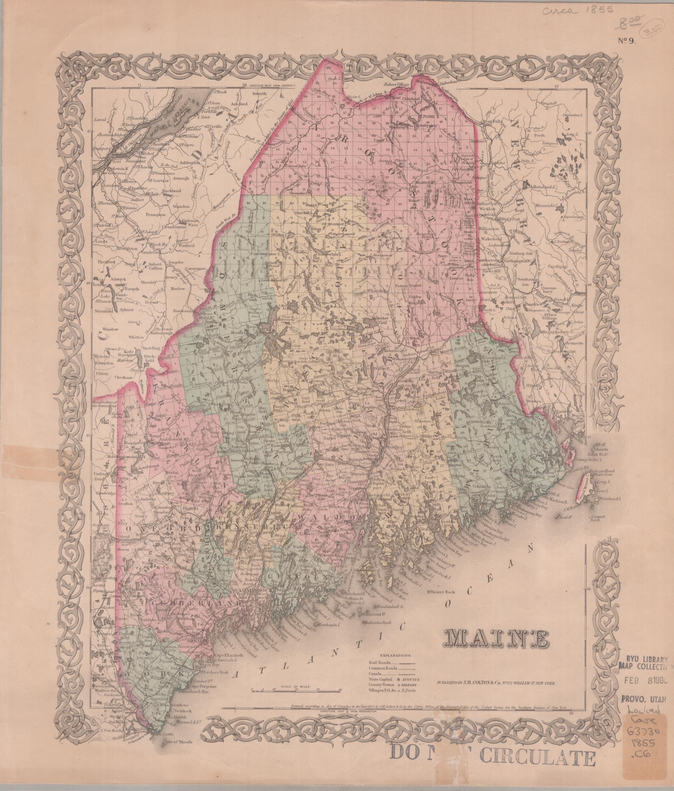
1855
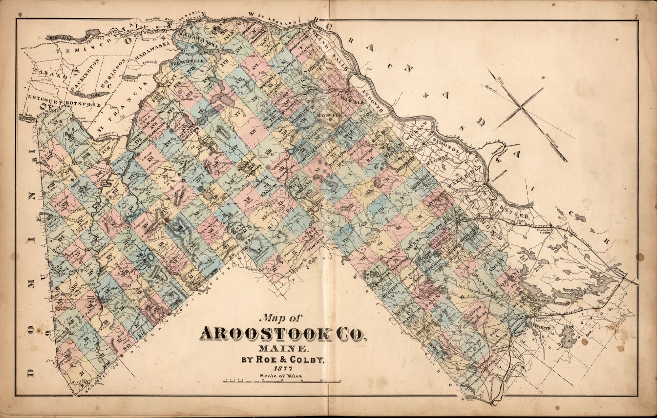
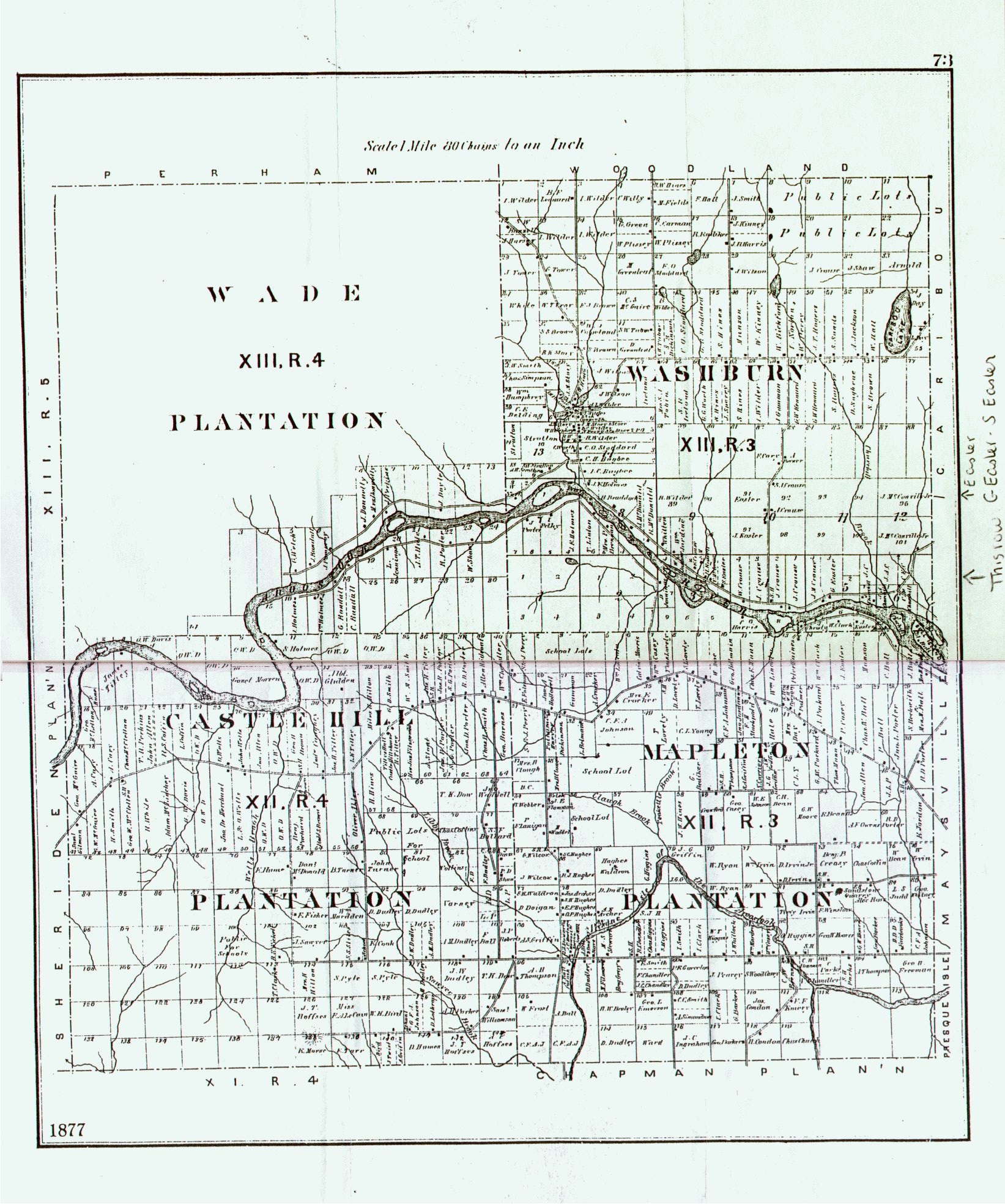
1877
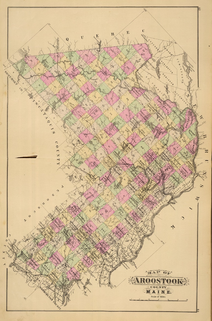
1885
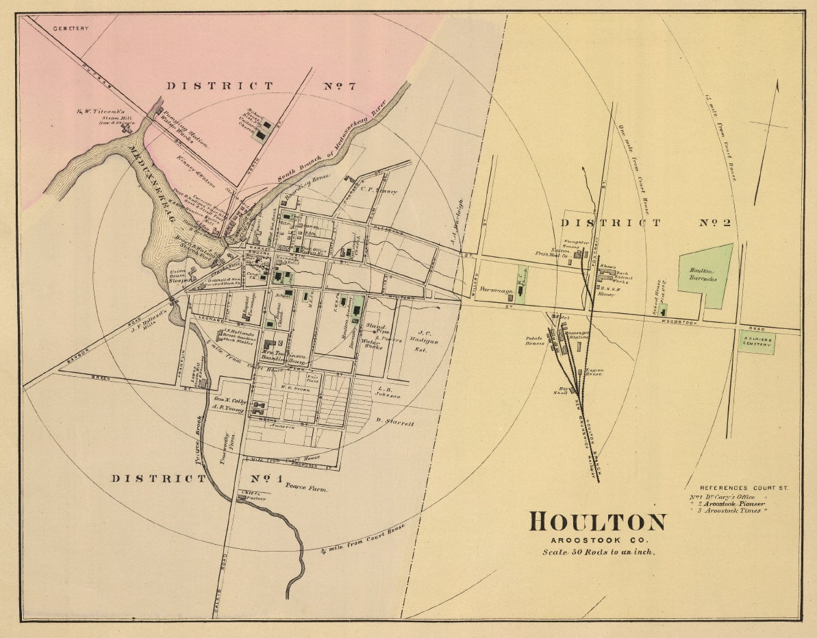
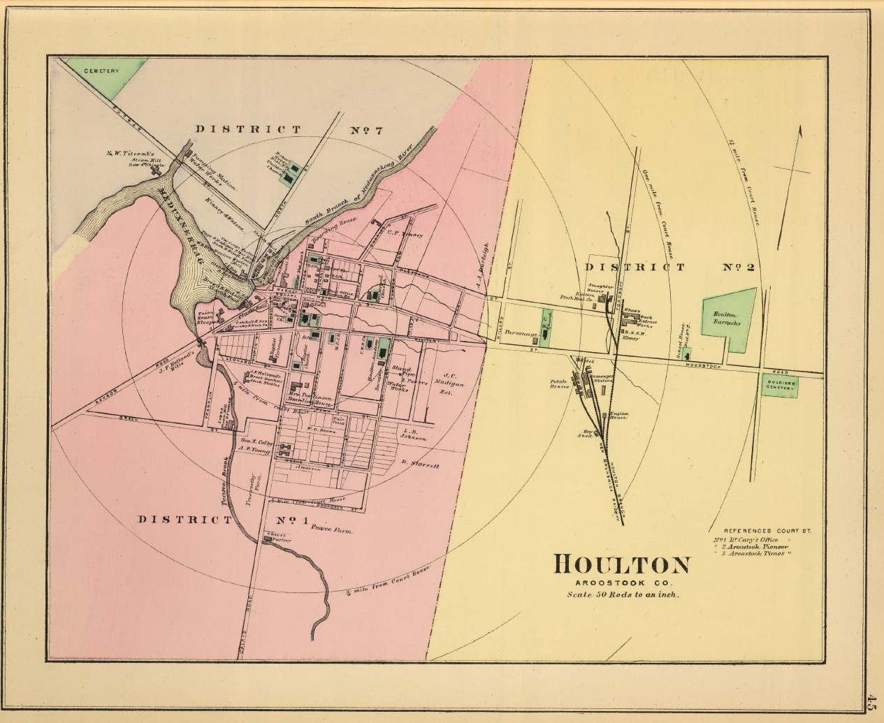
1885 Houlton
1894 Houlton
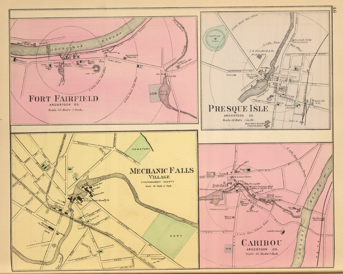
1894 Fort Fairfield, Presque Isle, Mechanic Falls, Caribou
1895
1903
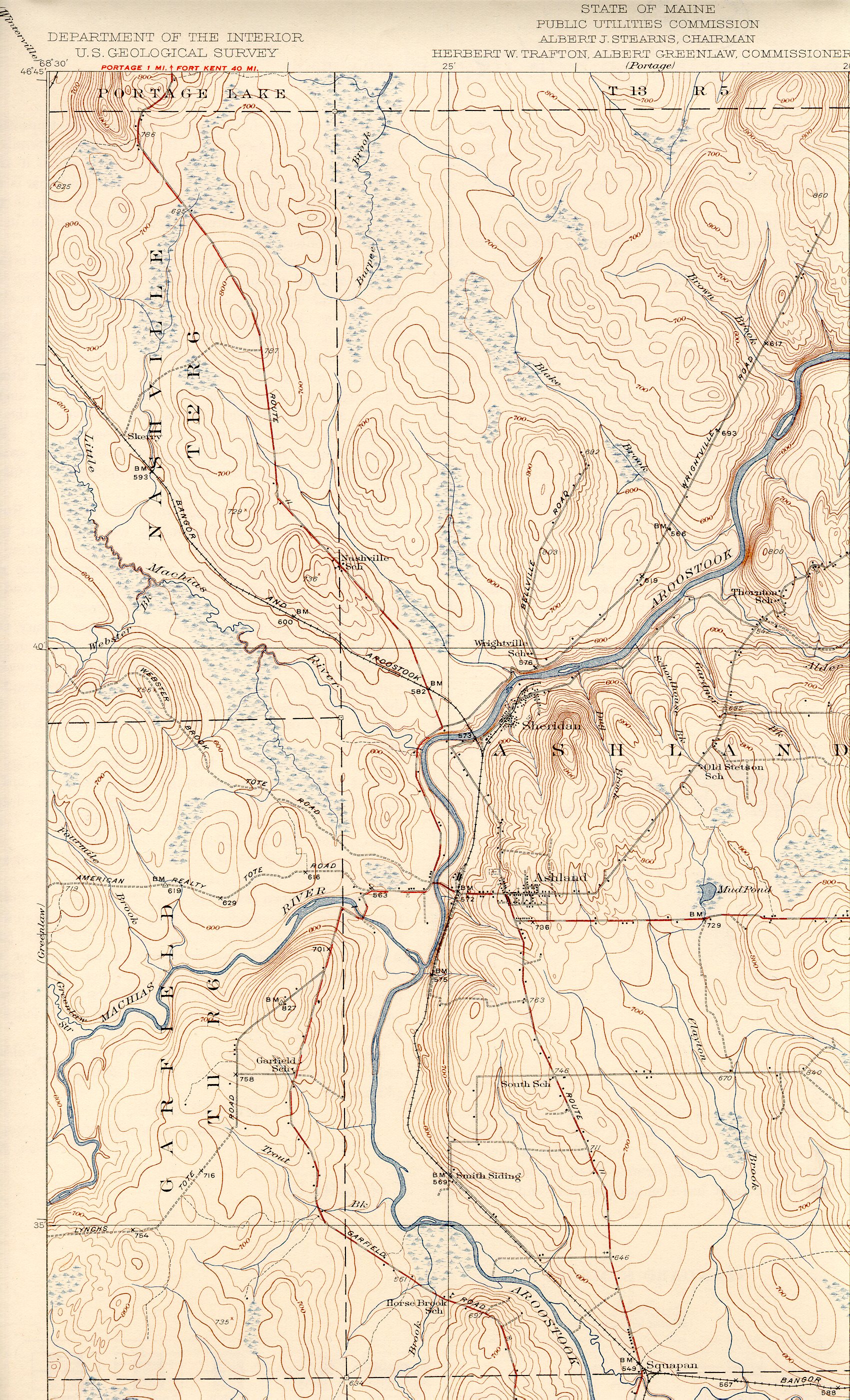
1934 Ashland northwest
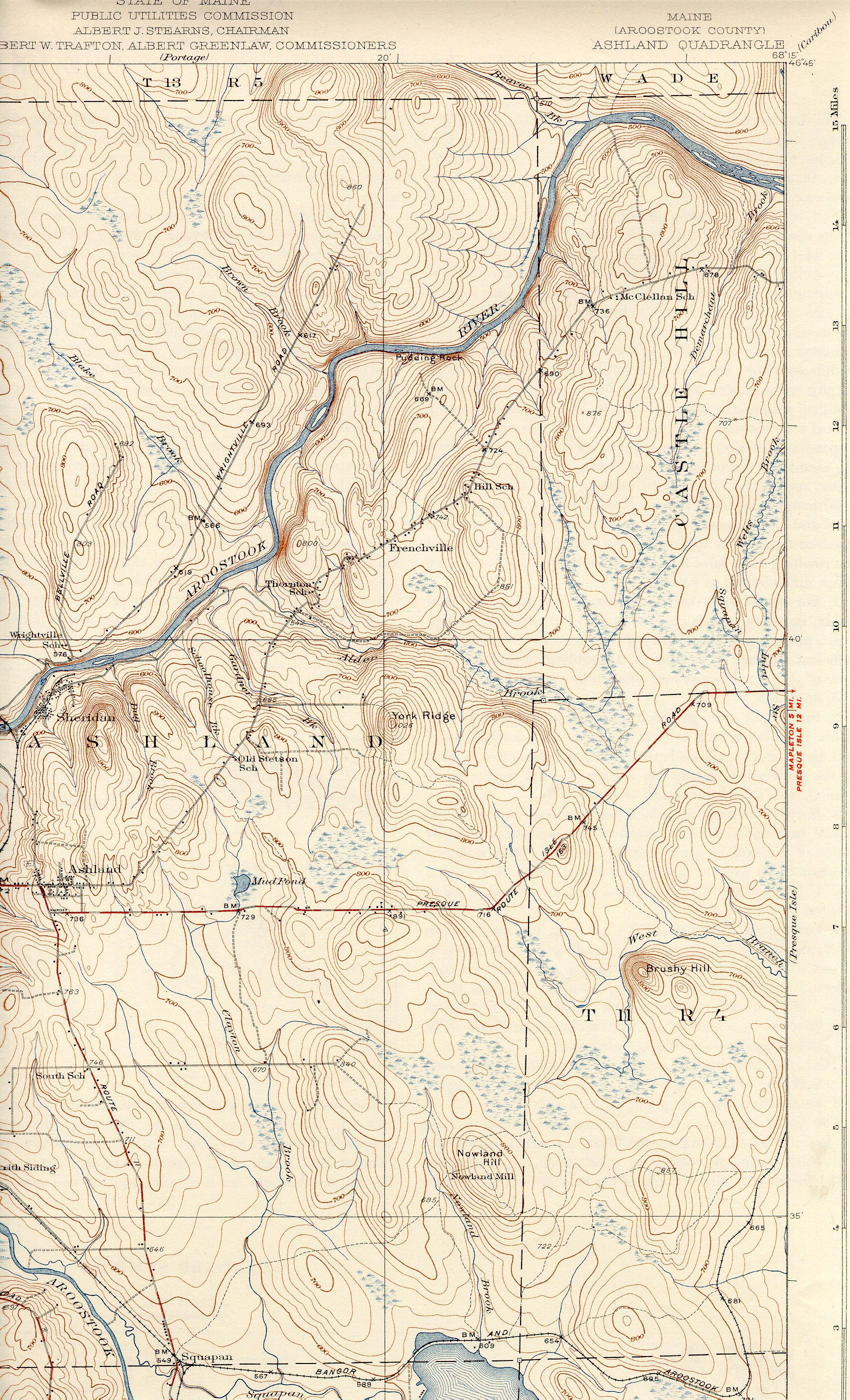
1934 Ashland northeast
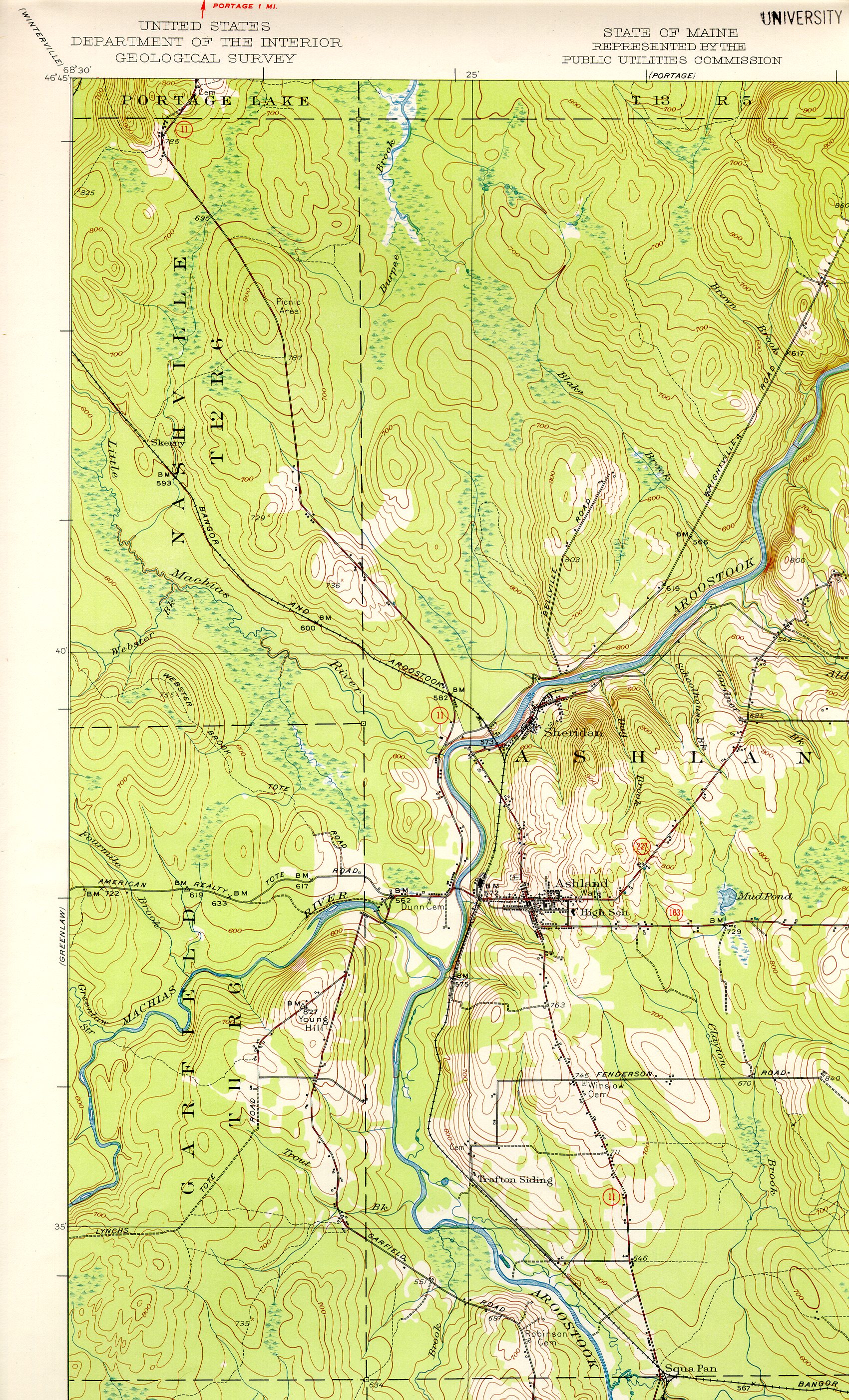
1953 Ashland northwest
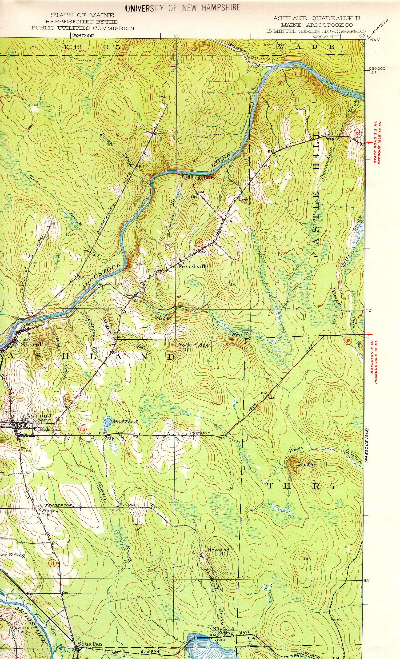
1953 Ashland northeast
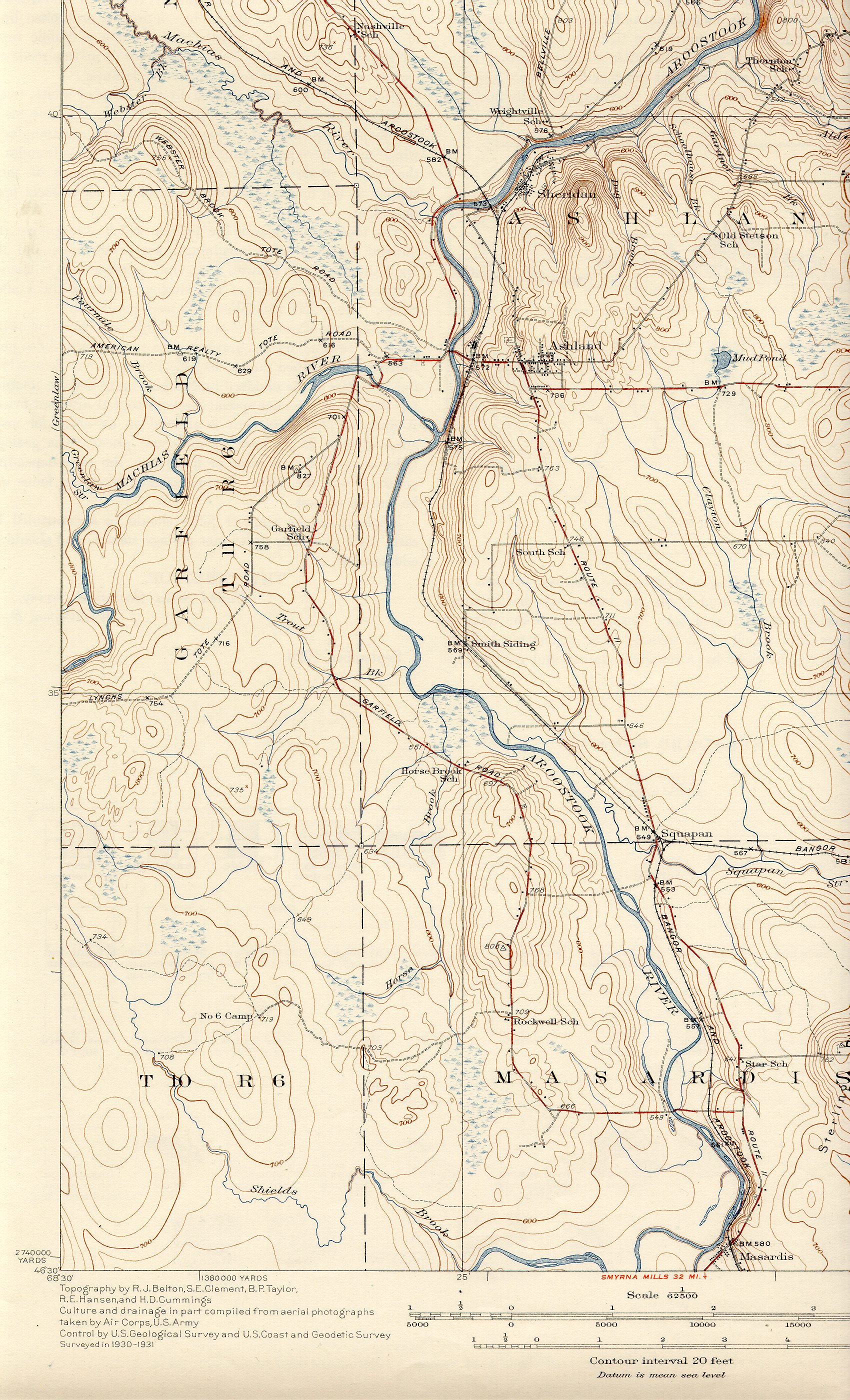
1934 Ashland southwest
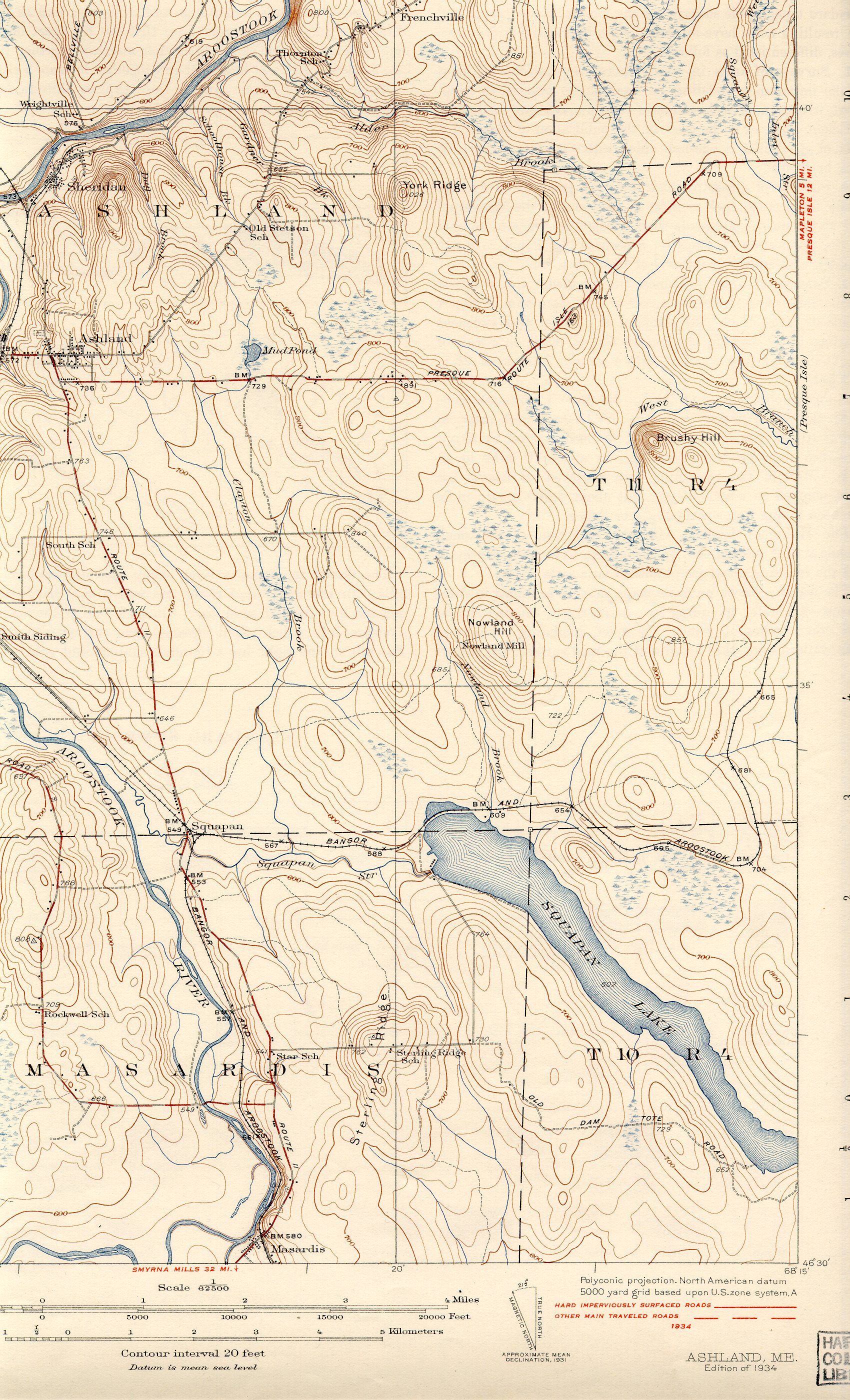
1934 Ashland southeast
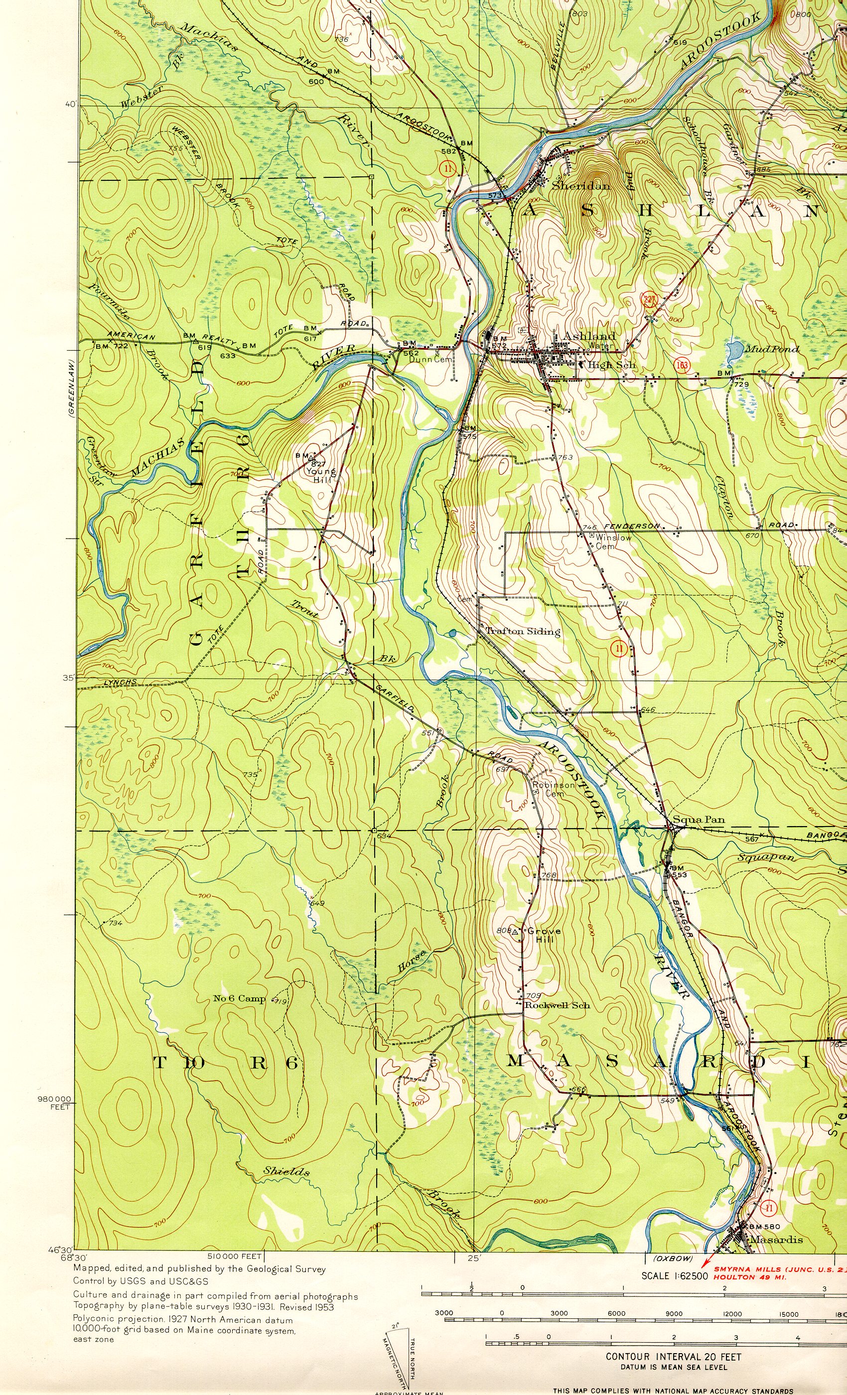
1953 Ashland southwest
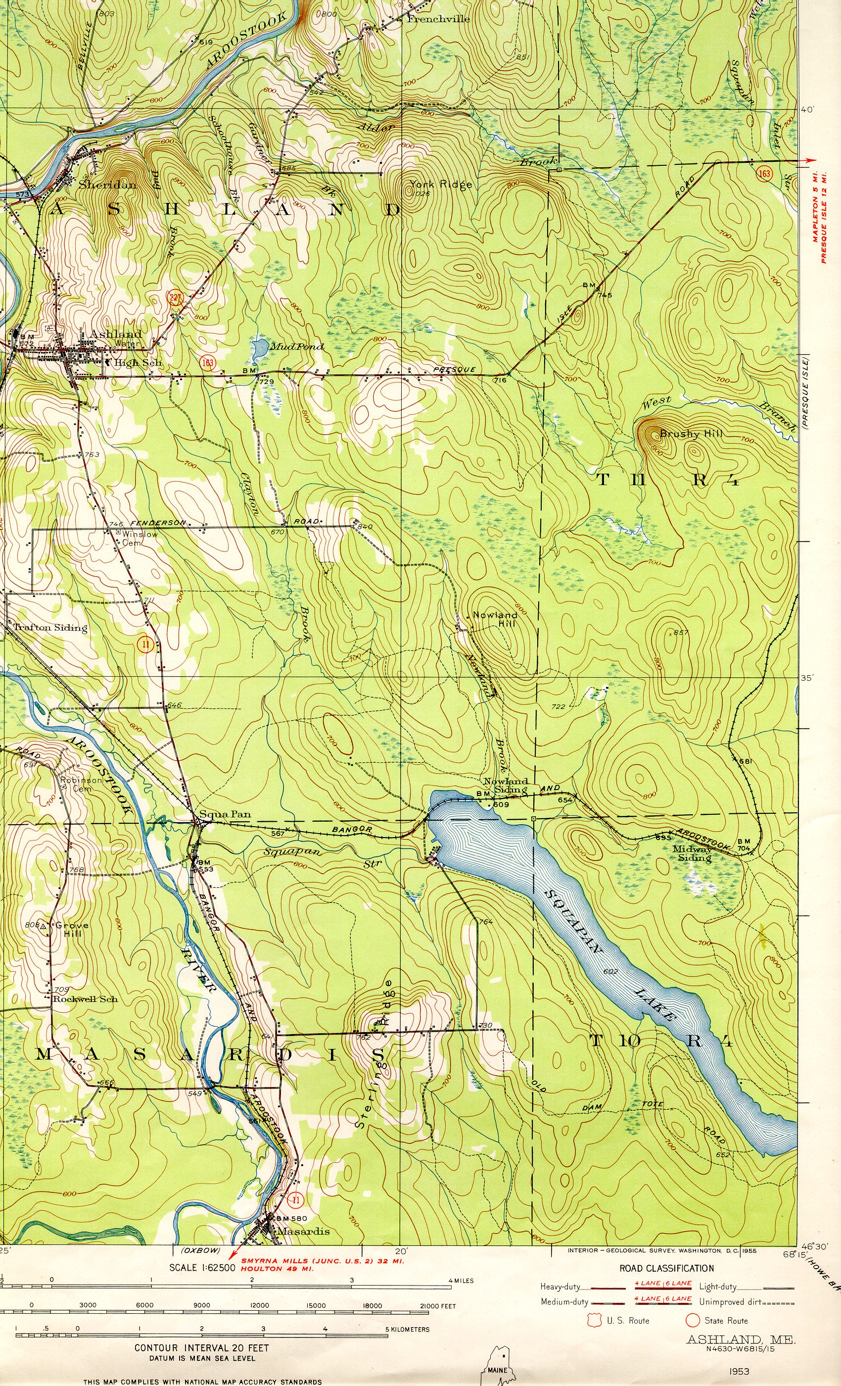
1953 Ashland southeast
Towns in the Ashland Quadrangles: Ashland, Castle Hill, Garfield, Masardis, Nashville, Portage Lake, and Wade.
Caribou and Presque Isle are Aroostook County's only cities.
Allagash, aka Moosetown, unique Irish/Scotch culture imbedded in the French dominated St. John Valley
Amity
Ashland
Blaine
Bridgewater
Castle Hill
Caswell
Chapman
Crystal
Dyer Brook
Eagle Lake
Easton
Fort Fairfield
Fort Kent
Frenchville
Grand Isle
Hamlin
Hammond
Haynesville
Hersey
Hodgdon
Houlton (county seat)
Island Falls
Limestone
Linneus
Littleton
Ludlow
Madawaska
Mapleton
Mars Hill
Masardis
Merrill
Monticello
New Canada
New Limerick
New Sweden
Oakfield
Orient
Perham
Portage Lake
Saint Agatha
Saint Francis
Sherman
Smyrna
Stockholm
Van Buren
Wade
Wallagrass
Washburn
Westfield
Westmanland
Weston
Woodland
Castle Hill Plantation
Chapman Plantation
Cyr Plantation
Garfield Plantation
Glenwood Plantation
Macwahoc Plantation
Mapleton Plantation
Moro Plantation
Nashville Plantation
Reed Plantation
Saint John Plantation
Wade Plantation
Washburn Plantation
Winterville Plantation
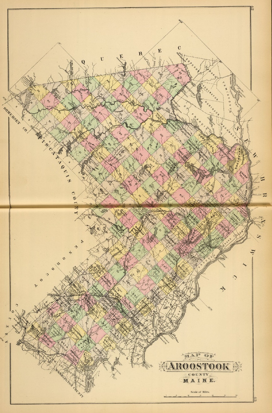
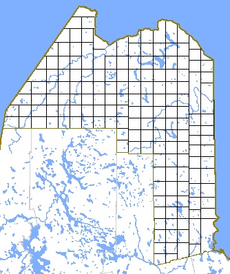 Aroostook county is laid out in a grid-like fashion. Ranges run north and south,
and are numbered westward from the eastern border of the state (up to range 17).
Each range is made up of townships, which are numbered from south to north
(up to township 20, although, because of the irregularity of the shape of Aroostook
county, not all ranges contain 20 townships). The township numbers for the ranges in
Aroostook county are:
Aroostook county is laid out in a grid-like fashion. Ranges run north and south,
and are numbered westward from the eastern border of the state (up to range 17).
Each range is made up of townships, which are numbered from south to north
(up to township 20, although, because of the irregularity of the shape of Aroostook
county, not all ranges contain 20 townships). The township numbers for the ranges in
Aroostook county are:
Ranges 1-2: Townships are not numbered (see below)
Ranges 3-5: Townships 1-18
Ranges 6-7: Townships 9-18
Range 8: Townships 9-17
Range 9: Townships 11-17
Range 10: Townships 11-18
Range 11: Townships 11-20
Range 12: Townships 11-19
Range 13: Townships 11-18
Range 14: Townships 11-17
Range 15: Townships 11-15
Range 16: Townships 11-14
Range 17: Townships 11-12
A specific township in a specific range may have been named a plantation. Some plantations were given names (such as Range 6, Township 9: "Oxbow Plantation"), while others (in ranges 1 and 2) were given simple letter designations (such as "Letter D Plantation"). Oftentimes these names were derived from villages that were established within them, which can cause some confusion -- Van Buren village, for example, is different from Van Buren Plantation. All others are referred to (in census records, etc) simply by their range/township numbers (such as Range 9, Township 16).
Copyright © 1996- The USGenWeb® Project, MEGenWeb, Aroostook County
Design by Templates in Time
This page was last updated 09/12/2024