Maps & Land Records
Land Records
Currently none on site.
Maps
Click on the highlighted title to view maps, some maps can be made larger. There are links to other websites with maps in the right column. Use you browsers back button to return to this page.
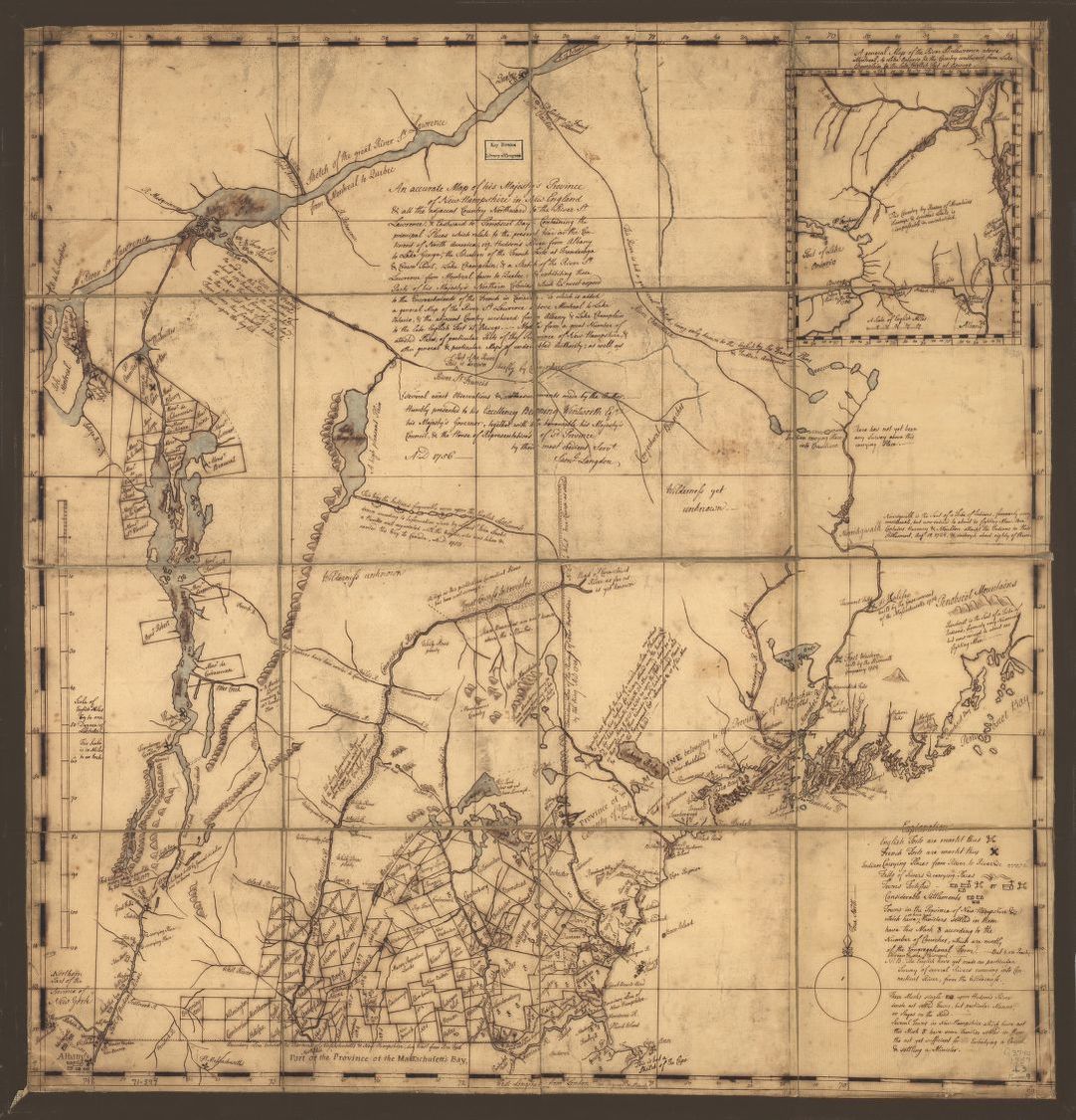
Vermont Area Map circa 1756: An accurate map of His Majesty's Province of New-Hampshire in New England & all the adjacent country northward to the River St. Lawrence, & eastward to Penobscot Bay, containing the principal places which relate to the present war on the continent of North America. By Saml. Langdon (1723-1797).
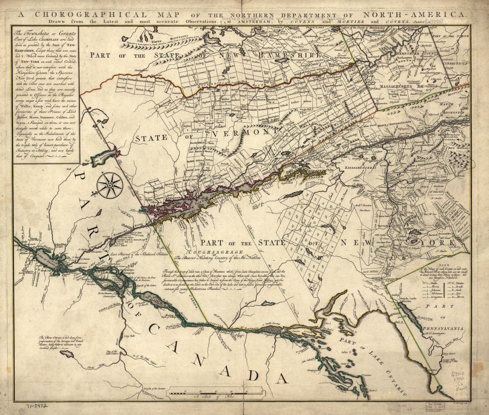
Circa 1780 Map which shows land grants and purchases in northeastern New York State and granted townships in Vermont and parts of New Hampshire, and Massachusetts: A chorographical map of the Northern Department of North-America, drawn from the latest and most accurate observations, at Amsterdam by Cóvens and Mortier and Cóvens, junior. By H. Klockhoff, sculp., [Amsterdam] 1780. Repository: Library of Congress Geography and Map Division Washington, D.C. 20540-4650 USA.
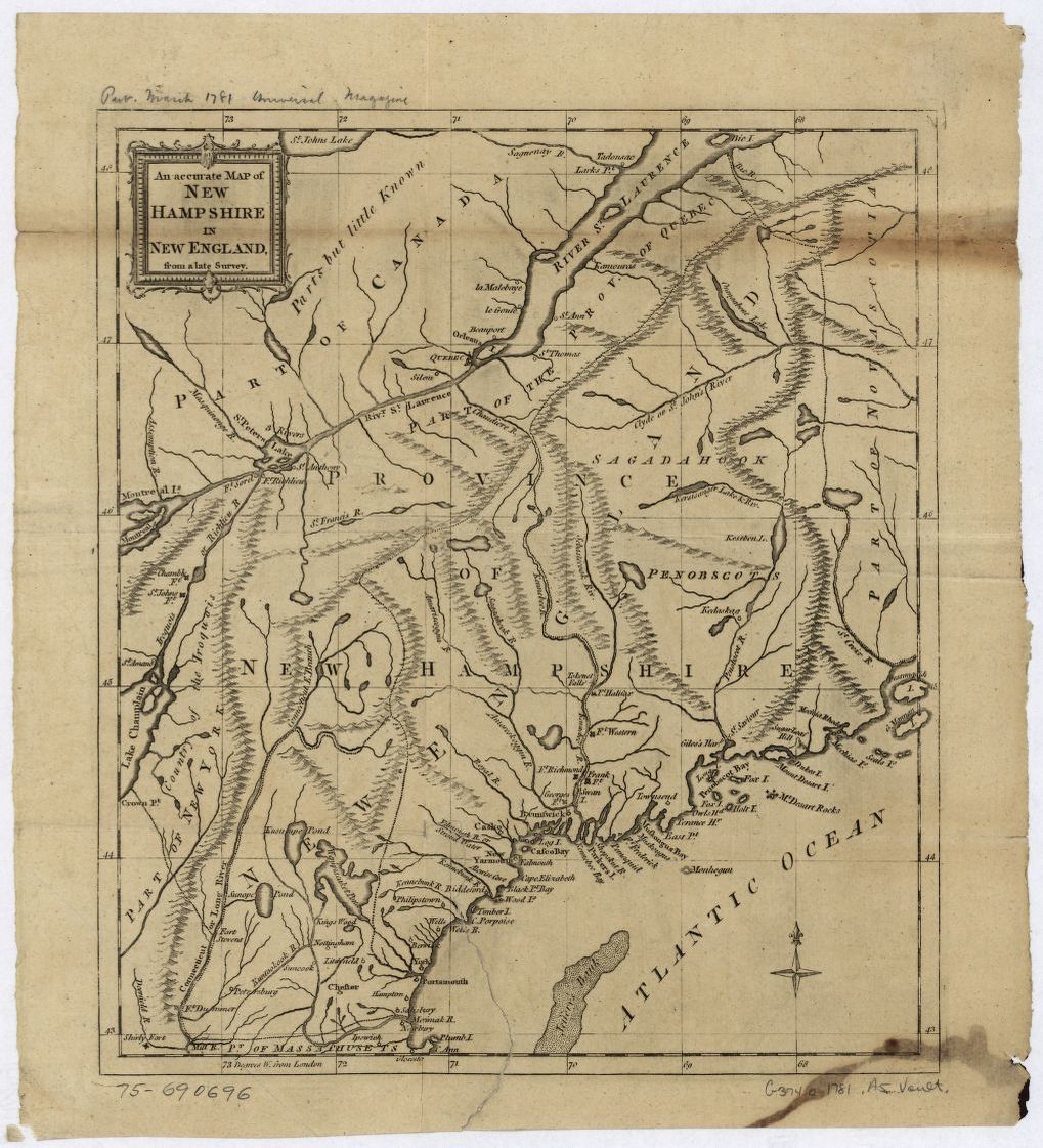
Circa 1781 Map: An Accurate map of New Hampshire in New England, from a late survey. [London, 1781]. From the Universal magazine of knowledge and pleasure. March, 1781. Repository: Library of Congress Geography and Map Division Washington, D.C. 20540-4650 USA.
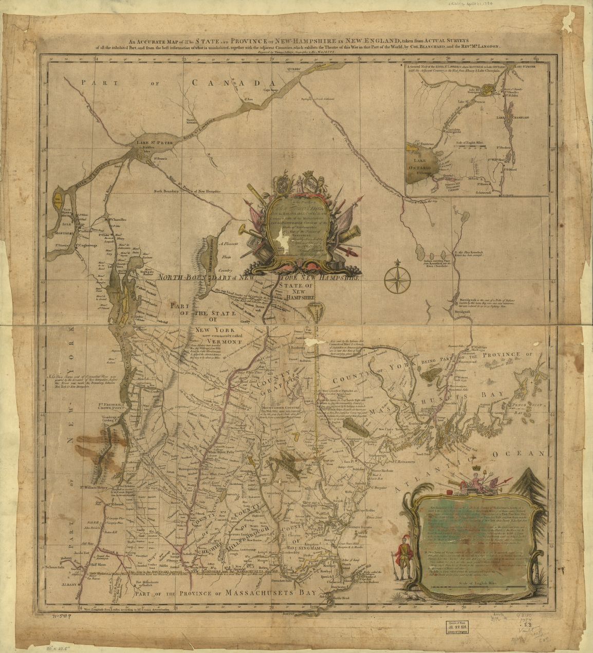
Circa 1784 Map: An accurate map of the State and Province of New-Hampshire in New England, taken from actual surveys of all the inhabited part, and from the best information of what is uninhabited, together with the adjacent countries, which exhibits the theatre of this war in that part of the world, by Col. Blanchard and the Revd. Mr. Langdon. Engraved by Thomas Jefferys. With many additions by Abel Sawyer. Boston, 1784. Repository: Library of Congress Geography and Map Division Washington, D.C. 20540-4650 USA.
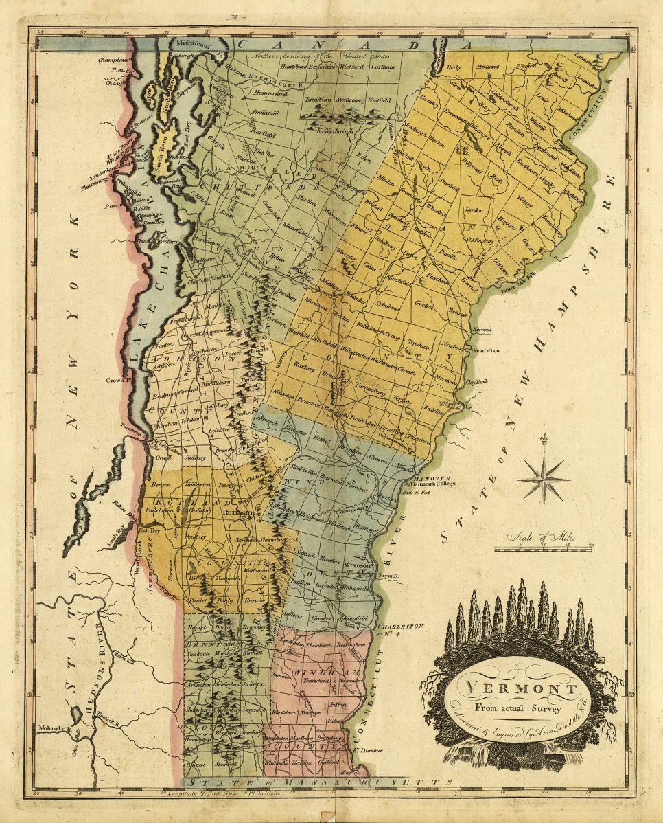
1795 Map of Vermont, from actual survey. By Doolittle, Amos (1754-1832). From Carey's American Atlas, Philadelphia, 1795. DLC. Philadelphia, 1795. Repository: Library of Congress Geography and Map Division Washington, D.C. 20540-4650 USA, This map shows the original Orange county from which Caledonia County was created in 1796.
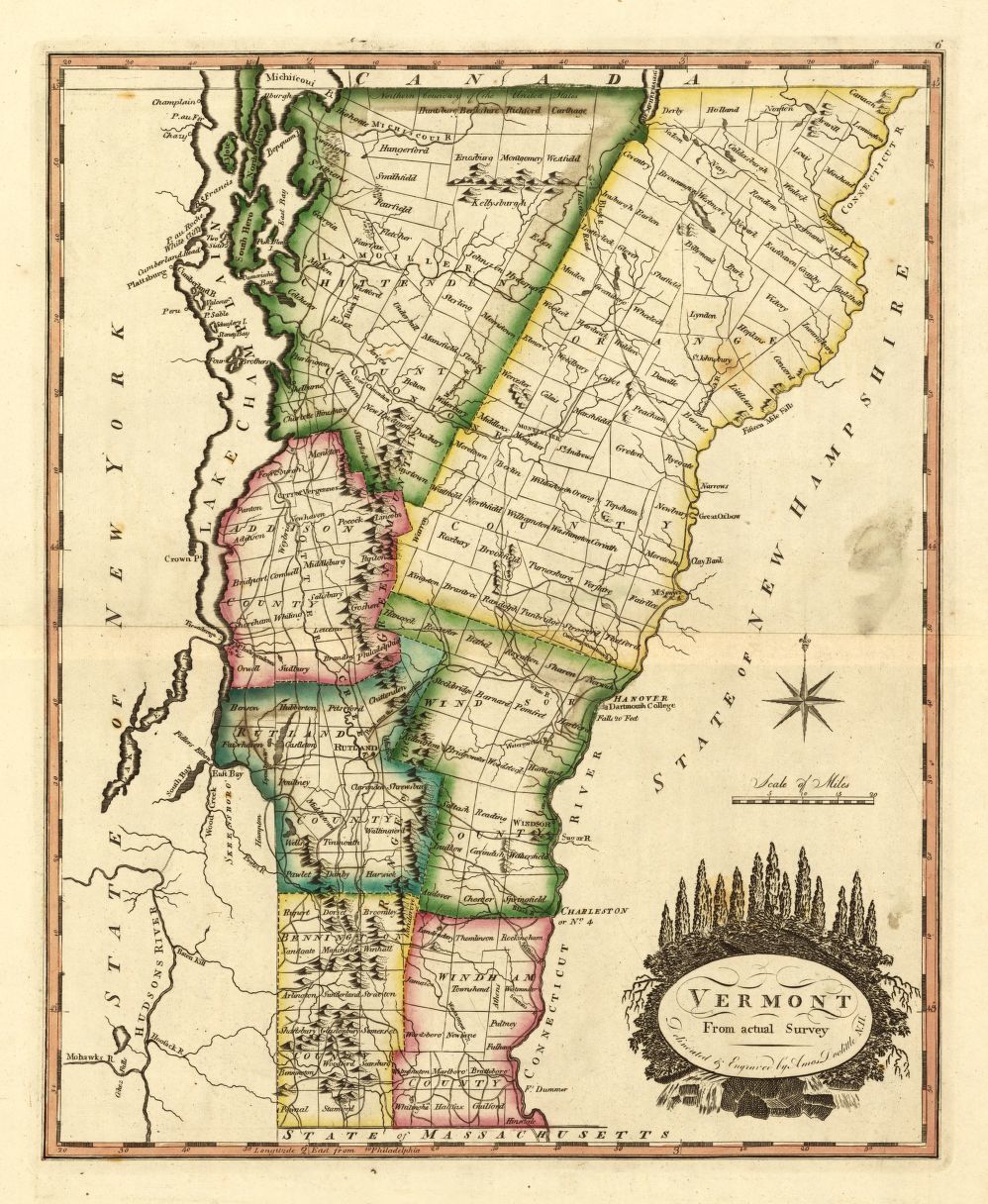
1814 Map of Vermont, from actual survey. By Carey, Mathew (1760-1839). From Carey's General Atlas of the World. DLC. [S.l.], 1814. Repository: Library of Congress Geography and Map Division Washington, D.C. 20540-4650 USA.
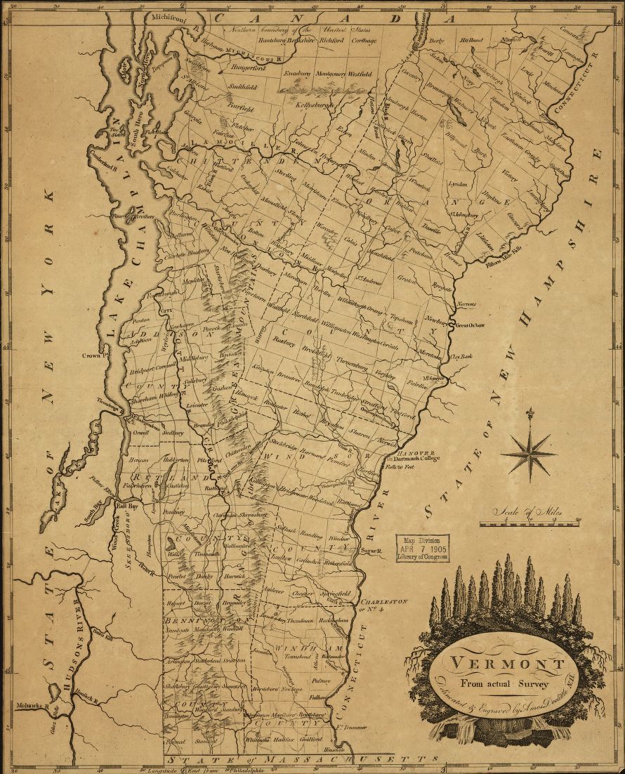
1817 Map of Vermont, from actual survey. By Doolittle, Amos, 1754-1832. From Samuel Lewis' Atlas, 1817. DLC. [S.l., 181-]. Repository: Library of Congress Geography and Map Division Washington, D.C. 20540-4650 USA.
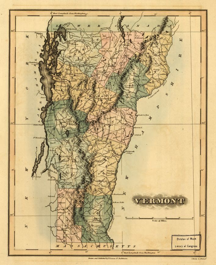
1826 Map of Vermont. By Lucas, Fielding, 1781-1854. [S.l.], 1826. Repository: Library of Congress Geography and Map Division Washington, D.C. 20540-4650 USA.