

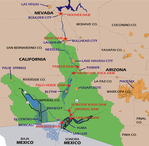
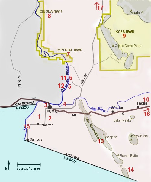
Places
Assorted Maps

Cities and Towns
Adonde
A siding still exists at this location where the S.P.R.R. first came through on January 9, 1879. During the days of the steam railroad, the company used wells at this location to water its engines. The location was an old one, having been used as a stage station for many years. [*1]
Ankrim's Landing
Capt. William Ankrim (d. Mar 1859) was one of the early steamboat men on the Colorado River. He had been active in driving sheep to the California market, at one time hearding 22,000 of the animals to the West Coast. During one trip he had a battle with Apache Indians in which he reported killing nearly forty and losing five of his own party. He also stated that the Indians used both clubs and firearms and that they had gold bullets.
When Ankrim decided to become a steamboat piolot he was a partner with William Jaeger, who ran a ferry across the Colorado. Subsequently, Ankrim bought out Capt. George A. Johnson's interest in the ferry company, in which Ankrim was active until his death.
The Colorado steamer Uncle Sam sank at Ankrim's Landing on June 22, 1853. [*1]
Araby
The name may have been derived from the fact that the surrounding country resembles an Arabian desert. A railroad section house and an alfalfa dehydrating plant exist at this small place today. [*1]
Avalon
When the railroad yards were getting too large to be accommodated in Yuma itsself, they were moved to this location. The yards were still extant in 1956. Lettuce sheds rose around this location. [*1]
Aztec
80 miles east of Yuma. Post Office was established by Charles A. Dallen on September 12, 1889. Just off I-8. Aztec was a stop on the Southern Pacific Railroad line between Phoenix and Yuma. Link to more.
Blaisdell
There were two Blaisdells concerned with the pioneer history of Yuma during Arizona territorial days. One was Ira Blaisdell, who was in Yuma in 1879. He was successful in getting the S.P.R.R. to permit him to manage the water pump and supply the city of Yuma with water.
The second pioneer was Hiram W. Blaisdell, who was the engineer of two canals in the area, and it was probably for the latter that the small railroad station was named. [*1]
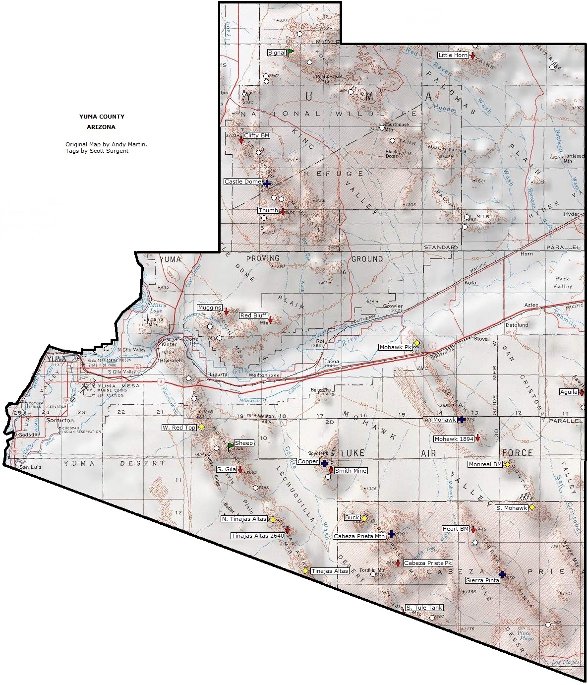
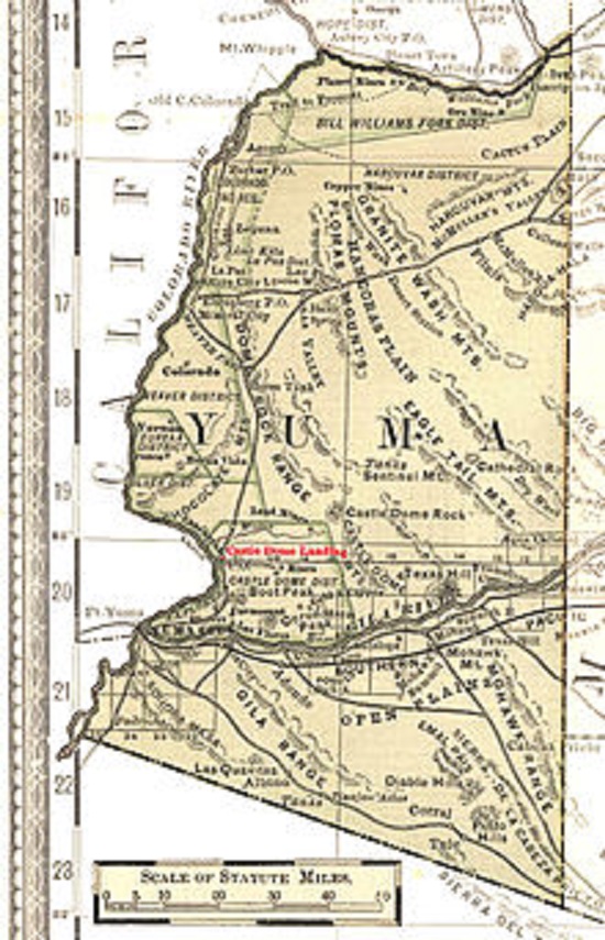
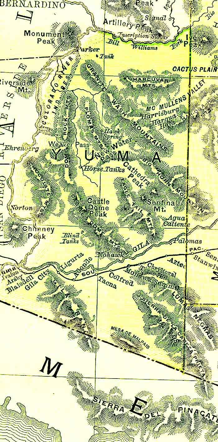
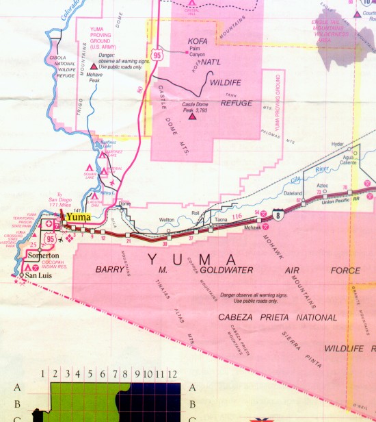
Castle Dome
Castle Dome was a small mining settlement which first produced silver and later lead. Since lead is not nearly as valuable as silver, the mine did not last very long. The post office opened in 1875 and closed in 1876. Link to more.
Castle Dome Landing
Castle Dome Landing's post office was established December 17, 1875 and discontinued June 16, 1884. Castle Dome Landing was the supply and shipping depot for mines in the nearby Castle Dome Mountains. It was the first stop for steamboats on their way up the Colorado river. A small but active town, Castle Dome Landing had a store, hotel, saloon, stage agency, smelting furnace, and a justice of the peace. As the mines played out there was no longer a need for a supply town. Today the site is covered by water after the building of the Imperial Dam. Link to more.
Chrystoval
Cibola
Postoffice in Yuma county, 85 miles north of Yuma, the county seat. Blythe, Calif., is the nearest Railroad and banking point. Farming and stockraising the industries. Altitude 215 feet.
Clanton's Well
Thomas Newton Clanton, a native of Missouri, came to Arizona in 1877 as a rancher at Bigbug, moving from there to Phoenix in 1880. He later (1885) contracted to build ten miles of canals at Buckeye, and in 1888 moved to that community. He also dug the well which bears his name, and the name gradually extended to the Clanton Hills twenty-five miles north of Palomas. THe importance of the well was due to its being the only one in the region. [*1]
Colfred
The treasurer of the S.P.R.R. in 1881 was Col. Fred Crocker. The name was taken from his military title and first name. [*1]
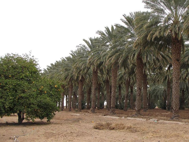
Dateland
A large grove of date trees was the source of the name for Dateland, which was built about 1930 by Mrs. William Harrison. The grove of date trees still exists, but the work buildings and large residence do not. A few buildings are still standing. [*1]
Dome
Dome first appears in 1875 as Gila City on maps examined. It is not the same as Castle Dome City.
Gila City was a bonanza development which began in 1858 when Jacob Snively found rich deposits of placer gold. Before long, one thousand prospectors swarmed through the surrounding canyons and gulches. Only four or five permanent adobe buildings were erected, with the remainder of the town's population finding refuge in temporary quarters, either tents or roughly build structures. J. Ross Browne said, 'Enterprising men hurried to the spot with barrels of whiskey and billiard tables; Jews came with ready-made clothing and fancy wares; traders crowded in with wagons of pork and beans; and gamblers came with cards and monte-tables. There was everything in Gila city within a few months but a church and a jail ...'
Gilla City was nearly obliterated by a flood in 1862. Nevertheless, miners still thronged in the area, recovering the magic metal by dry washing, but by 1865 the great wealth had been taken out of the ground. By 1872 Gila City consisted of a single house, a stable, and a corral.
When the railroad line came through the southern part of ARizona, a siding was constructed approximately one and a half miles east of the old Gila location. The siding was given the name of Dome, apparently because when river boats creased operation in 1883, this siding became the most important mining-shipping point for the Castle Dome and other mines. The establishment of the railroad siding at Dome was the death blow to Castle Dome Landing.
By 1890 Dome had enough residents to establish a post office. [*1]
"Postoffice in Yuma county and station on the
Southern Pacific railway, 20 miles east of Yuma,
the county seat and nearest banking point.
Leading industry placer mining and lead mining.
Altitude 188 feet. Population 500."
"Dome Hotel, E W McDaniel prop
Hull A G, S G Ashe mgr, mines
Lawson C O, agt S P Ry
McDaniel Eugene W, genl merchandise,
justice peace, postmaster
Mabel Mine, J A McCaddon
New King of Arizona Mines, J W Johnson supt
Reorganized United Mines Co, Wm R Scott mgr
Zavala Geo, constable"
Source: 1922 Arizona
Business Directory, Volume 1, page 135.
A post office was established here first under
the name of Gila city (see Gila City) in 1858.
The new post office was established as Dome in
1892 and subsequently opened and closed many
times finally closing in 1940.
Link to more.
Filibuster's Camp
Henry A. Crabb was married to a member of a prominent Sonoran family, and while visiting his wife's relatives in 1856, he met and talked to Pesqueira, who at that time hoped to unseat Gandera, the legally elected governor of Sonora. Pesqueira suggested that Crabb bring a thousand Americans to help with the proposed revolution and in return Crabb was to be given a strip of territory along the border between Mexico and Arizona. Apparently Crab had no difficulty raising his little army and it proceeded to the spot on the Gila River called Filibuster's Camp.
Pesqueira, however, not waiting for Crabb's help, was already governor of Sonora. He denied any connection with Crabb, goin beyond that to actually rousing the Mexican government against Crabb and attacking him at Caborca. More than half of Crabb's advance contingent of one hundred men was killed or wounded. Crabb surrendered on promise of immunity. The promise was kept just long enough to get Crabb and his remaining men under control. They were then butchered and Crabb's head was sent to Mexico City as evidence of Pesqueira's own loyalty. The nine hundred men who awaited news of the advance party disbanded at once and only twent-seven Americans started from Tucson to get relief to Crabb. They arrived too late.
In 1858 the Butterfield Overland Stage line established a station at Filibuster's Camp, but abandoned it in late 1859. [*1]
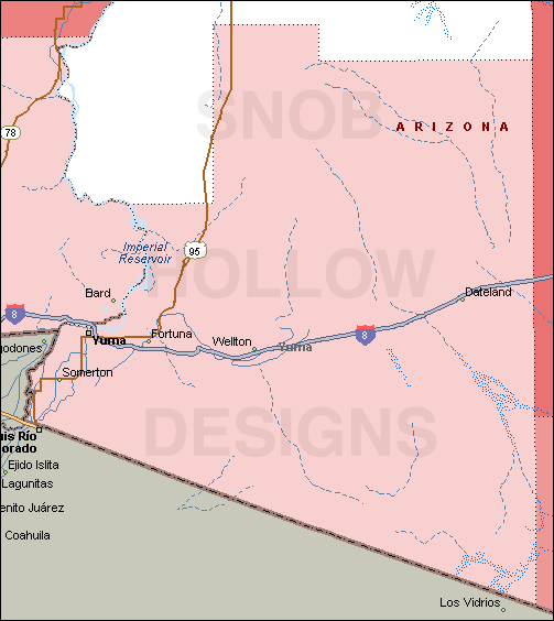
Fortuna
Fortuna's post office was established September 30, 1896 and discontinued November 20, 1904. Located close to the Camino del Diablo or the road of death, Fortuna was a lighthouse in the dark for thirsty miners in the yuma area. The road was named as such due to the number of travelers that died trying to cross the desert. Water was very scarce, but when the Fortuna mine was found, a pump was set up at the Colorado river and water was pumped the 20 miles to the townsite. First located in 1894, the claim was worked until 1904, and then intermittently after that for the next 20 years. In its heyday the town has saloons, a hotel, and a stage and freight line. You can almost feel the thirst of the stage coach drivers as they finally rolled into Fortuna after traversing the Camino del Diablo. Link to more.
Gila City
Gila City's post office was established December 24, 1858 and discontinued July 14, 1863. Destroyed by a flood in 1862, Gila City at one time had over 1200 residents. Located on the Gila river, Gila City was one of the first boom towns in Arizona. Its life was short lived as the mines and Placer gold played out, but for a short time it was quite a town. Today, nothing is left of the site. Link to more.
Hyder
Hyder, 3 miles to the north after Agua Caliente was one of places were general George S. Patton´s forces trained desert war in Second World War. Its very little what remains about the old camp, but veterans sometimes come back to visit this place. Link to more.
Ingalls Lagoon
Capt. Frank S. Ingalls (b. Maine, 1851; d. 1927) came to Arizona in 1882. Ingalls, who had been in Prescott serving as Surveyor General of the Territory, was sent to Youma to take charge of the territorial prison in 1882. He began a company farm on what came to be known as Ingalls Lagoon. Ingalls sought to discover what paroduce would grow best in the Yuma area. [*1]
Kim
The president of the S.P.R.R., Epes Randolph, had on his private railroad car a Chinese cook named Kim. The siding was named for the cook. Kim had never seen his "town," and on one trip Randolph offered to let Kim be dropped off to see it. THe train stopped; Kim dropped off. The Randolph private train pulled away. There was nothing at "Kim" except the cook and the railroad spur. However, Randolph had arranged for the next train through to pick Kim up. When the Chinese was asked how he liked his town he replied, "Fine! Fine! Lots of room to grow." [*1]
Kofa
Kofa's post office was established June 5, 1900 and was discontinued August 27, 1928. Kofa, which stands for King of Arizona, was plagued with scarcity of water. the first year the ore was found the mine couldn't even support a town because of the lack of water. Finally, a well was dug five miles from the townsite and a mill was constructed. The ore ran out in 1910 but the town managed to survive through 1928. Kofa's mill capacity was at one time 250 tons. Today, Kofa is located withing a military bombing range. Link to more.
La Laguna
"Postoffice
in Yuma county, 12 miles from Yuma, the county
seat, railroad and banking point. Farming and
stockraising the principal industries.
Population 75. Altitude 120 feet.
Cavanaugh R W, genl mdse
Ferguson E Mrs, justice peace
Sells Geo W, postmaster"
Source: 1922 Arizona Business Directory, Volume 1, page 260.
A town due to placer gold, and like so many
others, didn't last long. About 2 years, in
fact, is all. From 1860 to 1862, this small camp
served placer miners and had a few merchants, a
few miners, and a ferry. When the La Paz gold
struck, every one left. Today the site is
submerged under Mittry Lake.
Link to more.
Ligurta
The origin of this place name is not known. However, it is worth noting that it bears a close resemblance phonetically to lagarto (Spanish: "lizard") and that lizards abound in the area. The more recent name Fossil Point came from the finding here on October 31, 1917, of fossil bones buried on the land bordering the Gila River. [*1]
Mohawk
"Postoffice
in Yuma county, 60 miles east of Yuma the county
seat and nearest banking point, on Southern
Pacific railway. Altitude 540 feet.
Black F E, agt S P Ry, postmaster
Clump M J genl mdse
Mohawk Cons Copper Co, H S Gleen
Red Cross Mine, G W Norton"
Source: 1922 Arizona Business Directory, Volume 1, page 276.
Norton
See: 1922 Arizona Business Directory, Volume 1, page 290.
O'Neill Pass
Dave O'Neill was an old prospector who c. 1916 died of exposure and over-exertion in the pass in which he is buried and which bears his name. His burros walked to Papago Well after his death, which led the people living there to investigate and find his body. [*1]
Owl Station
1870's was water pickup station to make it on up and over mohawk pass to aztec water tower.1928 standard oil chartered service station for travelers between tucson and sandiego[the only road ,it was sand & gravel,still visible from owl.Cabin camp of 7 cabins,cafe,and garage was added.In 40's,soldiers came from 50 miles east & west to dances.Best chili beans in az.Truckers said. Burned down early 60's.After i-8 opened up. Link to more.
Palomas
Flocks of white-wing doves are always found here during the summer months. Palomas was first known as Doanville, for John Doan, a pioneer in the district. The community is now gone and the entire area is under cultivation. [*1]
See: 1922 Arizona Business Directory,
Volume 1, page 292.
Parker (now in La Paz county)
Postoffice in northern Yuma county, on the Santa
Fe Ry., located on the Colorado river at the
head of the great Parker valley. Dry healthful
clomante. Elevation about 380 feet. Population
500.
Brown B B, billiards cigars
Brown Mary E, postmaster
Bush J E Ferry & Frieght Co
Brown & Lamoureaux, bottling works, ice
Collins Abbie E, real est, undertaker
Day C E, justice peace
Ditrick Chas, groc
Ewing Frank, drugs
Foster C K, barber
Grand View Hotel, E D Hobbs prop
Harris C L, contr
Hasfelt C H, moving pictures
Hotel Manitaba, B M Fuqua prop
Indian Industrial School, W T Haygood supt
Marsh G A, banker
Martin R J, plumber
Methodist Church, Rev P S Ryan pastor
Miskell L, billiards
Nettle Anna I, phys
Neuman Bros, rest
Parker Commercial Co, genl mdse
Parker Motor Co, J D Mathews prop
Parker Valley Bank
Raney Mercantile Co, genl mdse
Rea B B , agt A T & S F Ry
Reed W C, garage
Sexton W J, shoes
Stevens Frank, Blksmith
Strohm A H, billiards
Source: 1922 Arizona Business Directory, Volume 1, page 293.
Polaris
Polaris' post office was established June 17, 1909 and was discontinued July 31, 1914. Felix Mayhew discovered the outcropping responsible for Polaris and sold it for a cool $350,000. Polaris was named for the North Star and reported about 150 residents. The mines played out in 1911 and Polaris was no more. Link to more.
Quartzsite (now in La Paz county)
See: 1922 Arizona Business Directory, Volume
2, page 366.
Roll
The community of Roll was named for early settler John H. Roll. It lies along the lower Gila River between the Yuma Proving Ground and the Barry M. Goldwater Air Force Range.
Salome (now in LaPaz county)
See: 1922 Arizona Business Directory, Volume 2, page 375.
San Luis
The city was established in 1930 with the opening of a border-crossing station.
Somerton
Somerton was established in 1898. Somerton has
an annual Tamale Festival that benefits students
from the area who will be attending Arizona
State University.
See: 1922 Arizona Business Directory, Volume
2, page 380.
Swansea (now in LaPaz County)
See: 1922 Arizona Business Directory, Volume 2, page 387.
Tacna
In 1854 Lt. N. Michler reported that Antelope Peak lay on his route. The peak is about a mile by a half-mile wide and rises steeply, forming a striking sandstone eminence. Although Antelope Hill was not one of the original Butterfield Overland Stations of 1857, a station was built here by John Kilbride and shows on the 1859 itinerary for the overland stage. Subsequently, the Antelope Hills Stage Station became Tacna.
For the past twenty-five years an Easter Sunrise Service has been held at the base of this hill. The service is supposed to have originated with Indians. An Indian cemetery on the knoll back of Antelope Hill is still being used. [*1]
Vicksburg (now in LaPaz County)
See: 1922 Arizona Business Directory, Volume 2, page 424.
Wellton
See: 1922 Arizona Business Directory, Volume 2, page 425.
Wellton, founded in 1878 and incorporated in 1970, lies 29
miles east of Yuma, Arizona. It is a center for business,
services, and recreation for more than 5,000 residents in the
valley and the surrounding area. Winter and retired residents
also contribute to the local economy.
Wellton (originally Well Town) was named for the time water
wells were drilled to service the Southern Pacific Railroad.
Most areas were settled in the 1860's as the need arose for
stations to serve the Butterfield Overland Mail stagecoaches.
With the railroads eventually supplanting the stagecoach lines
in the 1870's, several communities were established (Tacna and
Wellton) to provide water facilities for the old steam-powered
engines. As the stagecoach gave way to the railroad, so the
railroad gave way to the automobile. Though rail service is
still maintained through Wellton-Mohawk Valley, the current
economic livelihood is based on agriculture.
Wenden (now in LaPaz County)
See: 1922 Arizona Business Directory, Volume 2, page 425.
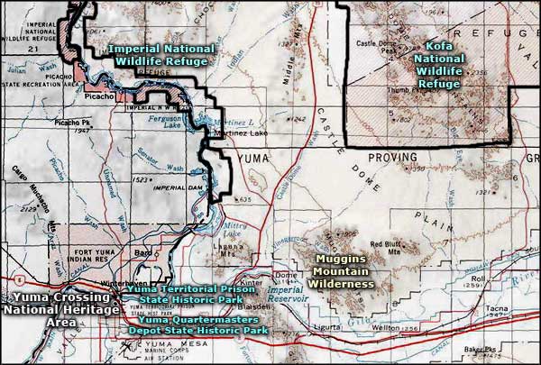
Yuma Crossing
Crossing the Colorado River was a dangerous thing in the old days. Only at the place were the Colorado and Gila River meet each another was it possible to cross over. Even though the Colorado river area was searched by Spanierds in the beginning of 1540's, the first Spanish settlement was not founded until 1775, when Fr. Francisko Garces (who lead missionarys together with the soldiers), founded the mission close to the place were the rivers ran together.The next 6 years settlers terrorized Quechan Indians who lived along the river, forcing them to katolism and destroyed their farmland with grassing cattle and horses. After they lived in terror, the Indians started killing soldiers, settlers and Fr.Garces - all were killed except the woman and children. In the next 50 years nobody tried to settled here. A change came in 1829 when Kit Carson came to the place which will get the name Yuma Crossing. He collected more then 2000 pounds of beaver skin during his time here. Carson came back with the military in 1846 together with Cpt. Philip St.George Cook and the Mormon Battalion who were occupied building the first wagon road through the country witch eventually became Arizona. During the Mexican war (1846-48), Mexican and American soldiers crossed the Colorado River close to the Spanish mission. Later, streams of people came to California for the gold rush, and there was so many that Maj. Samuel Peter Heintzelman in 1850 lead a group of 92 man and founded Camp Calhoun on a hilltop on the California side (at that time under Arizona's command) with a great overview over the crossing place. In 1852 this military post was known as Fort Yuma and the same year arrived the first steamboat cargo from Gulf of California. One society started growing on the Arizona side, across the Fort. The first post office was founded in 1857 and named Colorado City, but one year later, the name was changed to Arizona City. In 1883, six years after railroad arrived, the need for military protection was over. The next year the Fort Yuma was given to the Department of the Interior and thereafter to Quechan Indians. In 1866 the post office was officially named Yuma. Link to more.
Yuma
Located at the point where the Gila and Colorado Rivers converge, Yuma originated as a major transportation hub, as goods came from the west coast and were shipped up river. Since prehistoric times, Yuma has been the best site for crossing the Colorado River - Spanish conquistadors traveled this route in the 1500's and the only Ocean to Ocean bridge was constructed here in 1920, linking the Eastern U.S. and the West Coast. (previously known as Arizona City)
[*1] Extracted 28 Jul 2017 from Arizona Place Names, published in 1960.
