

note: the maps found on this site are for your viewing pleasure and should not be published without permission from the repository.
 |
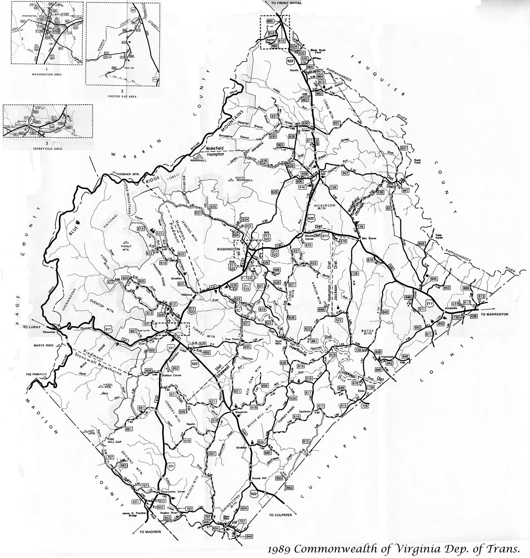
1989 Commonwealth of Virginia Department of Transportation map: General Highway map with roads, districts, towns, rivers, creeks, some public buildings such as schools and Churchs. Prepared by Virginia Department of Transportation. This is a scanned copy, mileage will not be accurate. North is top of map. Also shows names of bordering county locations. Click here for Medium jpg image 3meg
|
 |
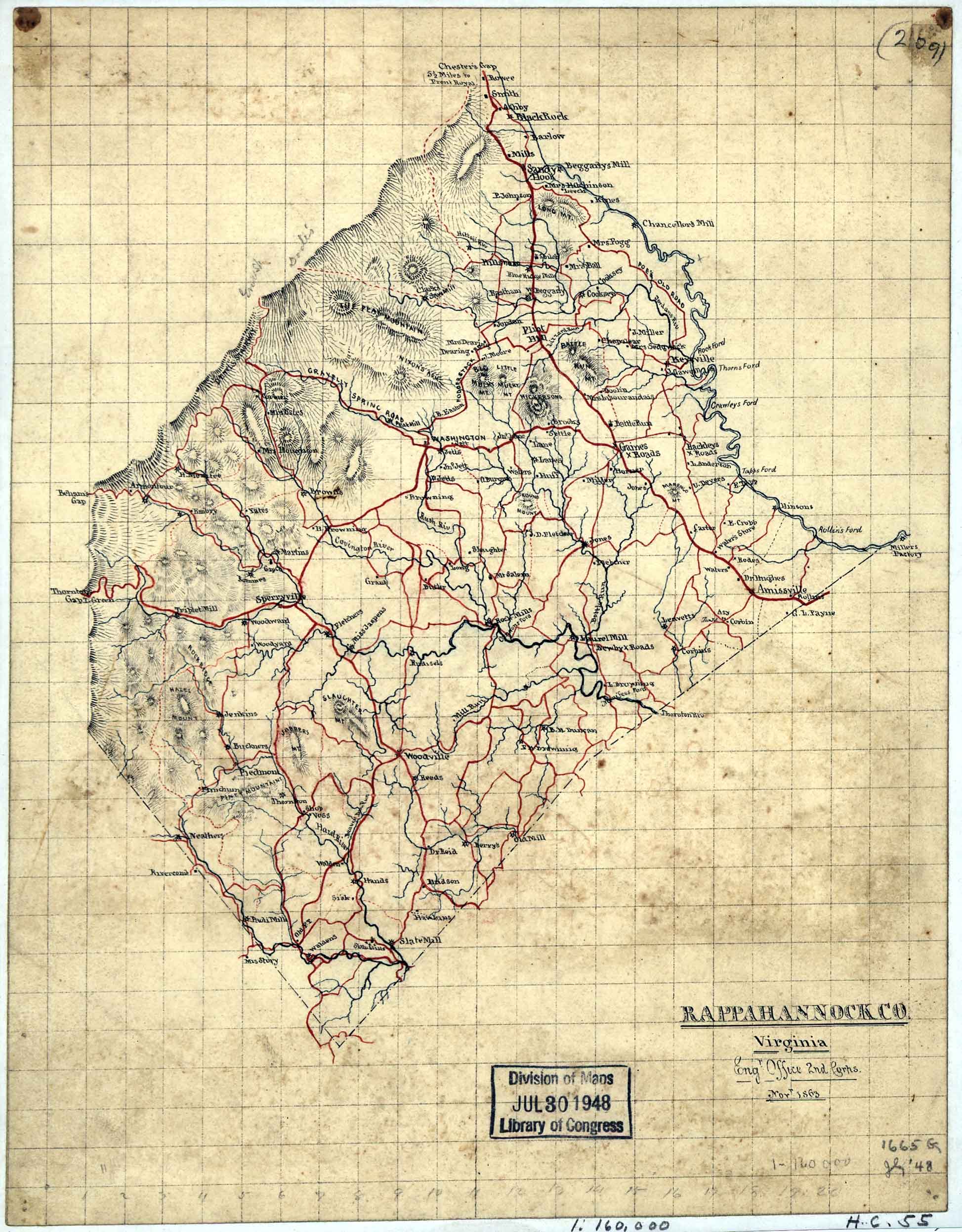
1863 map of Rappahannock County, Virginia: This is a great map of Rappahannock County, Virginia giving the county boundary along with showing some of the residents. It's a civil war era map created by the Engineers office, 2 Corps, November 1863. Relief is shown in hachures, drawn in Pen and ink with pencil annotations on a 3/8 inch grid. Repository is the Library of Congress Geography and Map Division, Washington D.C. |
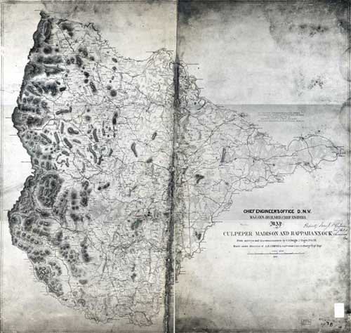 |
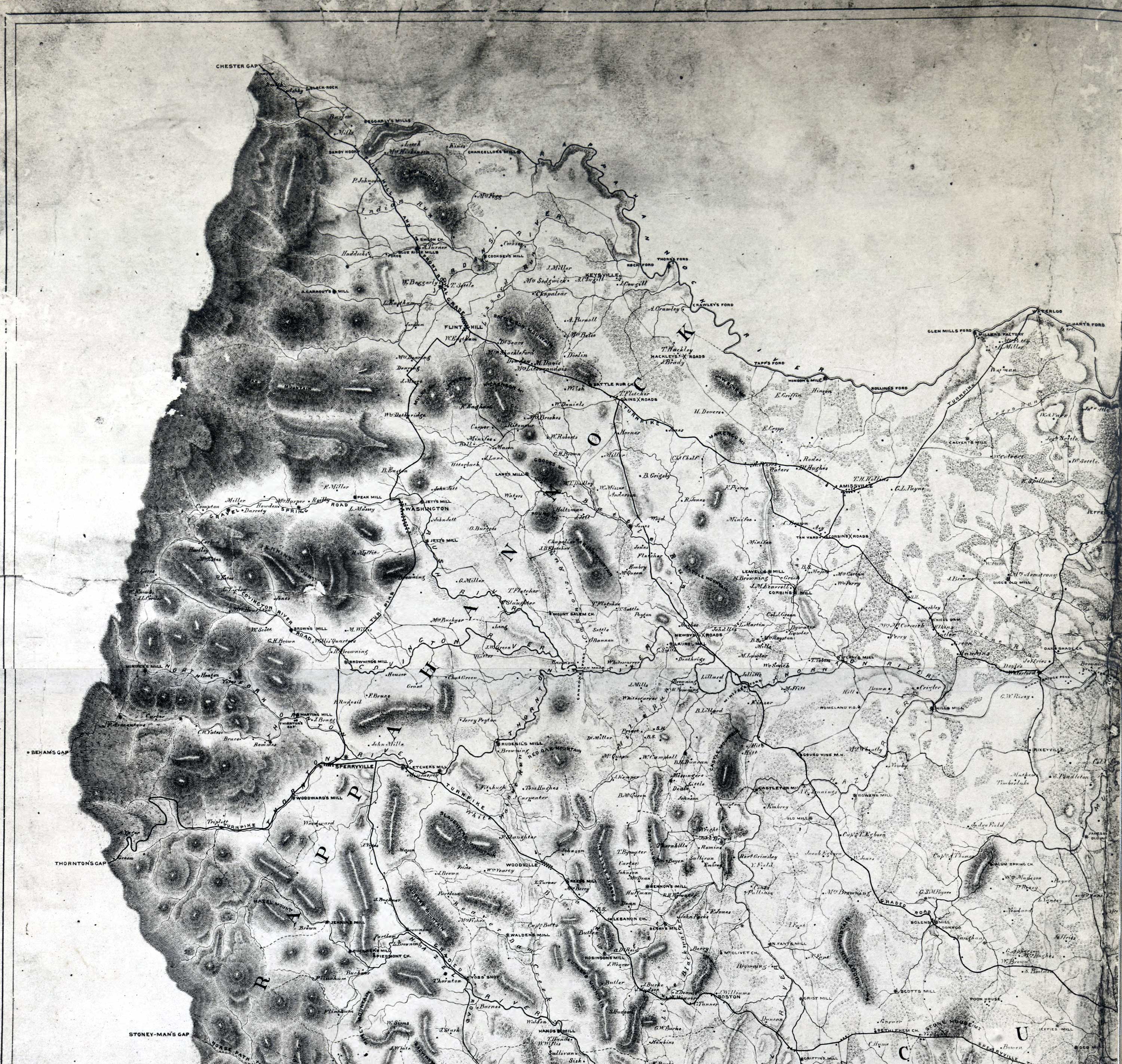
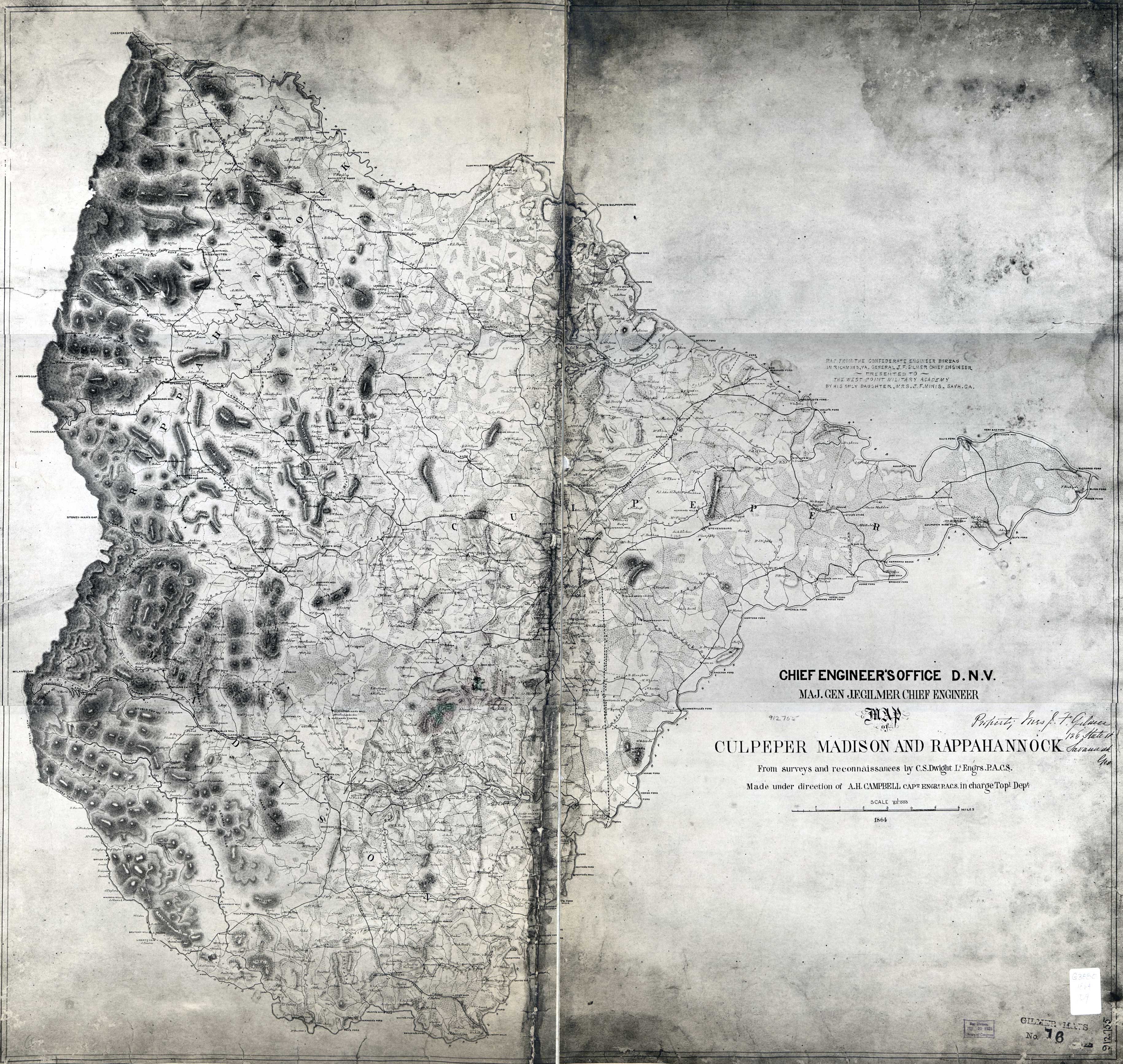
1864 Map of Culpeper, Madison and Rappahannock County: This is a large map drawn during the civil war, with great detail showing relief in hachures. It was drawn from surveys and reconnaissances by C.S. Dwight, Lieutenant Engineers of P.A.C.S., made under the direction of A.H. Campbell Captain Engineers, P.A.C.S. in charge of the Topographical Department. It shows some residents. At head of title: Chief Engineer's office D.N.V. Major Gen. J.F. Gilmer, chief engineer. "Map from the Confederate Engineer Bureau in Richmond, Va. General J.F. Gilmer Chief Engineer . Presented to the West Point Military Academy by his only daughter, Mrs J.F. Minis, Savh, Ga." "Property of Mrs. J.F. Gilmer 126 State St., Savannah, Geo." Repository: Library of Congress Geography and Map Division Washington, D.C. 20540-4650 USA Click here to show the Rappahannock County area of the map |
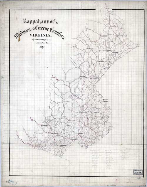 |
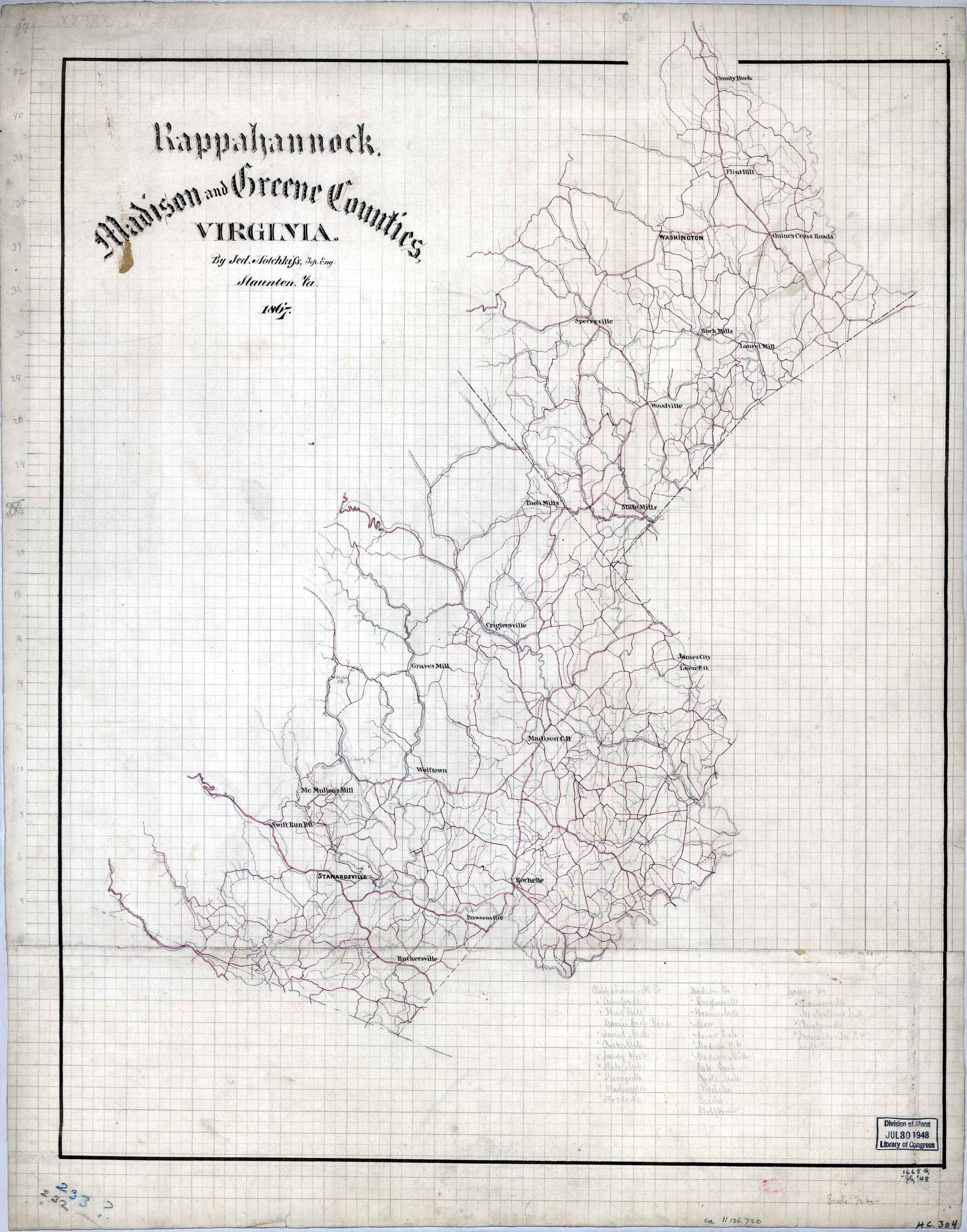
1867 map of Rappahannock, Madison, and Greene counties, Virginia / by Jed. Hothckiss, Top. Eng., Staunton, Va., This map shows some towns and many roads. Drawn with Pen-and-ink and pencil on 2 sheets of paper that have been pasted together and mounted on cloth. In Pencil 232 and crayon 233? in the upper left corner. Repository: Library of Congress Geography and Map Division Washington, D.C. 20540-4650 |
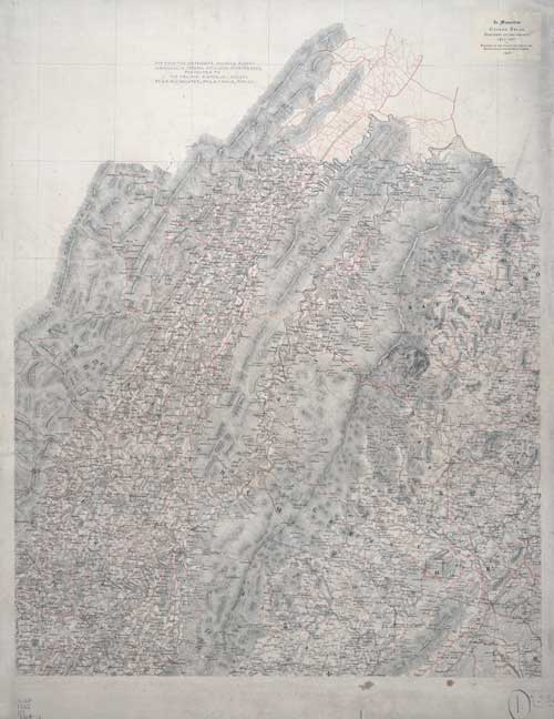 |
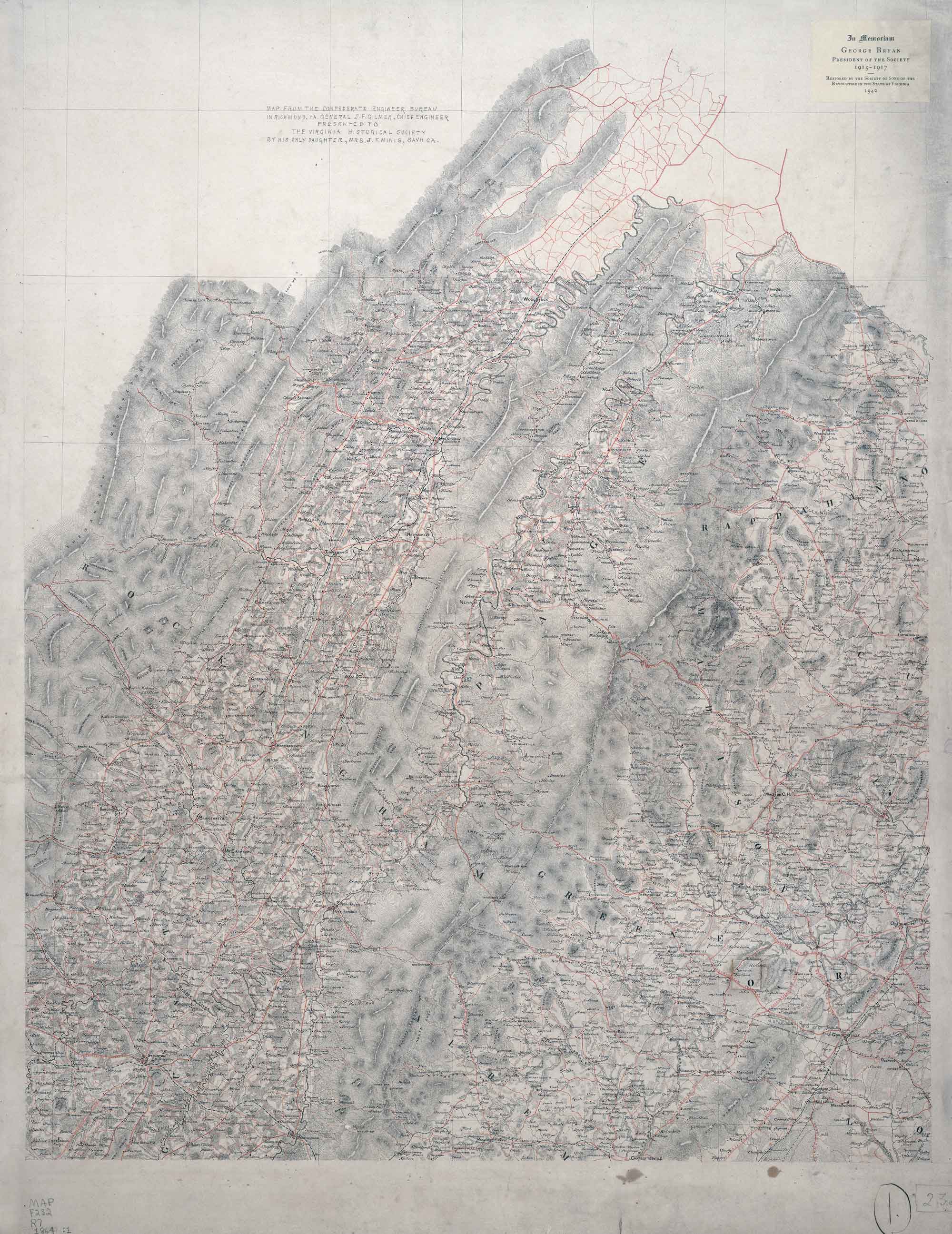
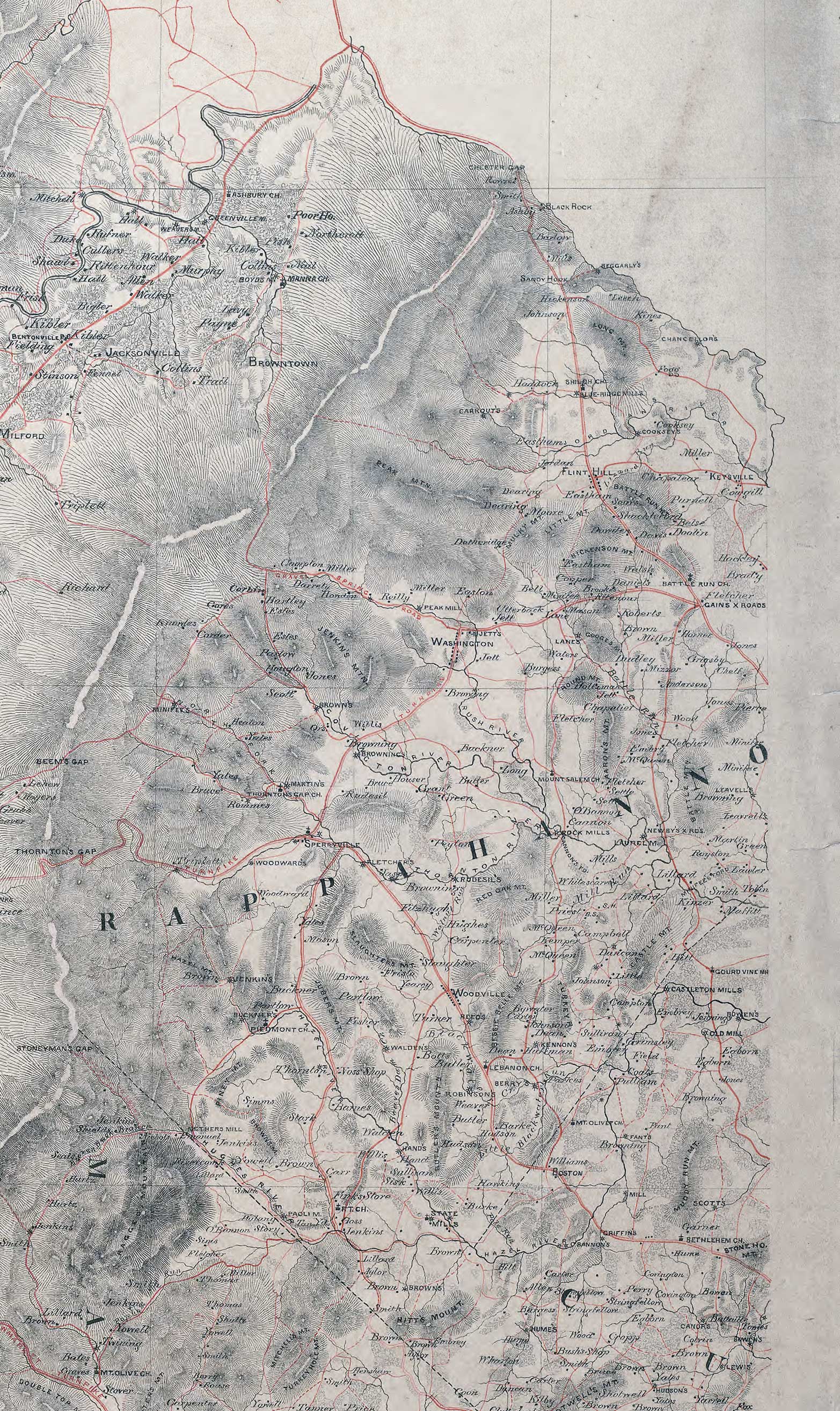
1864 Map of the counties of Greene, Madison, Page, and Rockingham, and parts of the counties of Albemarle, Augusta, Culpeper, Louisa, Orange, and Rappahannock, Va. "Map from the Confederate Engineer Bureau in Richmond, Va. General J.F. Gilmer, Chief Engineer[.] Presented to the Virginia Historical Society by his only daughter, Mrs. J.F. Minis, Sav[ana]h, Ga."--Note on map. Relief shown by hachures. Shows towns, waterways, roads, and geographic features. Gift of Mrs. Louisa Porter (Gilmer) Minis (i.e., Mrs. J. F. Minis), Savannah, Ga., in 1911. Forms part of the Gilmer Map Collection. Repository Virginia Historical Society, P.O. Box 7311, Richmond, VA 23221-0311 USA This digital copy is from the Library of Congress Geographical and Maps Division. Click here to view the Rappahannock area |
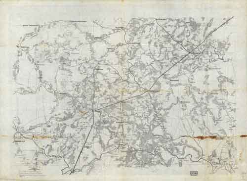 |
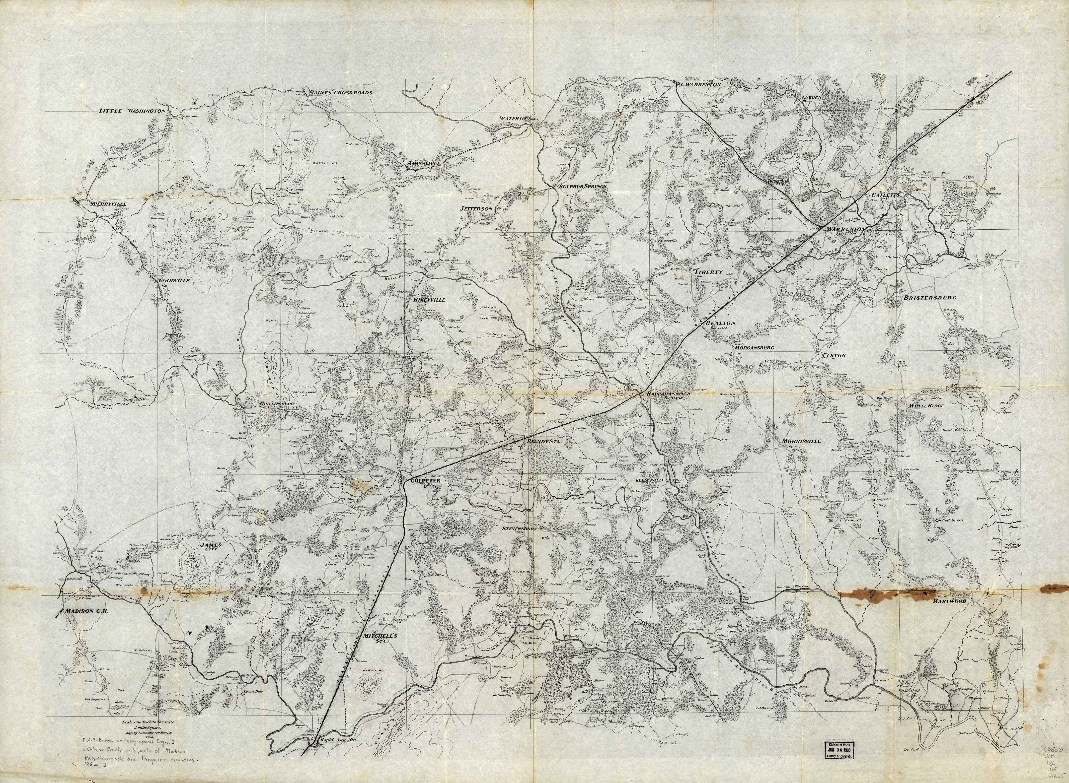
1863? Map of Culpeper County with parts of Madison, Rappahannock, and Fauquier counties, Virginia engr. by J. Schedler ... N. York. Printed general map without title or border showing roads, railroads, settlements, farms with owners' names, vegetation, streams, and fords. Relief shown by form lines in hilly areas. Also covers Culpeper city region (Va.) Repository: Library of Congress Geography and Map Division Washington, D.C. 20540-4650 |