
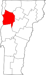
Chittenden County
VTGenWeb

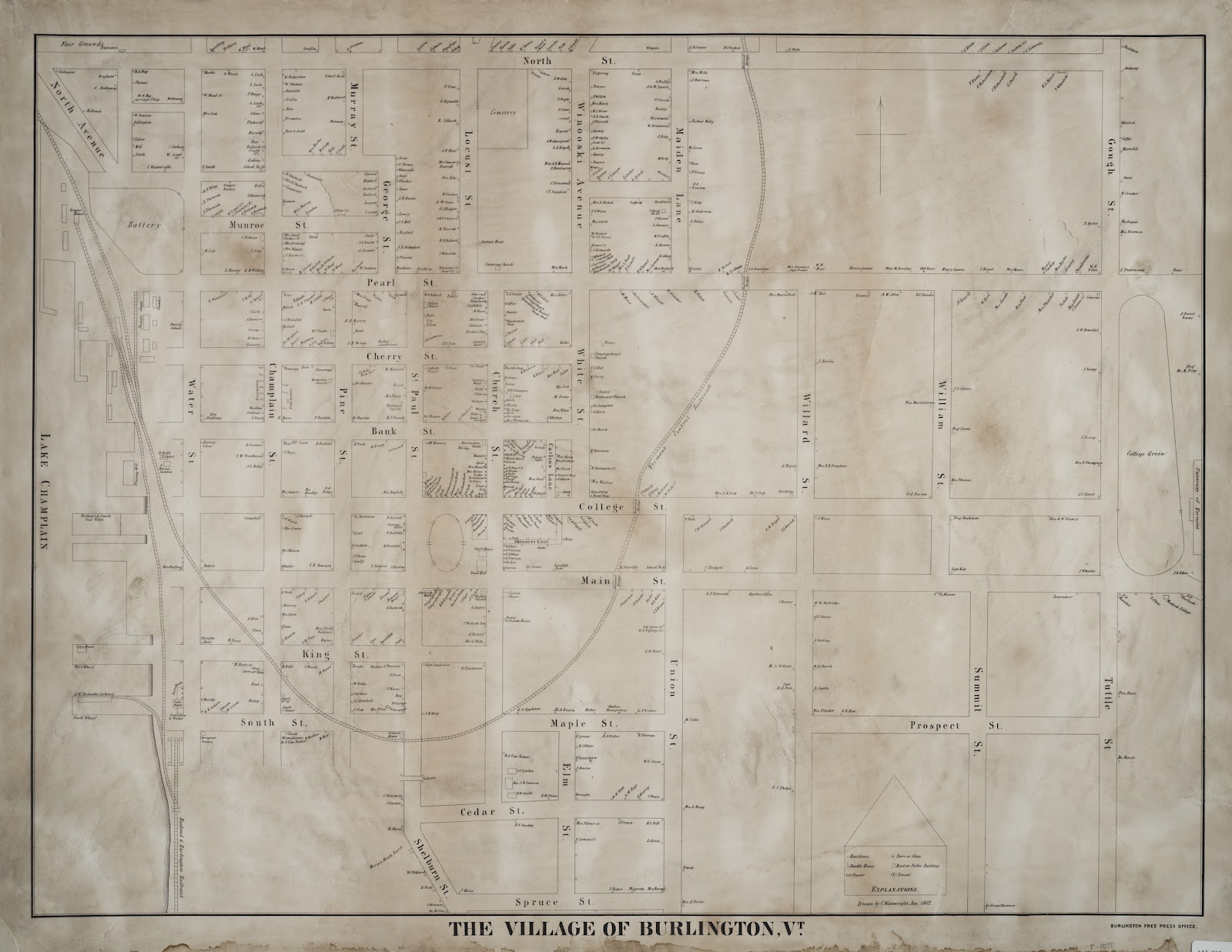
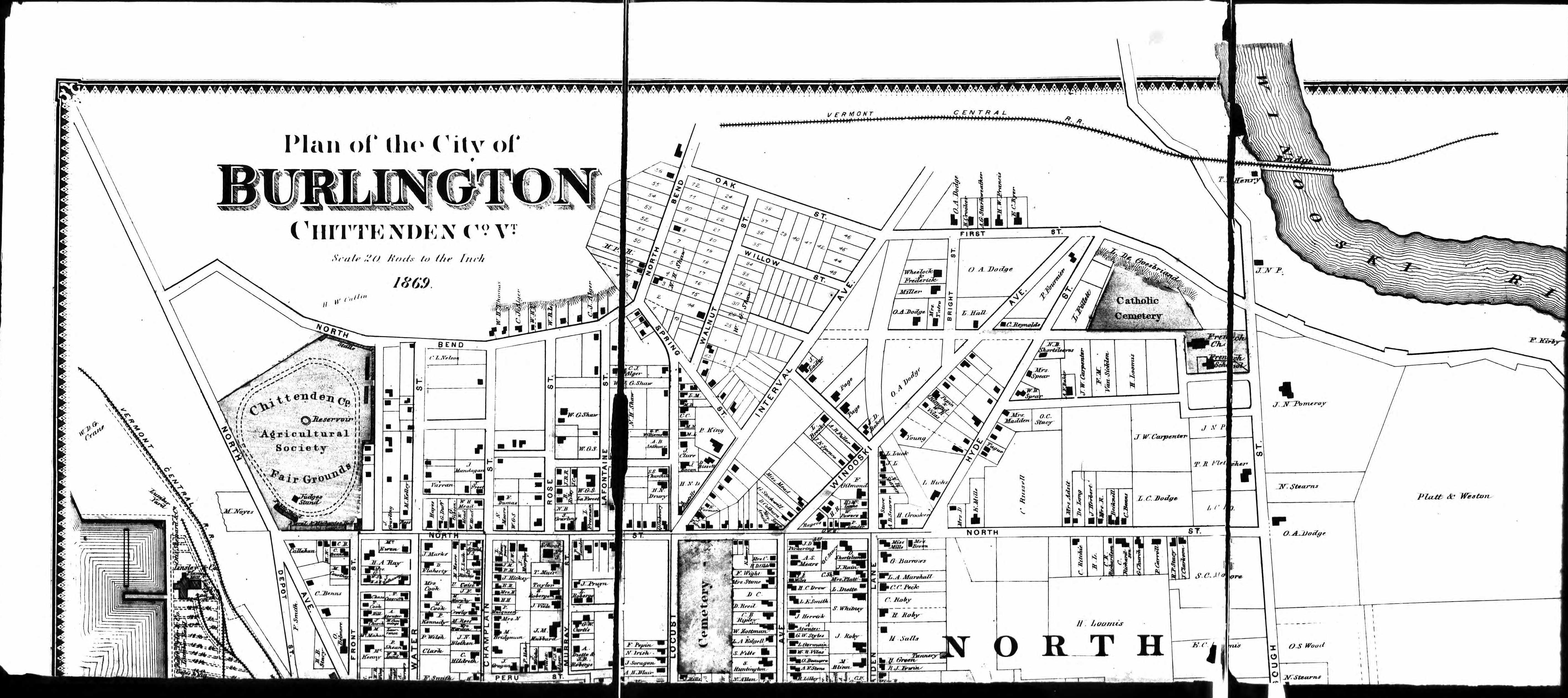
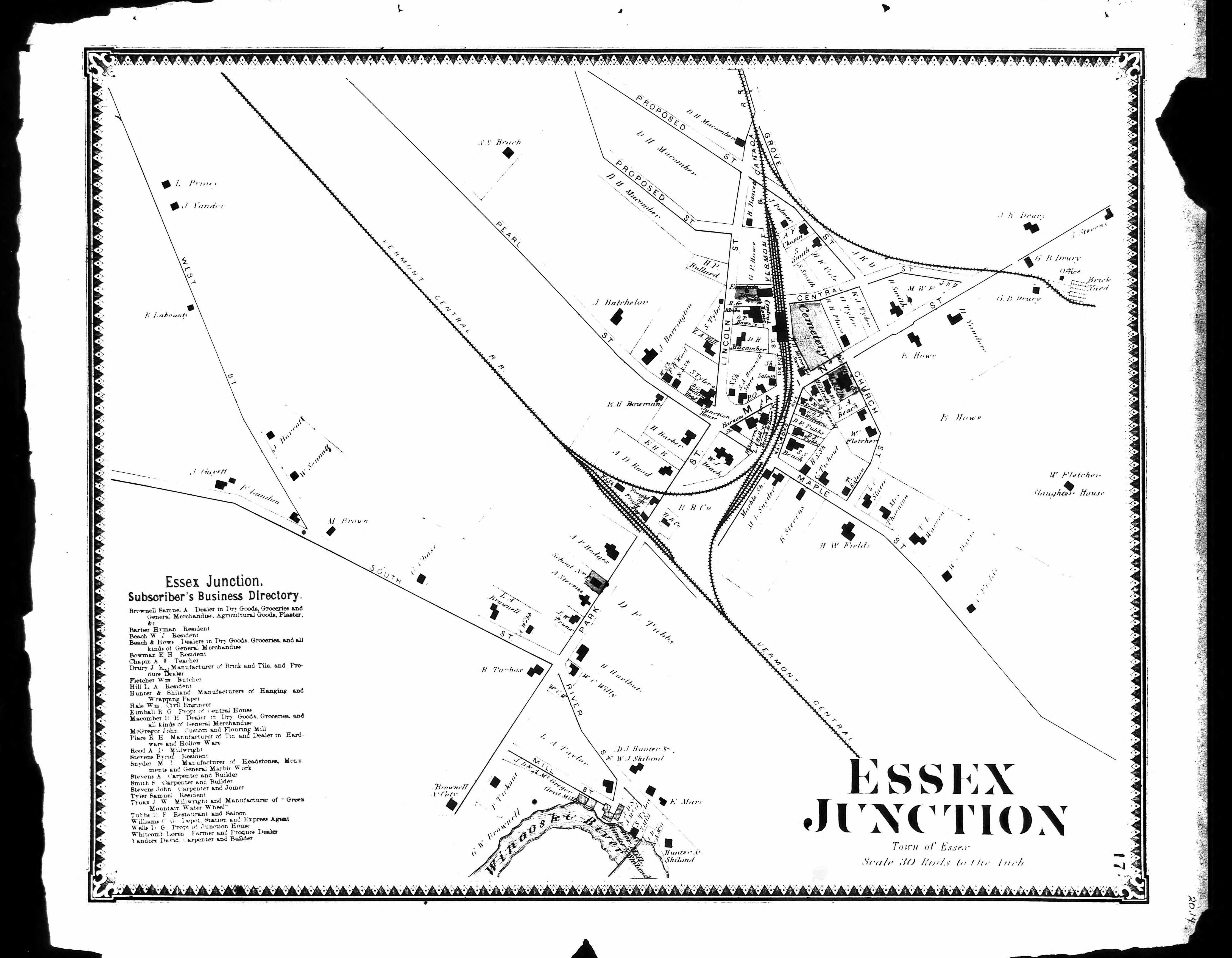
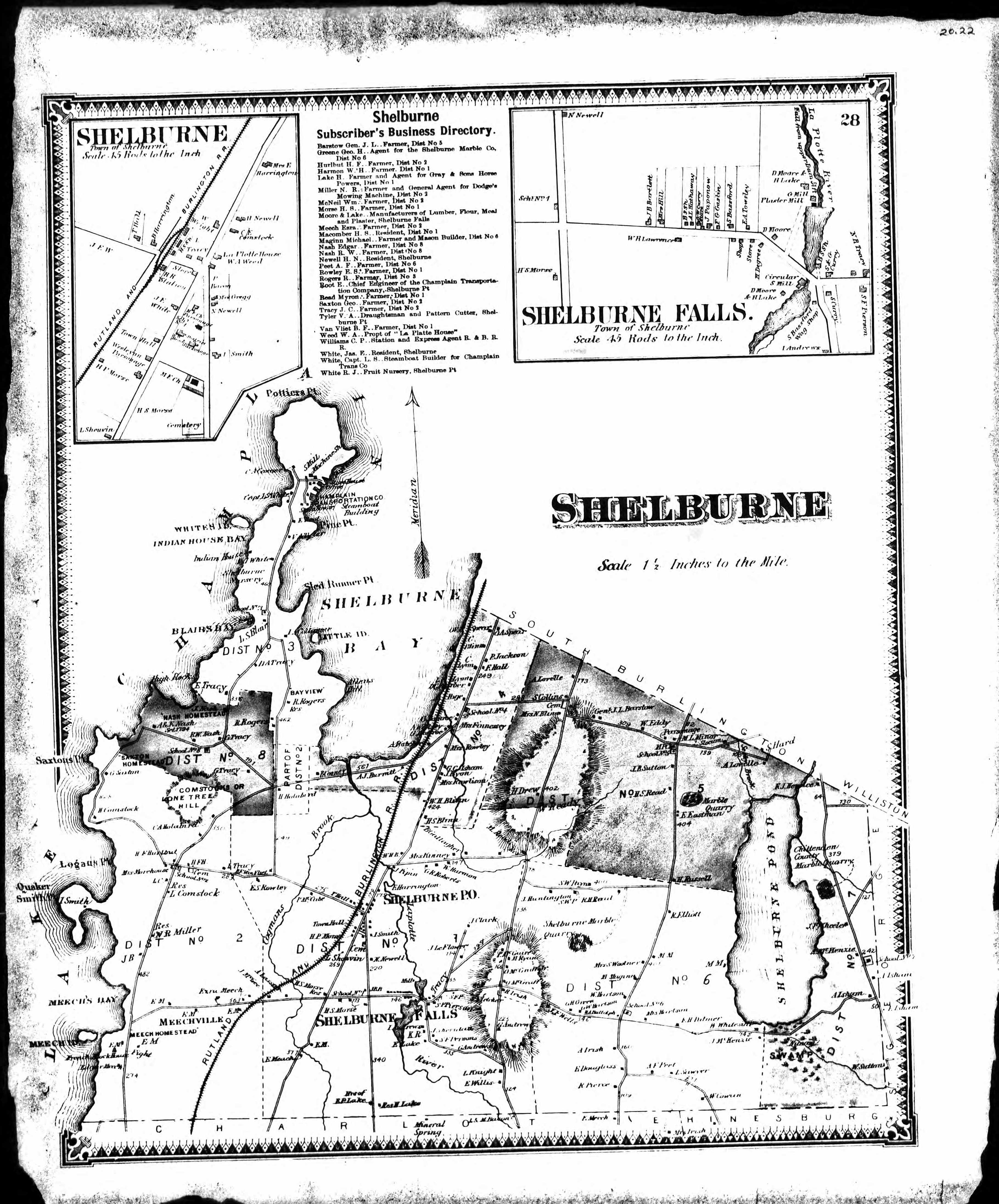
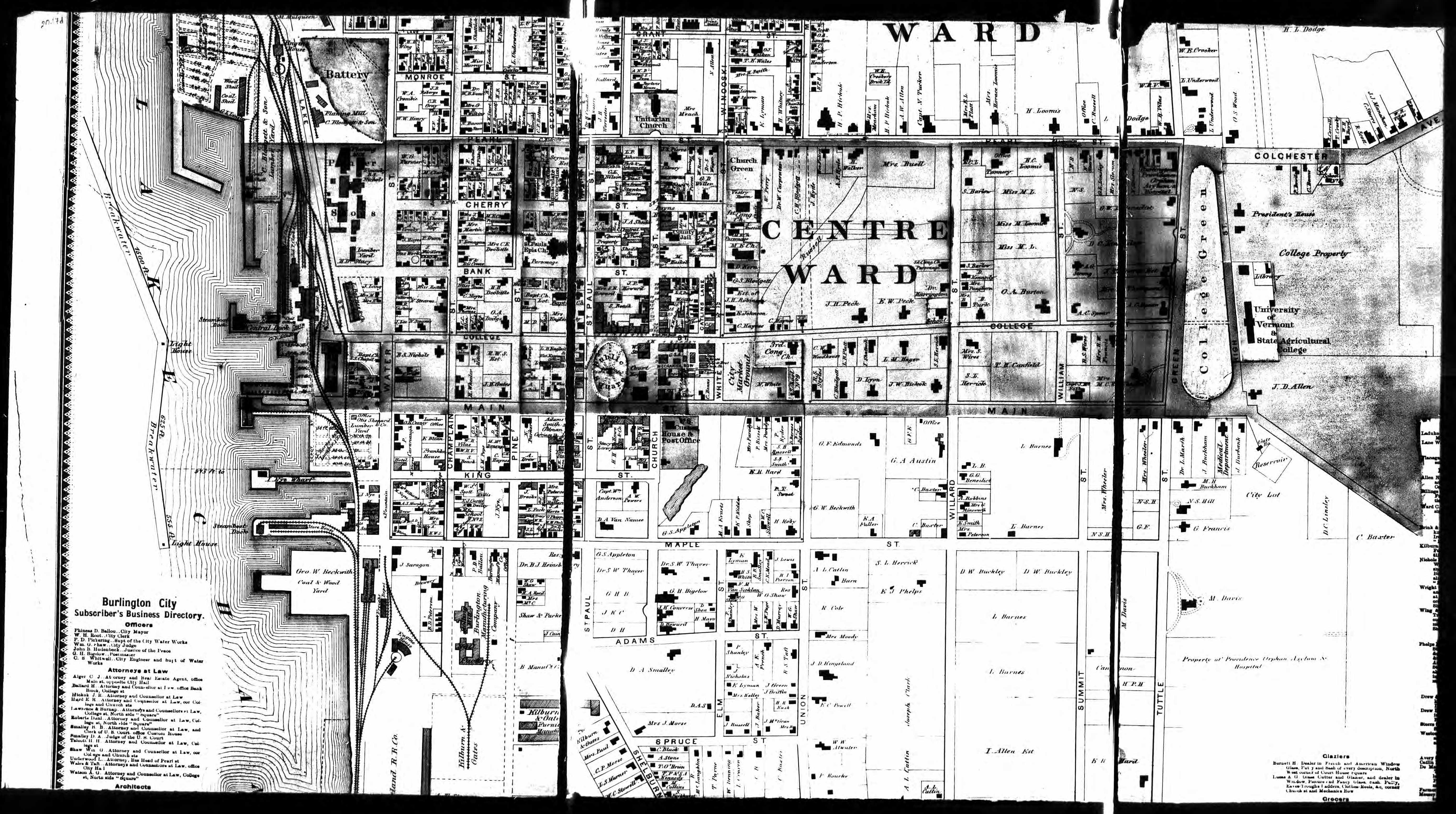
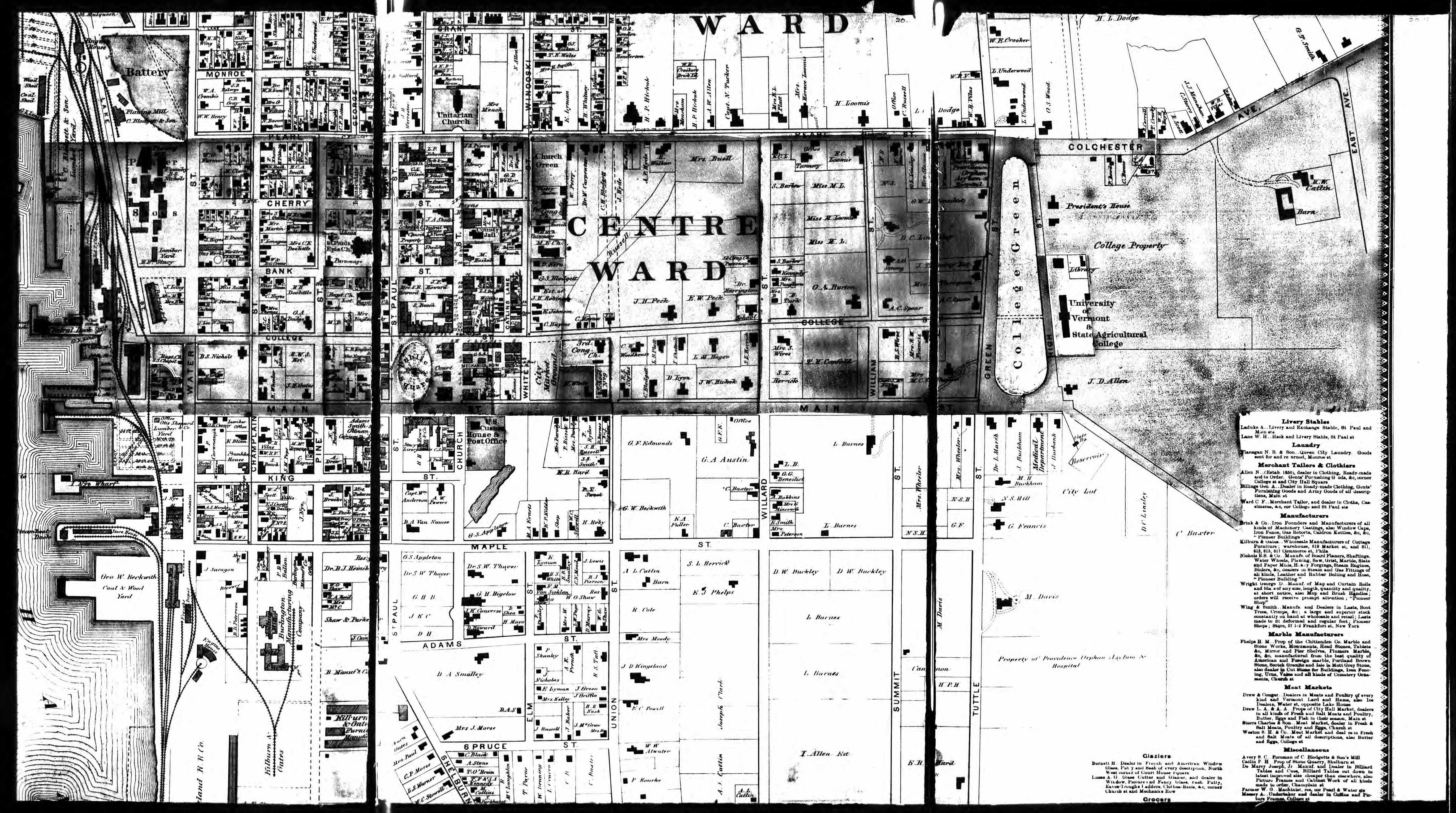
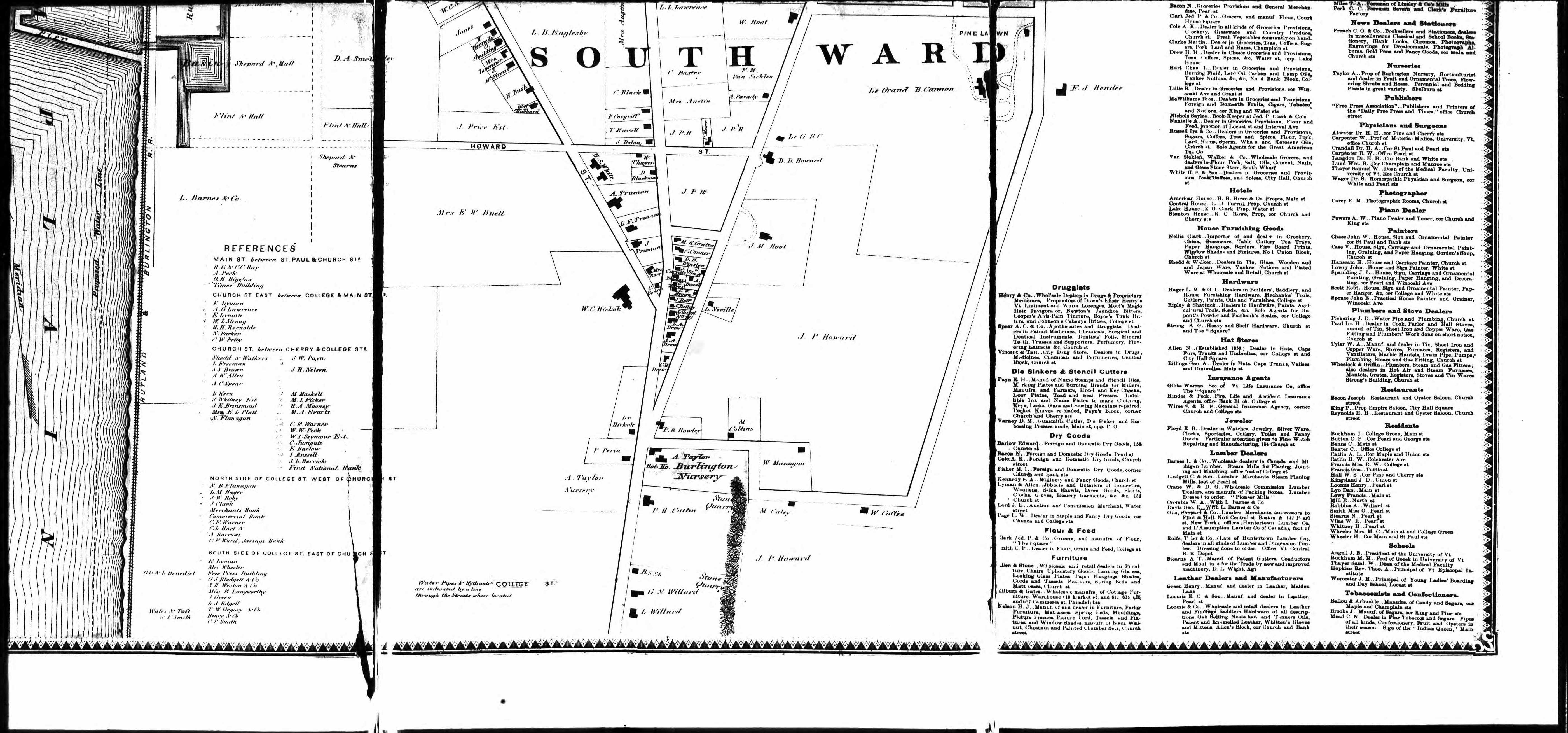
1862 Burlington Map
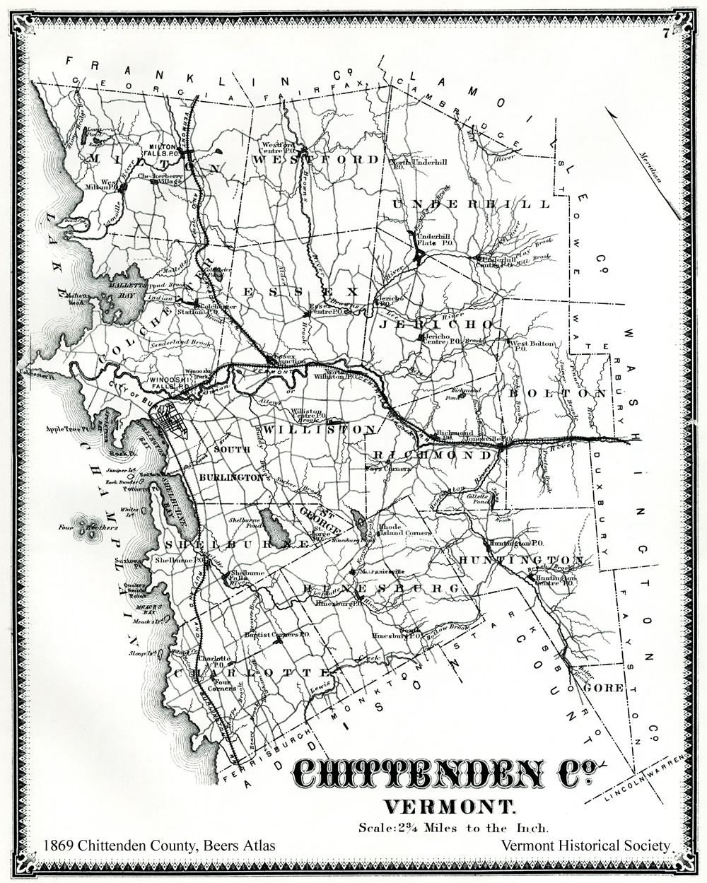
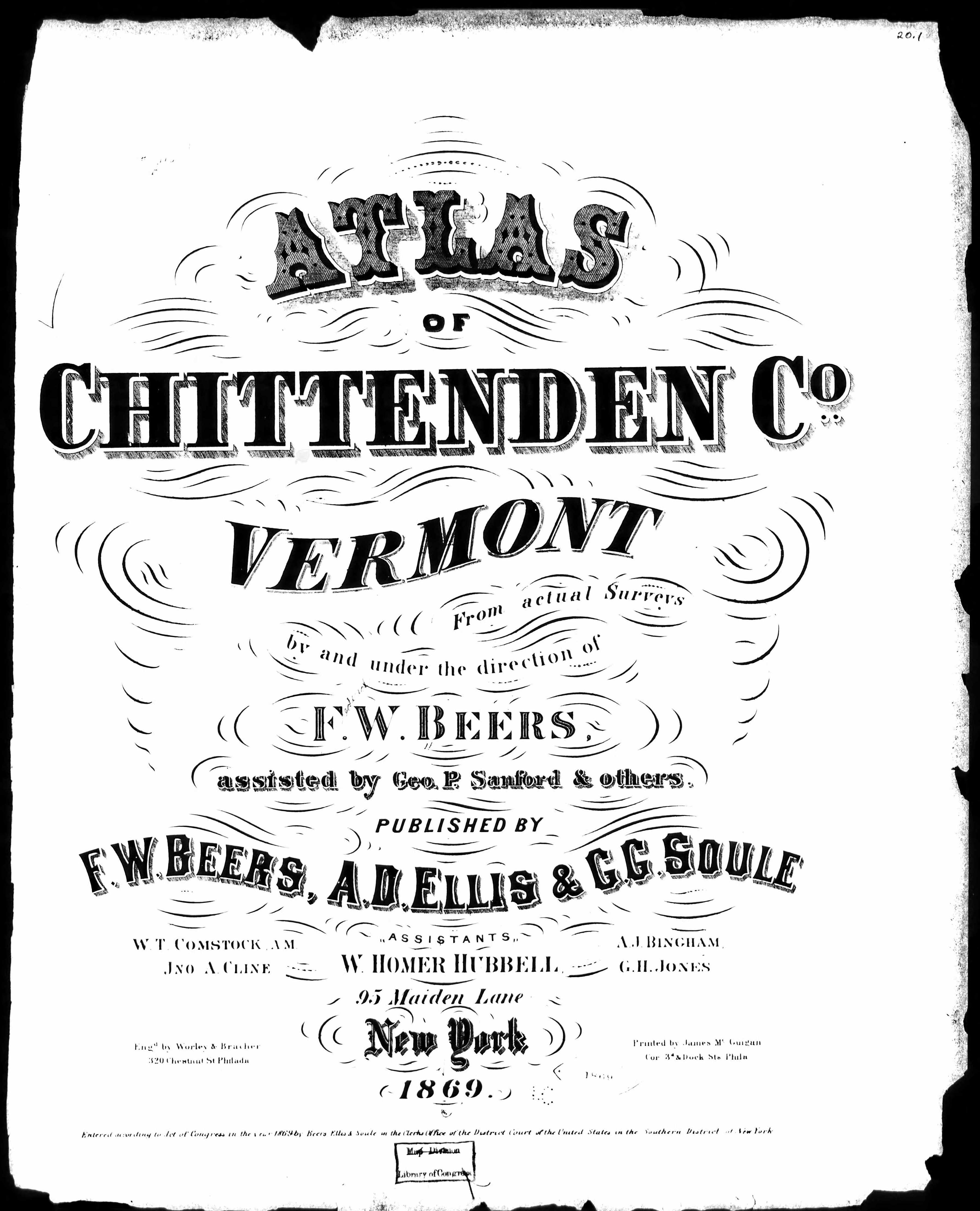
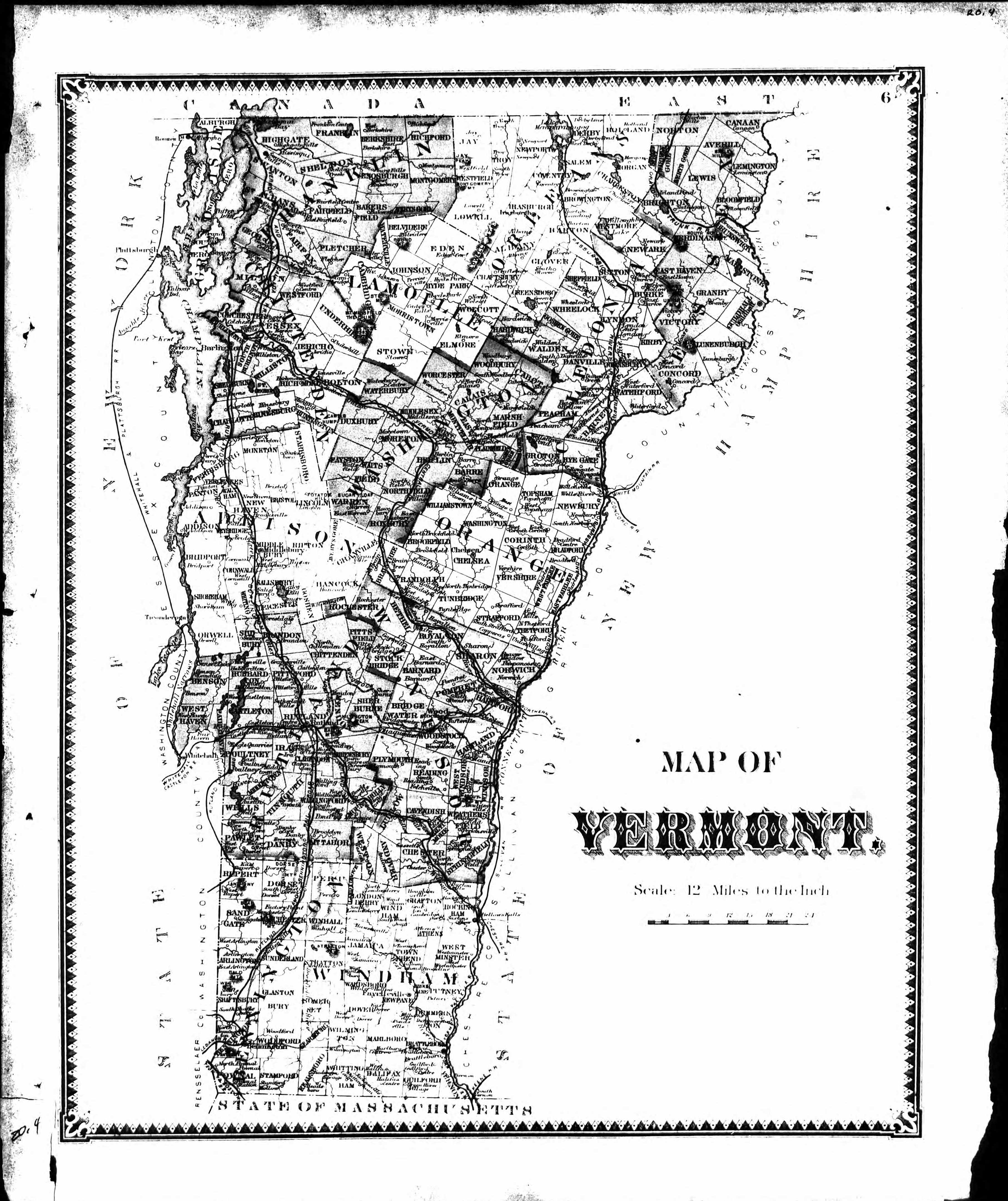
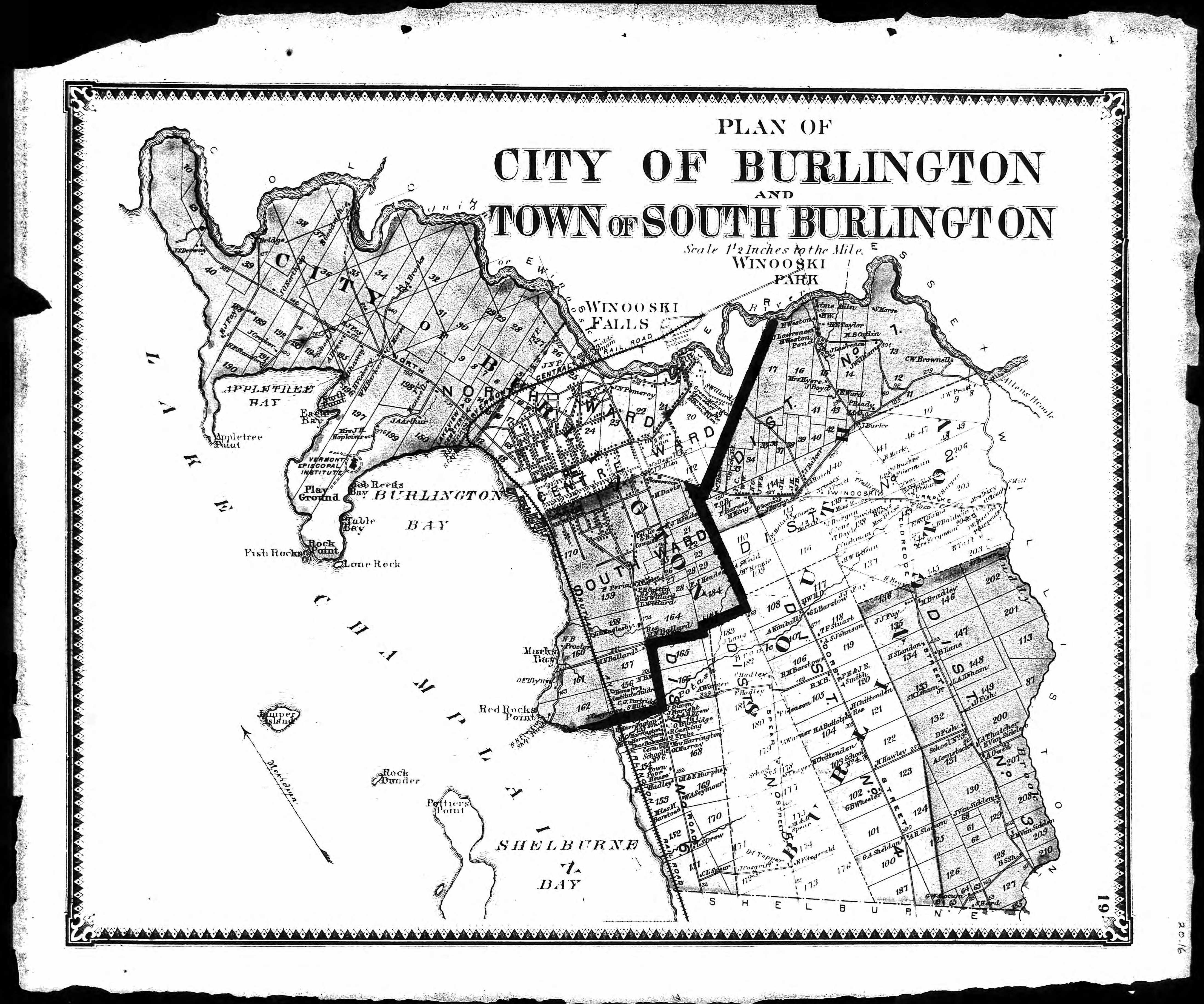
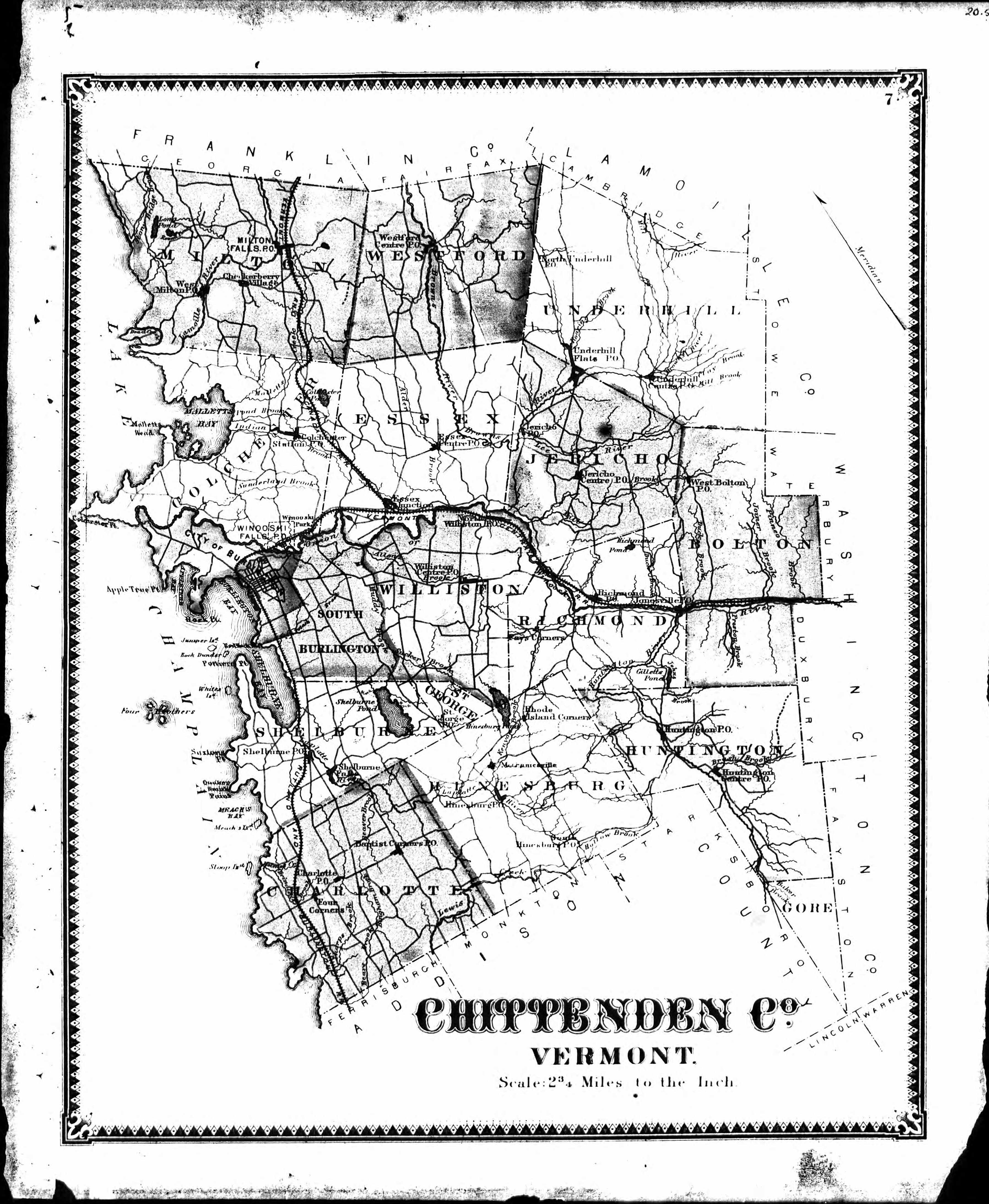
1869 County Map
Modern
|
Cities, Towns, Villages & Hamlets |
|||
|
|||
|
|
|||
|
Townships |
|||
|
|
|
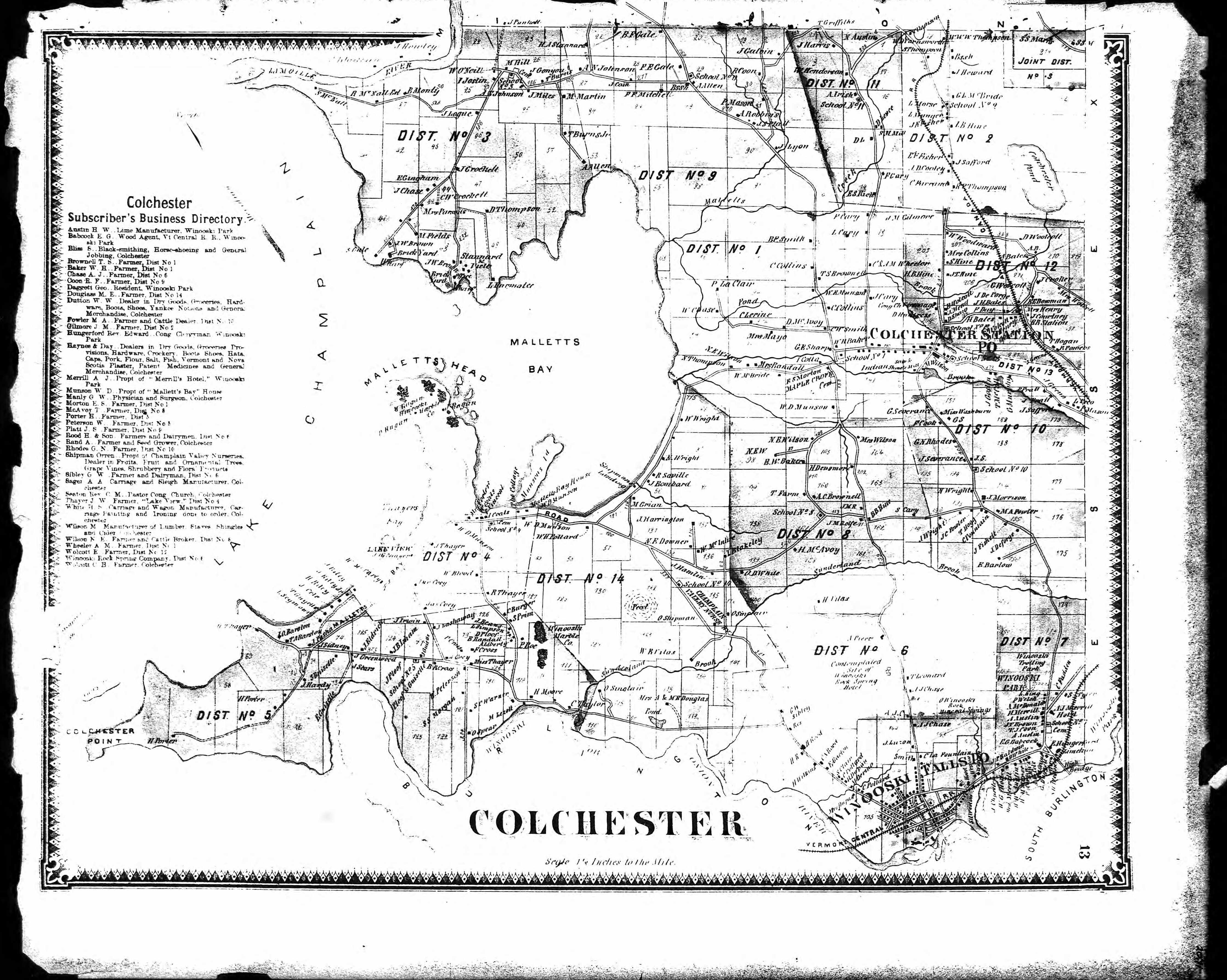
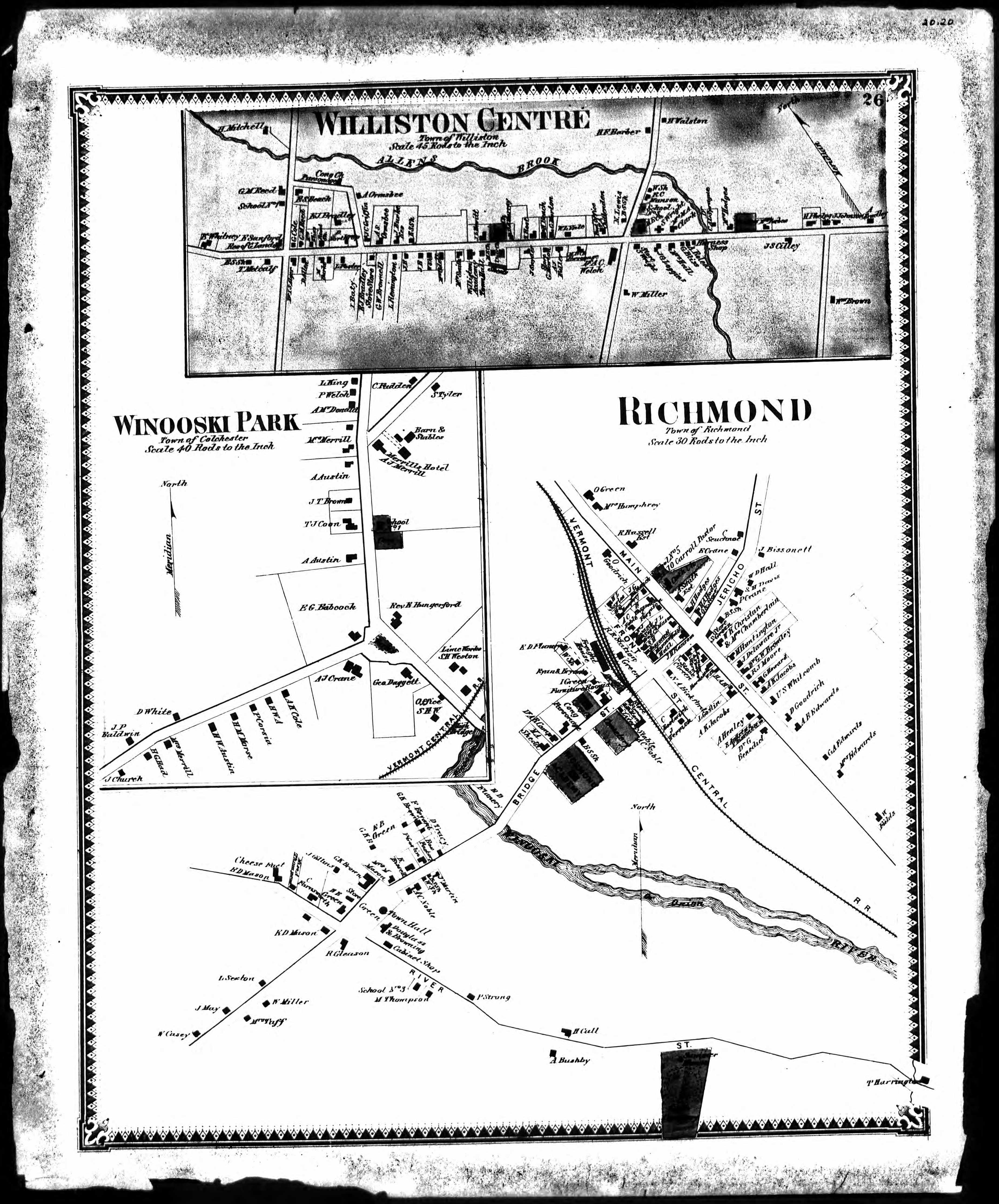
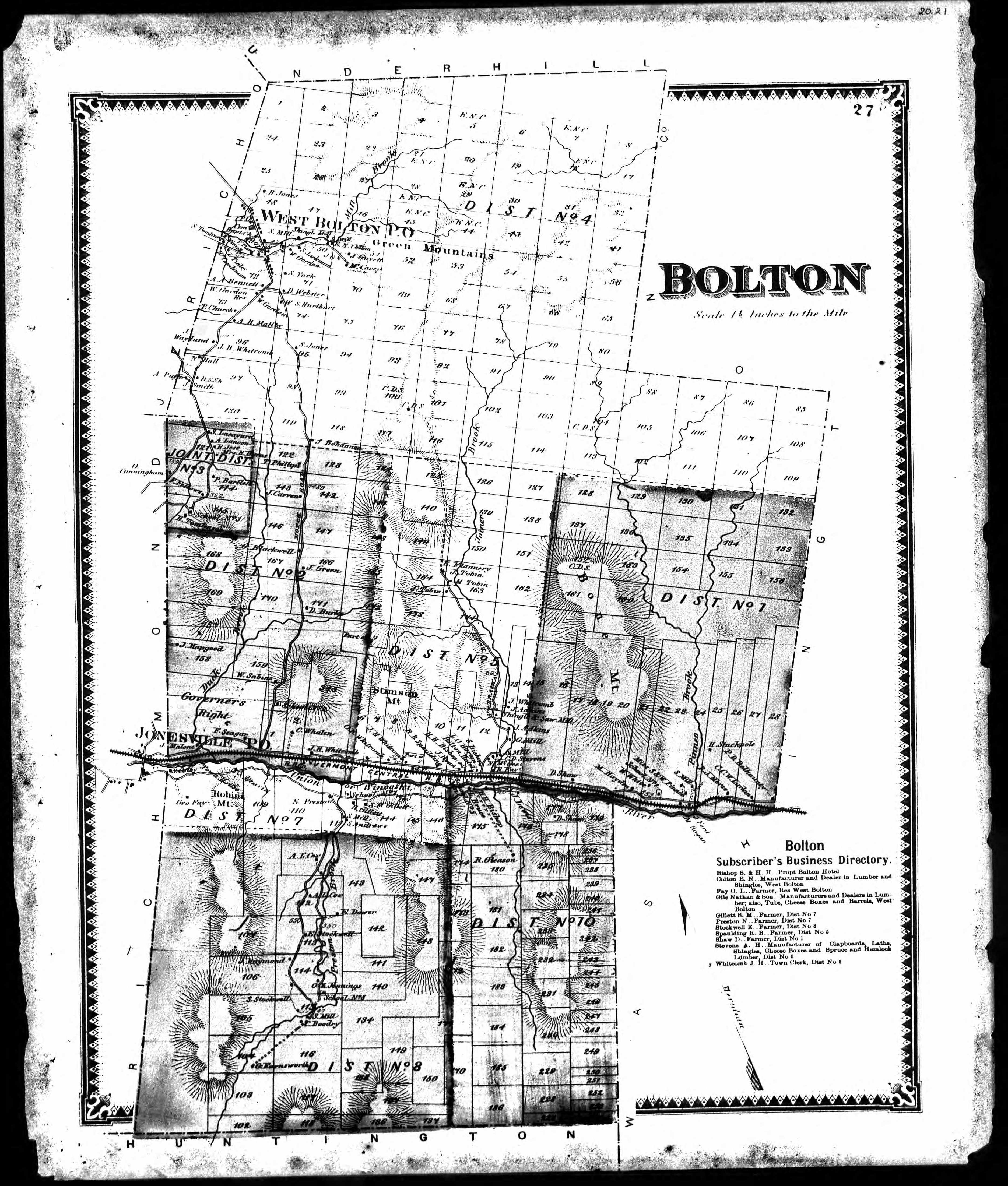
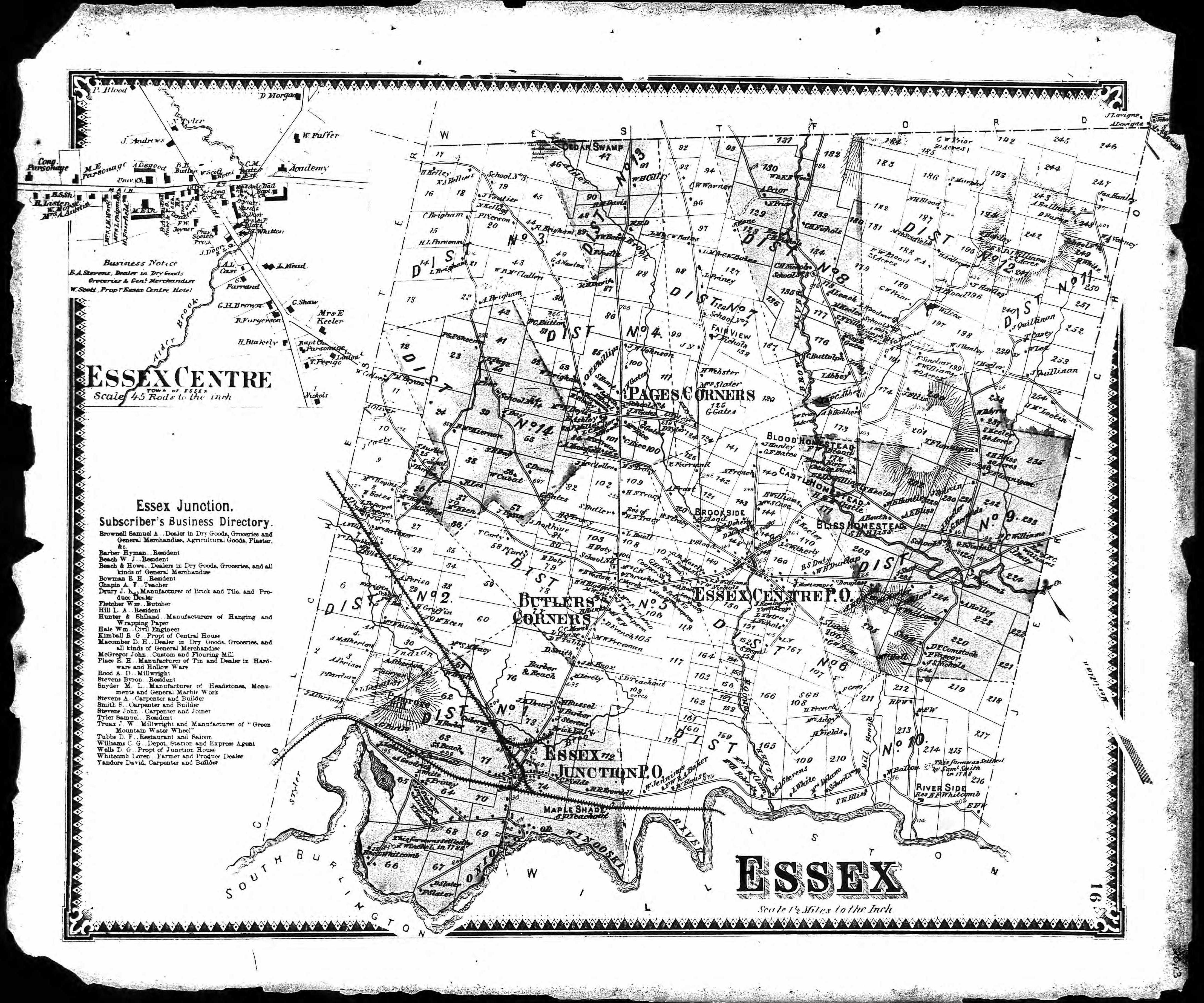
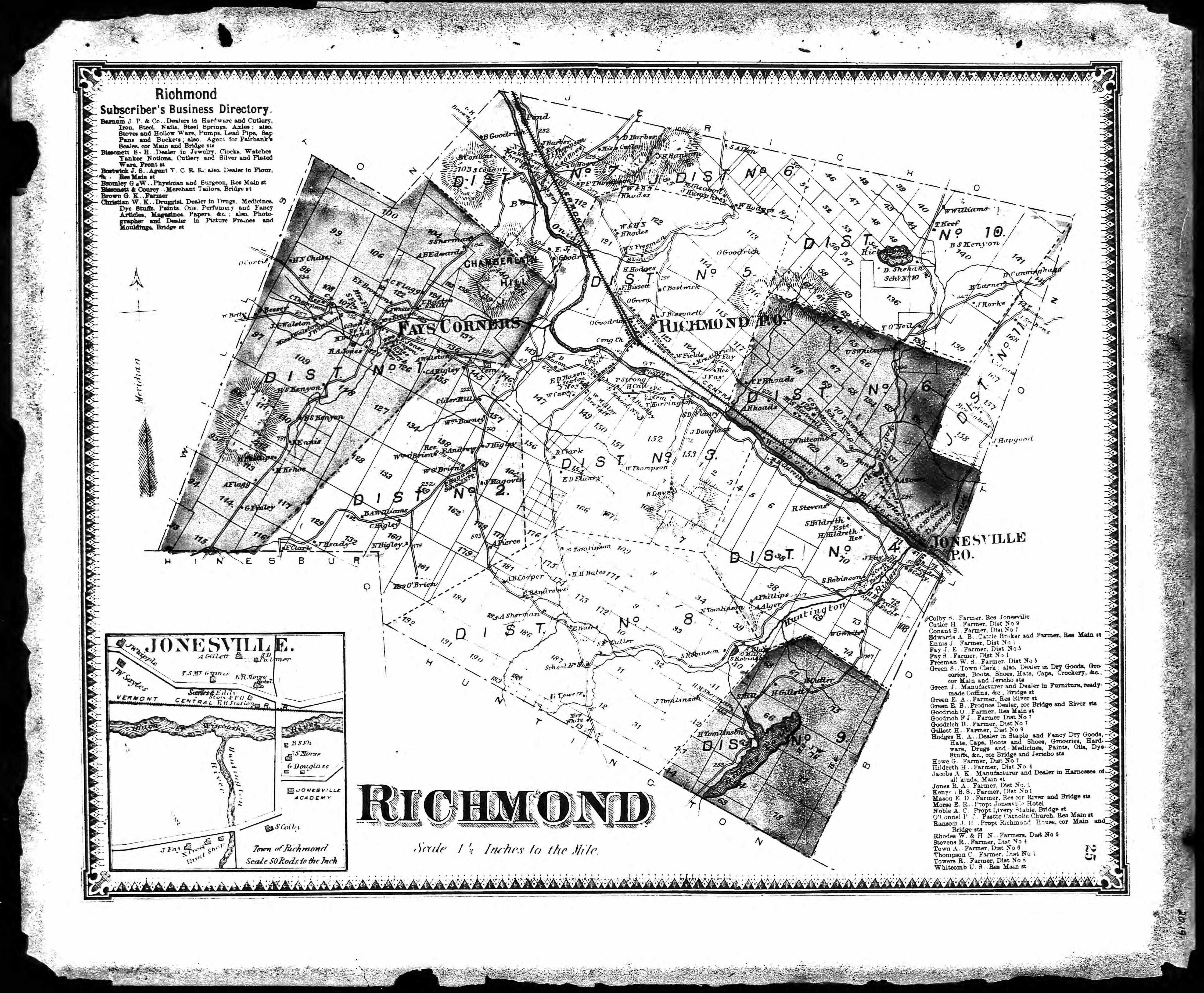
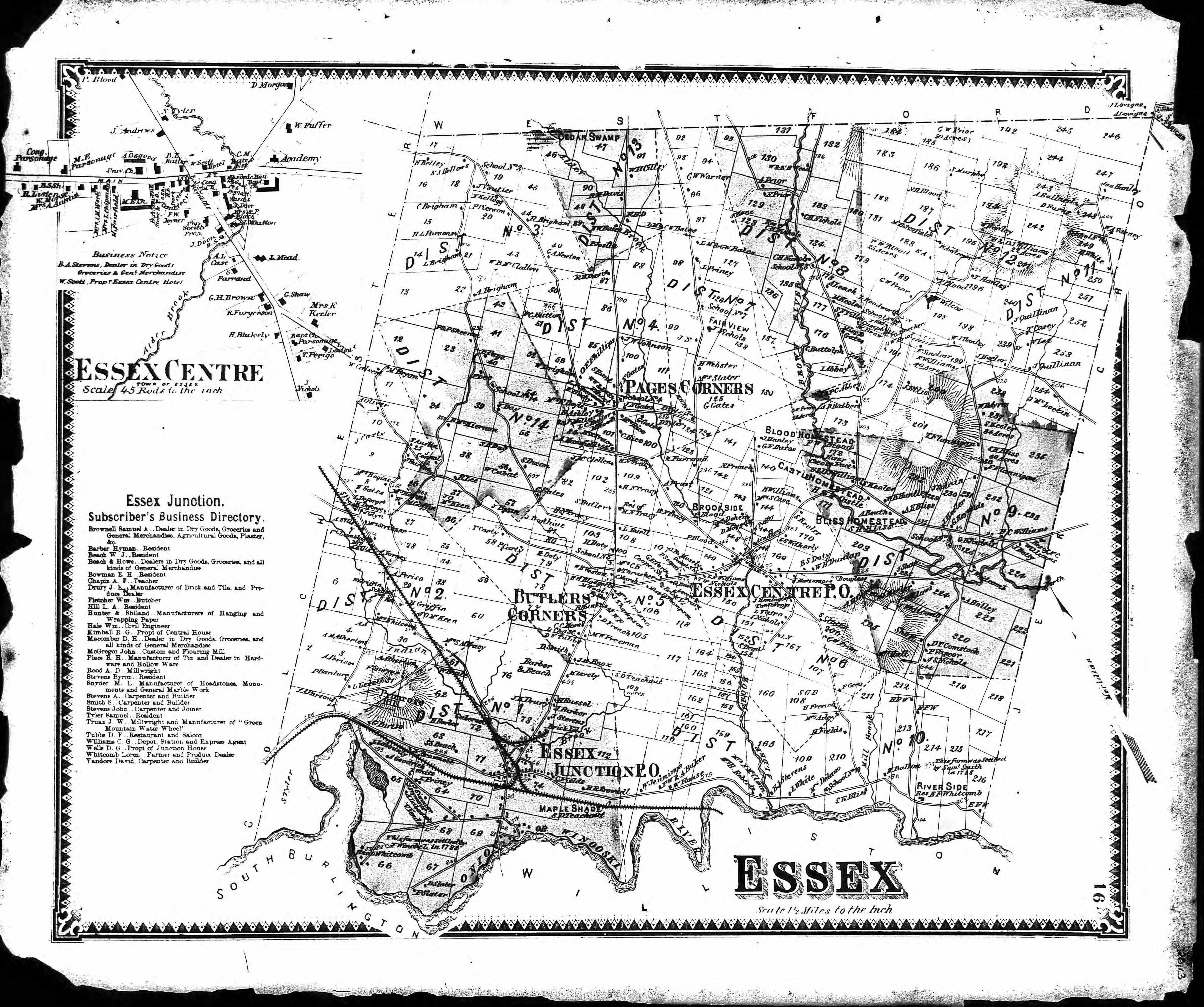
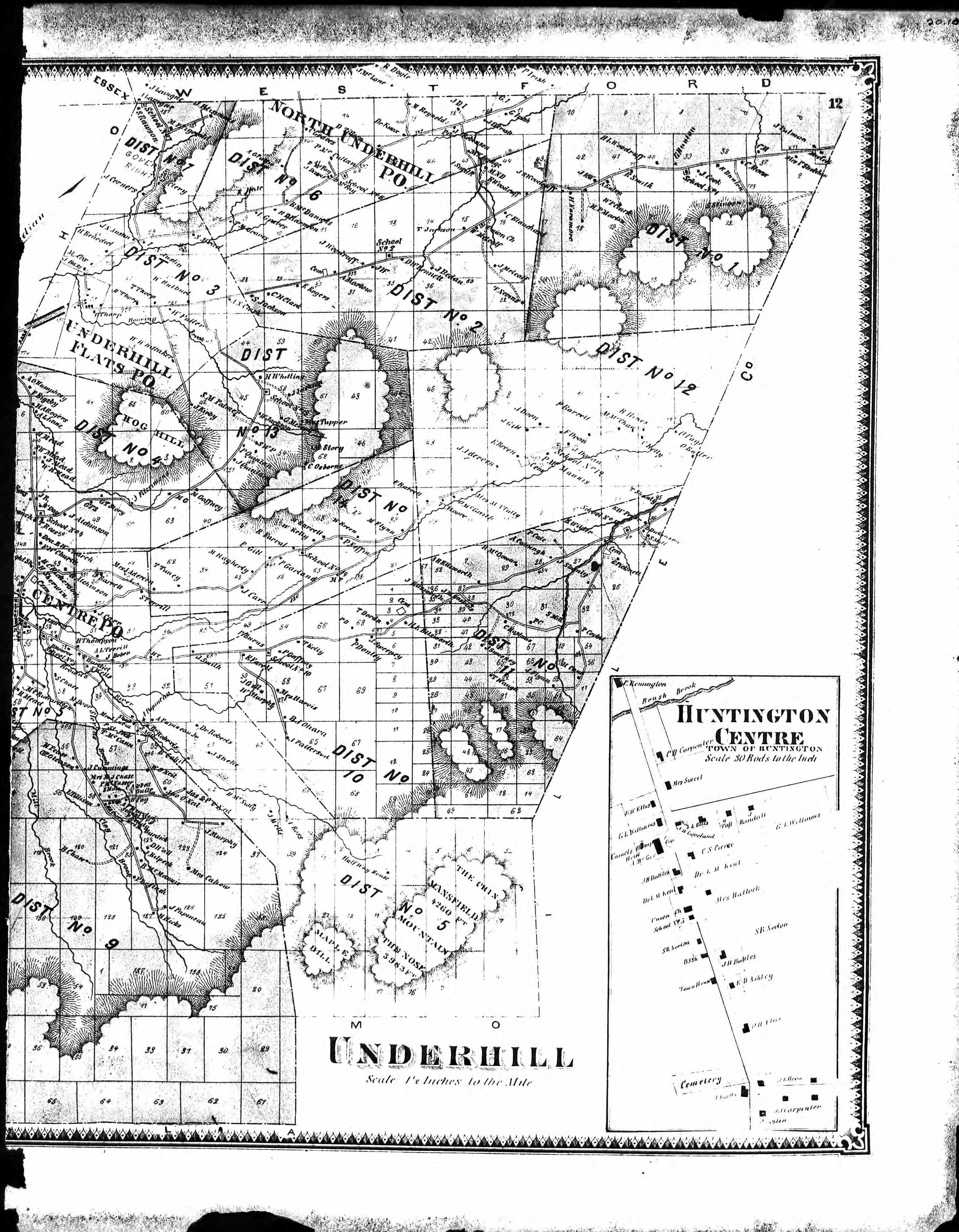
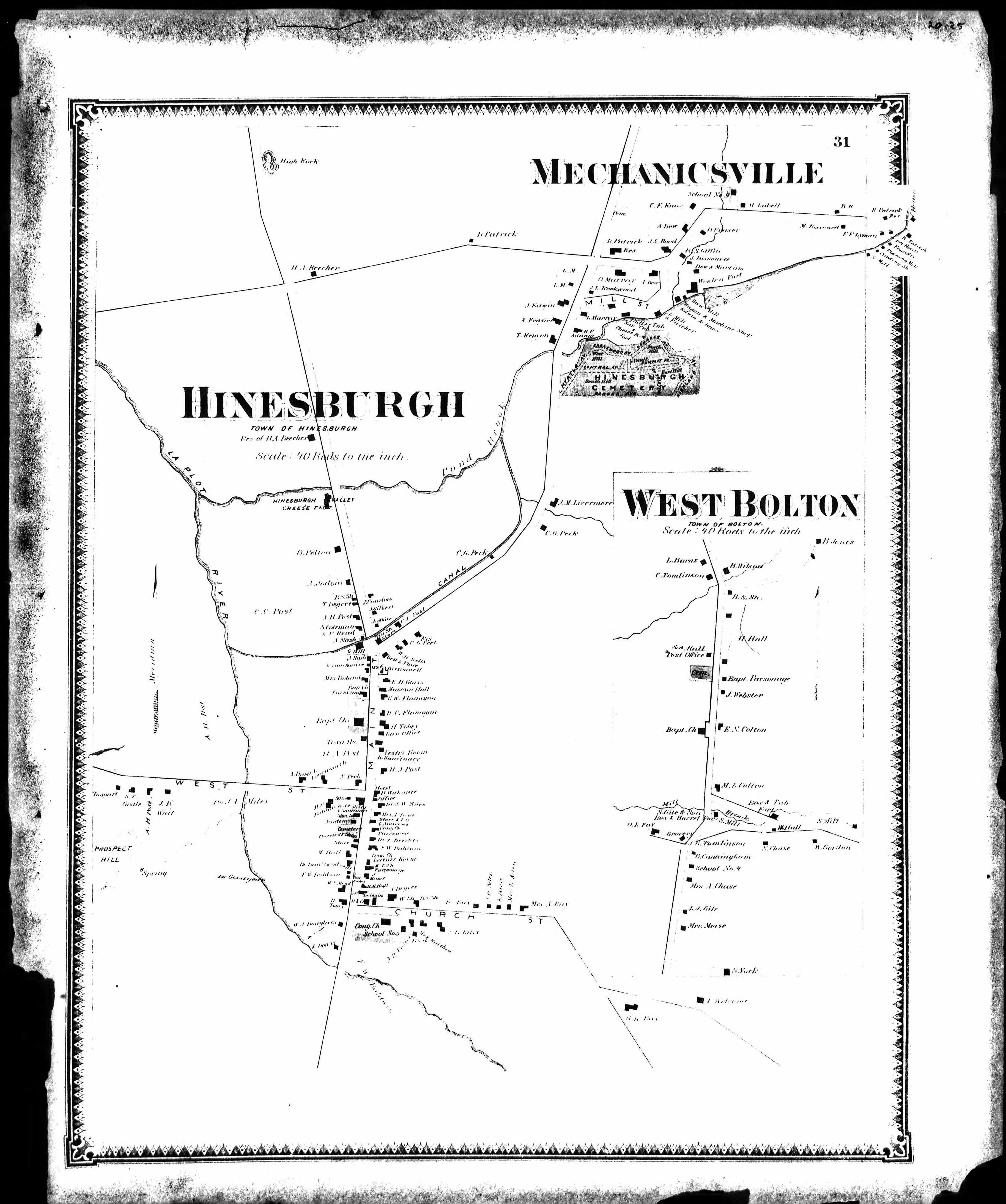
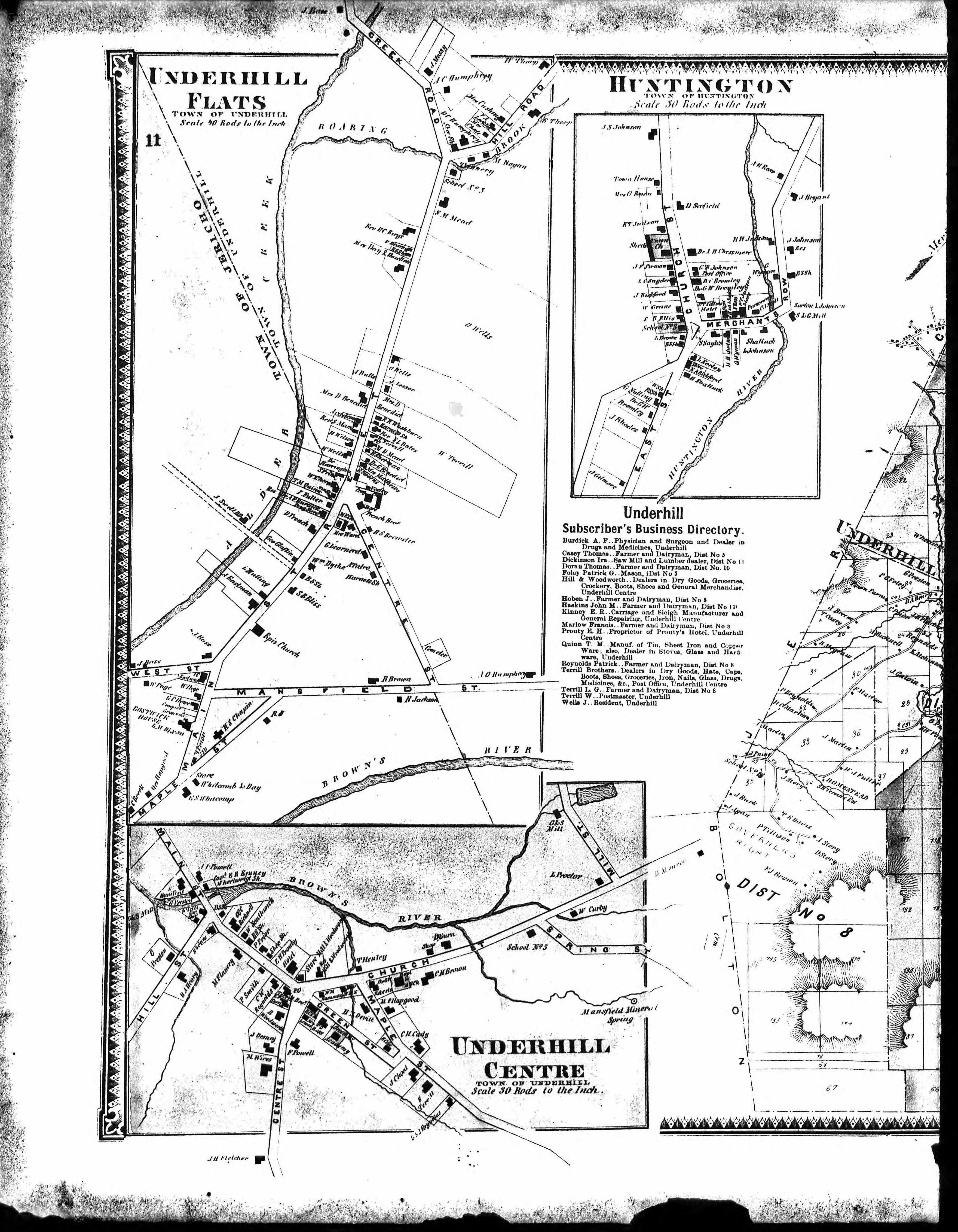
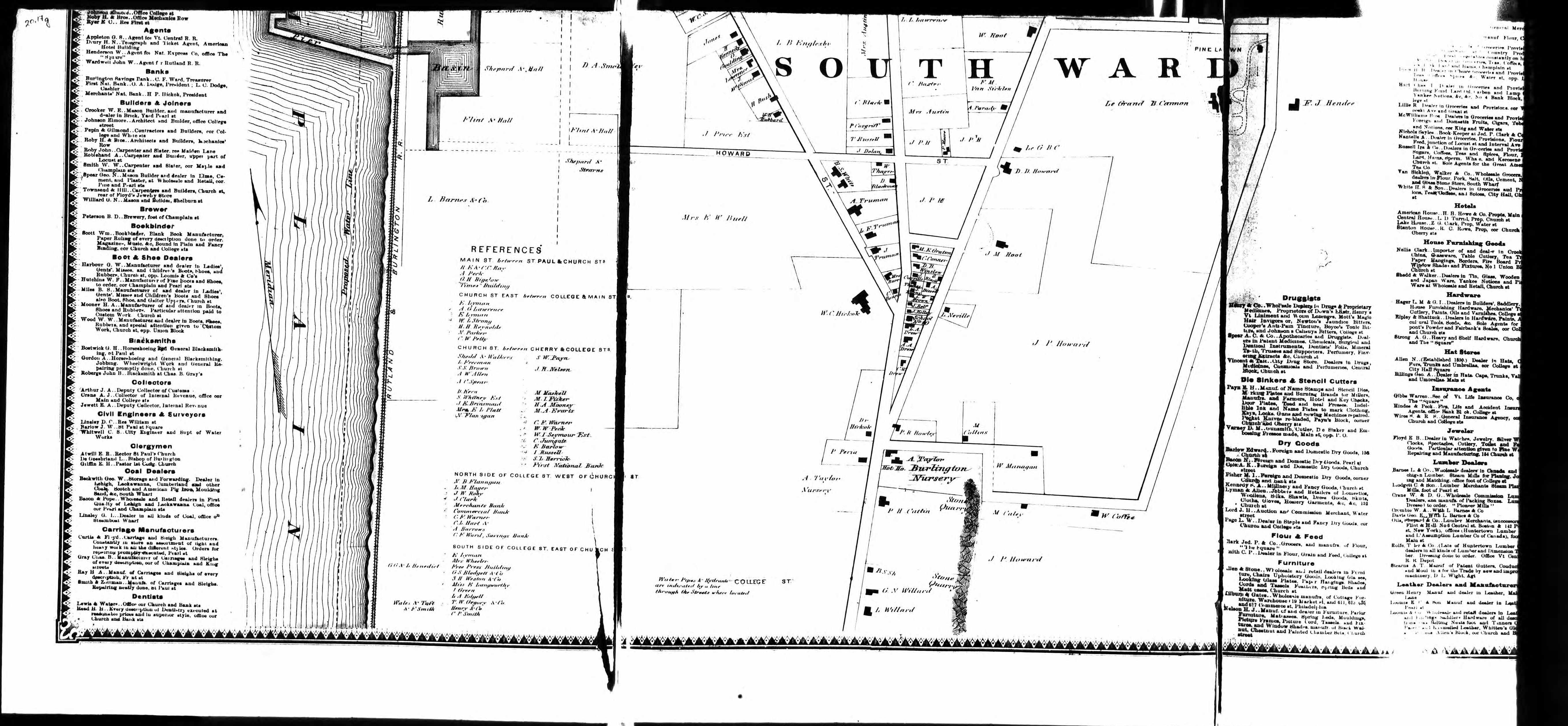
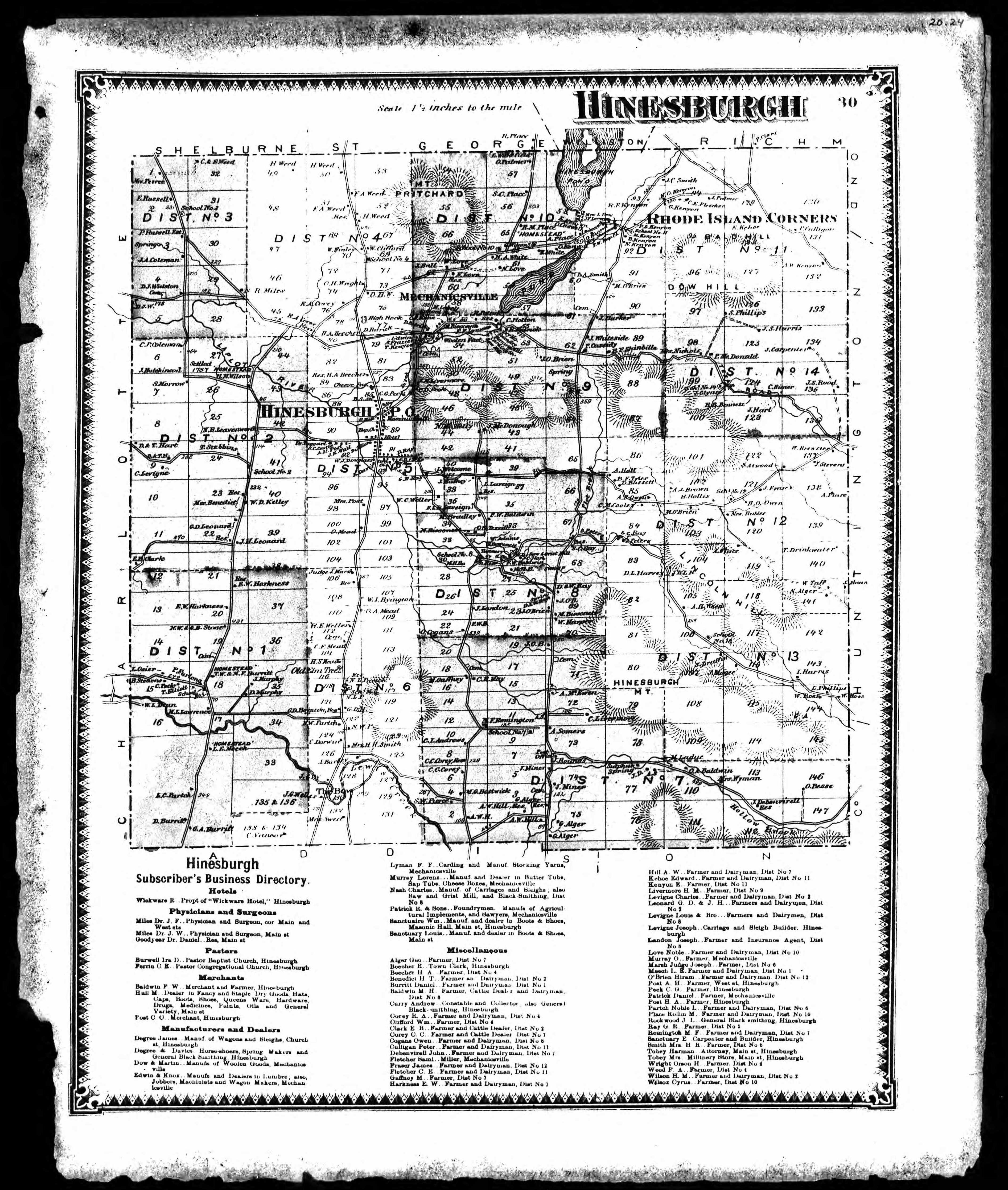
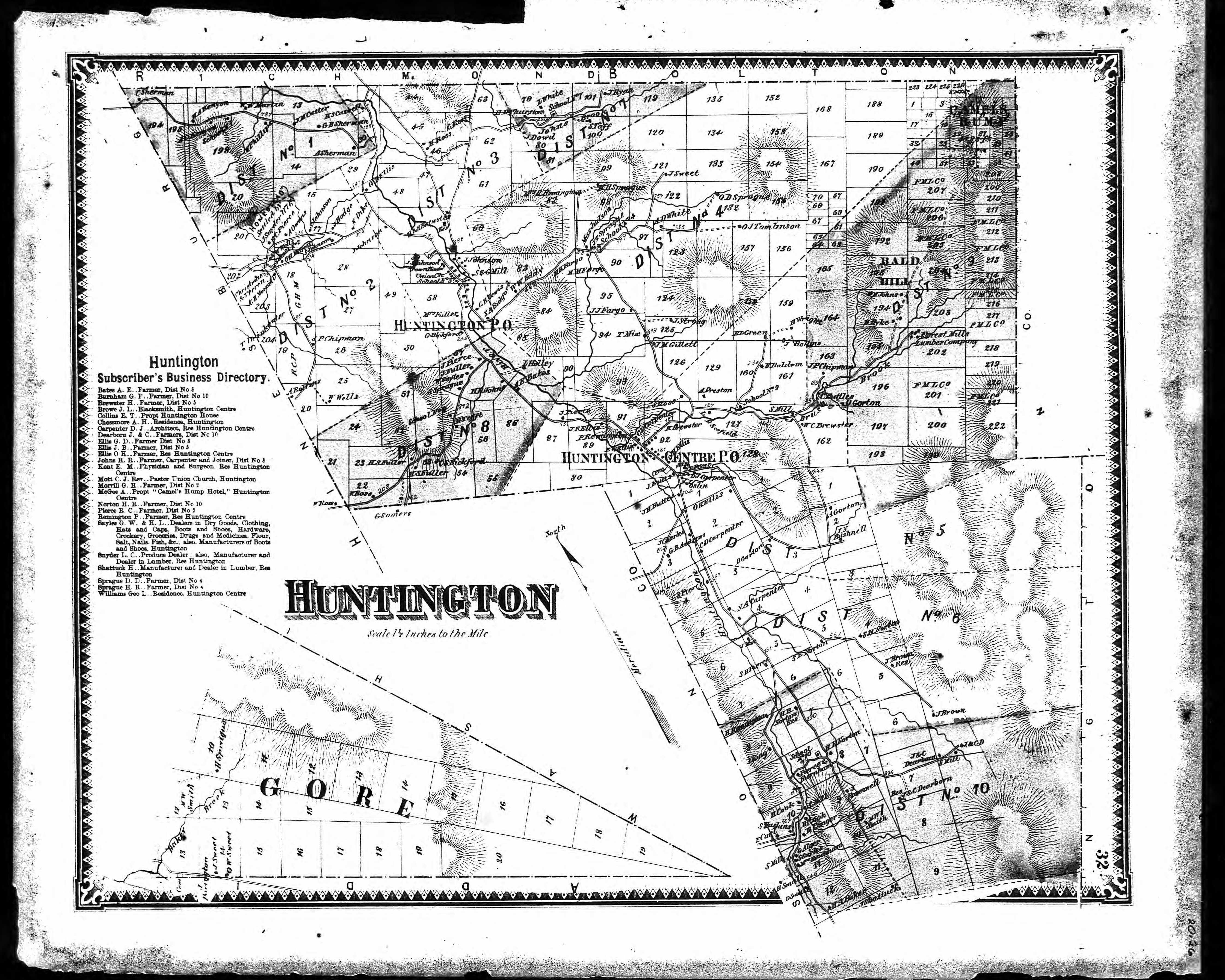
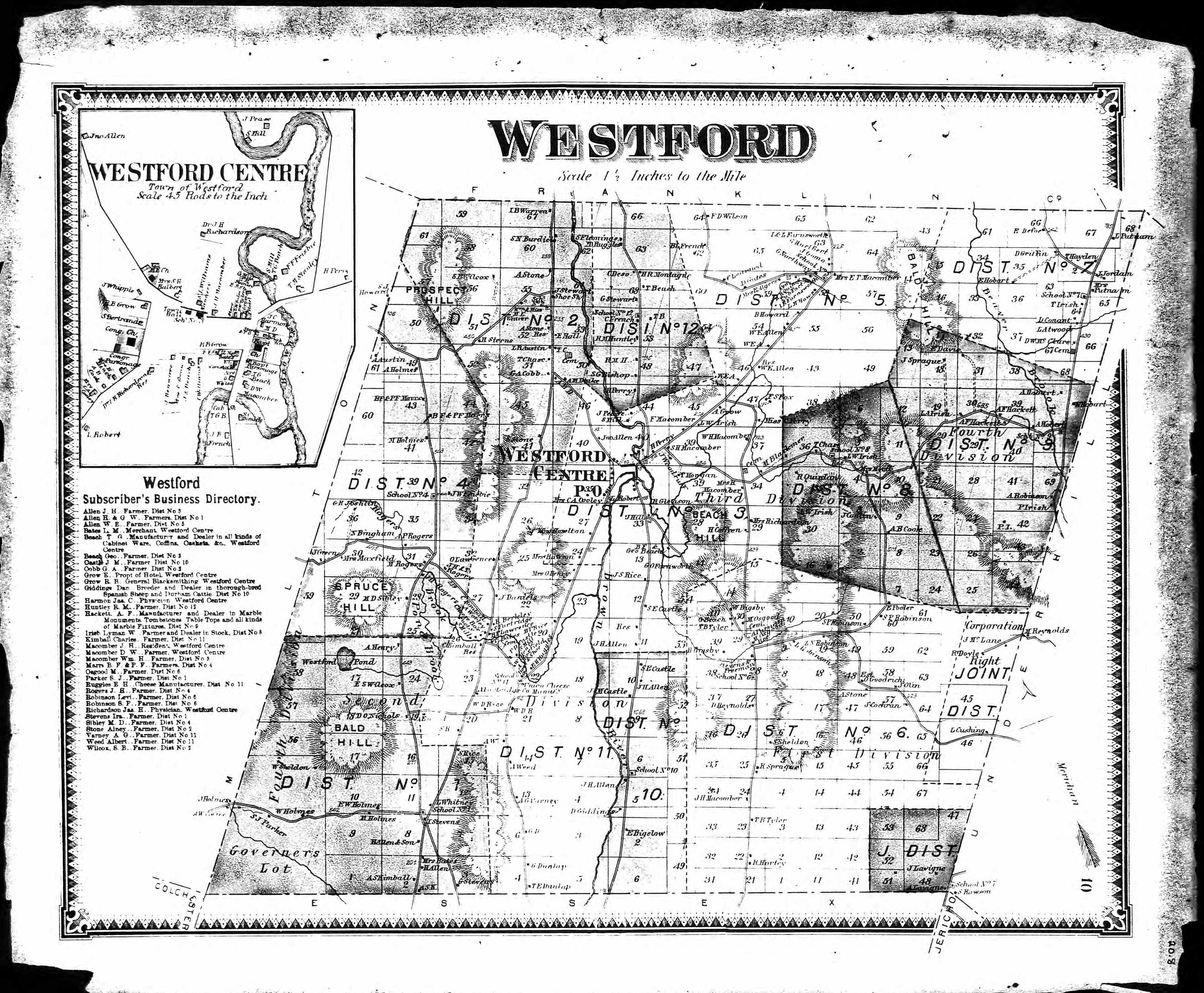
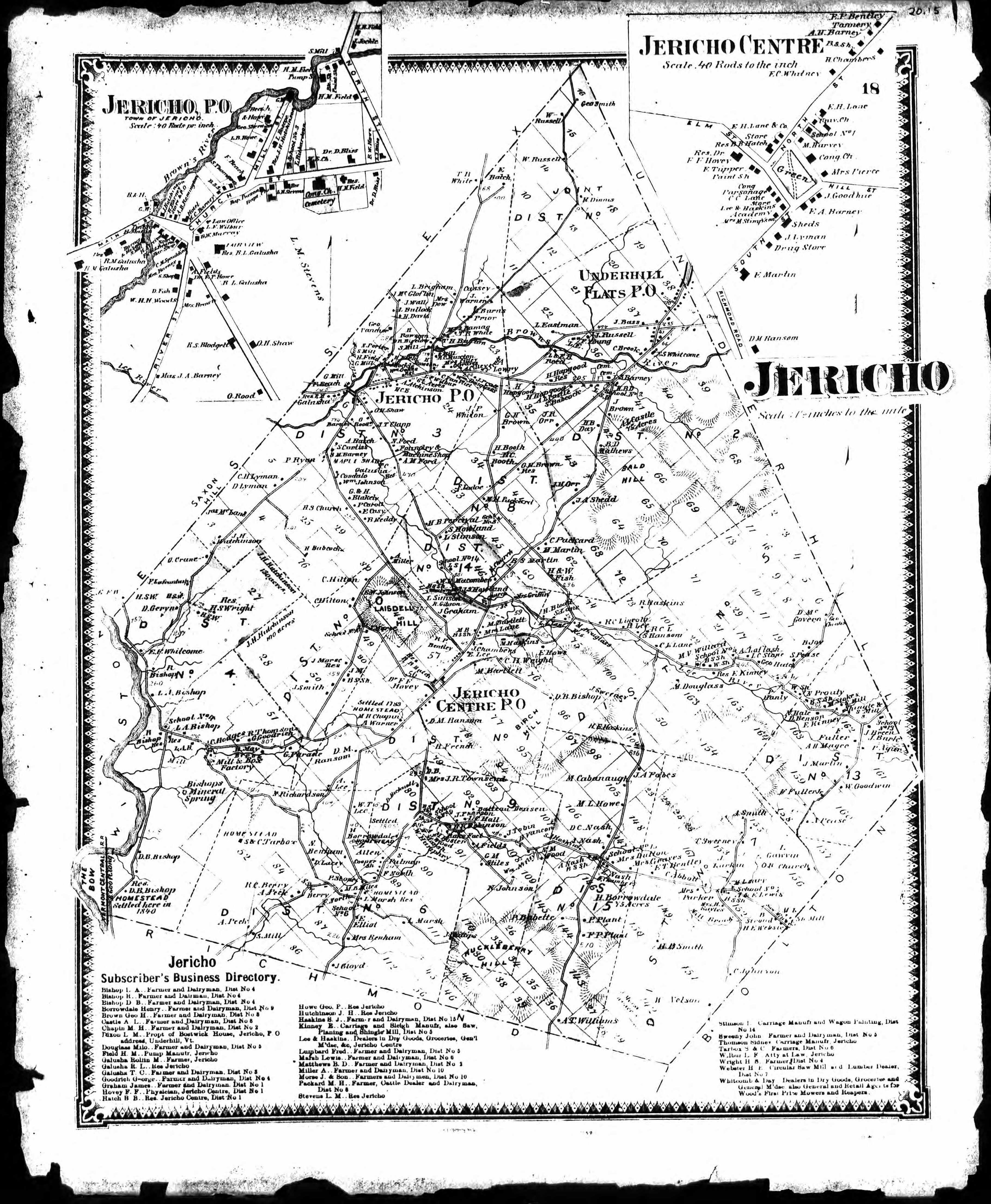
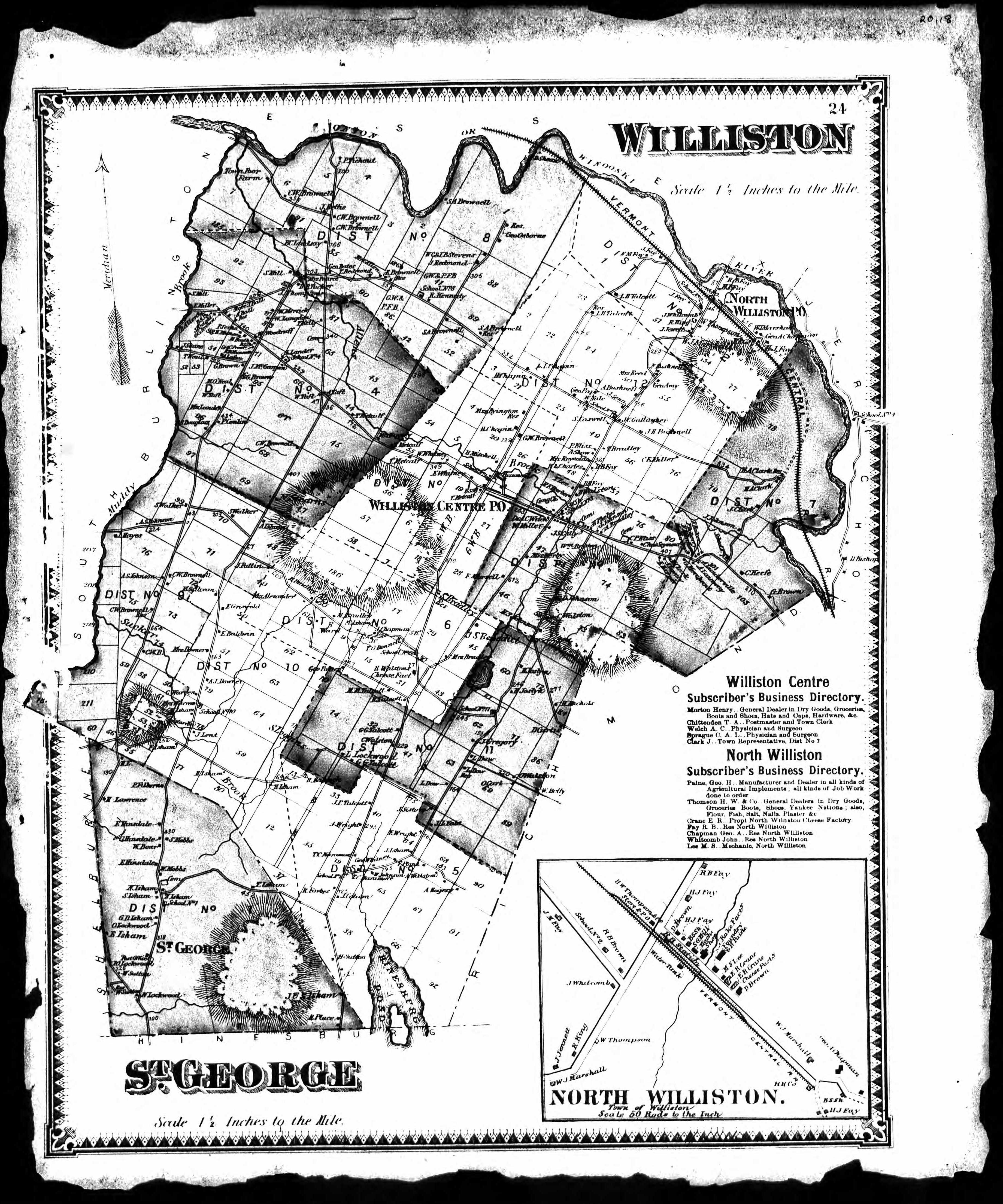
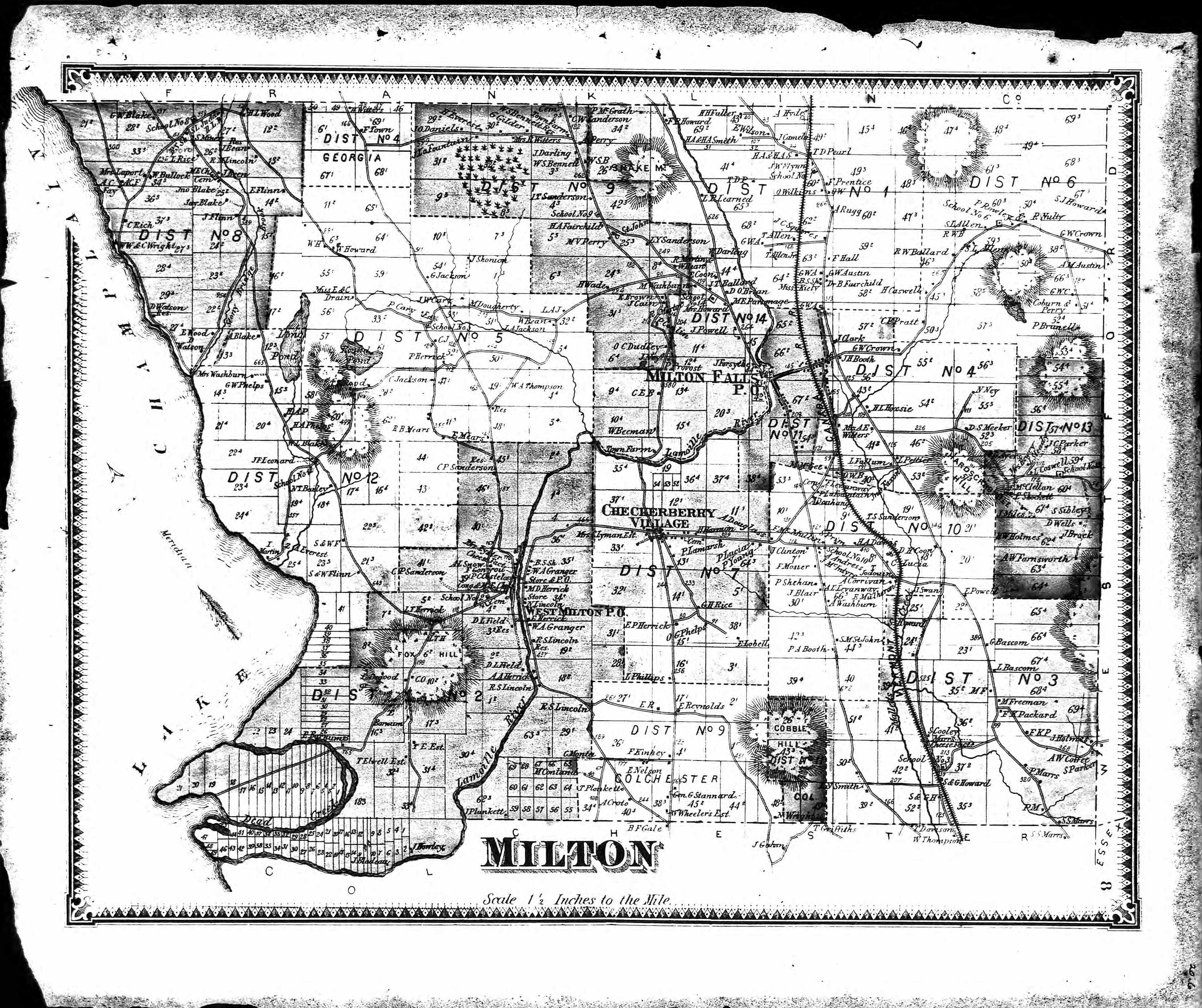
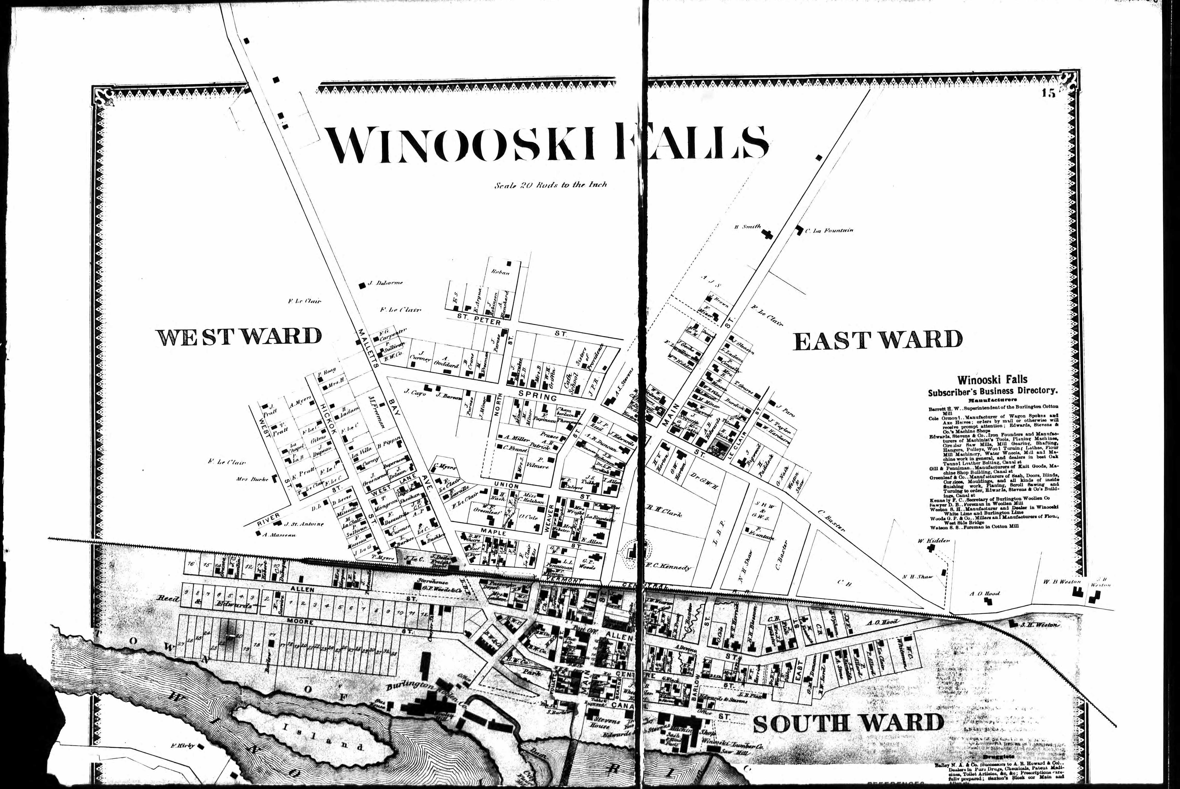
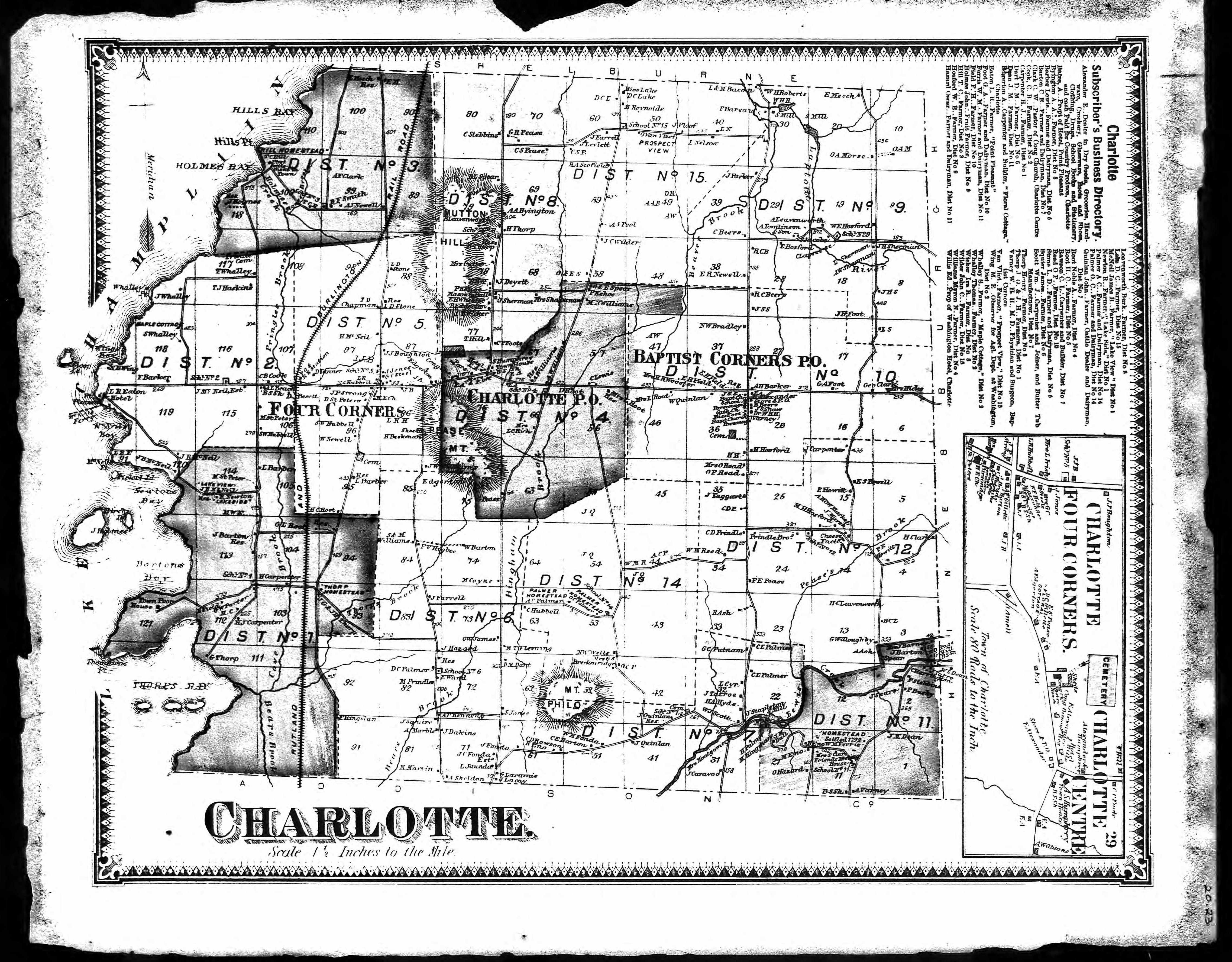
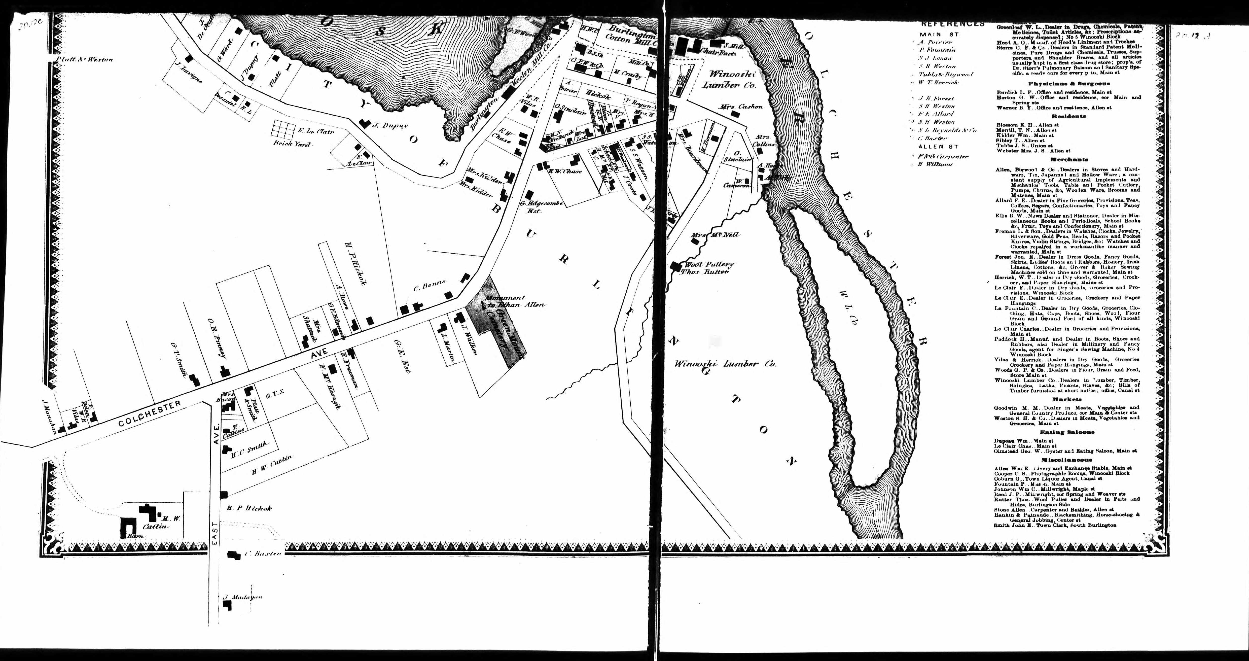
1869 Plat Maps |
|
|
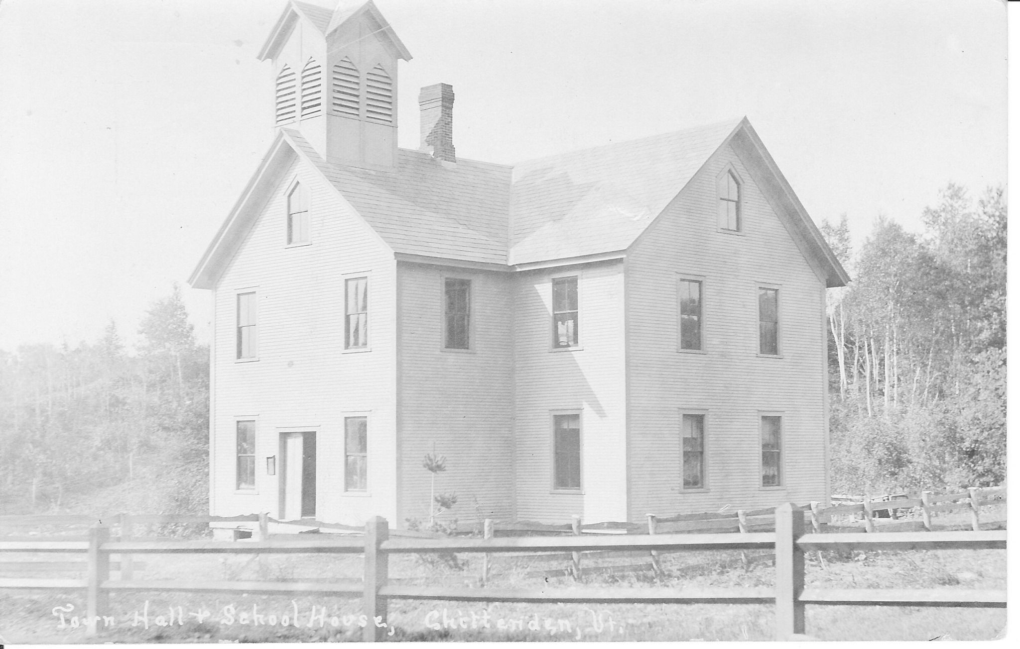 Chittenden: District 5- South Chittenden School ???- First school opened. 1869- School location was shown in the Beers Atlas. c.1890- First school closed and second school opened. 1930- School received a Standard rating. 1931- 27 students were enrolled in two rooms. ???- School closed. The building currently serves as the town hall. The photograph is an undated postcard. 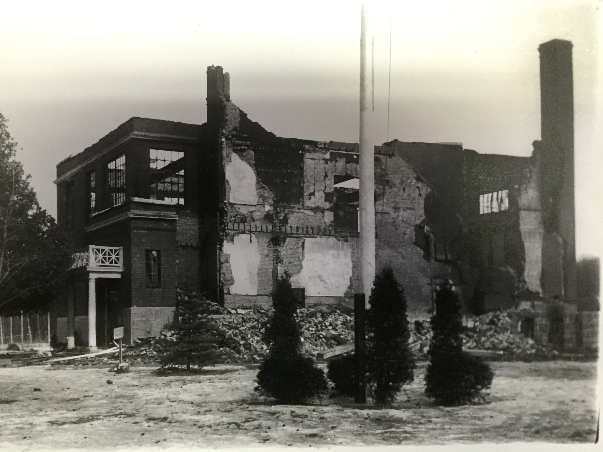 Chittenden County Schoolhouse Story Milton: Milton High School Thursday, February 18, 1943 started out like any normal school day. All of the students from grades 1-12 arrived at school and struggled out of their warm winter outerwear for another day of classes. Around 10:00 am, student Paul Bushey noticed wisps of smoke emanating from a heating vent. He immediately told his teacher, Mr. Bill. Mr. Bill wasted no time- he pulled a nearby fire alarm. The Milton students and staff had many fire drills through the years but this was the real deal. No doubt many of the 200 students believed they were in the midst of another drill. They did not stop for their belongings or winter clothing, they just formed their lines and retreated through the closest exits into the frigid weather. The fire department arrived only to find that the hydrants were frozen so they would have to get their water from a distance. With no immediate water source, the fire spread quickly. The students were brought into nearby homes to warm themselves. Firemen dragged the janitor, Fred Ballard from the burning building. He had reentered the building to make sure everyone was out. Ballard was slightly singed but everyone else had escaped unharmed. The building was completely destroyed. Historically many schools have been destroyed by fire but rarely are the buildings occupied at the time of the fire. The fire drills served their purpose. The students resumed their classes in various town buildings and a new school was constructed in a short amount of time. The photograph (1943) is courtesy of the Milton Historical Society. |
|
|
|
Off~Site Links |
|
Vermont Land Records, Early to 1900 - Land records give the locations and dates for land transactions with the names of buyers and sellers.
Bolton Land Records - You need to sign into FamilySearch to view.
Vermont State Archives & Records Administration - Lotting plans divided land among the proprietors of the town who were originally granted the land. Use dropdown menu for 'Current Name' and select 'Chittenden County (vt.)' for 19 maps.
1857 Map of Chittenden County, with land owner names
Library of Congress - Maps for Chittenden County VT; Sanborn Maps
University of Texas Libraries - Historic Topo Maps of Vermont
David Rumsey Map Collection for Chittenden County VT
Vermont History Explorer - County Maps
Google Earth - Opens over Vermont
|
Chittenden County VTGenWeb Copyright
Design by Templates in Time
This page was last updated 07/14/2026