
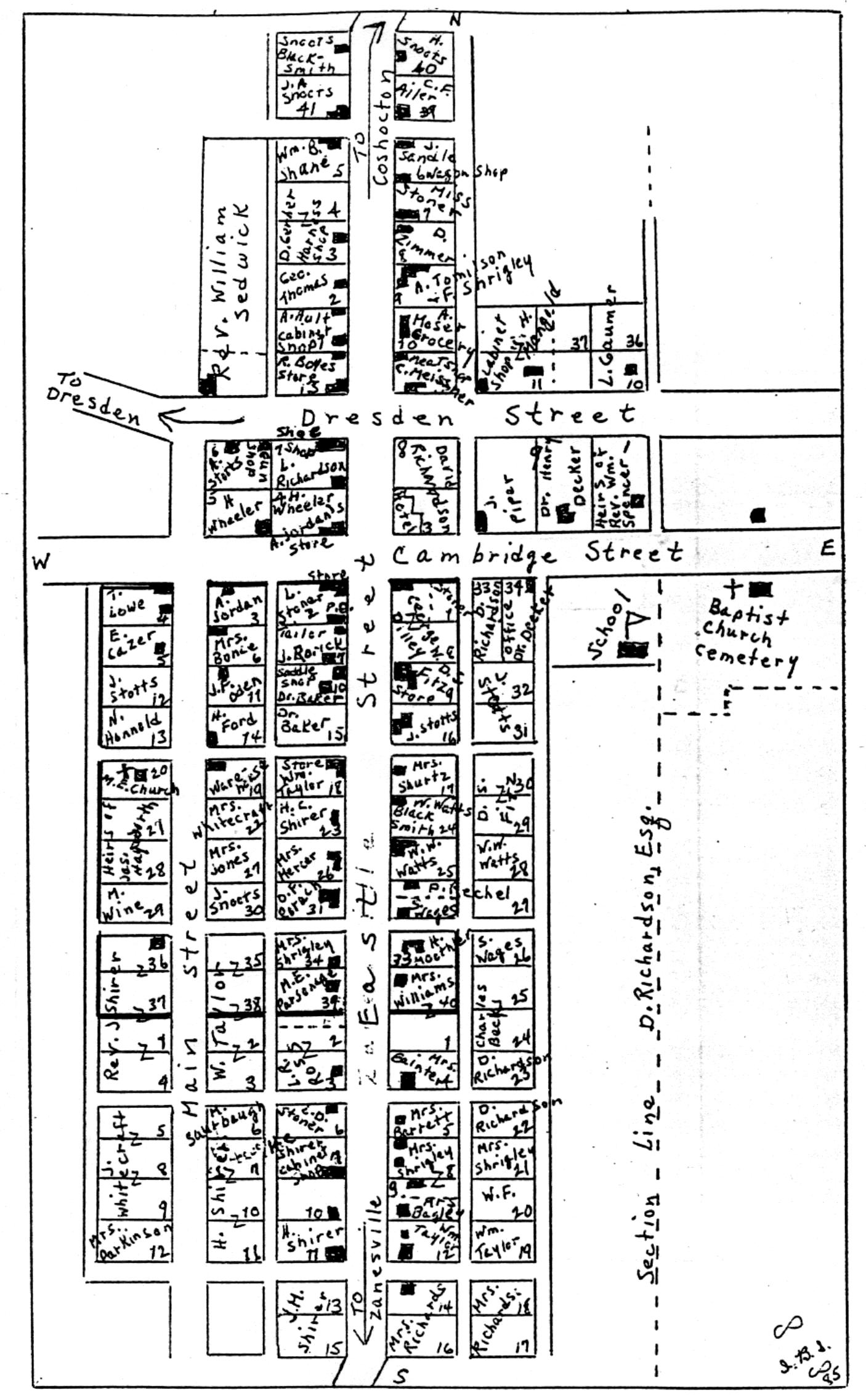
Adamsville Plat Map - 1866
|
The original Adams plat laid out by Mordecai Adams is shown bounded by the darker lines. The Wheeler addition lie's north of Cambridge Street and the Cone's addition lies to the east and south of the original plat. |
Map created by Ione Bradford Supplee

Last Updated on Sep 21, 2021
Denny Shirer