Churchill County Nevada in Maps
| |
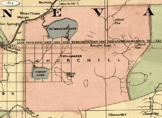
 Churchill County 1874 (82k)
Detail from a map of California and Nevada, Library of Congress, American Memory Map Collection. CALL NUMBER
G4360 1874 .A8 RR 188
“[New commercial and topographical rail road map & guide of California and Nevada]” Asher & Adams,
Created/Published: New York, 1874.
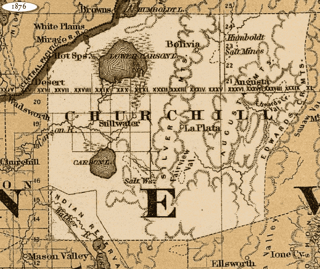
Churchill County 1876 (132k)
Detail from a map of California and Nevada, Library of Congress, American Memory Map Collection. CALL NUMBER
G4361.P3 1876 .G15 RR 568
“Map of California to accompany printed agreement of S. O. Houghton as to the rights of the
Southern Pacific R.R. Co. of Cal. to government lands under Acts of Congress passed July 27, 1866 and March 3,
1871 made before the committee of the judiciary of the Senate and Ho. of Reps. in May 1876.” G.W. & C.B.
Colton & Co., Created/ Published: [n.p., 1876]
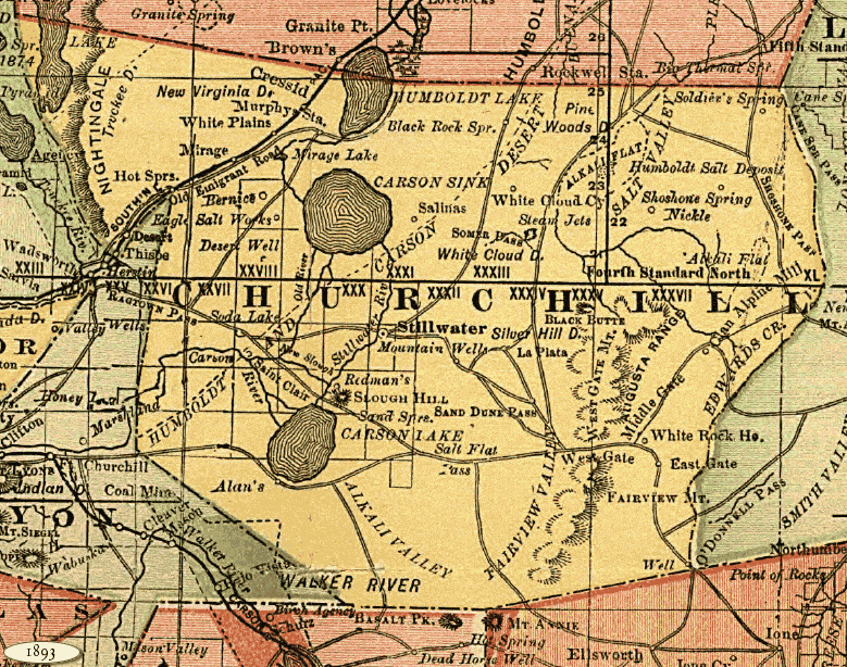
Churchill County 1893 (246k)
Detail from a Nevada state map, Library of Congress, American Memory Map Collection. CALL NUMBER G4350 1893 .R3 RR 253
“Indexed county and township pocket map and shippers guide of Nevada, accompanied by a new and
original compilation and ready reference index, showing in detail the entire railroad network.”
Rand McNally and Company, Created/ Published: Chicago, 1893.
|
|
