
by Betty Eichhorn
Understanding the historical boundaries of a county is crucial for genealogical and historical research. Knowing these boundaries helps ensure you're searching in the correct courthouses and census records. The following timeline highlights significant changes in the boundaries of Brevard County, providing essential context for where to locate historical documents.
1821-1844 Florida Territory. Brevard was part of Mosquito County (only material is currently in the USGW Archives).
14 Mar 1844 The county called St. Lucie was created. Note: The 1850 census of Brevard is under the title St. Lucie. Do not confuse with the present day St. Lucie County.
3 Mar 1845Florida became the 27th State.
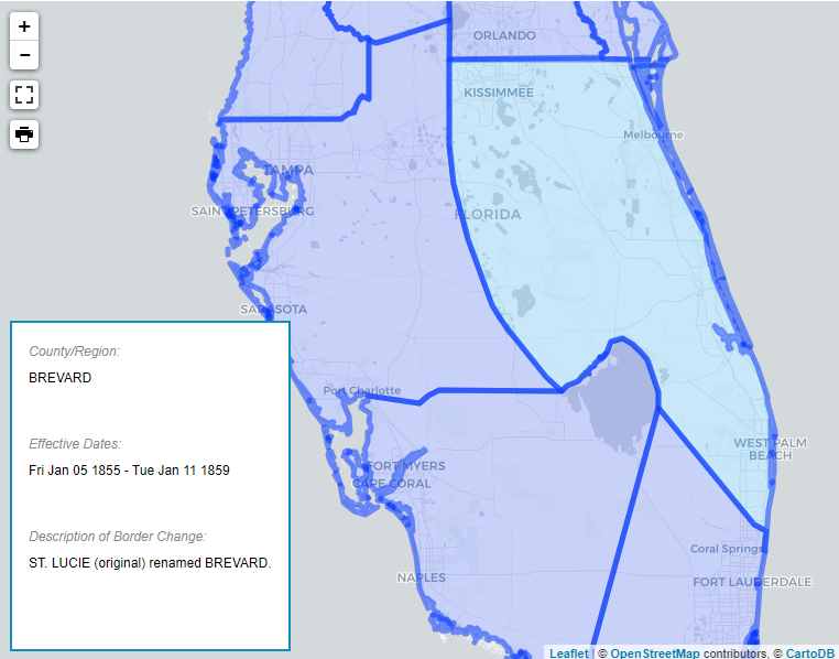
6 Jan 1855 St. Lucie renamed Brevard.
Brevard County covered a vast area with boundaries that changed several times. It included the eastern
half of Polk, Highlands, Glades, and Palm Beach Counties and all of present-day Martin, St. Lucie,
Okeechobee, and Indian River Counties, and some to all of Osceola County and sometimes a part of Orange
County. The northern part of Brevard would be in Orange and later Volusia County.
8 Feb 1861 Polk County created, making the Kissimmee River Brevard's western boundary.
8 Dec 1866 Dade County created. Brevard lost all territory south of a line paralleling the northern shore of Lake Okeechobee, including most of Martin County except for a small portion in the northeast corner.
19 Feb 1874 Brevard lost Highlands County and most of Glades County.
11 Mar 1879 Northern boundary of present-day Brevard County established. Prior to this time, the northern boundary (including present-day Osceola County) moved up and down over the years.
11 July 1887 Osceola County established. Brevard lost the territory of present-day Osceola and Okeechobee Counties.
1 July 1905 St. Lucie County was created which established the southern boundary of Brevard County.
3 Nov 1959 Brevard lost a small coastal area south of Sebastian Inlet to Indian River County.
Note: Source, and for more detailed information, see Florida Atlas of Historical County Boundaries, John H. Long, Editor. Charles Scribner and Sons, New York. 1997. Newberry Library has placed this information on map so you can see the boundary changes.
County Coordinator: Tricia Aanderud
State Coordinator: Jeff Kemp
Asst State Coordinator: Tricia Aanderud
This site is part of the FLGENWeb and USGenWeb® Project. Content is donated by hardworking volunteers. If you are interested in helping, please contact a coordinator for more information.
![]()