Maps & More
City, County & Plat Maps, Land Records
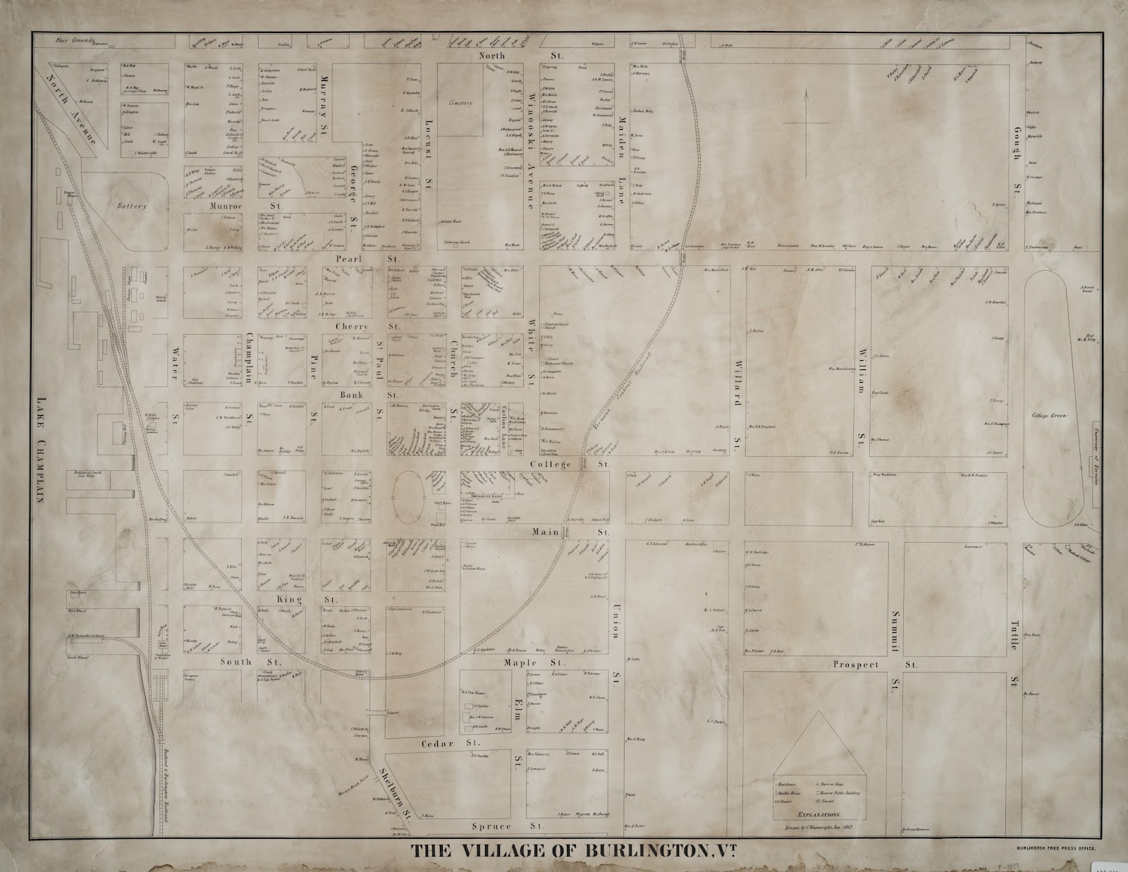
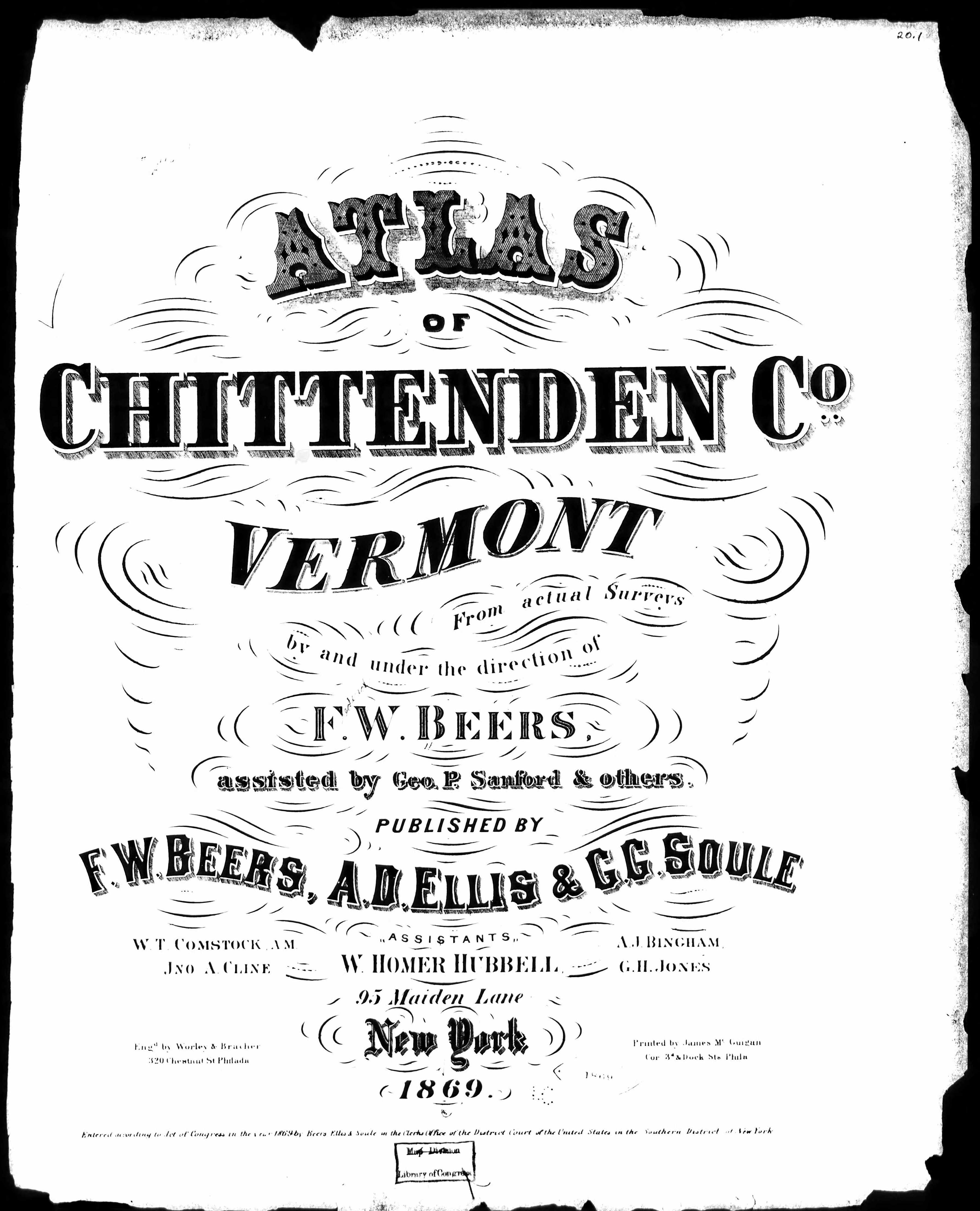
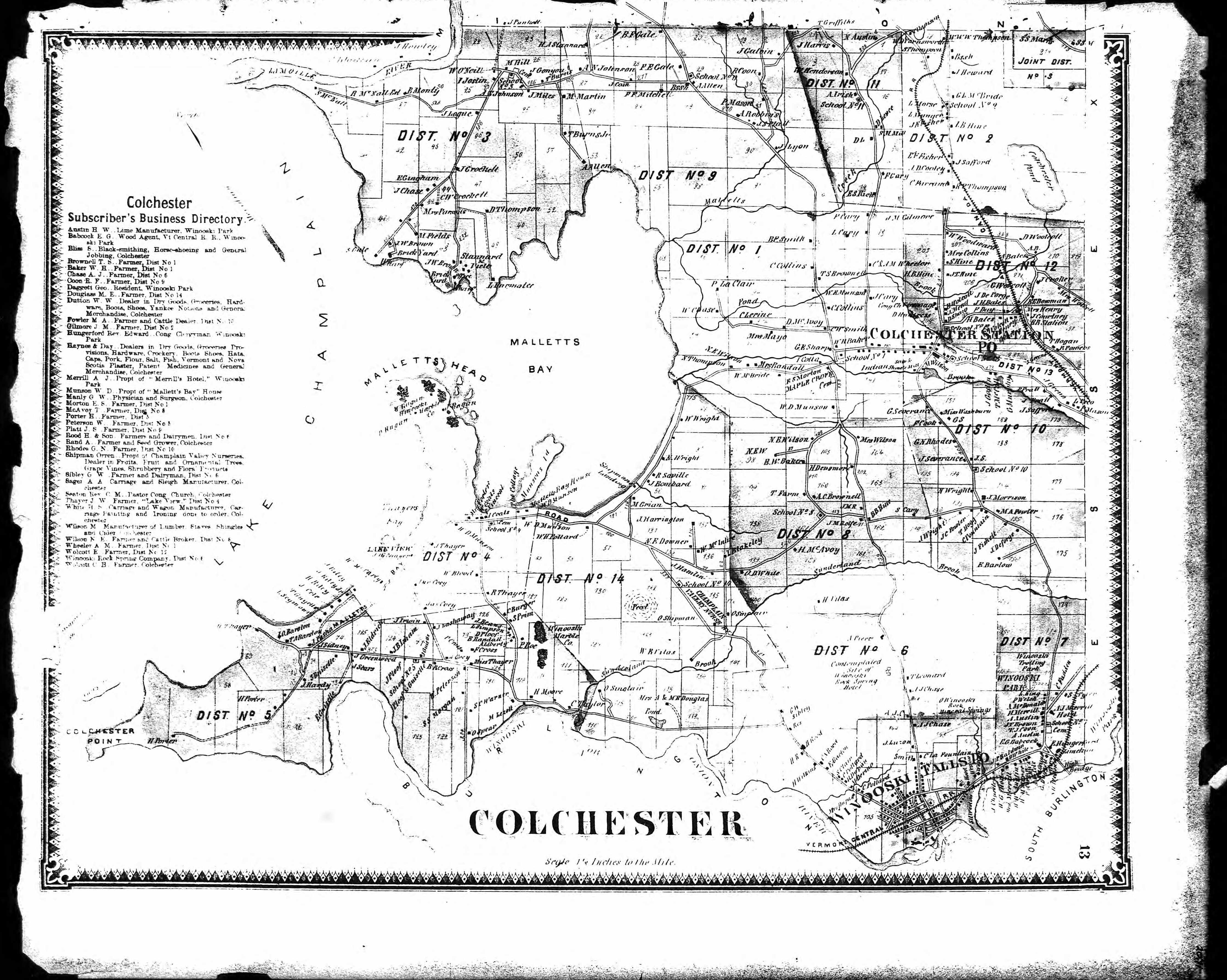
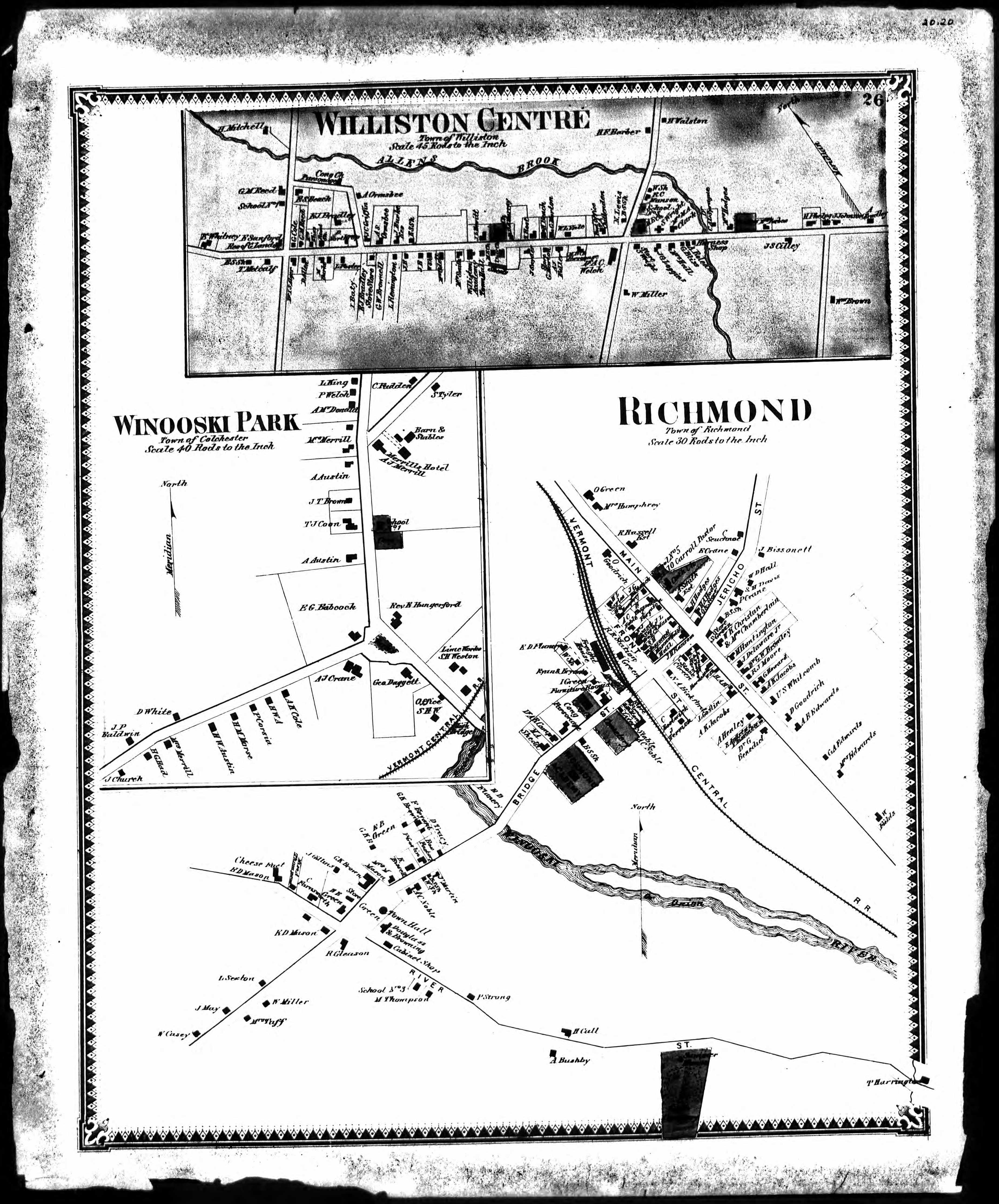
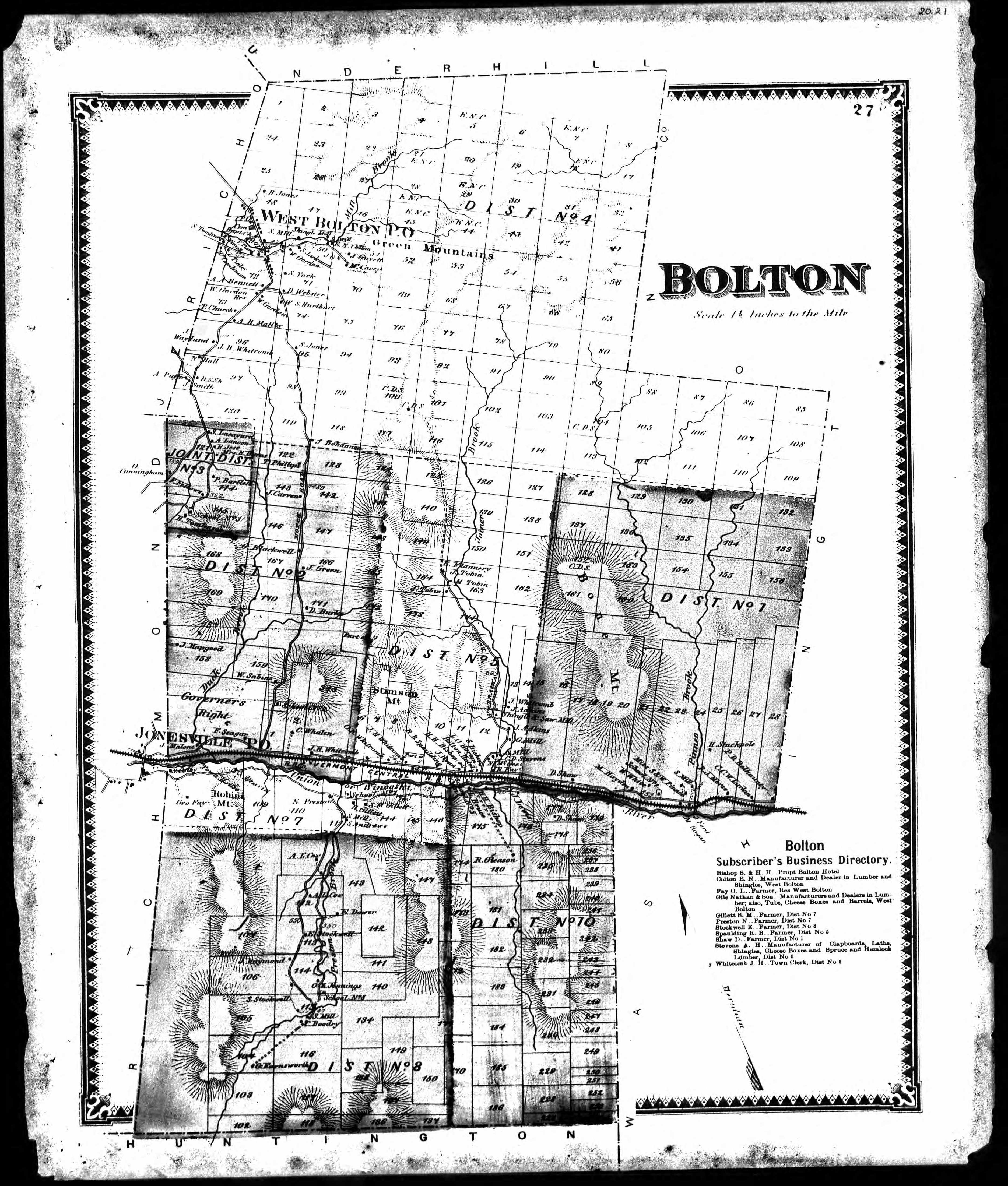
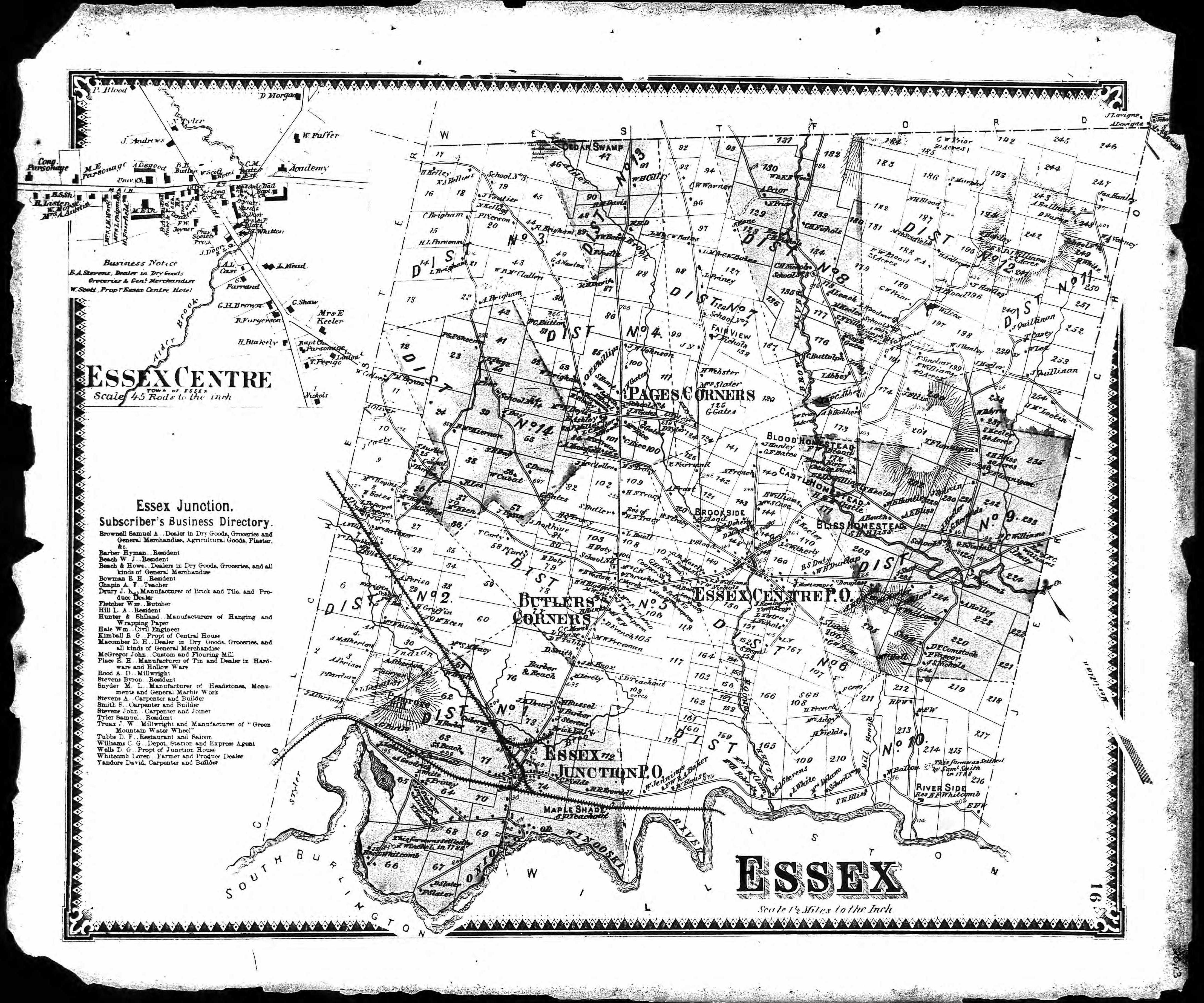
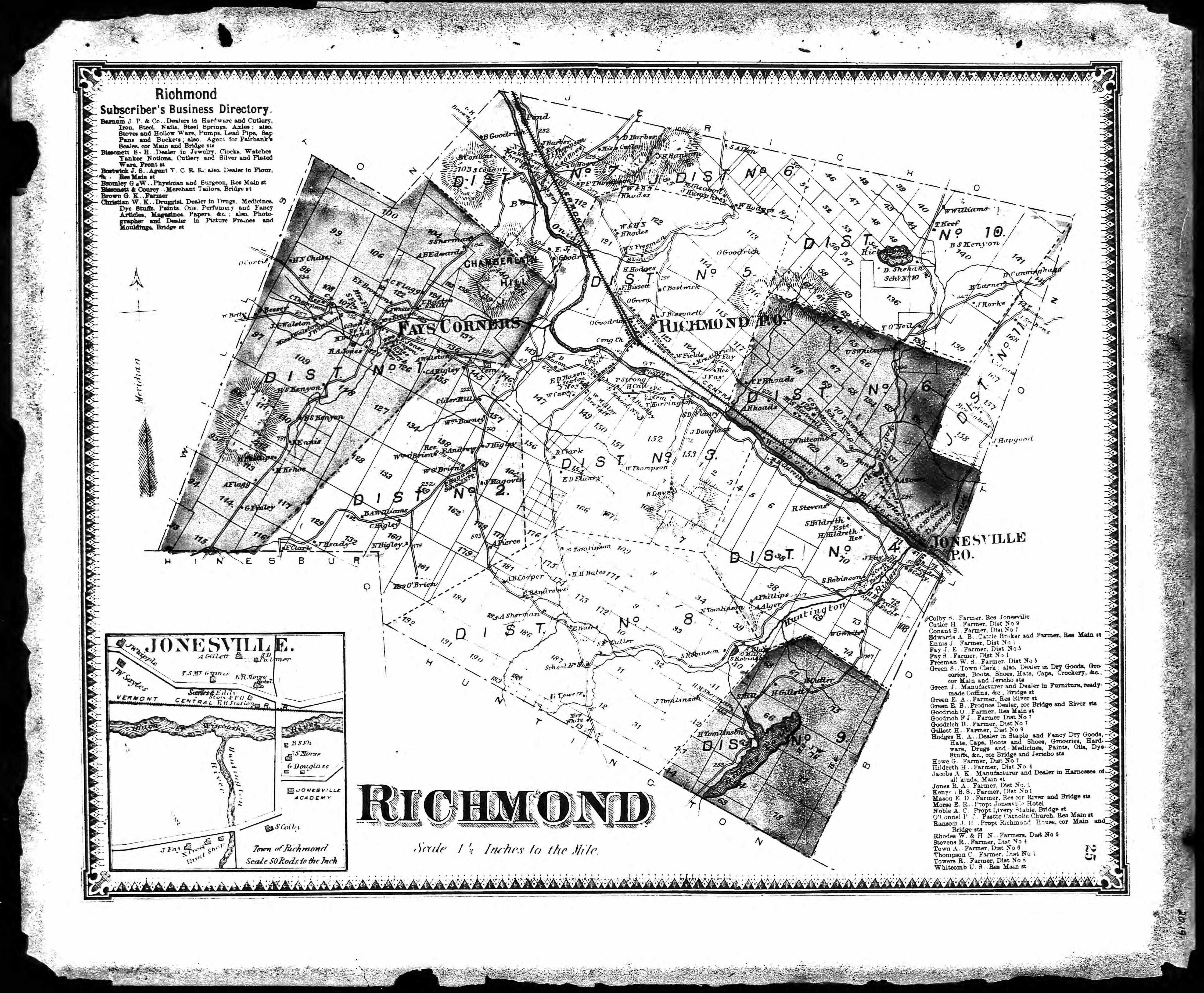
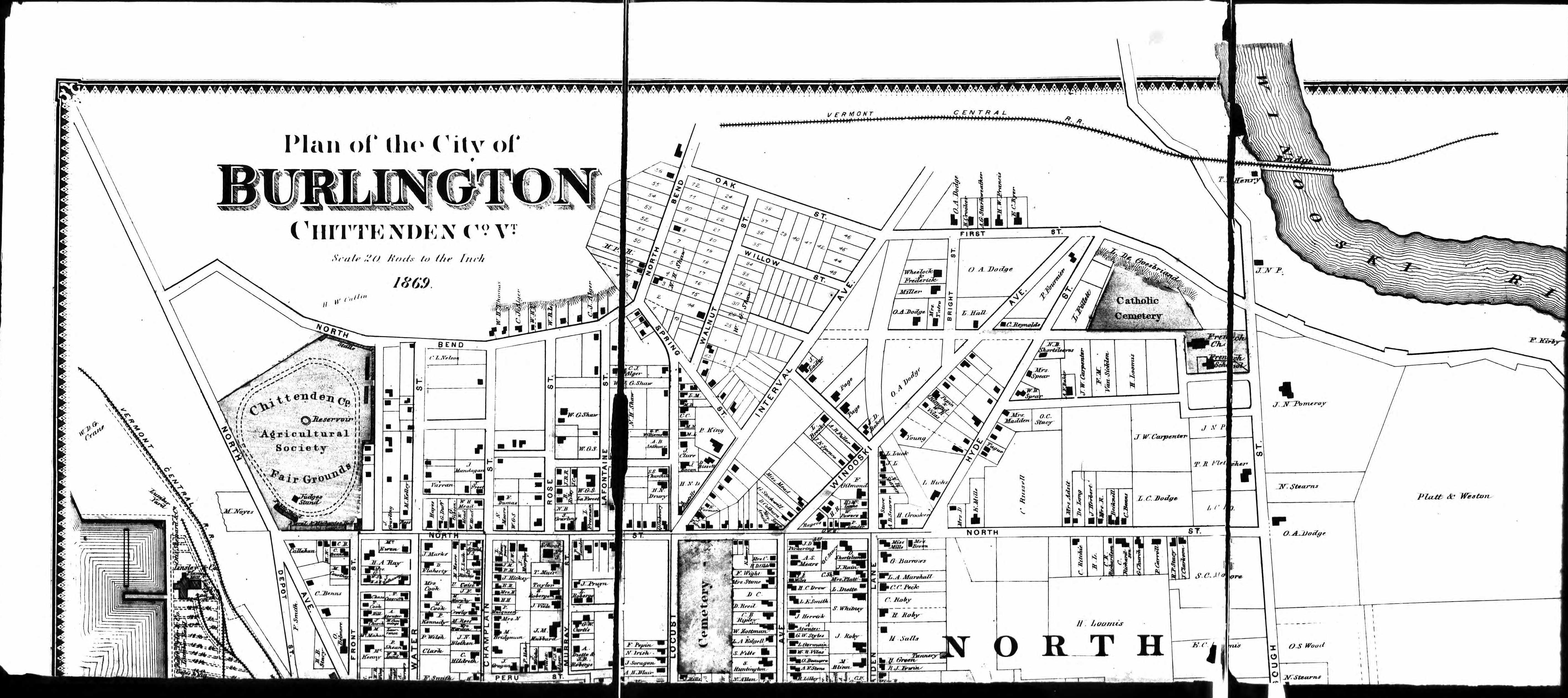
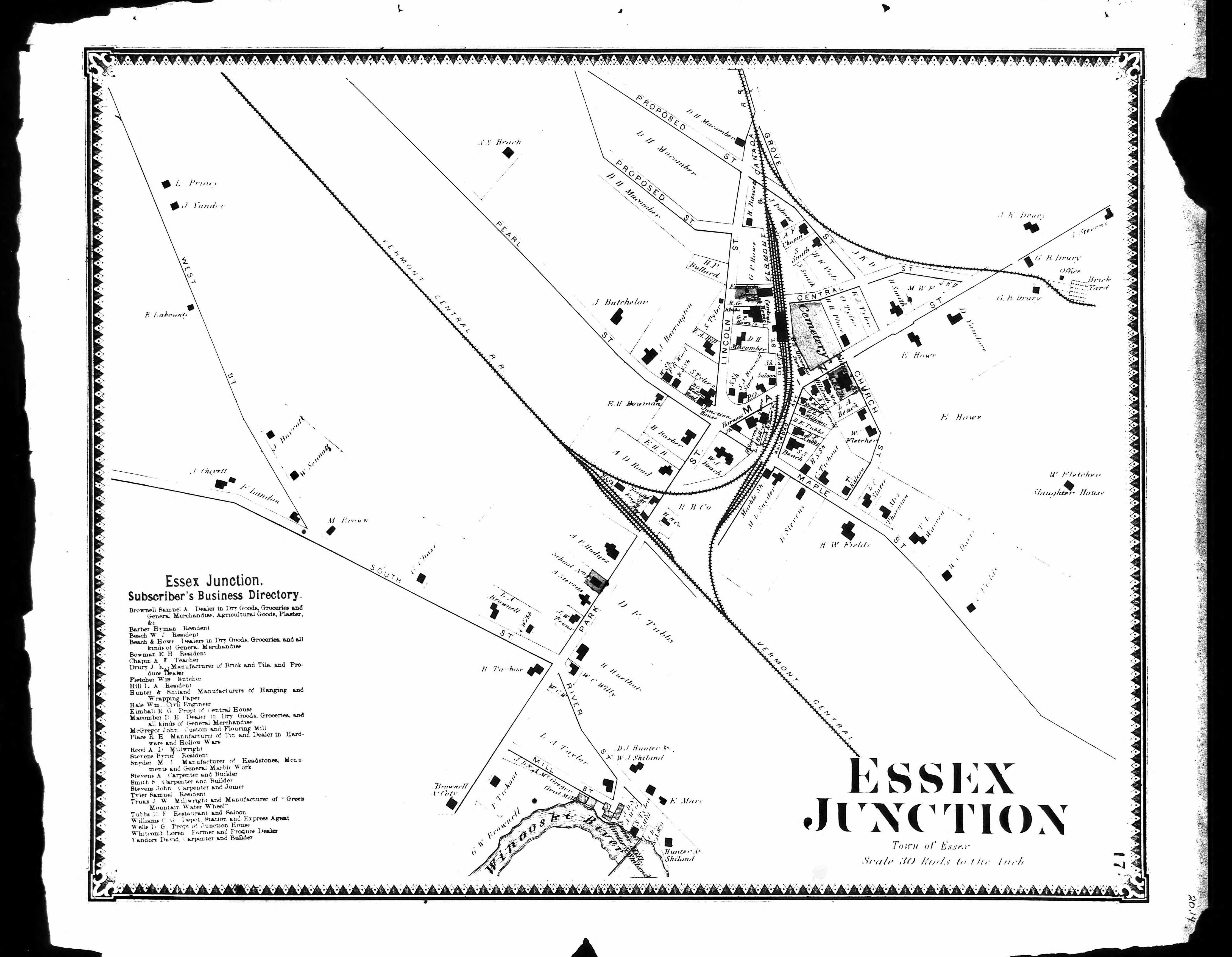
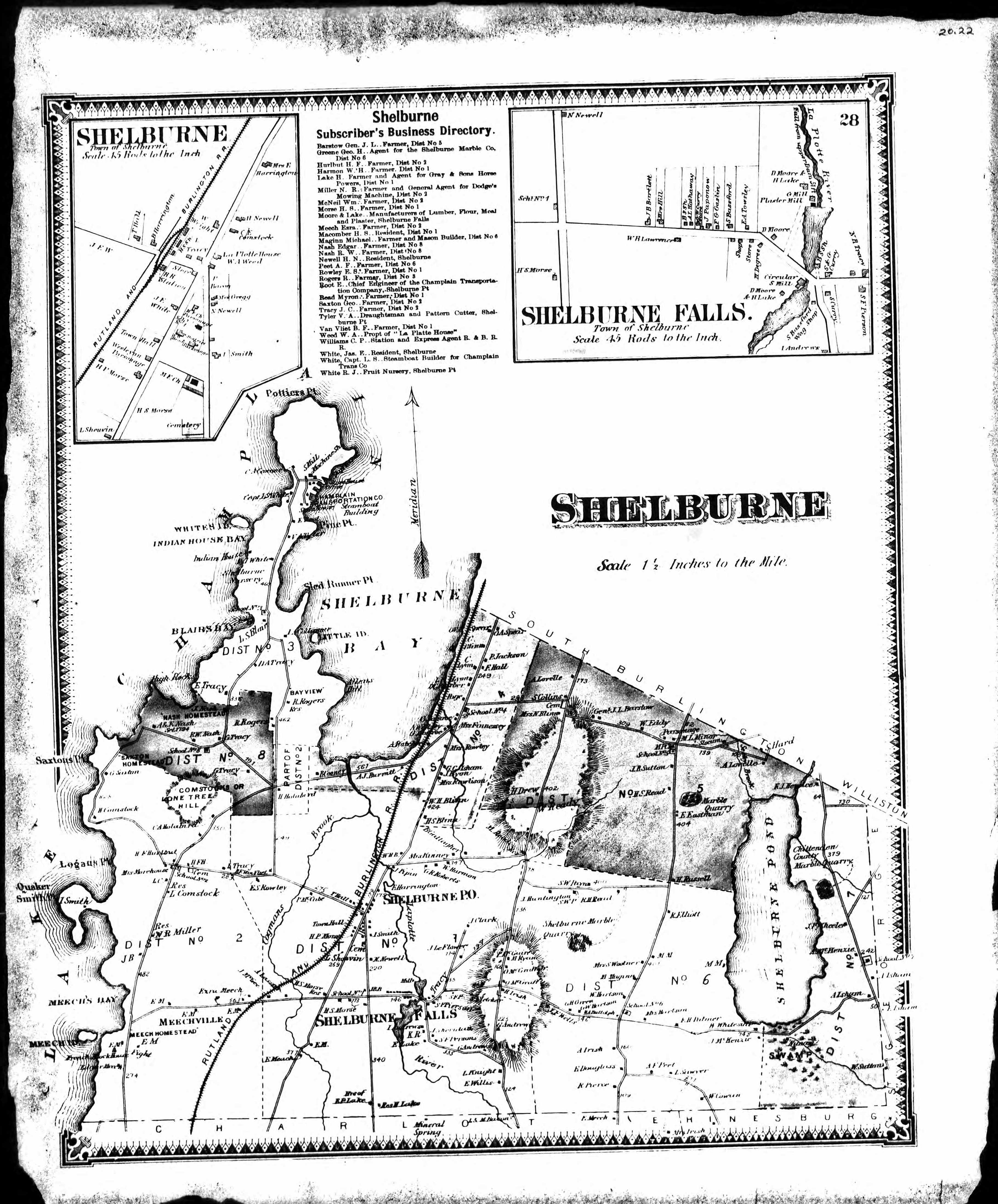
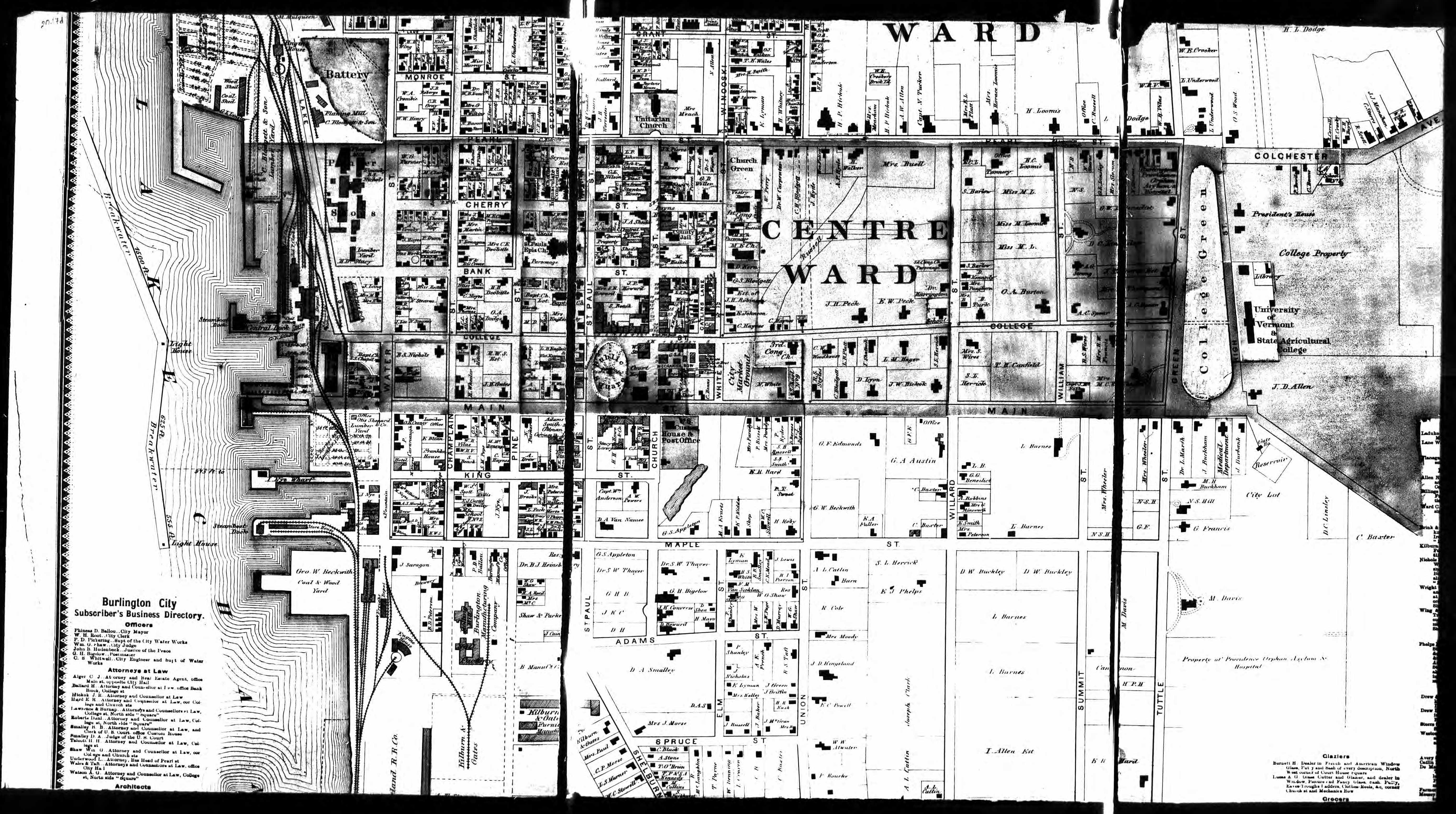
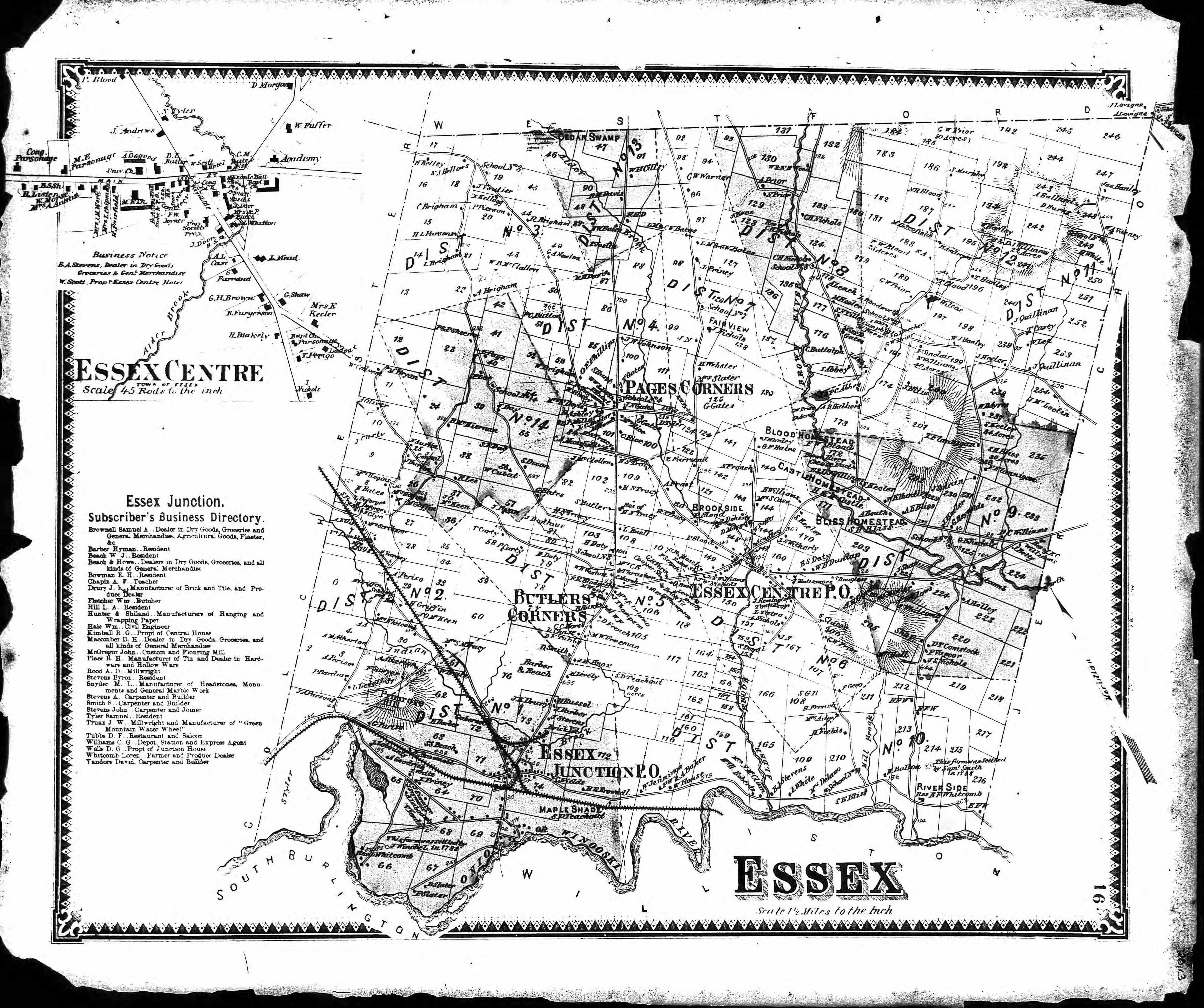
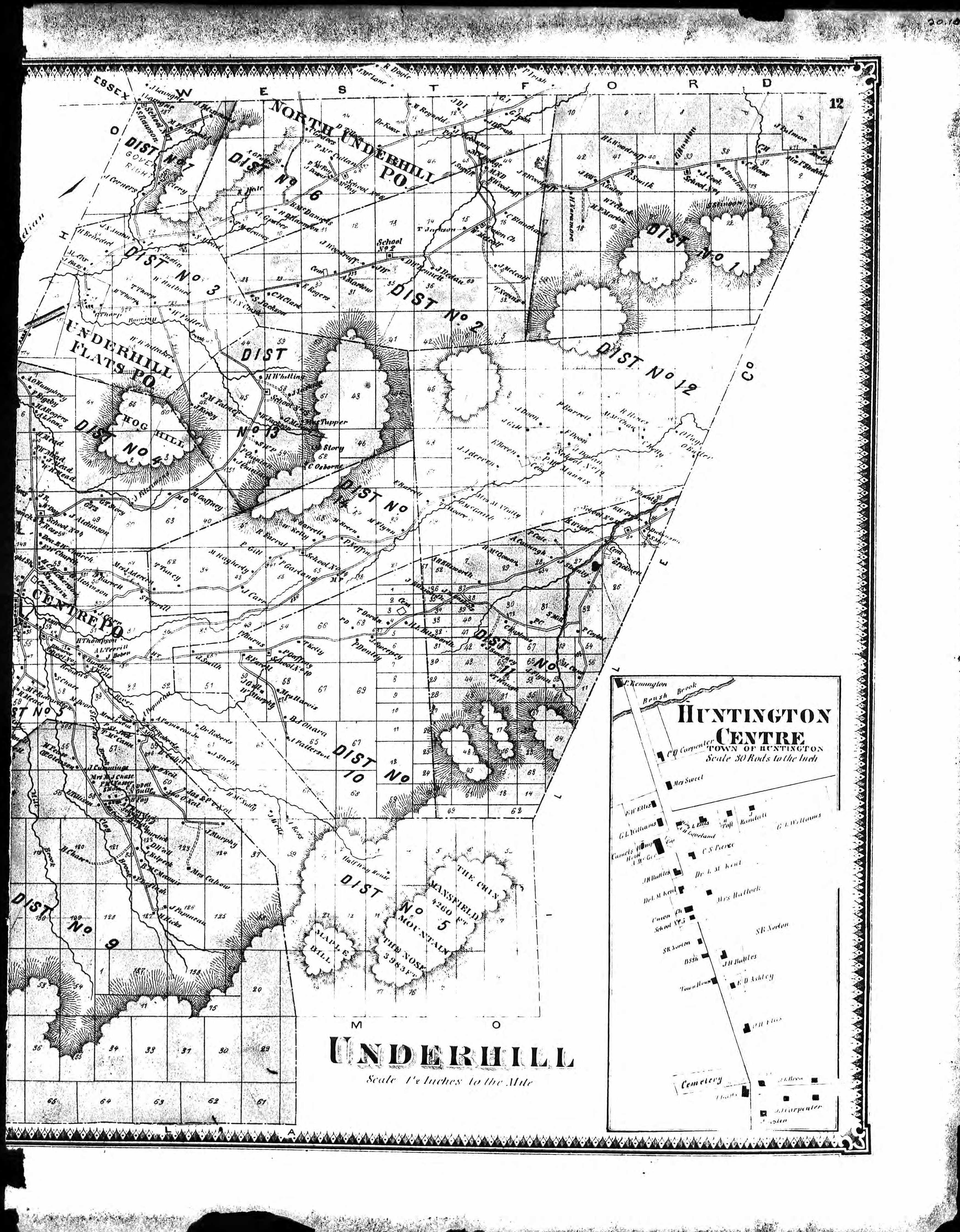
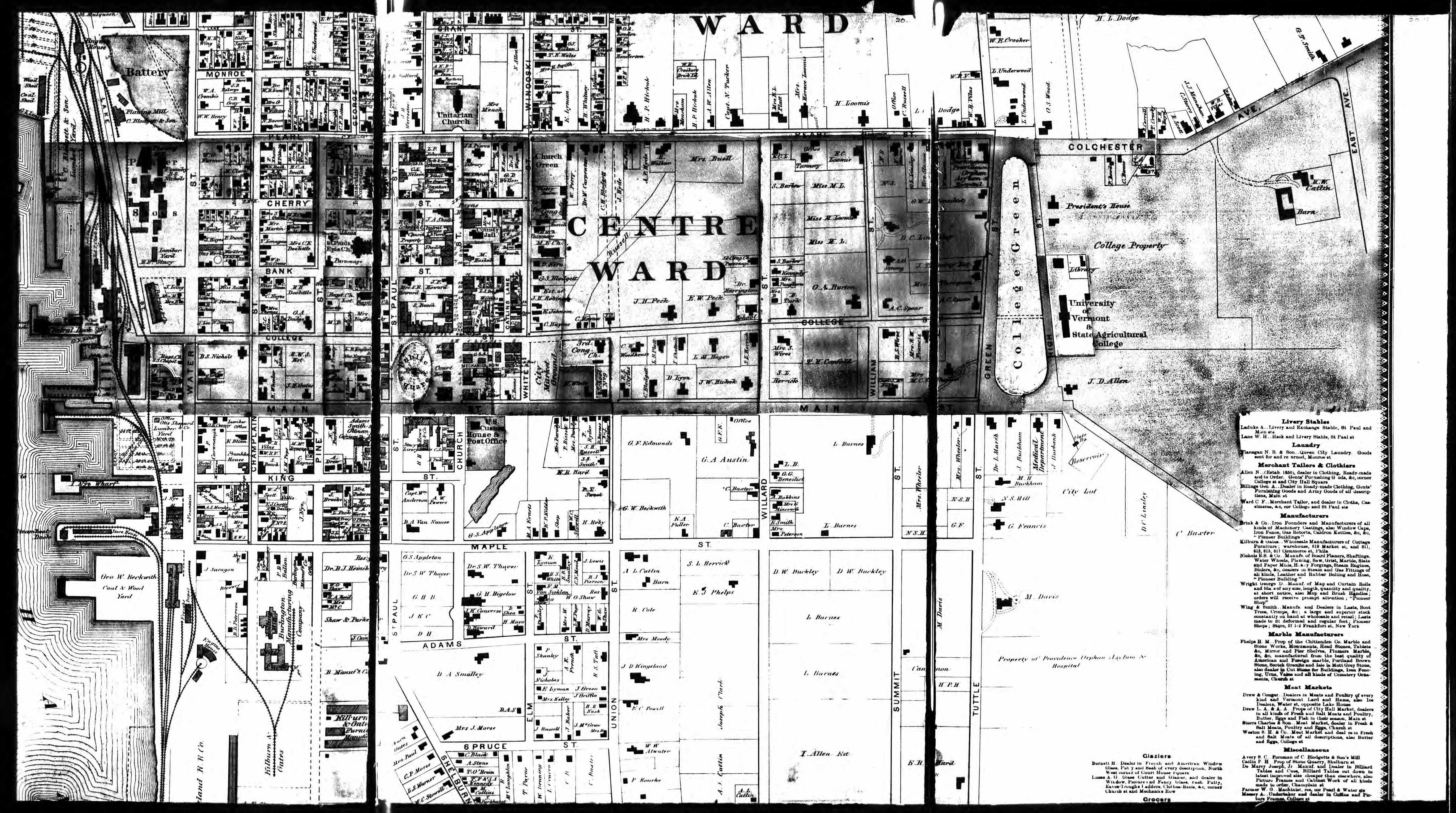
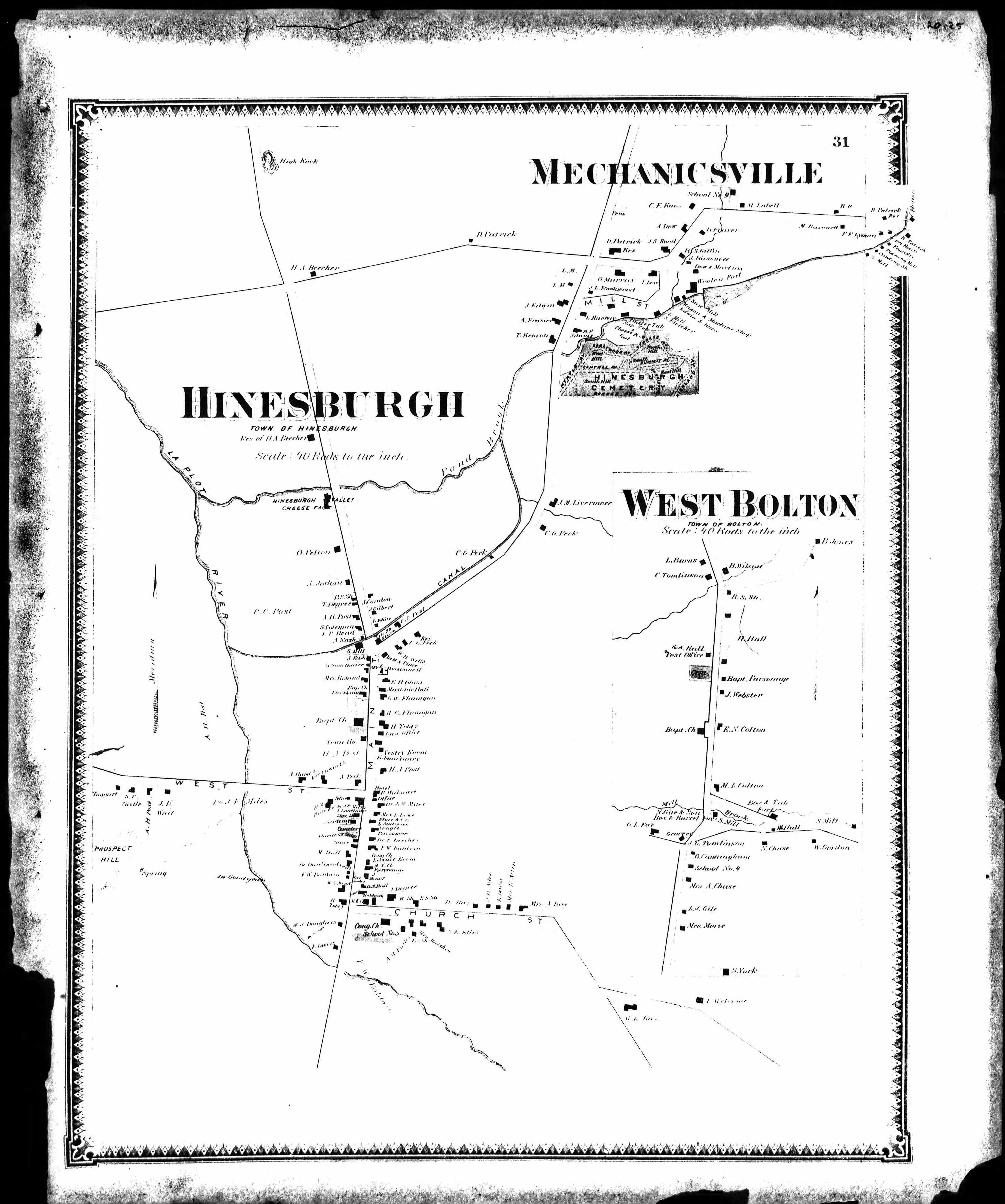
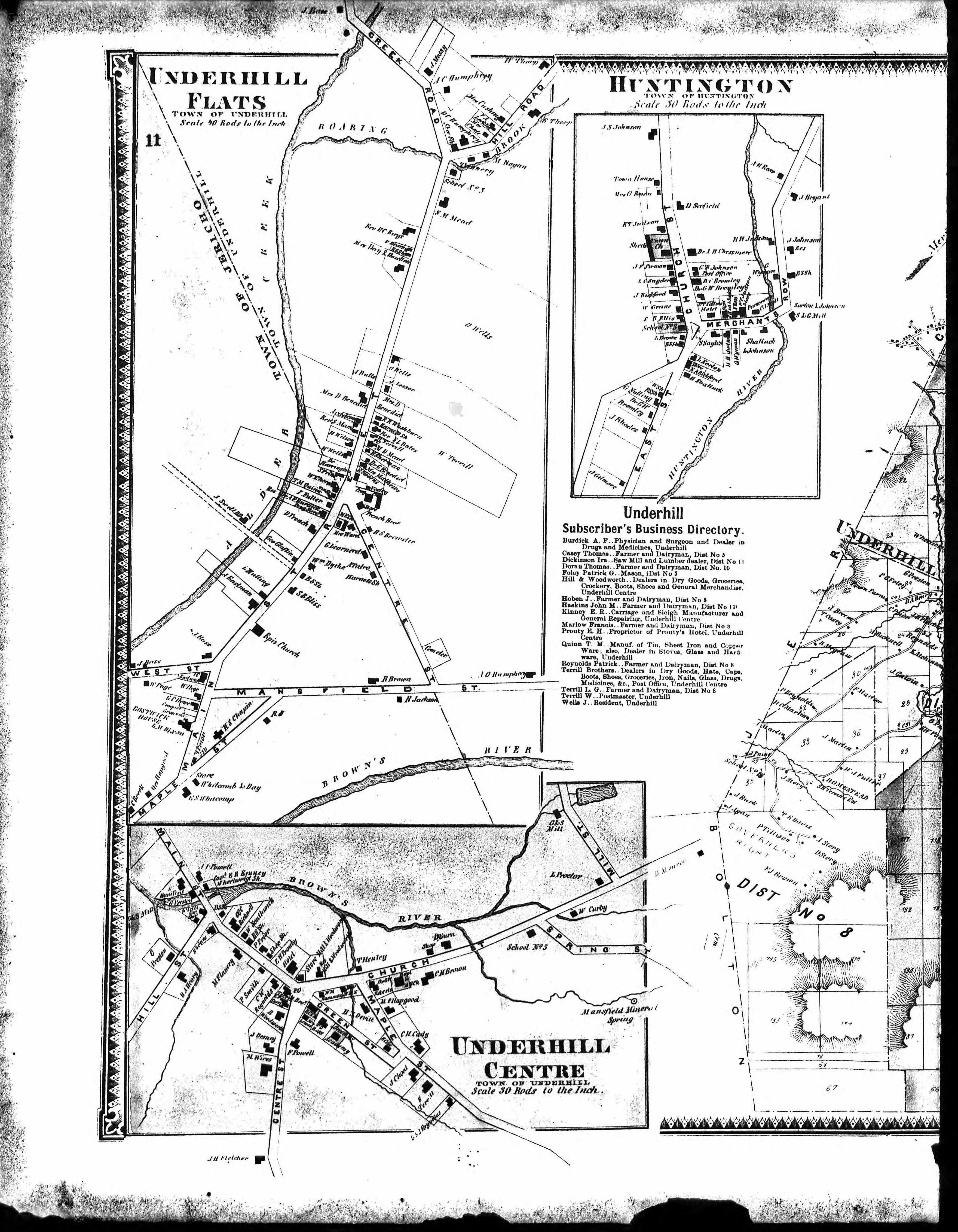
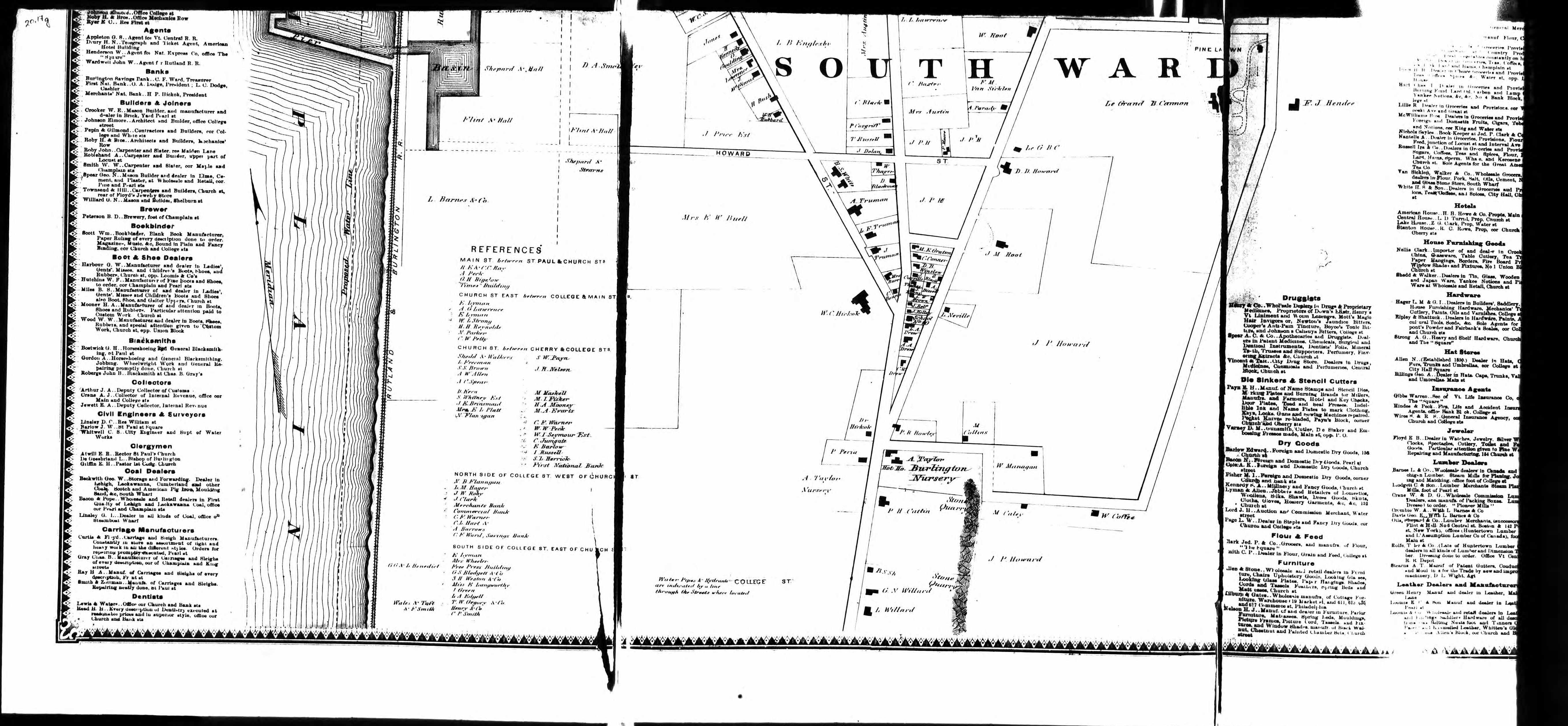
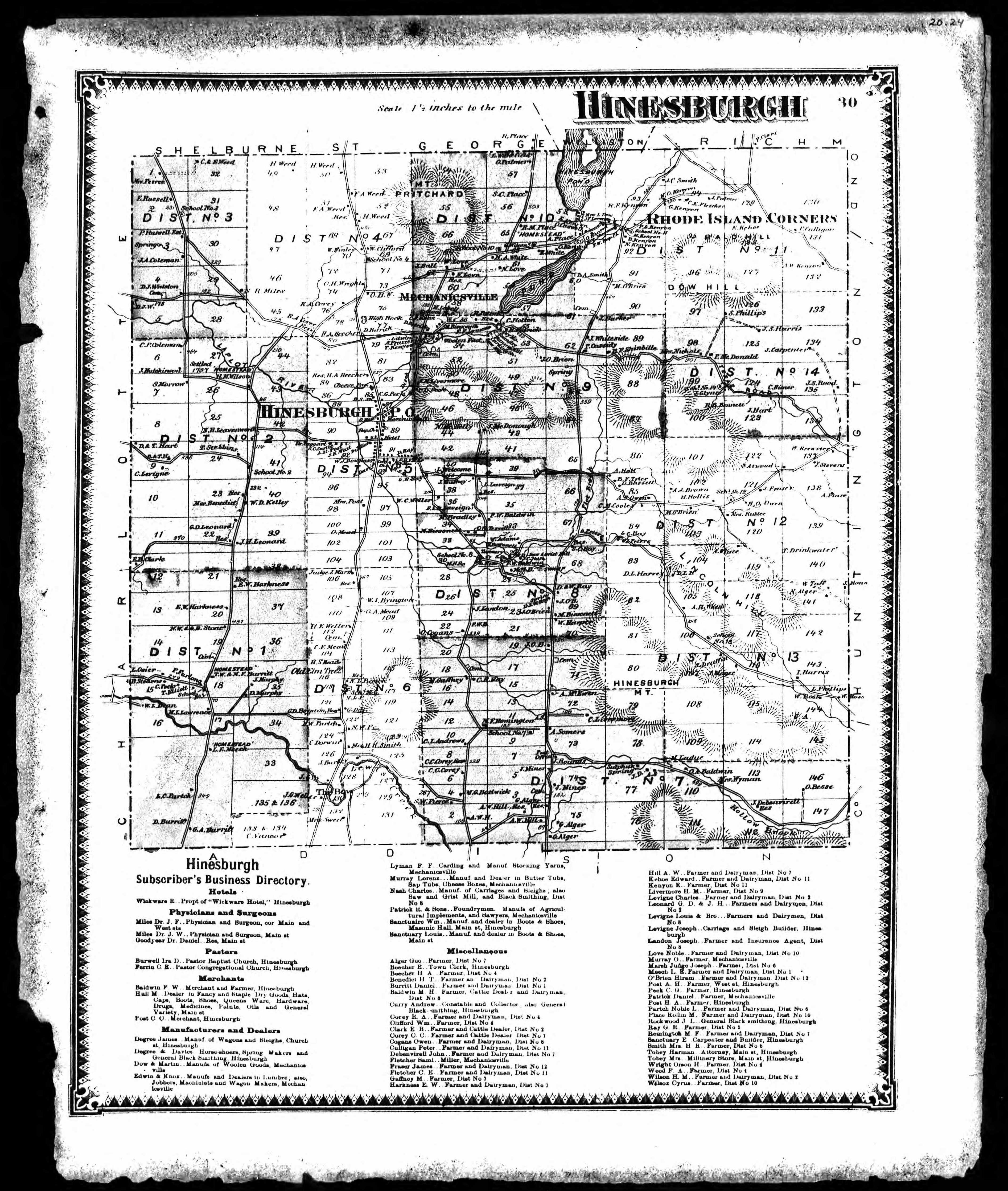
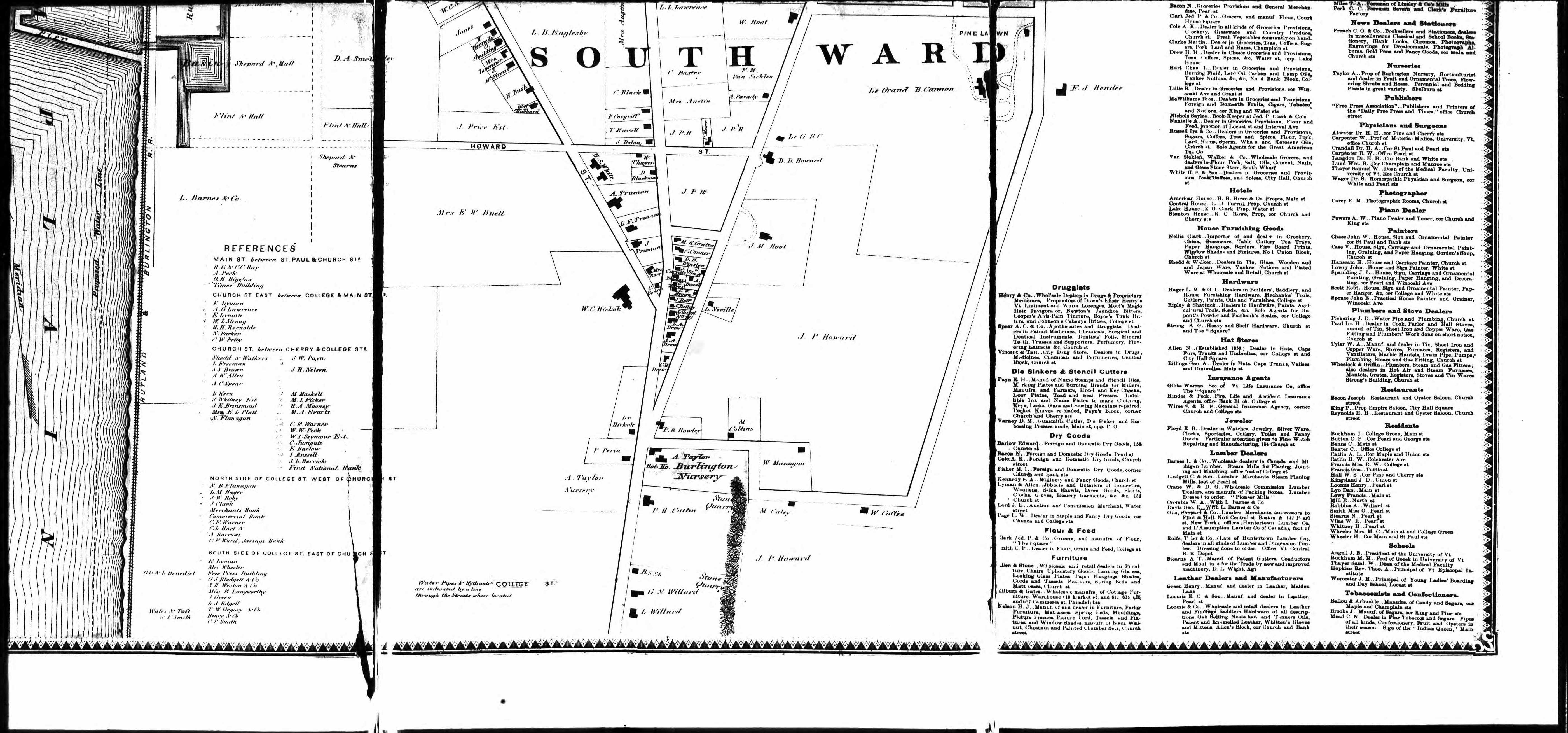
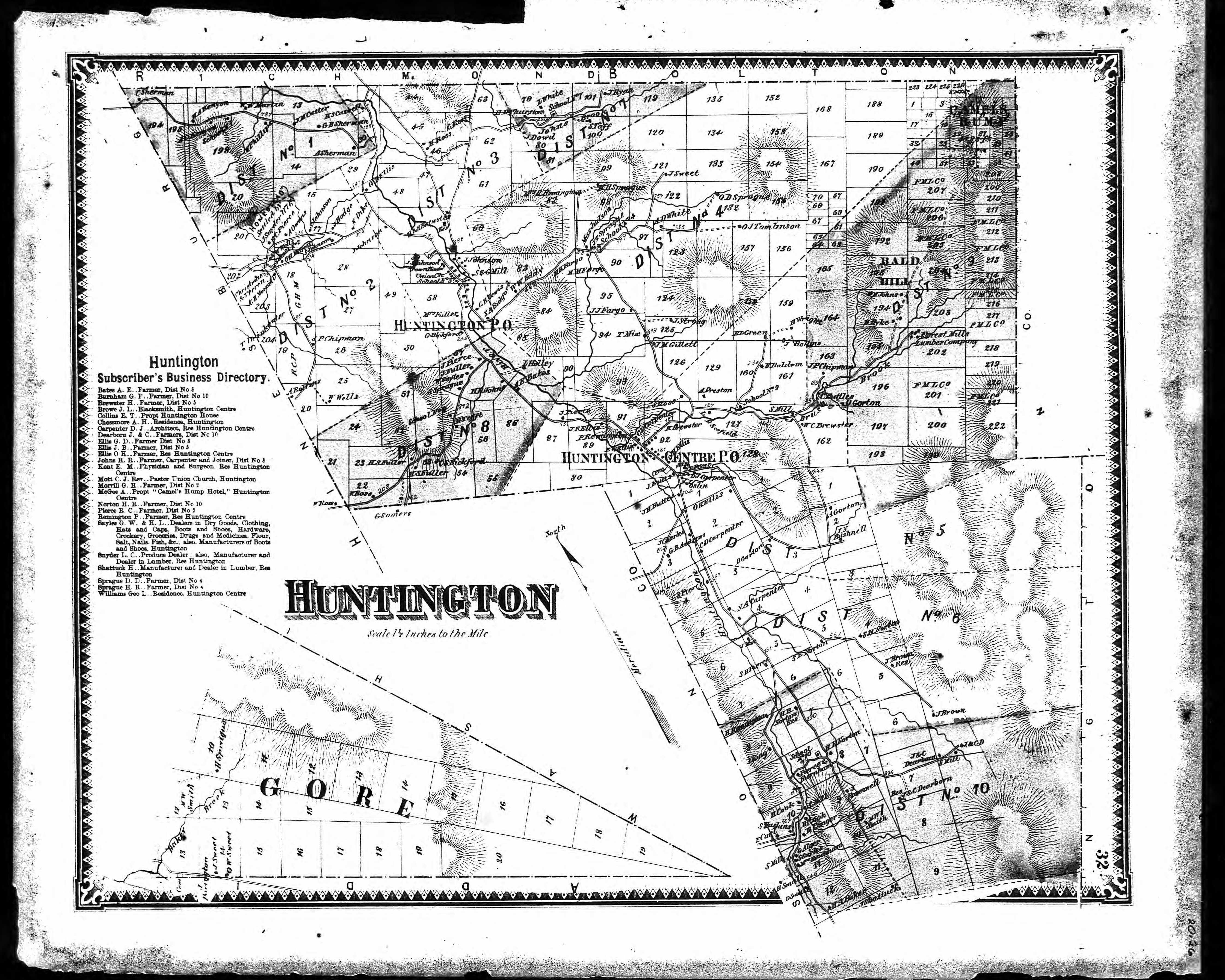
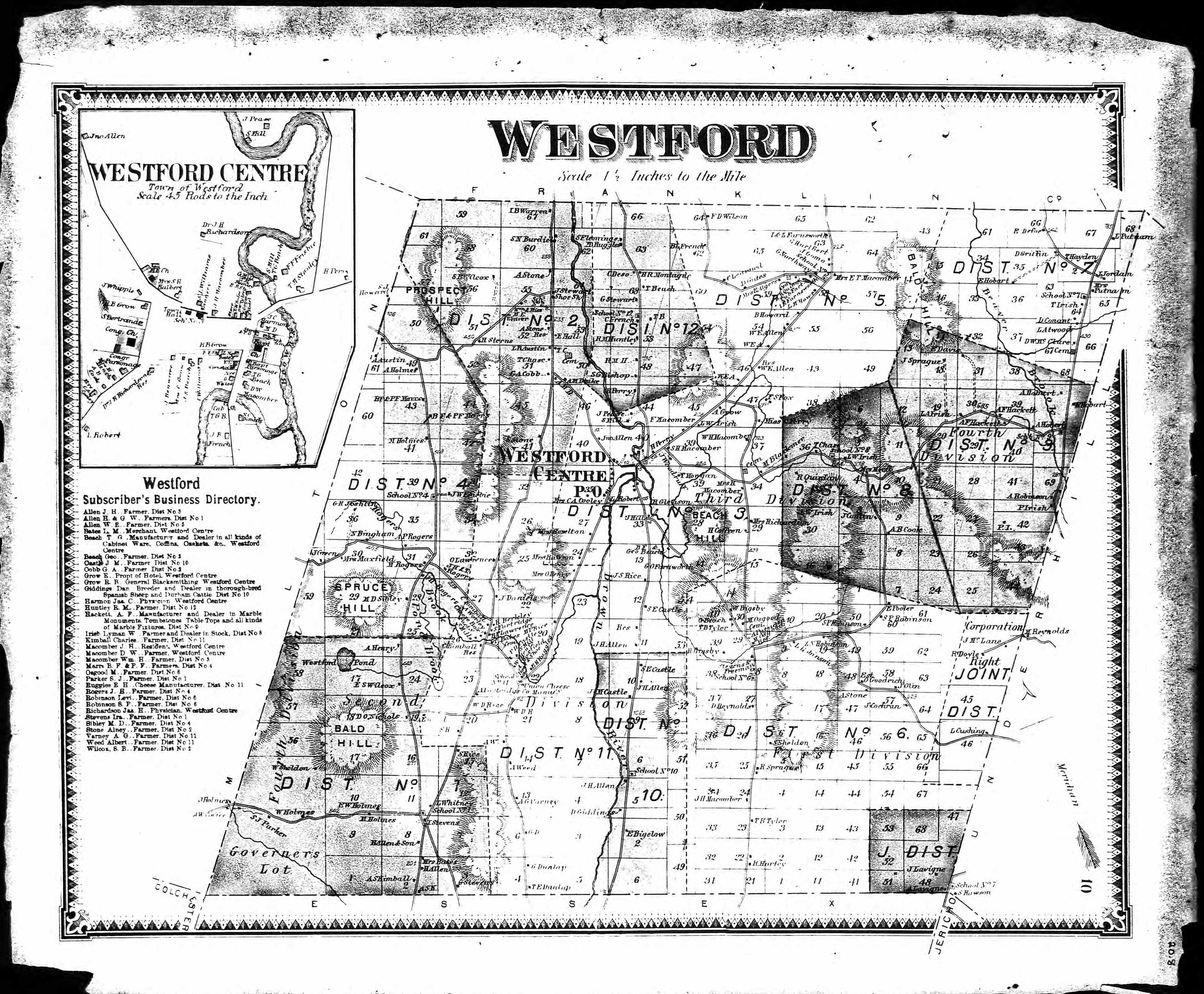
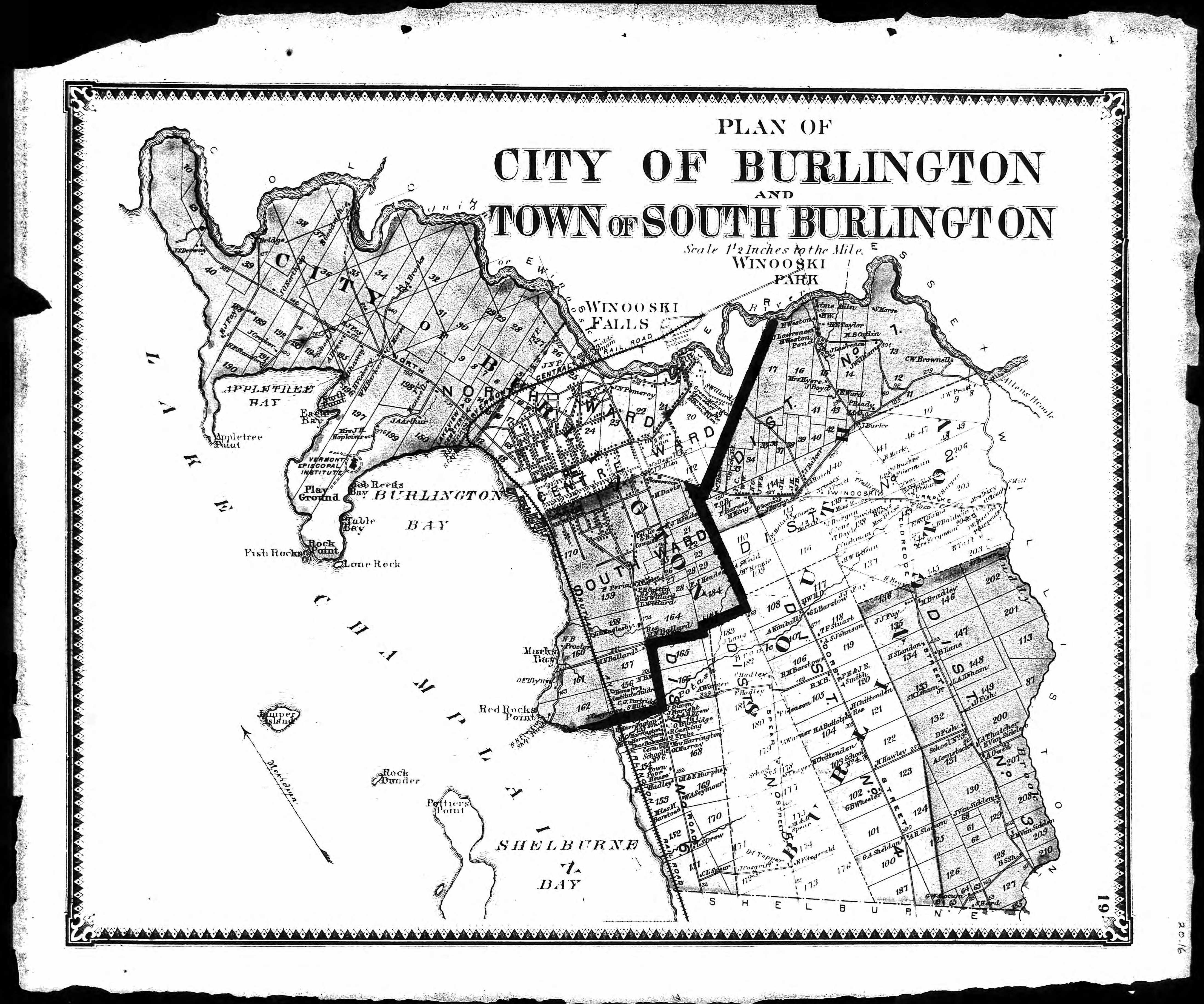
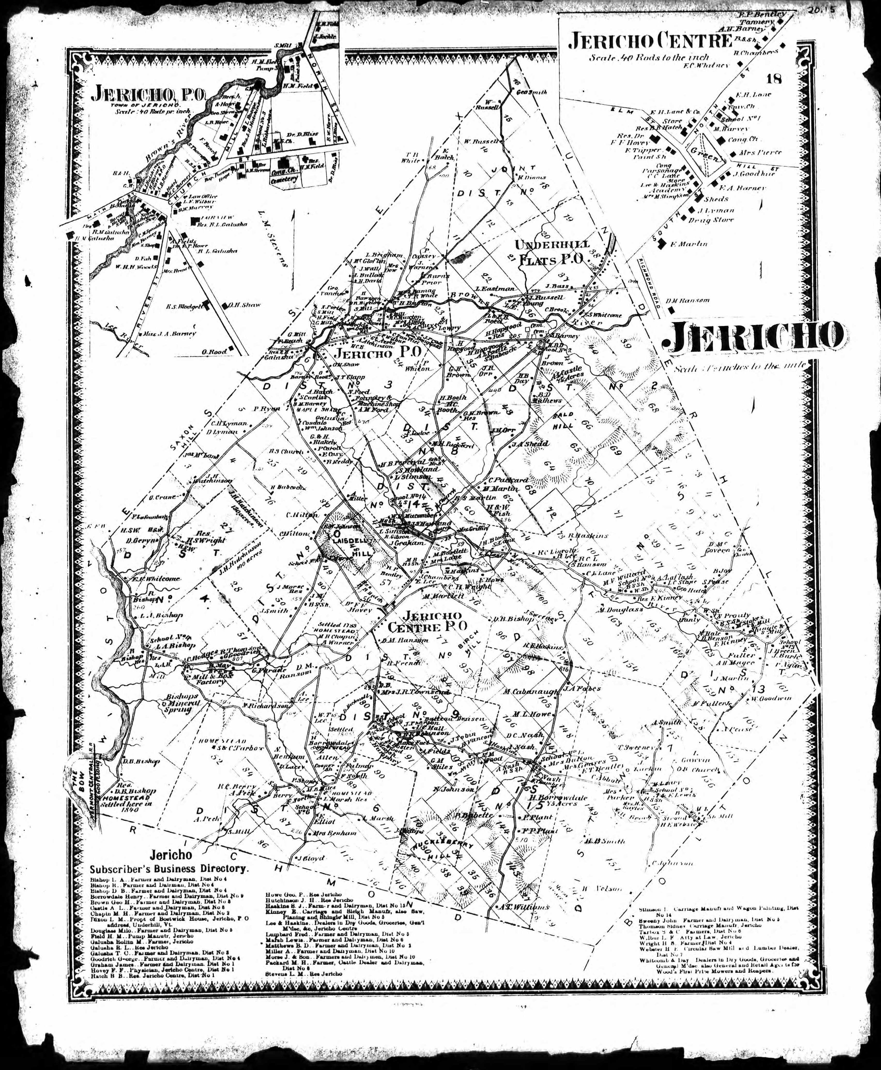
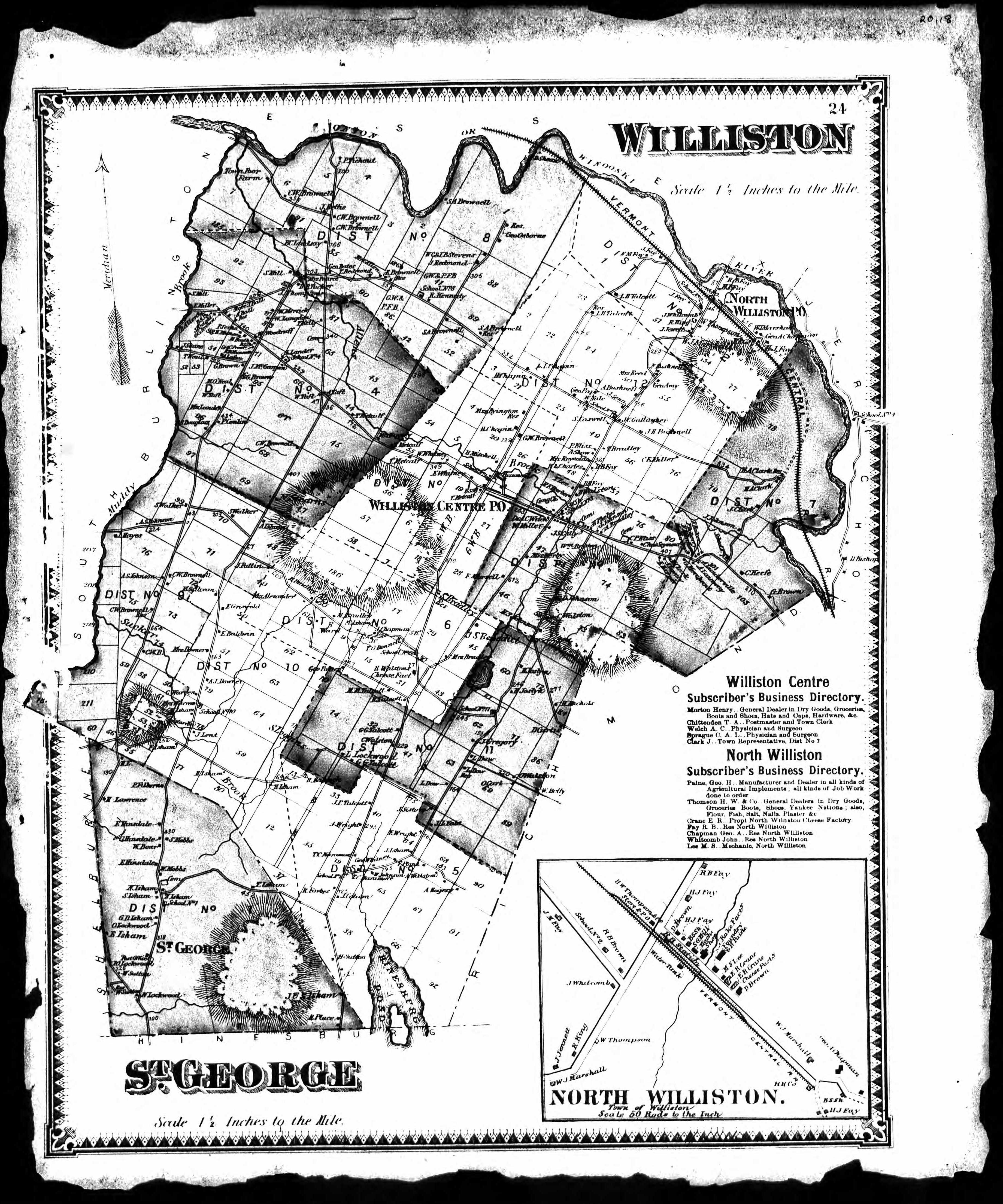
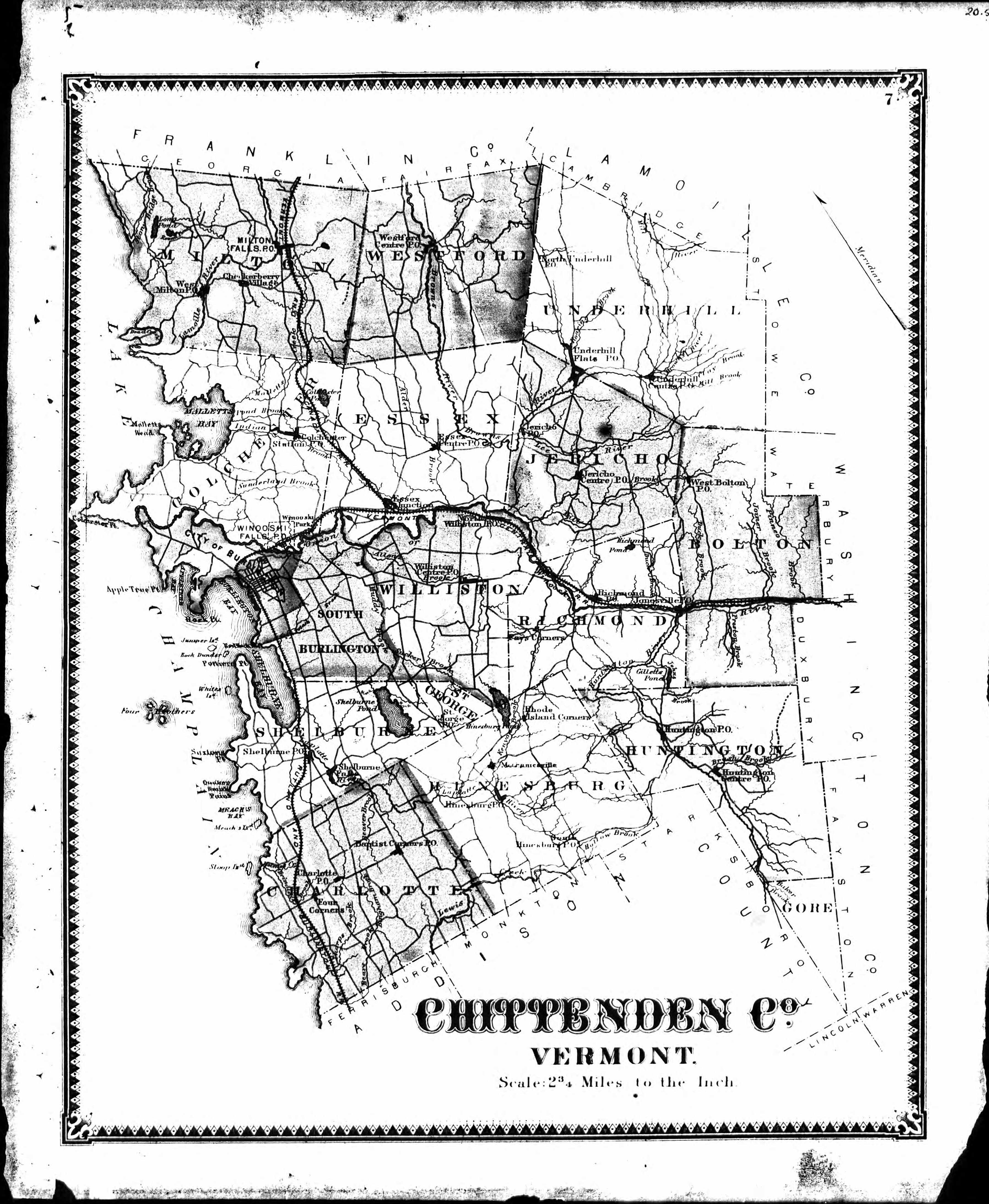
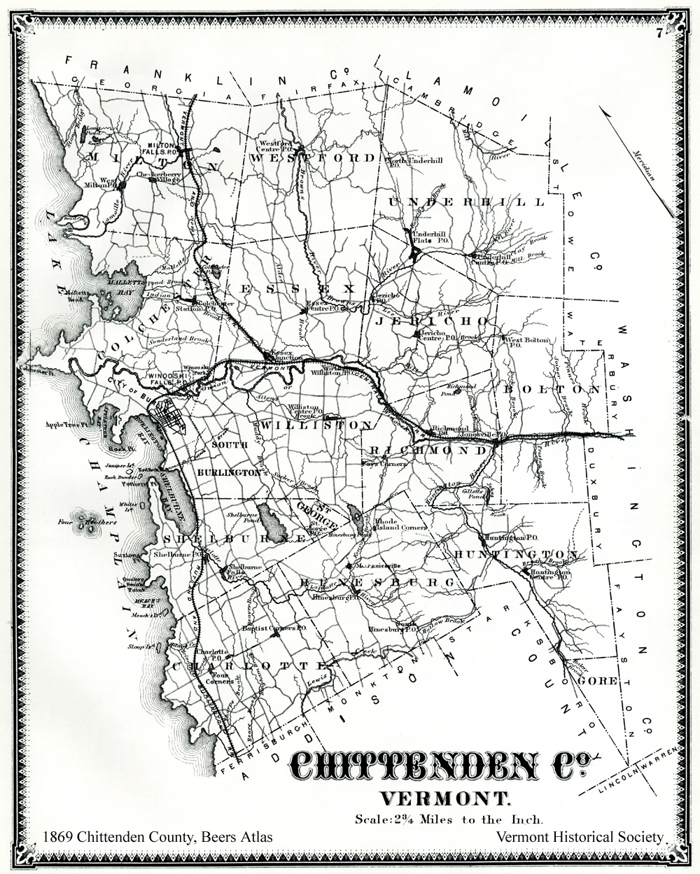
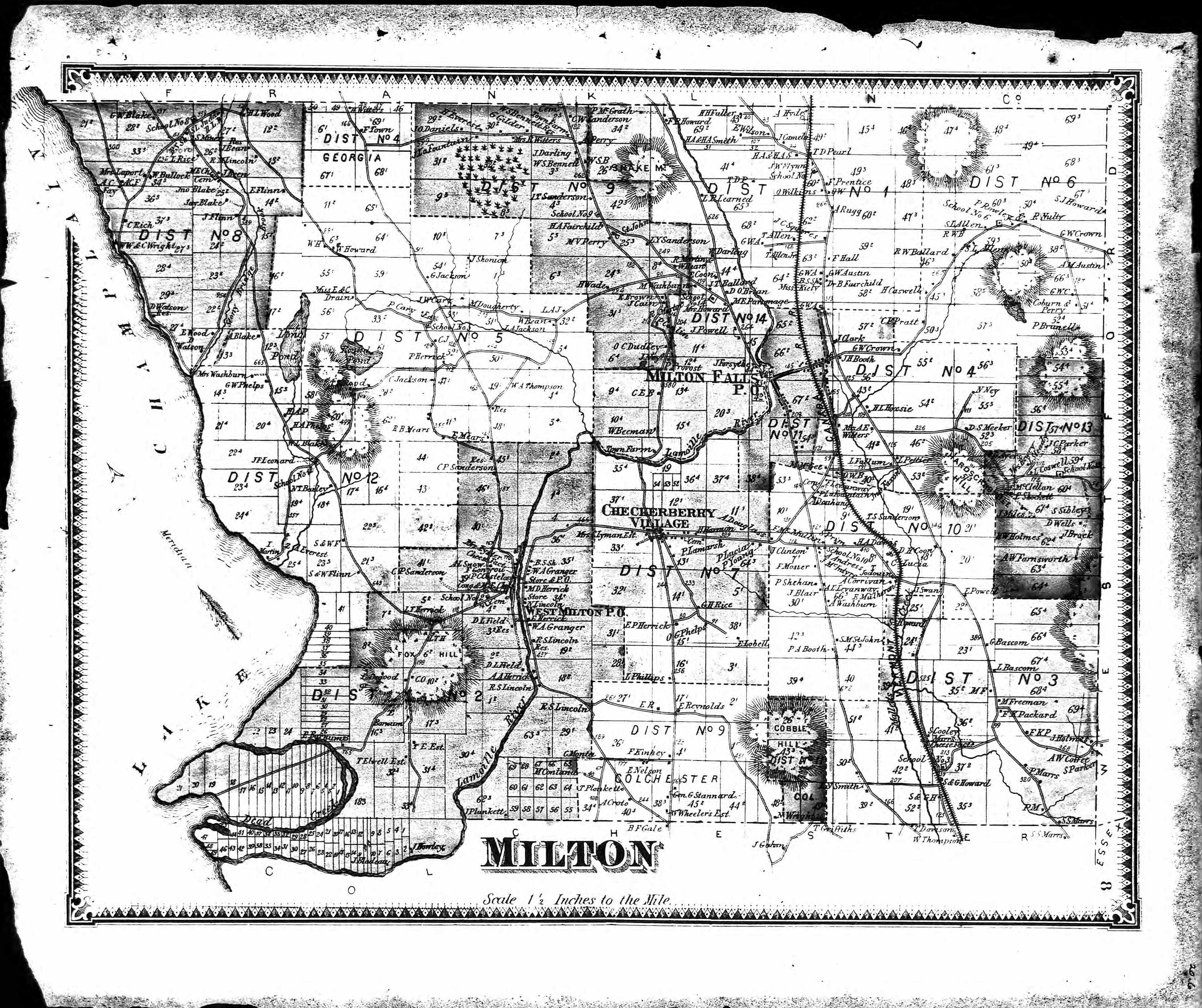
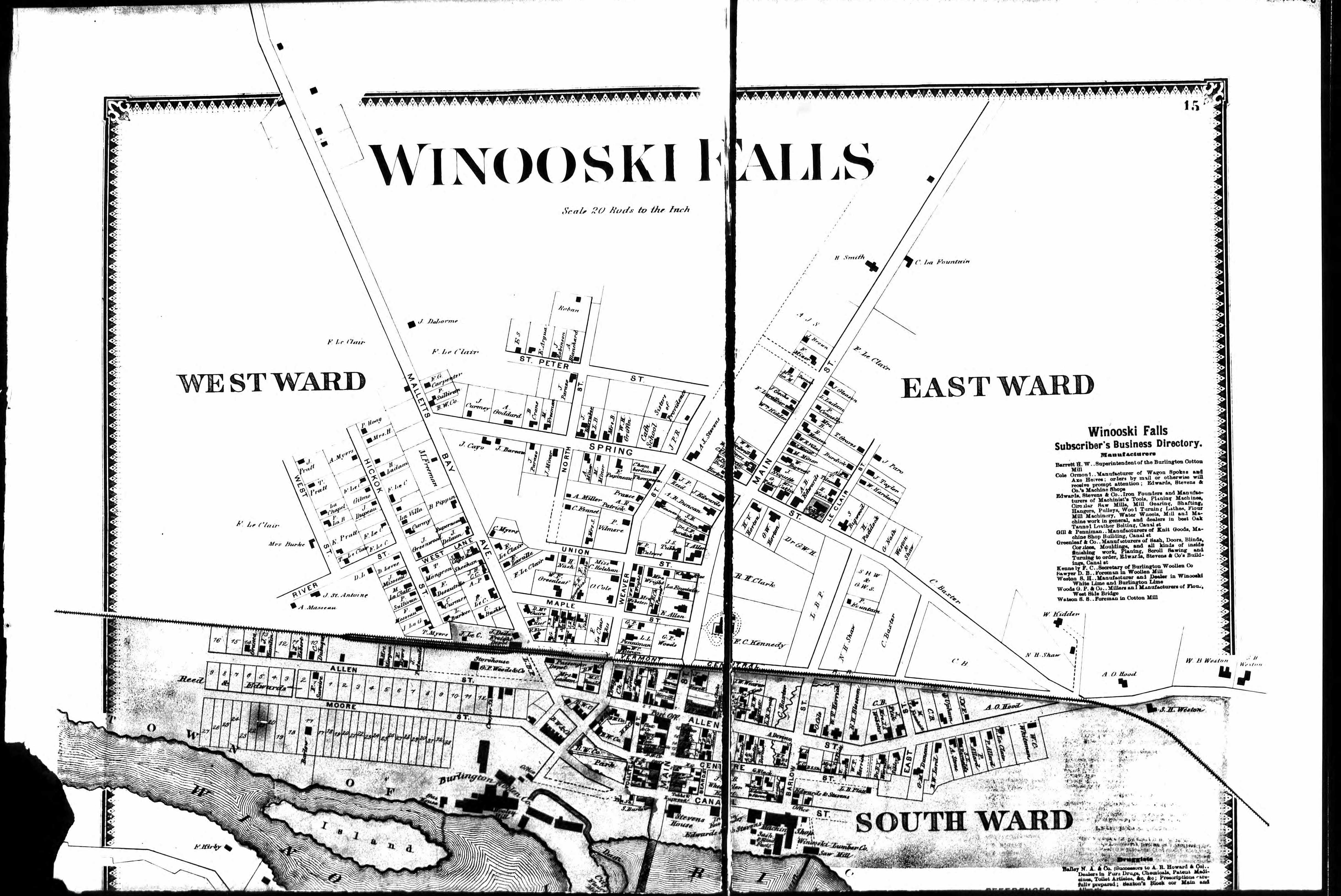
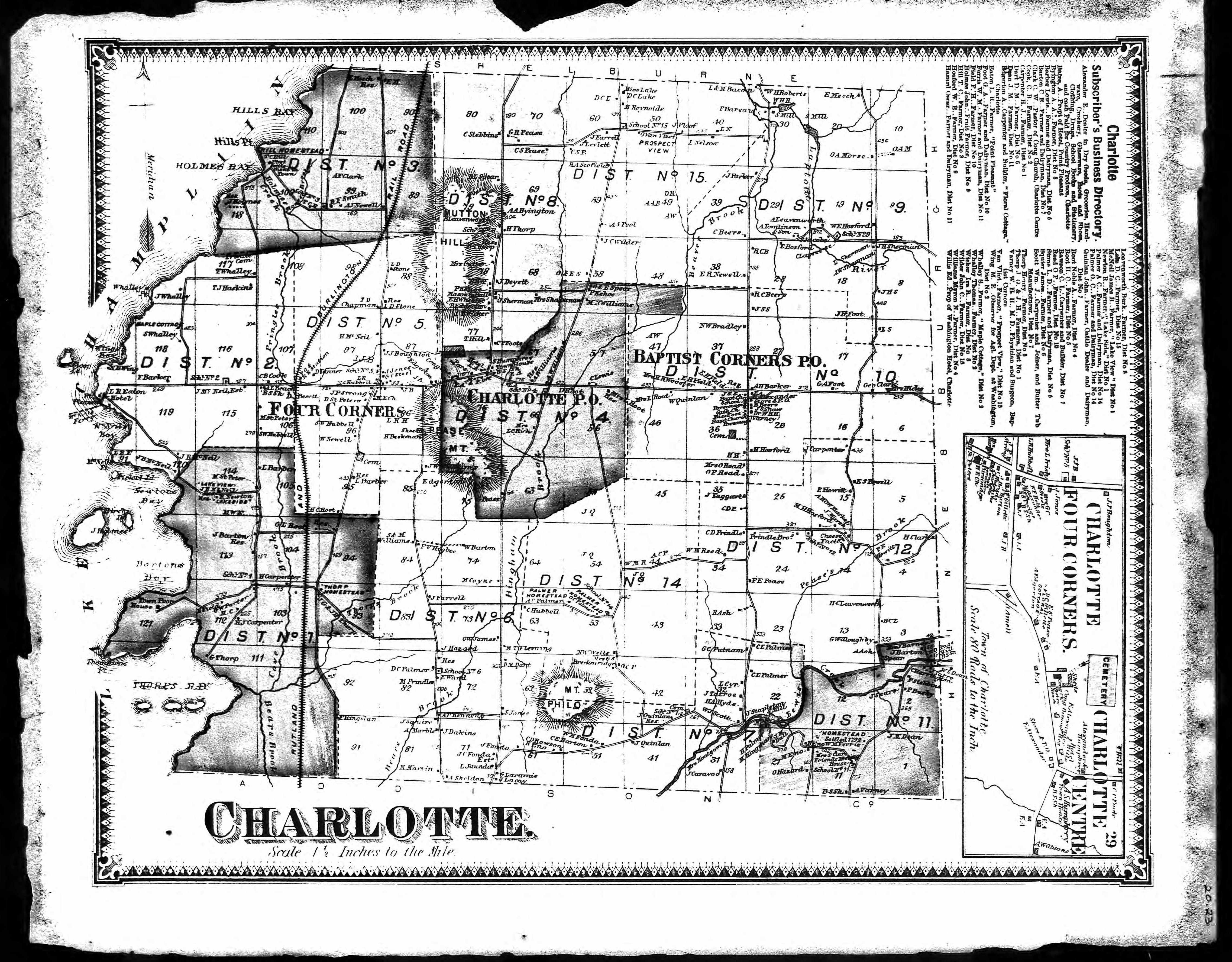
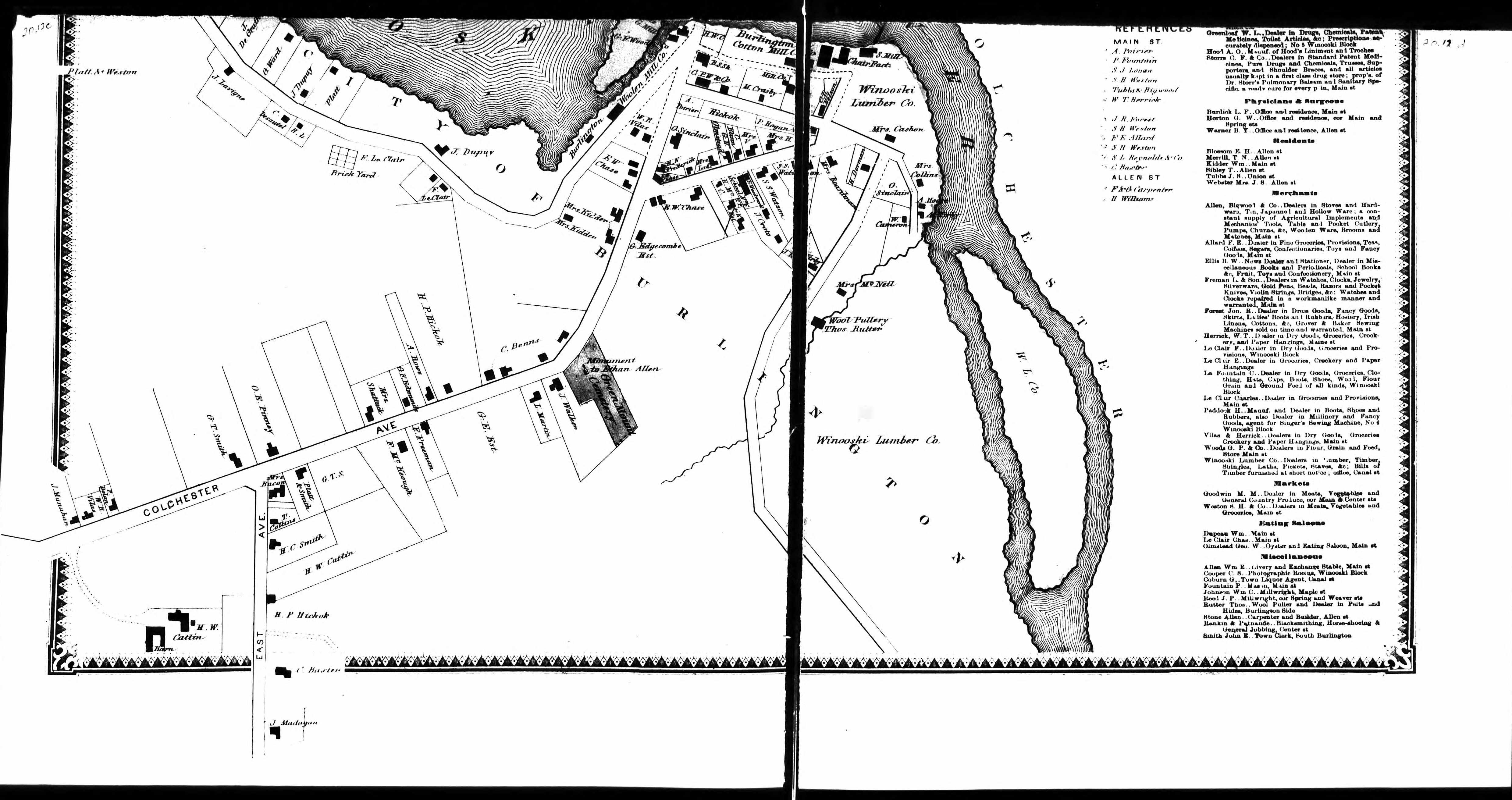
1869 Plat Maps
Miscellaneous Maps
Click on image for a larger view, if available
Off~Site Links
Vermont Land Records, Early to 1900 - Land records give the locations and dates for land transactions with the names of buyers and sellers.
Bolton Land Records - You need to sign into FamilySearch to view.
Vermont State Archives & Records Administration - Lotting plans divided land among the proprietors of the town who were originally granted the land. Use dropdown menu for 'Current Name' and select 'Chittenden County (vt.)' for 19 maps.
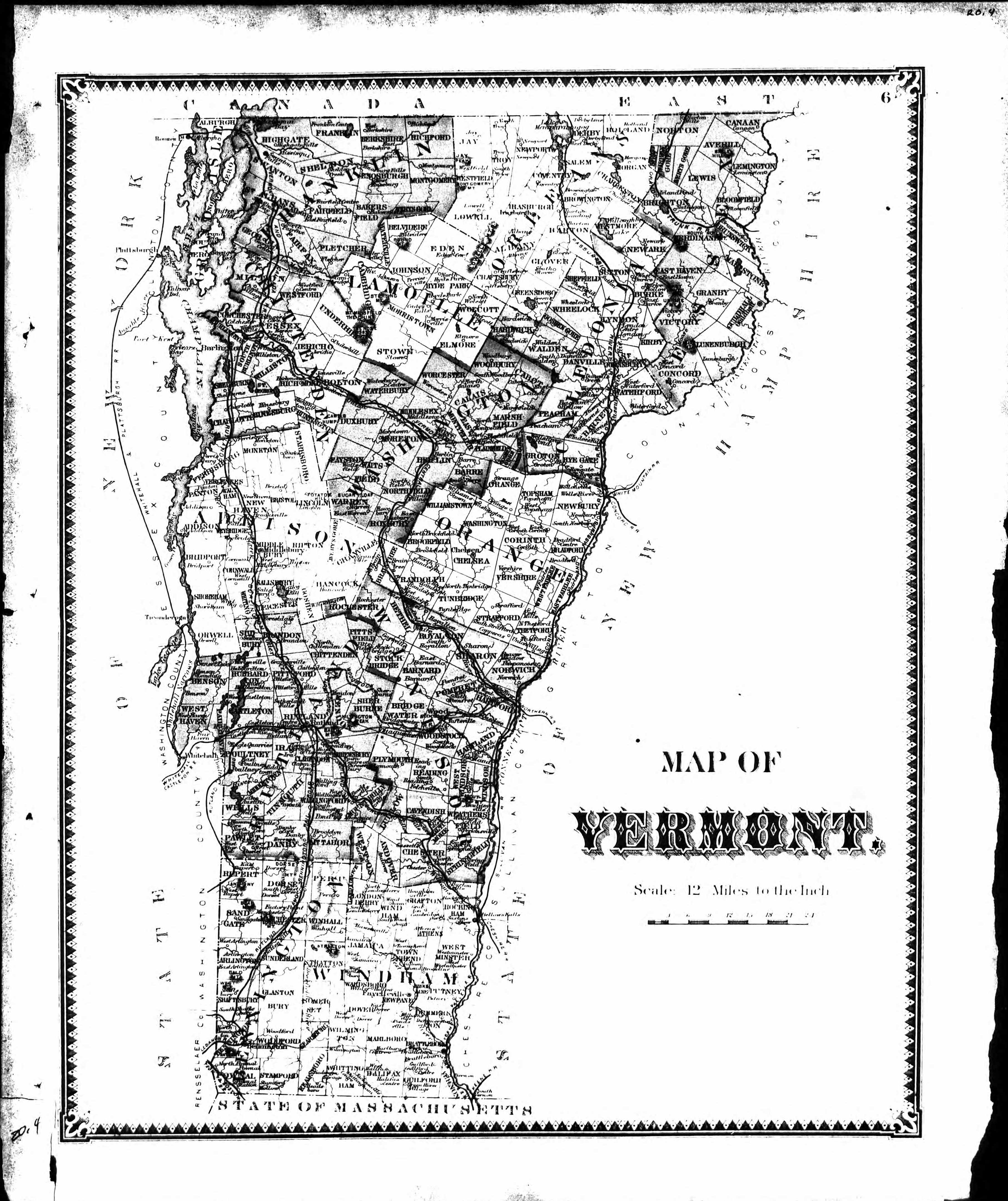
1857 Map of Chittenden County, with land owner names
Library of Congress - Maps for Chittenden County VT; Sanborn Maps
University of Texas Libraries - Historic Topo Maps of Vermont
David Rumsey Map Collection for Chittenden County VT
Vermont History Explorer - County Maps
USGS - Geologic Maps for Vermont
MapGoose for Vermont
Google Earth - Opens over Vermont
