© 1996 - 2023 VTGenWeb


|
© 1996 - 2023 VTGenWeb |
|
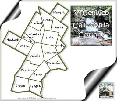
| Caledonia
County Vermont, a proud member of VTGenWeb and The USGenWeb Project State Coordinator: Denise Wells | Asst. State Coordinator: Karen De Groote County Coordinator: VACANT |
| Home |
Archives |
Bibliography |
Biographies |
Cemeteries | Census |
Cities/Towns |
History Maps | Military | Miscellaneous | Town Histories | Vital Records | Volunteer | What's New MAPS |
|
Ø Vermont
Area Map of ca. 1756: An accurate map of His Majesty's Province of
New-Hampshire in New England & all the adjacent country northward to the
River St. Lawrence, & eastward to Penobscot Bay, containing the
principal places which relate to the present war on the continent of
North America. By Saml. Langdon
(1723-1797).
Ø Ca.
1780 Map which shows land grants and purchases in northeastern New York
State and granted townships in Vermont and parts of New Hampshire, and
Massachusetts: A chorographical map of the Northern Department of
North-America, drawn from the latest and most accurate observations, at
Amsterdam by Cóvens and Mortier and Cóvens, junior. By H.
Klockhoff, sculp., [Amsterdam] 1780. Repository: Library
of Congress Geography and Map Division Washington, D.C. 20540-4650 USA,
url: <http://hdl.loc.gov/loc.gmd/g3715.ar082800>
Ø Ca.
1781 Map: An Accurate map of New Hampshire in New England, from a late
survey. [London, 1781]. From the Universal magazine of
knowledge and pleasure. March, 1781. Repository: Library of Congress
Geography and Map Division Washington, D.C. 20540-4650 USA, url:
<http://hdl.loc.gov/loc.gmd/g3740.ar087200>
Ø Ca.
1784 Map: An accurate map of the State and Province of New-Hampshire in
New England, taken from actual surveys of all the inhabited part,
and from the best information of what is uninhabited, together with the
adjacent countries, which exhibits the theatre of this war in that part
of the world, by Col. Blanchard and the Revd. Mr.
Langdon. Engraved by Thomas Jefferys.
With many additions by Abel Sawyer. Boston, 1784. Repository:
Library of Congress Geography and Map Division Washington, D.C.
20540-4650 USA, url: <http://hdl.loc.gov/loc.gmd/g3740.ar087100>
Ø 1795
Map of Vermont, from actual survey. By Doolittle, Amos
(1754-1832). From Carey's American Atlas, Philadelphia,
1795. DLC. Philadelphia, 1795. Repository:
Library of Congress Geography and Map Division Washington, D.C.
20540-4650 USA, url: <http://hdl.loc.gov/loc.gmd/g3750.ct000093>
o This
map shows the original Orange county from which Caledonia County was
created in 1796.
Ø 1814
Map of Vermont, from actual survey. By Carey, Mathew (1760-1839).
From Carey's General Atlas of the World. DLC. [S.l.],
1814. Repository: Library of Congress Geography and Map
Division Washington, D.C. 20540-4650 USA, url:
<http://hdl.loc.gov/loc.gmd/g3750.ct000094>
Ø Vermont
Maps – Middlebury College digital collections.
Ø 1817
Map of Vermont, from actual survey. By Doolittle, Amos, 1754-1832. From
Samuel Lewis' Atlas, 1817. DLC. [S.l.,
181-]. Repository: Library of Congress Geography and Map
Division Washington, D.C. 20540-4650 USA, url:
<http://hdl.loc.gov/loc.gmd/g3750.ct000097>
Ø 1826
Map of Vermont. By Lucas, Fielding, 1781-1854. [S.l.],
1826. Repository: Library of Congress Geography and Map
Division Washington, D.C. 20540-4650 USA, url:
<http://hdl.loc.gov/loc.gmd/g3750.ct000096>
Ø Index
to Names, Businesses, and Features, which appear in Caledonia County on
the ca. 1858 atlas: "Map of Caledonia County, Vermont
From Actual Surveys under the direction of H. F. Walling", New York :
Baker & Tilden, 1858.
Ø "Map
of Caledonia County, Vermont From Actual Surveys under the direction of
H. F. Walling",
New York : Baker & Tilden, 1858. [Library of Congress]
Ø Use
the query form, at USGS,
to map features including cemeteries, churches, populated places, and
more. Please note that the map town listed with a feature
may be used as a map reference for the site, and may not be the town
where the feature is actually located...Select a map to see the location
of the actual feature. This database may not be complete,
and, as with any database, there may be errors. |