

Douglas County
NVGenWeb

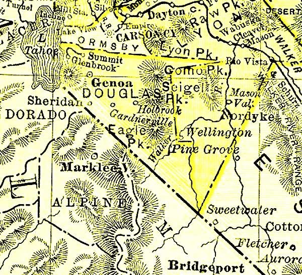
1895
Contributed by Rebecca Maloney
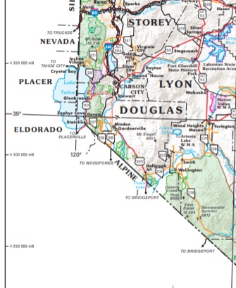
Courtesy of Nevada DOT, where the larger, original map may be found.
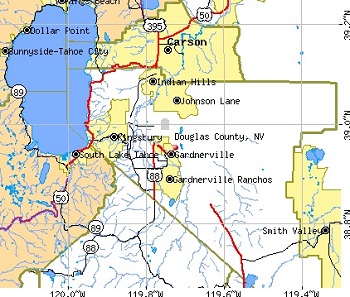
Courtesy of city-data.com, where the larger, original map may be found.
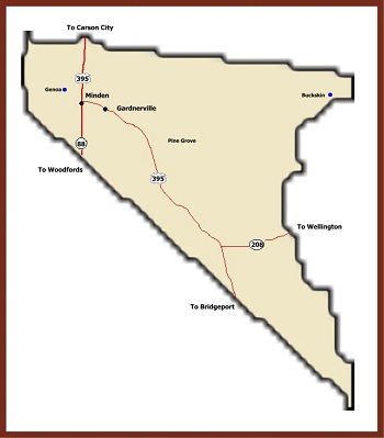
Courtesy of Ghosttowns.com, where the larger, original map may be found.
Boyd Toll Road - Highway 395, fourteen miles south of Carson City William H. Boyd was granted a Utah Territory Franchise December 19, 1861, to provide a road to join Genoa to the Cradlebaugh Toll Road, the trunkline to the mining district of Esmeralda. Boyd’s Toll Road is still visible. When the telegraph line from Placerville (Ca.) through Genoa was strung along it in 1863, the Boyd Road was also called "Telegraph Road." It was purchased by Douglas County from Henry Van Sickel and Lawrence Gilman is 1876 for $2,650.
Bridge House
Buckeye
Buckskin (historical)
Carman Heights
Carson Valley (see Genoa), the birthplace of Nevada - Carson River Basin In 1850, a first settlement was made at Mormon Station, renamed Genoa 1856. Here, in 1851, the first attempt to form a government was made. In 1861, Nevada’s Territorial Government was established at Genoa. Over the old road skirting the west bank of the Carson River thousands of immigrants moved southward to cross the Sierra, feeding their livestock on grass cut along the river. At Genoa, at Mottsville, settled in 1852; and at Sheridan, settled by Moses Job about 1854, they stopped to enjoy produce of the state’s first gardens. Pony Express riders used this route in 1860, switching in 1861 to the shorter Dagget Trail, now known as the Kingsbury Grade.
Centerville
Cradlebaugh (historical)
Double Springs (historical) - Highway 395 thirteen miles south of Gardnerville, Nevada. Double Springs was the notorious Round Tent Ranch, or Spragues, another station on the road to Esmeralda. Here, James C. Dean, one of the owners and Justice of the Peace in the District in 1864, murdered his wife. This station was connected by the Olds Toll Road with the headquarters of the horse thieves at Fairview (see Luther Canyon). This was also the place where the Washo Indian tribe, assisted by their neighbors, the Paiutes, held round dances in the spring to assure the growth of the pine nut, their staple food, and again in the fall for the quality and quantity of the crop. About four miles north of Double springs is Mammoth Lodge, post office of the Eagle Mining District, and the polling place in 1861 of the Mammoth precinct of Douglas County. After 1866, it was known as Carter’s Station, a stopping place on the road to Esmeralda.
Dresslerville - Highway 395, six miles south of Gardnerville In 1917 State Senator William F. Dressler gave this 40 acre tract to the Washo Indians, then living on ranches in the Carson Valley. After a school was opened in 1924, it became a nucleus of settlement. Before the intrusion of Caucasian in 1848, Washo lived in winter in the Pinenuts Hills where they stored autumn harvested pinenuts. In summer, they lived in the Lake Tahoe Basin fishing the tributary streams and gathering roots and berries. In the fall, they hunted jackrabbits and fathered seeds in Carson Valley. Their only form of organization was kinship. These stoneage people lived in daily communion with giants, monsters, animals whose characteristics were interchangeable with those of people, and with water babies, "having the bodies of old men and the long hair of girls," who lived in the lakes of the High Sierra.
Edgewood
Elk Point
Gardnerville - Carson Valley Early Gardnerville served the farming community and teamsters hauling local produce to booming Bodie (Ca.). The first buildings were a blacksmith shop, a saloon and the Gardnerville Hotel. The latter was moved by Lawrence Gilman in 1879 from the emigrant trail between Genoa and Walley’s Hot Springs, where it was known as Ken House, to its new site, the homestead of John. M. Gardner. Just as Genoa was the center for British Settlers (mostly Mormon) after 1851, so Gardnerville, after 1879, became the center for the 1870 Danish immigrants. They founded the Valhalla Society in 1885 and met at Valhalla Hall—now gone. Starting in 1898, Spanish and French Basque shepherds tended some 13,000 sheep in Carson Valley, increasing to 25,000 by 1925, when the Basques began acquiring their own sheep and land. After 1918, several Basques in Gardnerville opened inns which flourished during the Prohibition years.
Gardnerville Ranchos
Genoa (fka Carson Valley)
Glenbrook
Hobart (historical)
Holbrook Junction
Indian Hills
Johnson Lane
Kingsbury
Kingsbury Grade - Location: State Route 57 South of Genoa The Dagget Pass Trail, named for C.D. Dagget, who acquired land at its foot in 1854, was earlier called the Georgetown Train. Replaced in 1860 by the wagon road built by Kingsbury and McDonald, for which they received a Territorial Franchise in 1861, it shortened the distance between Sacramento and Virginia City by 15 miles. The road cost $585,000. Toll receipts were $190,000 in 1863. Heavy Eastward travel occurred in 1860 and 1868. The toll for a wagon and four horses was $17.50 round trip from Shingle Springs, California, to Henry Van Sickle’s station near the foot of the grade. Van Sickle, who helped finance the road, eventually acquired it and sold it to Douglas County in 1889 for $1000. Horse-drawn water carts sprinkled the summer dust, and sleds packed with winter snow, providing a year-round hard-surfaced road. The Pony Express and the Humboldt & Salt Lake Telegraph Company followed the Kingsbury Grade.
Kingsbury Meadows
Kingsbury Village
Lakeridge
Lincoln Park
Logan Creek Estates
Luther Canyon (Fay Canyon) - Location: State Route 57 10 miles South of Genoa Luther Canyon takes its name from Ira M. Luther, who from 1858-1865 had a sawmill there. His home still stands across the road from the Historical Landmark sign. In 1861, he was a delegate to the Second Nevada Territorial Legislature. After 1865, the canyon came to be known as Horse Thief Canyon, because of the "business" of John and Lute Olds, owners of the next ranch south. Besides operating a station along the Emigrant Trail for a number of years, they rustled horses from emigrants. The animals were sent up the canyon to drift over the ridge into Horse Thief Meadows; after resting and feeding, the horses were driven down to Woodfords Canyon to sell to other emigrants. A prospector called Saw Tooth was allegedly murdered and buried in the barn south of the Luther house. Sam Brown, a notorious badman, was shot and killed in from of the Olds barn in 1861 by a man he threatened. "Lucky Bill:" Thorington, implicated in a murder in California, for which he was hanged by vigilantes in 1858, had a ranch two and a half miles to the south—and the pioneers called the school district "Fairview".
Mammoth Ledge (historical)
Minden (county seat) - one mile north of Gardnerville. Minden, the seat of Douglas county since 1916, was named for a town in Westphalia, Germany, where the founder of the H.F. Dangberg Land and Live Stock Company was born in 1829. The company established Minden in 1905 to provide terminal facilities for the Virginia and Truckee Railroad, which was then extending a branch line southward from Carson City. Principal promoter of the town and its related development was H.F. Dangberg, Jr., secretary of the company and son of the founder.
Mottsville - state
Route 57, six miles south of Genoa. Hiram Mott and his son Israel
settled here in 1851. Their homestead was the scene of an impressive
number of firsts in the Carson County, Utah Territory:
1851: Israel
Mott’s wife, Eliza Ann Middaugh, was the first white woman settler.
1854: Mrs. Israel Mott opened the first school in her kitchen. The
Mott’s second child , Louisa Beatrice, was the first white girl child to
be born.
1856: Judge W.W. Drummond held the first session of the
United States District Court of the Third District of Utah Territory in
the Mott barn built in 1855.
1857: The third child of the Motts died
and was buried in the yard. This tiny grave was the first in what became
the first cemetery. (Note: see cemetery listings on this site).
Mountain House (historical)
Round Hill
Sheridan - State Route 57, eight miles south of Genoa In 1861, a blacksmith shop, a store, a boarding house, and two saloons comprised the village of Sheridan which had grown up around the general store of Moses Job established prior to 1855. This enterprising merchant named the peak, in the shadow of which the town stood, after himself having planted an American flag on the top. The Sheridan House was here built before 1875. The Surveyor General, in his 1889-90 biennial report, stated that Sheridan was a metropolis of the Carson River West Fork farmers. The Sheridan House still stands and is all that is left of the "metropolis."
Skyland
Stateline
Summit Village
Tahoe Village
Topaz Lake
Twelve Mile House - Highway 395, six miles south of Gardnerville, Nevada An important hostelry was so named because of its distance from Genoa and also from Cradlebaugh Bridge across the Carson River. It was built in 1860 by Thomas Wheeler where the Boyd Toll Road to Genoa and the Cradlebaugh Toll Road to Carson City converged. In this vicinity, a second station was built by Thomas Teasdale. Twelve Mile House was an important stop on the road to the Esmeralda mining camp of Aurora. The buildings of the original station still stand here.
Valley View (historical)
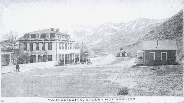 Walley’s Hot Springs - Location: State Highway 57, two miles south of
Genoa In 1862, along this Carson branch of the Emigrant Trail, David and
Harriet Walley developed a $100,000 spa with 11 baths, a ballroom and
gardens. The thermal waters (136 to 160 degrees Fahrenheit) became well
known as a cure of "rheumatism and scrofulous affections." (sic) It sold
for a mere $5000 in 1896 but functioned as a hotel until 1935 when it
burned. Its former cool cellar is still in use. In 1962, trial
hydro-thermal power holes were drilled here as deep as 1,250 feet;
maximum temperature is 181 degrees.
Walley’s Hot Springs - Location: State Highway 57, two miles south of
Genoa In 1862, along this Carson branch of the Emigrant Trail, David and
Harriet Walley developed a $100,000 spa with 11 baths, a ballroom and
gardens. The thermal waters (136 to 160 degrees Fahrenheit) became well
known as a cure of "rheumatism and scrofulous affections." (sic) It sold
for a mere $5000 in 1896 but functioned as a hotel until 1935 when it
burned. Its former cool cellar is still in use. In 1962, trial
hydro-thermal power holes were drilled here as deep as 1,250 feet;
maximum temperature is 181 degrees.
Zephyr Cove
Original list contributed by Doreen Robinson, compiled by the Nevada Division of Water Planning
Additions made 2021 Jan 27 by Norma Hass, extracted from USGS GNIS
Captain George Donner
Clara Holbrook Frank Family
Eastside Memorial Park
Garden
Gardnerville
Genoa
Glenbrook
Happy Hunting Grounds
Jack's Valley
Knott Family Graveyard
McMichael Family
Mottsville
St. John's in the Wilderness
Washoe
Compiled 2021 Jan 27 from USGenWeb Archives, Tombstone Transcription Project, and FindAGrave, where burial info and photos may be found.
Copyright © 1996- The USGenWeb® Project, NVGenWeb, Douglas County
Design by Templates in Time
This page was last updated 02/01/2024