 |
Map Resources
How the Counties of Virginia were formed
|
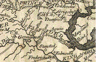
A portion of the 1795 Mathew Carey map from the National Atlas. The complete map will be found on the web site below. For a more complete selection of Historic Virginia maps, please visit the web site of David Rumsey.
- More Maps -
Chart explores Stafford County's historical hotspots. Copyright 2003 The Free Lance Star Publishing Co. of Fredericksburg, VA
Civil War Map of Stafford County
Color Landform Atlas of Virginia
Map Collections 1500 - 1999, housed in the Library of Congress
Pre-Revolutionary Maps & Civil War Battles
If you know of additional sites with resource maps, please let me know.