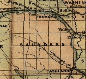
To see the full State map see: Library of Congress State Map Collections Follow the link for Nebraska, then for the 1874 Nebraska map.
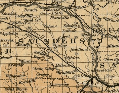
To see the full State map see: Library of Congress State Map Collections Follow the link for Nebraska, then for the 1876 Nebraska map.
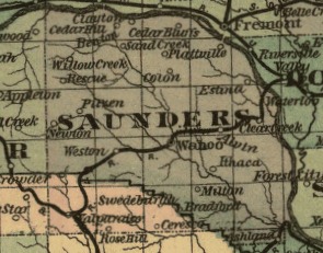
To see the full State map see: Library of Congress State Map Collections Follow the link for Nebraska, then for the 1879 Nebraska map.
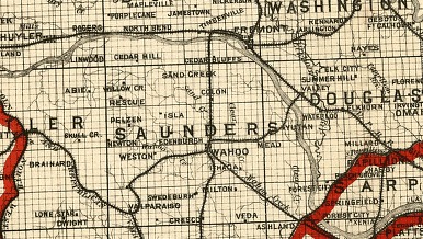
To see the full State map see: Library of Congress State Map Collections Follow the link for Nebraska, then for the 1886 Nebraska map.
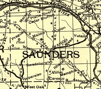
From a Railway map of Nebraska issued by State Board of Transportation 1889.
To see the full State map see: Library of Congress State Map Collections Follow the link for Nebraska, then for the 1889 Nebraska map.

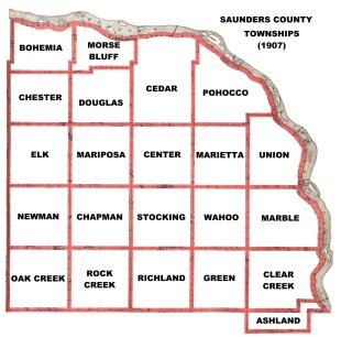
Map showing the location of Townships in Saunders County in 1907.
DONE! This book has a farmer's directory for each township, and includes some portraits and pictures of the county in 1907 besides the plat maps.
From the Saunders County Historical Society website
Farmers Directories (on this site)
