Historical & Modern Maps Collection
This page is a collection of historical and modern maps of Hall County, Nebraska.
- 1885 Township Atlas Provided by Ted & Carole Miller
- 1885 Nebraska State Atlas
- 1890 Hall County Atlas
- 1895 Hall County Map Provided by Pam Rietsch
(This ia a wonderful site and we owe Pam a debt of gratitude) - 1904 Hall County Atlas is provided by "Hall County IT Department" in Adobe Acrobat PDF format. The 1904 Hall County Atlas (originally published by Geo. A. Ogle & Co.) was scanned and added to the Historical Atlases page in the Register of Deeds section of this website. If you have interest in the history of Hall County or its past residents, historical atlases are a wealth of useful information. Details regarding property ownership, school locations, and city plats are all included along with photos of select residents. It is planned that other historical atlases of Hall County will be added when available.
COMPLETE INDEXED 1904 ATLAS
Each page number is linked to the "Hall County IT Department"
provided by "Hall County NEGenWeb Project"
1904 Atlas Directory Main Page
[A - C] - [D - F] - [G - H] - [I - L] - [M - P] - [Q - R] - [S - V] - [W - Z]
Courstey of Nebraska State Historical Society (NSHS) - Hall County Plat Map Books: About This Collection
- 1920 Plat Book - W. W. Hixson & Company
- 1953 Plat Book & Farmers Directory - Farm Plat Book Publishing Company
- 1971 to 2003 Plat Books - R.C. Booth Enterprises
- Hall County GIS Interactive Map. Additional GIS Links for Hall County, Nebraska
- Historical Maps Of Grand Island & Hall County
- City of Grand Island, Nebraska GIS Interactive Map
This is the location of Hall County in Nebraska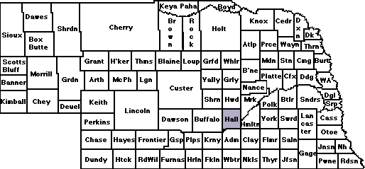
This is the Today's location of Hall County
COPYRIGHT INFORMATION
All materials contained on these pages are furnished for the free use of those engaged in researching their family origins. Any commercial use or distribution, without the consent of the host/author of these pages is prohibited. All images used on these pages were obtained from sources permitting free distribution, or generated by the author, and are subject to the same restrictions/permissions. All persons contributing material for posting on these pages do so in recognition of their free, non-commercial distribution, and further, is responsible to assure that no copyright is violated by their submission.