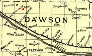
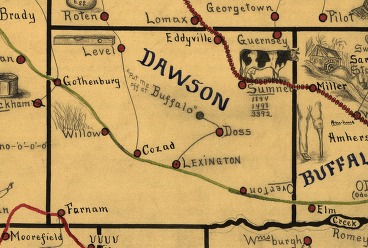
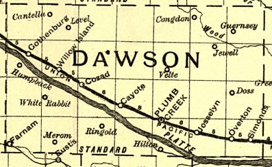
- Many lists of early Dawson County communities overlook Level, a small farming community in the northwest corner of Dawson County. Only maps published between 1884 and 1904 show it. This page attempts to put Level back on the map.
- The Name: According to Perkey's Nebraska Place Names, the name was "probably descriptive in origin."
- Population: The population was listed as 30 in Cram's Standard American Atlas of 1889, making it larger than Congdon, Humpback, Velte or White Rabbit, and nearly as large as Willow Island.
- Post Office: The Level post office was established June 18, 1884 and discontinued April
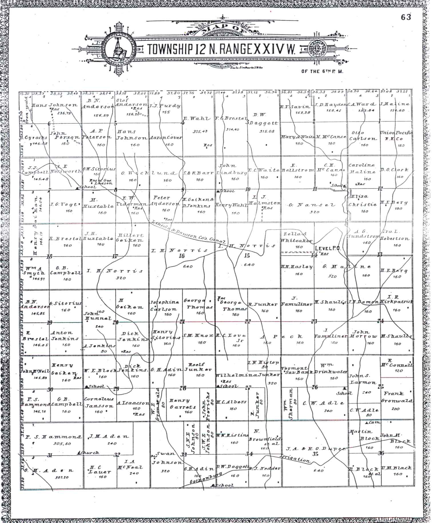
29, 1904. At least part of that time, the post office was in the home of Ernest Eri Peck, two miles west and one and a half miles north of the Walnut Grove Church. Ernest's daughter, Dr. Gladys Peck Croman, said the post office was in the home of her grandfather Rufus H. Peck. A 1904 plat map showed it on the property of Gust Maline.
- Residents: Farmers with Level addresses listed in the 1890-91 directory were:
Gerhard and Jno Aden
Charles W. Adle
H.C. Albers
N. Anderson
B. R. and T. J. Barton
A. O. Berg
Jno, Martin
R. and Wm Black
Alfred Block
N. and Wm S. Brownfield
G. B. Campbell
D. W. Daggett
G. L. Ditto
Wm. Drinkwater
Thos Durland
Jno Frerichs
Henry Garralts
Henry Geiken
Hilbert Griken
P. S. Hammond
Geo H. Haye
D. R. Henud
John Hunnel
Aug Isaacson
Dick Jenkens
Cornelius Jansen
Swan Johnson
Rolf Junker
H. E., F. R., J. T. and E. M. Kirkpatrick
John Lammers
H. C. Lauer
J. H. Lemmon
R. C. Love
C. H. McCaurl
A. D. McGrew
F. A. and Jno McNeal
Gust and Jonas Maline
Jno Morrow
Chas Norstrom
Nels Olson
E. E., H. C. and R. H. Peck
A. P. Peterson
James Purdy
G. A. Rhodin
W. W. Ristine
Lars Sandquist
P. W. Sealander
Wm. Sherman
Gerd and Henry Sitorius
Geo Stimson
Herman Strate
Geo Thomas
E. Totten
Riley Vedder
Elias and Henry Wahl
Carl Westpahl
Alf Wickland
Sherman Wilson
C. Youngberg
- Sources:
* Burlington Route Map of Nebraska. 1886. Compiled from the official records of the government and railroad offices. Library of Congress state map collections.
* Cram's Standard American Atlas, 1889. Railroad and County Map of Nebraska, Geo. F. Cram, Engraver and Publisher, Chicago.
* Dawson County Platbook, 1904, Township 12 N. Range 24 W.
* Galbraith's railway mail service map. 1898. Library of Congress state map collections.
* Nebraska State Board of Transportation. 1889 Railway map of Dawson County. Library of Congress state map collections.
* Nebraska State Gazetteer. Business Directory and Farmers list for 1890-1891, J.M. Wolfe & Co., Publishers, 1890.
* Perkey, Elton A. Perkey's Nebraska Place Names, J&L Lee Co. Nebraska State Historical Society, 1995.
|
