This Dawson County, Nebraska 1919 Atlas is presented as part of the
Dawson County NEGenWeb Project
and the MARDOS Memorial Library Collection.
** Submitter's Note: These electronic pages are provided for your personal use, and may not be reproduced in any format for profit, nor for presentation in any form by any other organization or individual. They may be freely copied for your personal use.**
*** The map images are very large in order to show the detail. They will take a while to download. ***
| MAP | FARMER'S DIR. | |||||
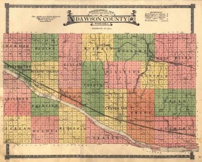
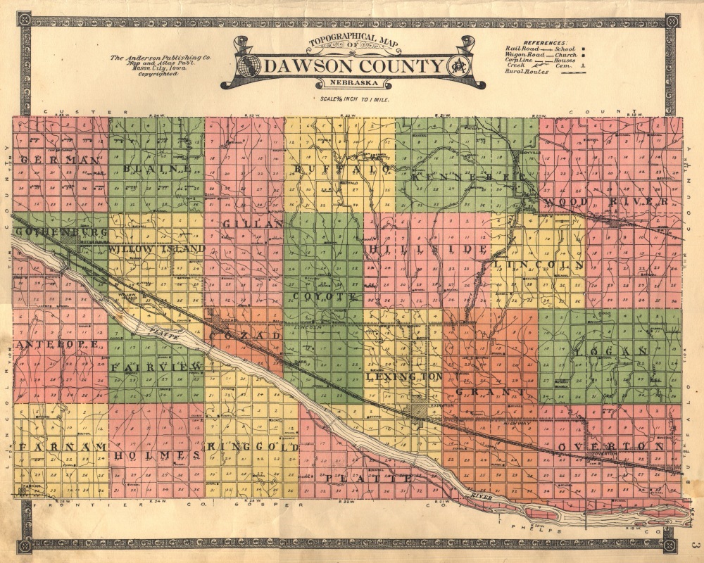
| COUNTY OUTLINE MAP | _3 | |||||
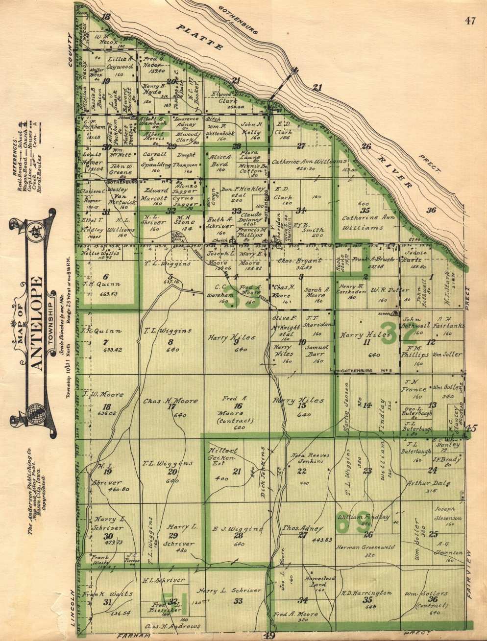
| ANTELOPE | PREC. TOWNSHIP | 10-11 N. | RANGE | 25 W. of 6 P.M. | 47 | 46 |
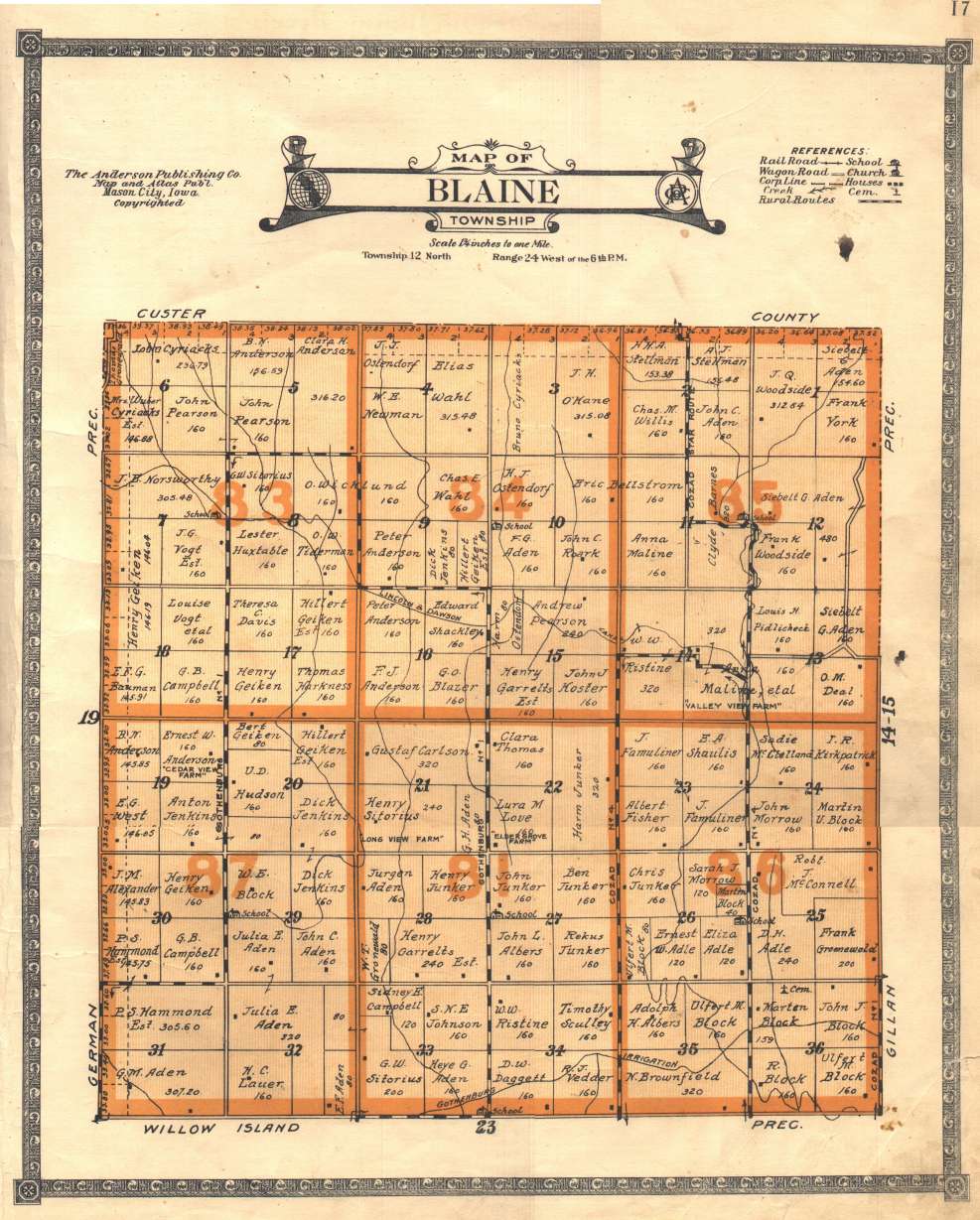
| BLAINE | " " | 12 | " | 24 W. of 6 P.M. | 17 | 16 |
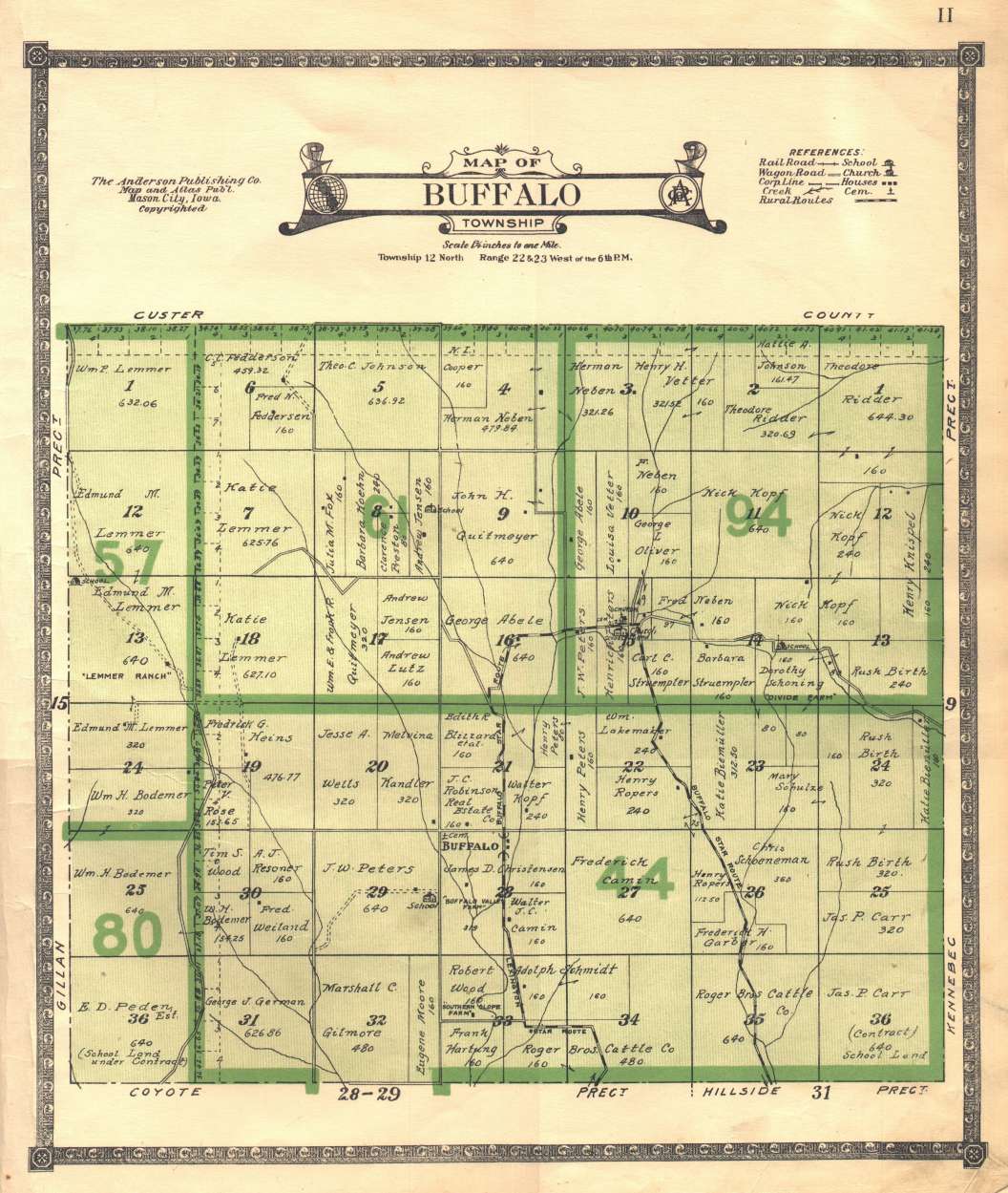
| BUFFALO | " " | 12 | " | 22-23 W. of 6 P.M. | 11 | _8 |
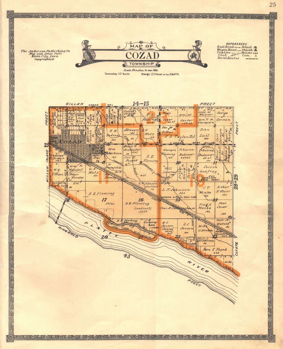
| COZAD | " " | 10 | " | 23 W. of 6 P.M. | 25 | 18 |
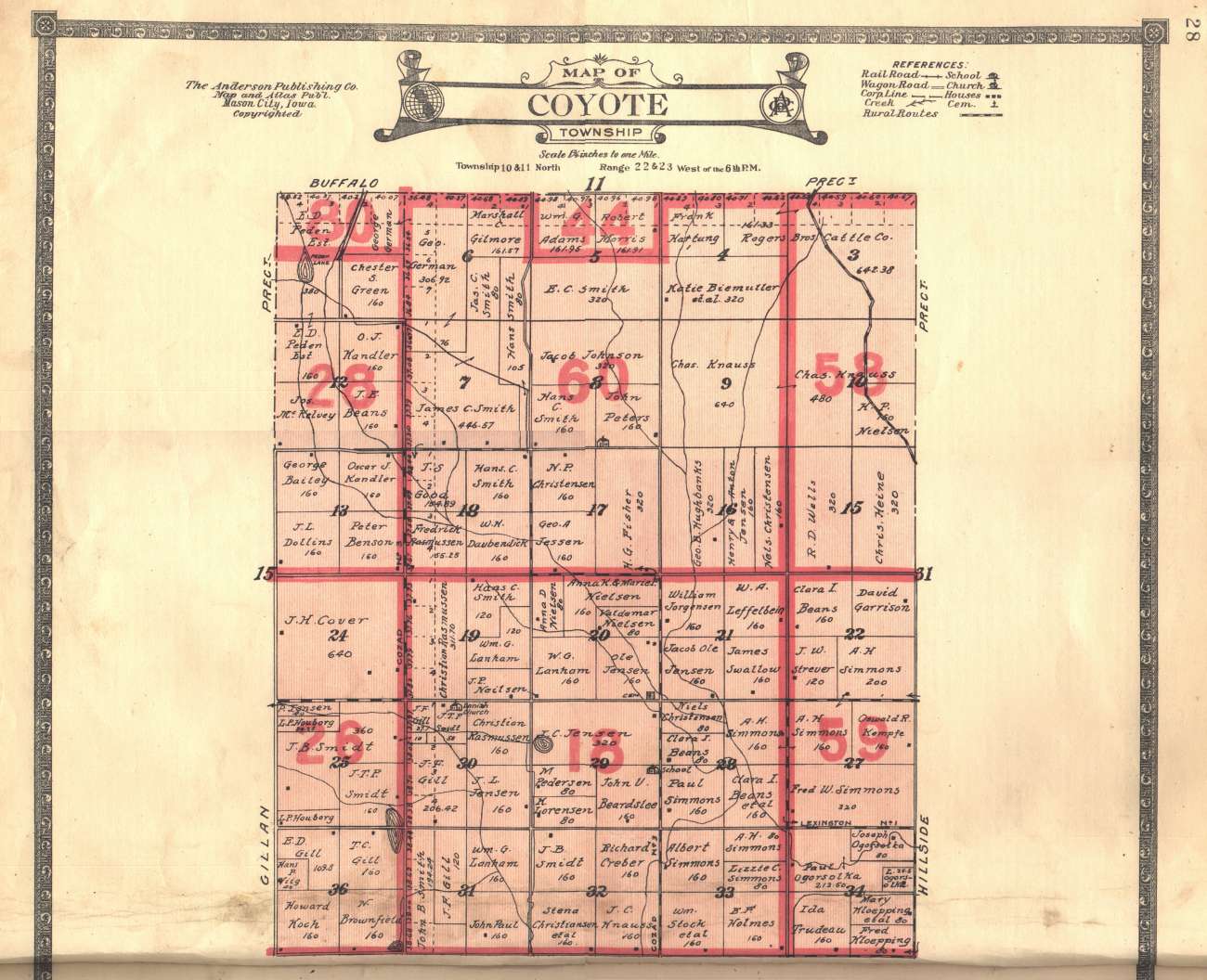
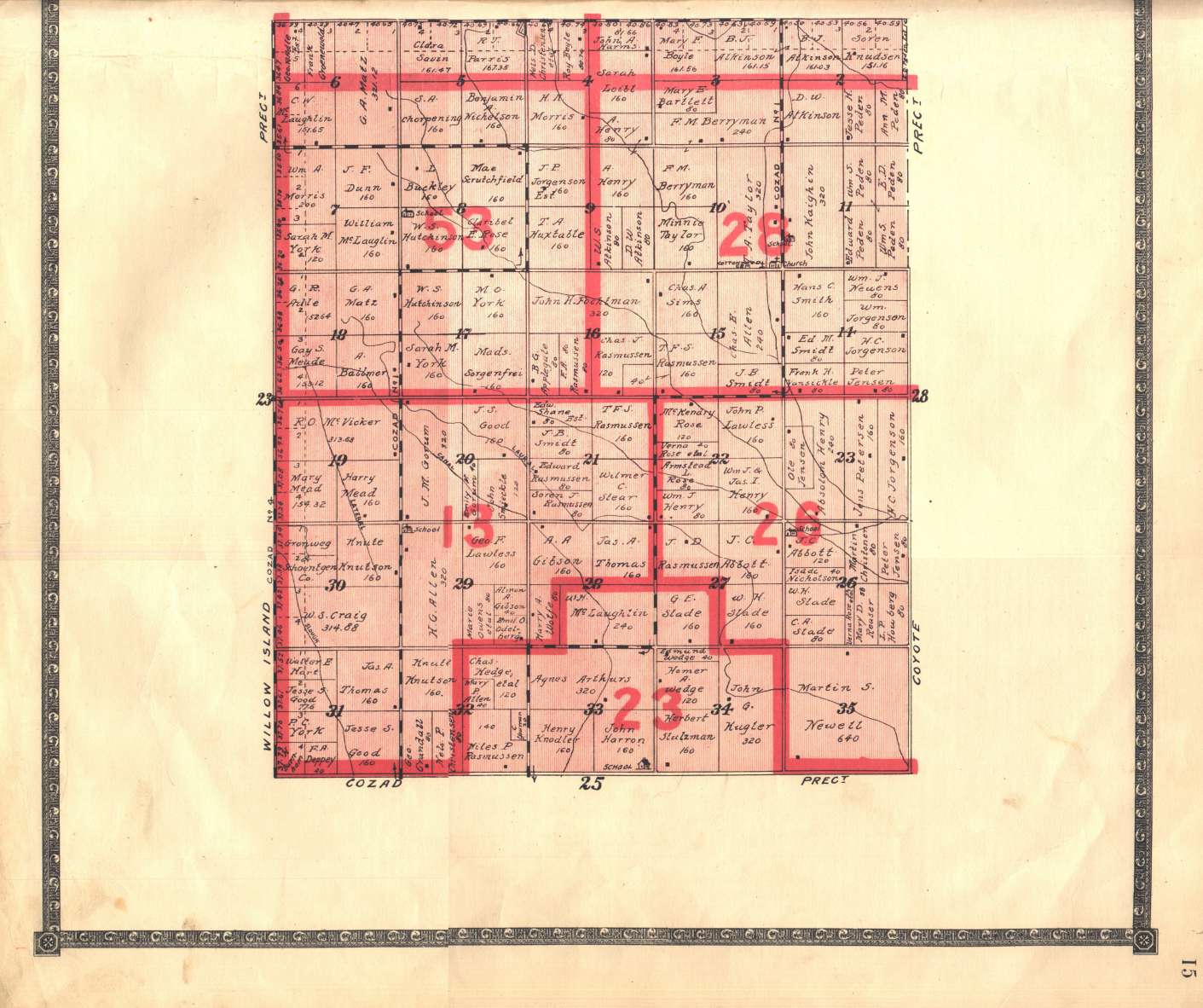
| COYOTE | " " | 10-11 | " | 22-23 W. of 6 P.M. | 28-29 | 27 |
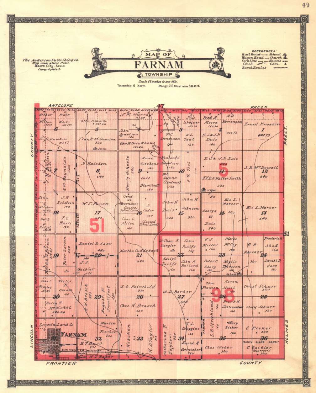
| FARNAM | " " | 9 | " | 25 W. of 6 P.M. | 49 | 46 |
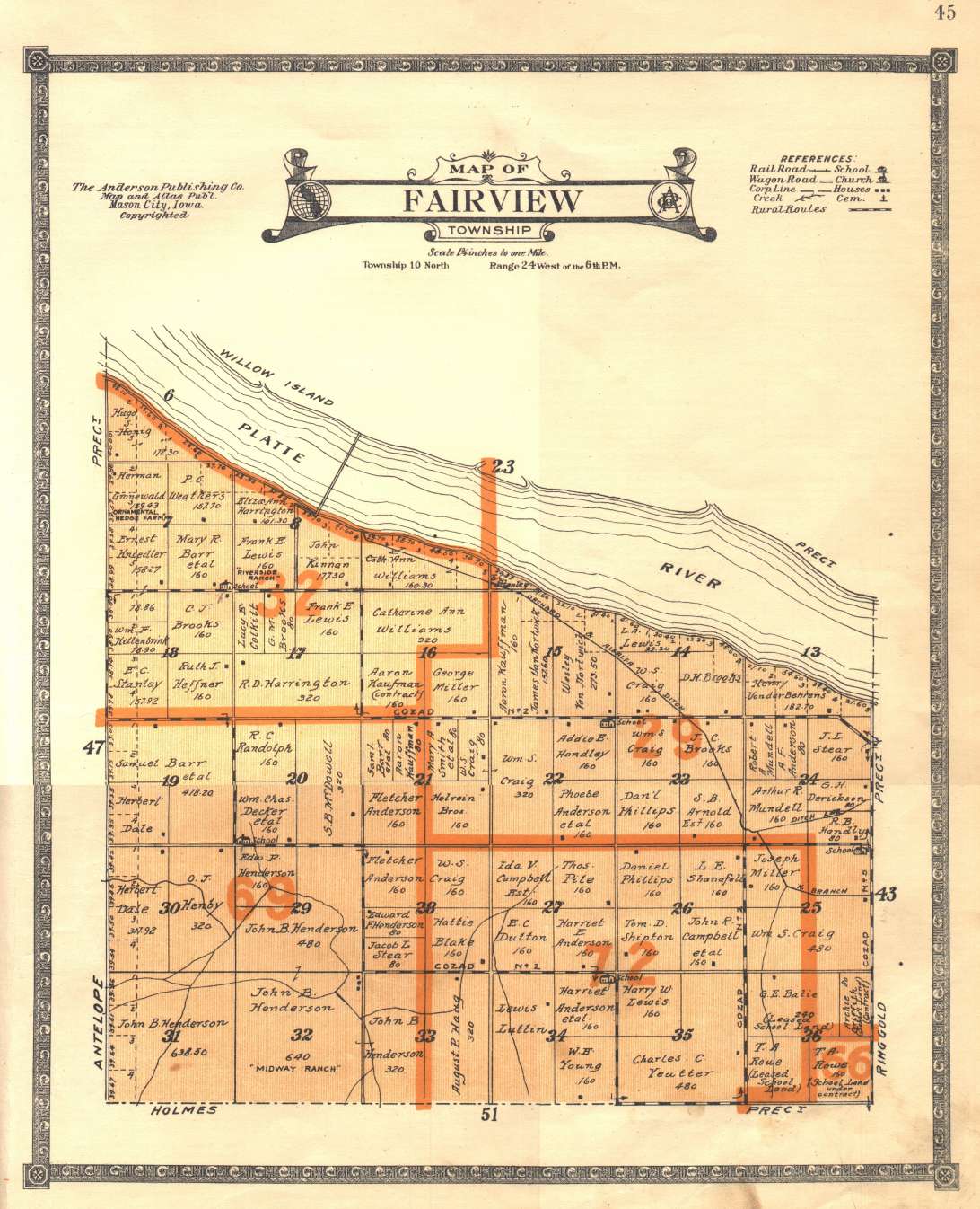
| FAIRVIEW | " " | 10 | " | 24 W. of 6 P.M. | 45 | 42 |
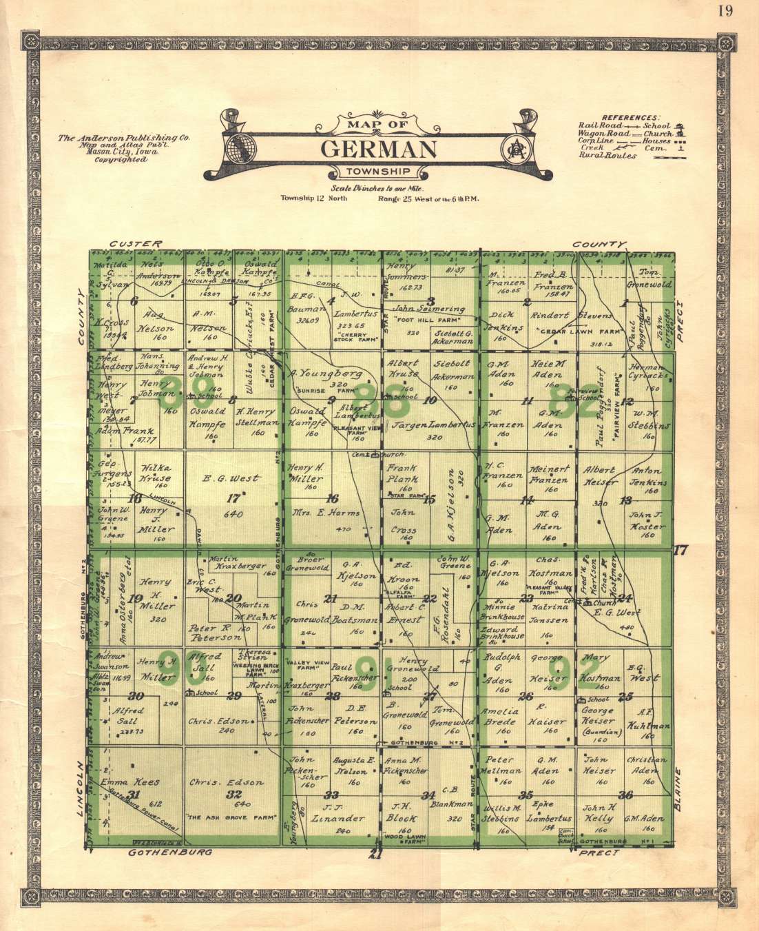
| GERMAN | " " | 12 | " | 25 W. of 6 P.M. | 19 | 18 |
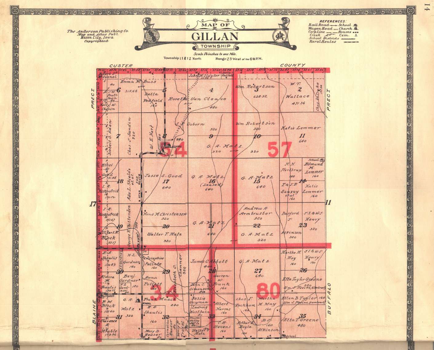
| GILLAN | " " | 11-12 | " | 23 W. of 6 P.M. | 14-15 | 13 |
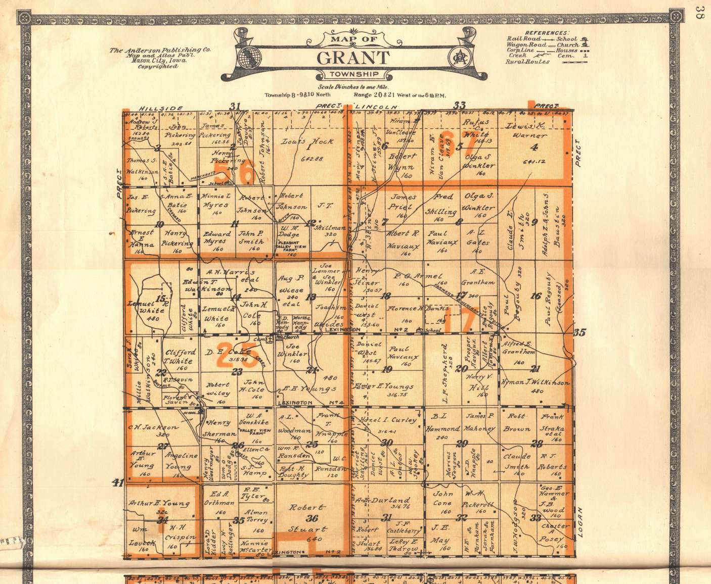
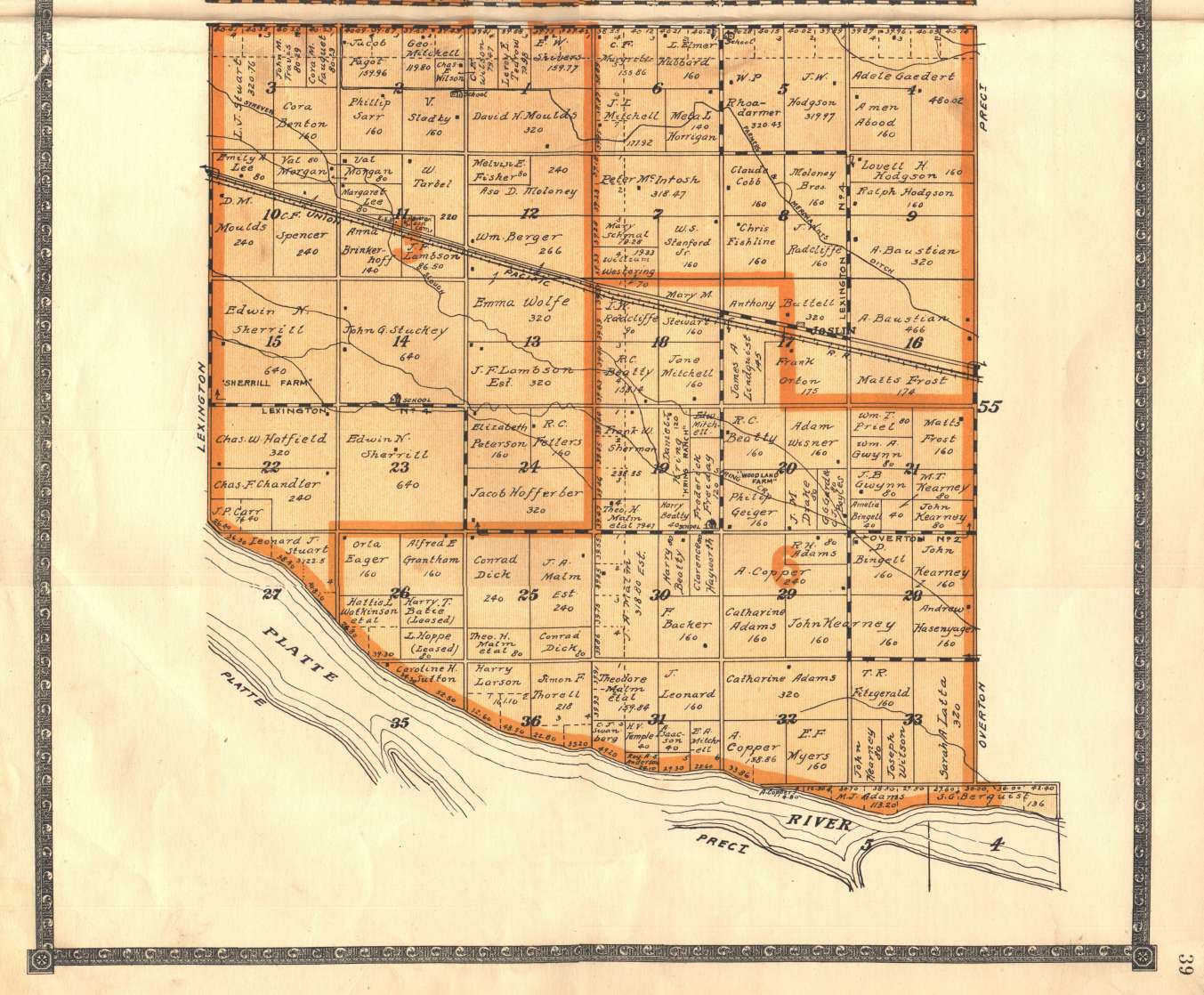
| GRANT | " " | 8-9-10 | " | 20-21 W. of 6 P.M. | 38-39 | 37 |
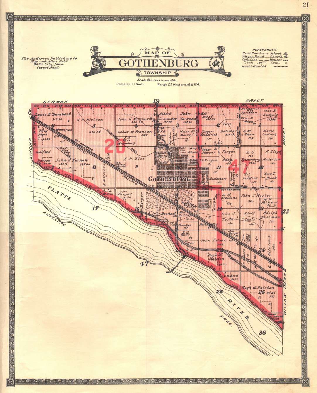
| GOTHENBURG | " " | 11 | " | 25 W. of 6 P.M. | 21 | 16 |
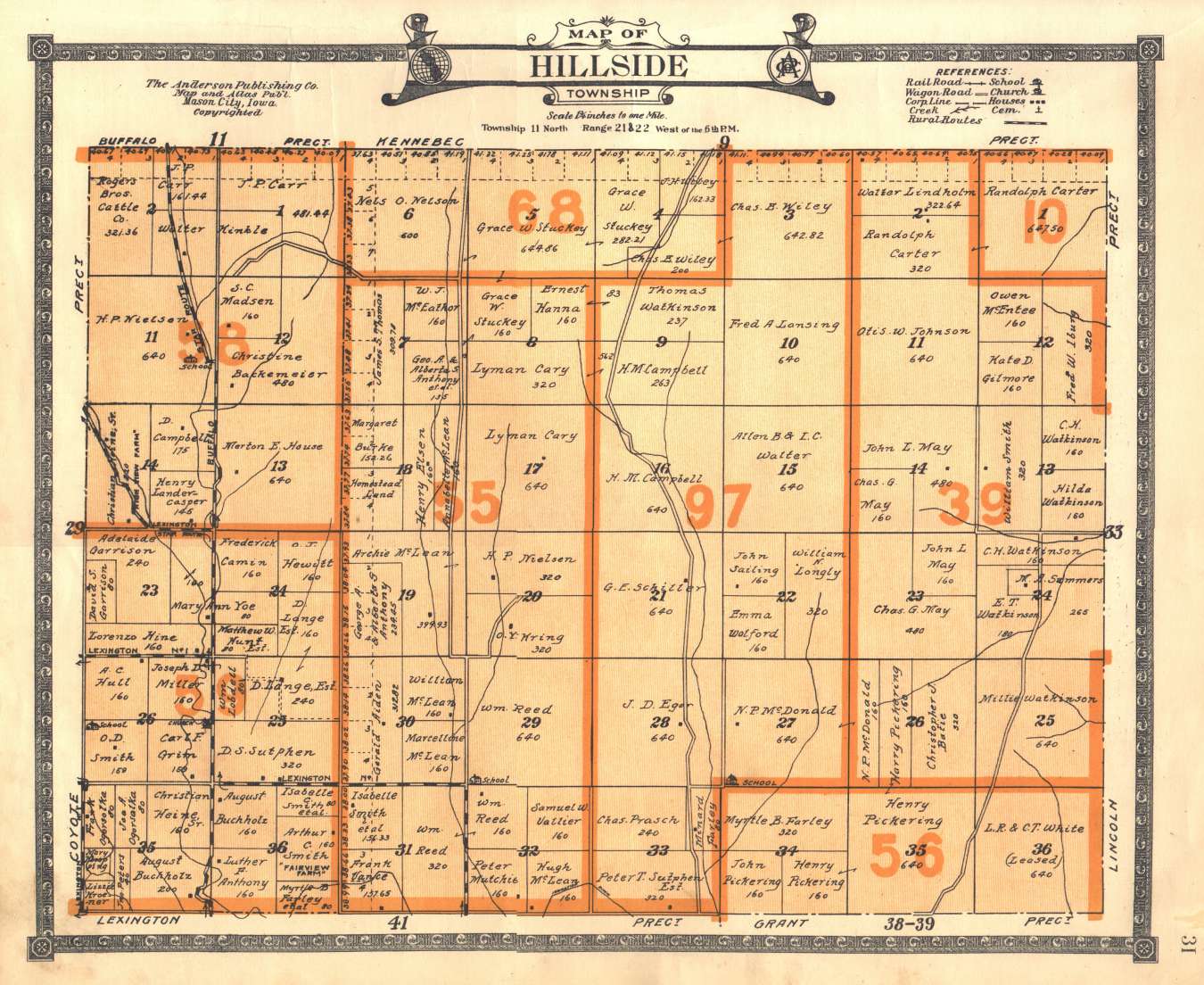
| HILLSIDE | " " | 11 | " | 22-22 W. of 6 P.M. | 31 | 32 |
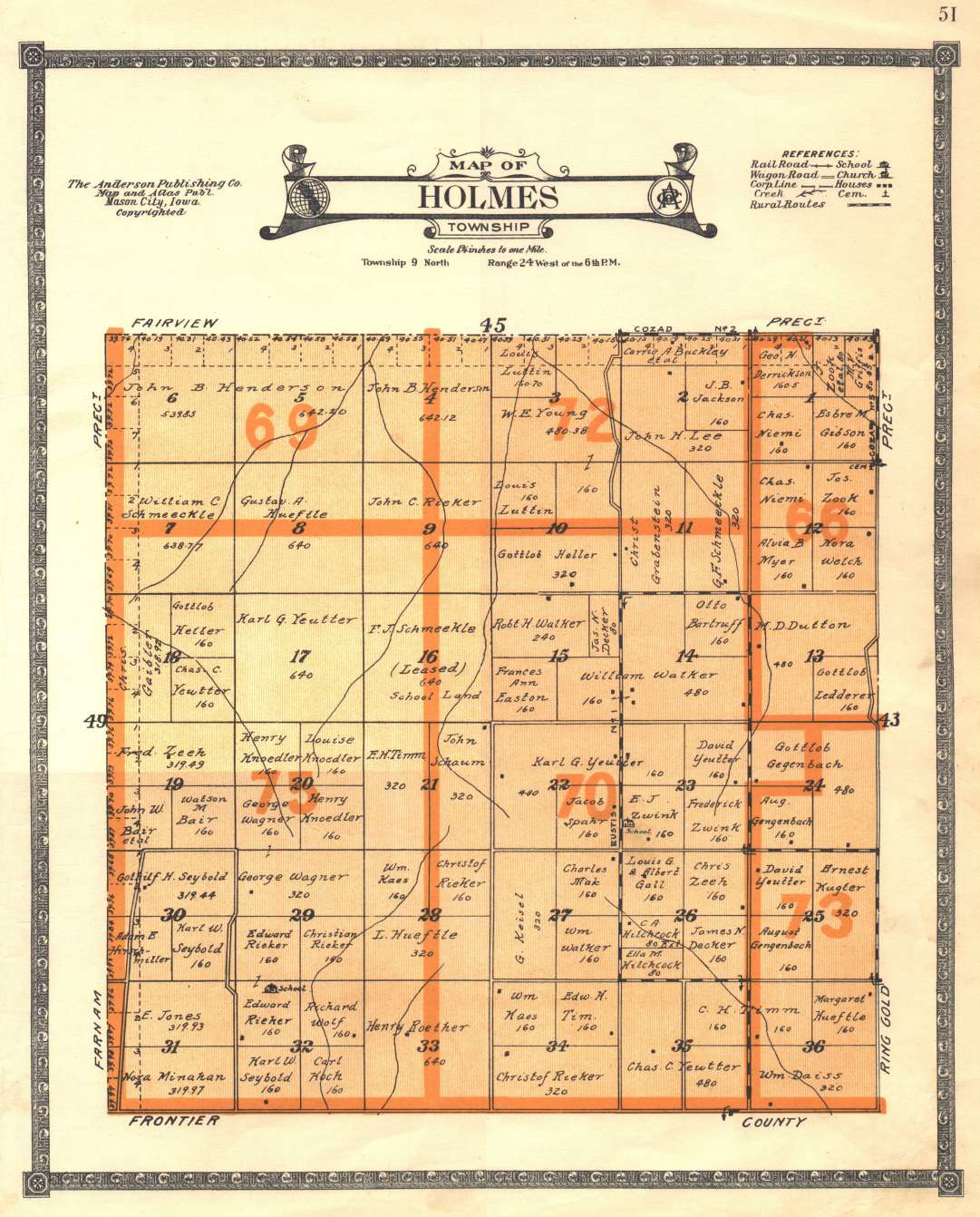
| HOLMES | " " | 9 | " | 24 W. of 6 P.M. | 51 | 50 |
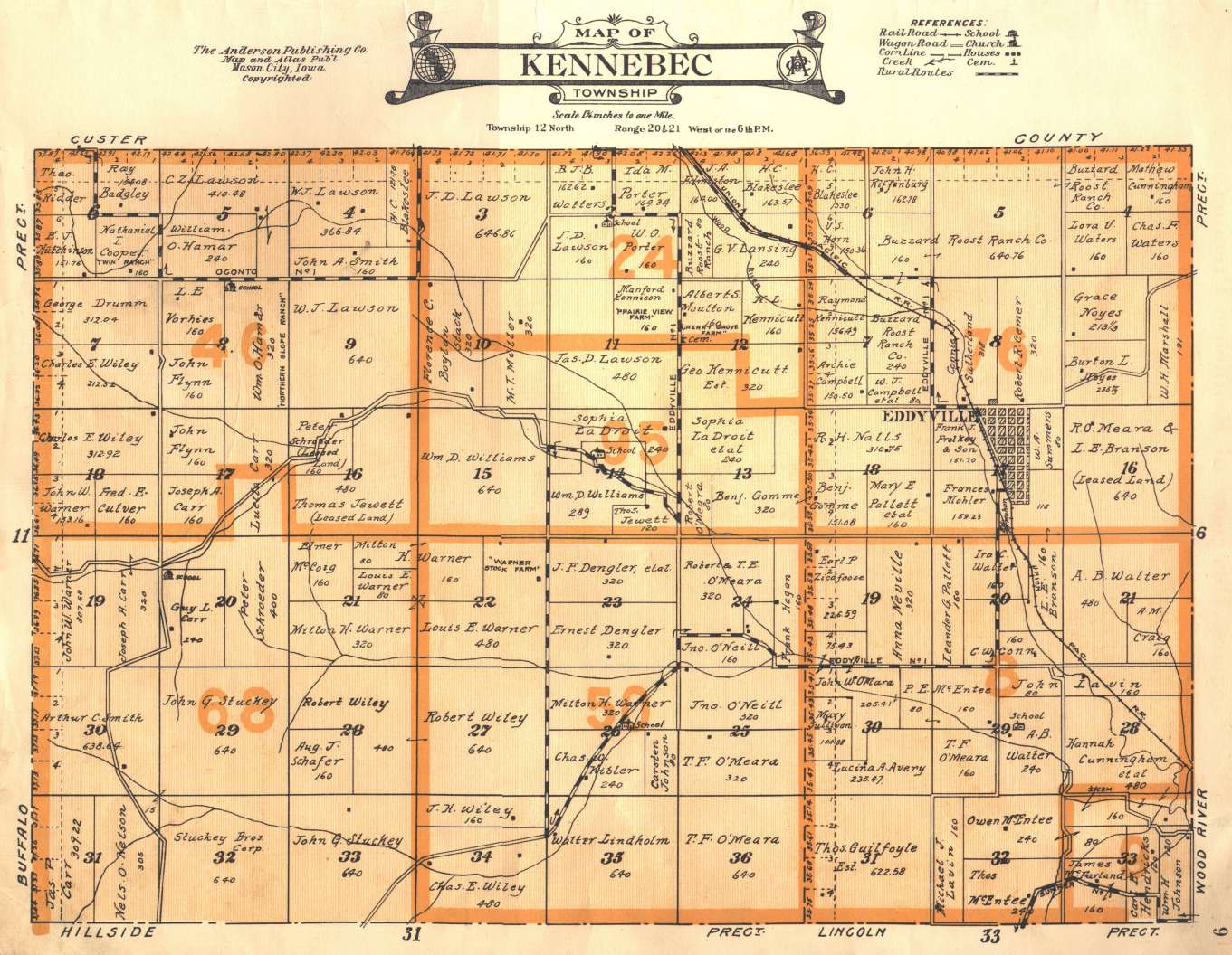
| KENNEBEC | " " | 12 N. | " | 20-21 W. of 6 P.M. | _9 | _8 |
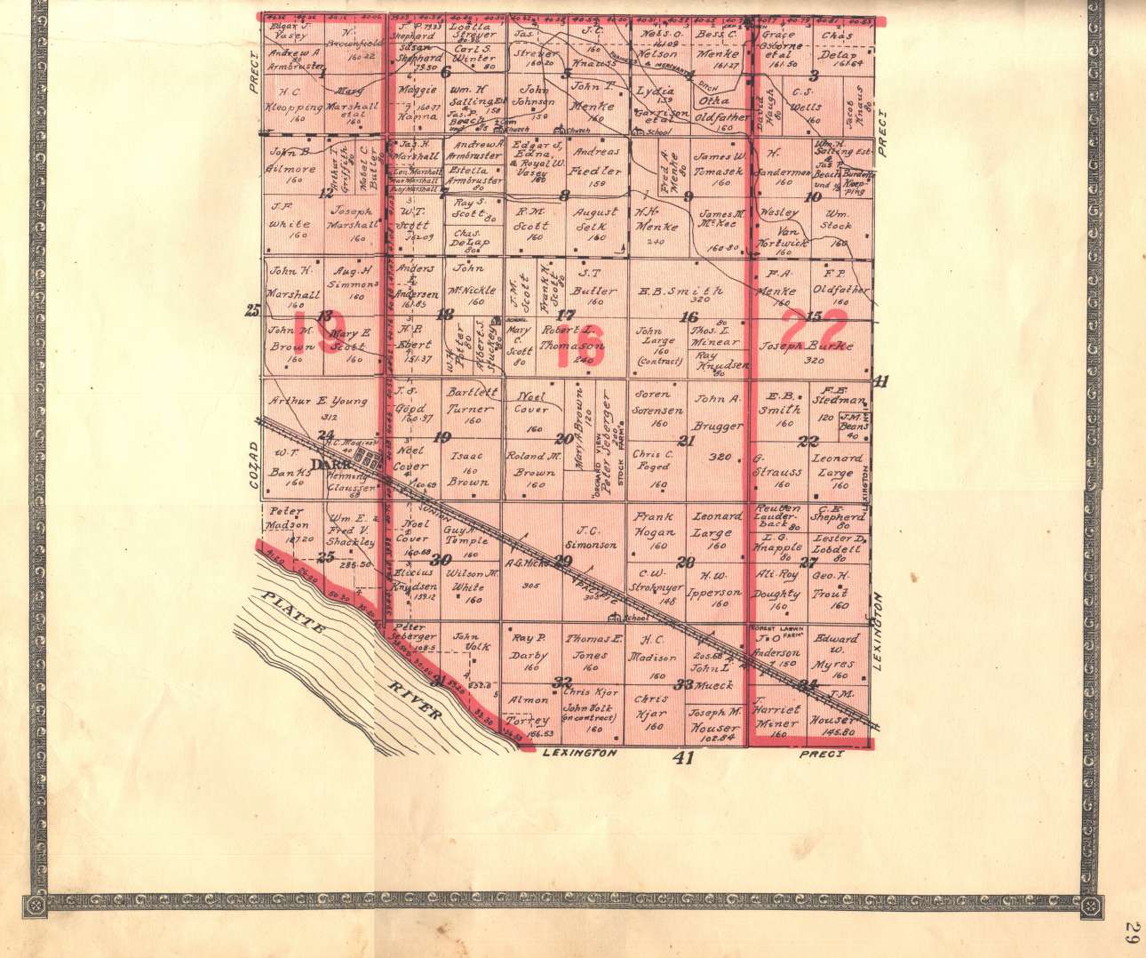
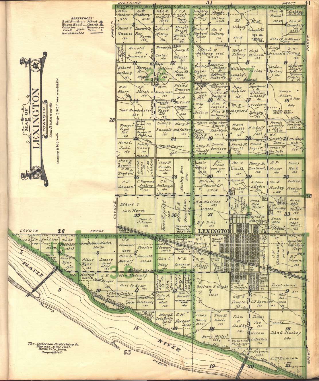
| LEXINGTON | " " | 9-10 | " | 21-22 W. of 6 P.M. | 41 | 40 |
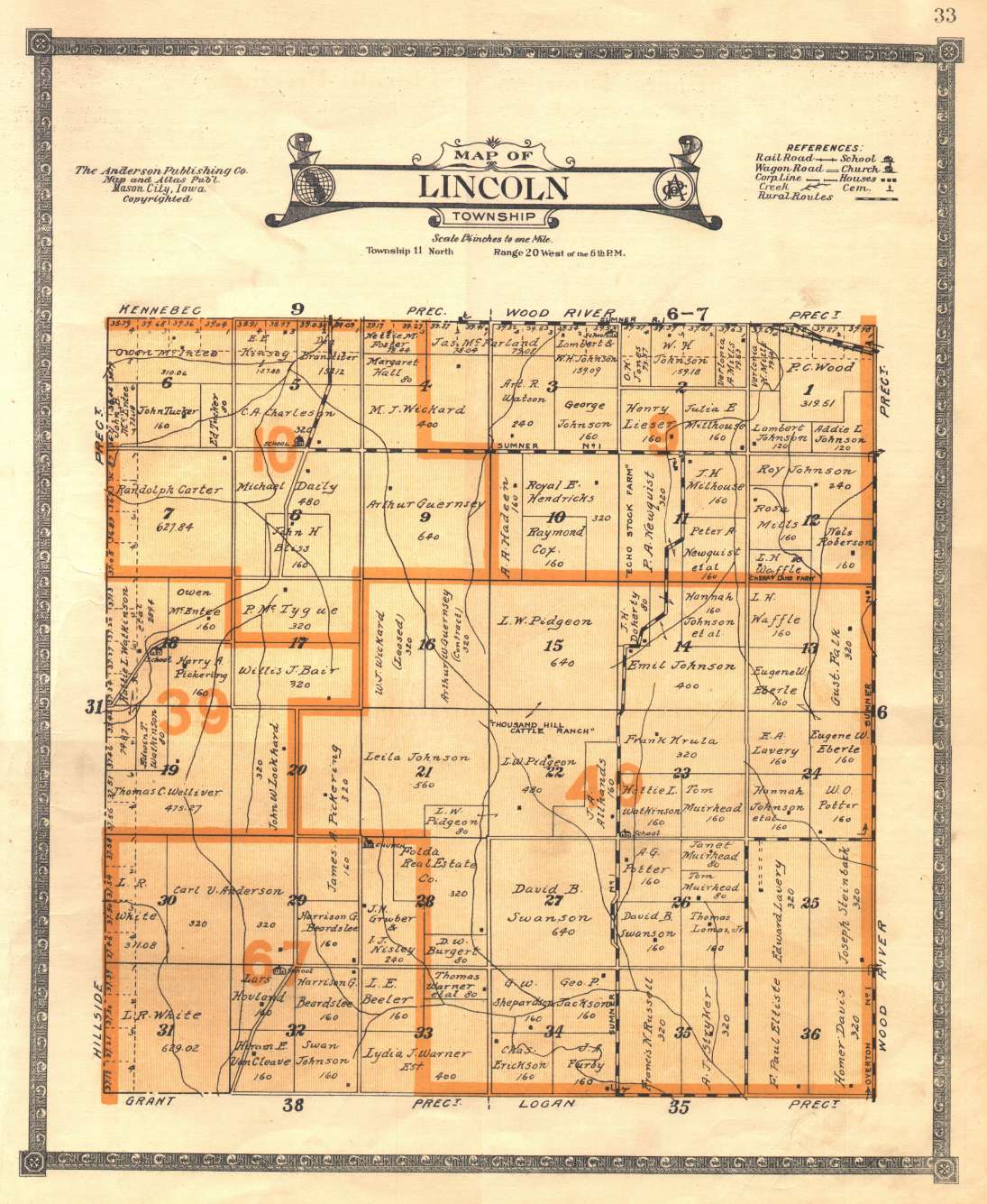
| LINCOLN | " " | 11 | " | 22 W. of 6 P.M. | 33 | 32 |
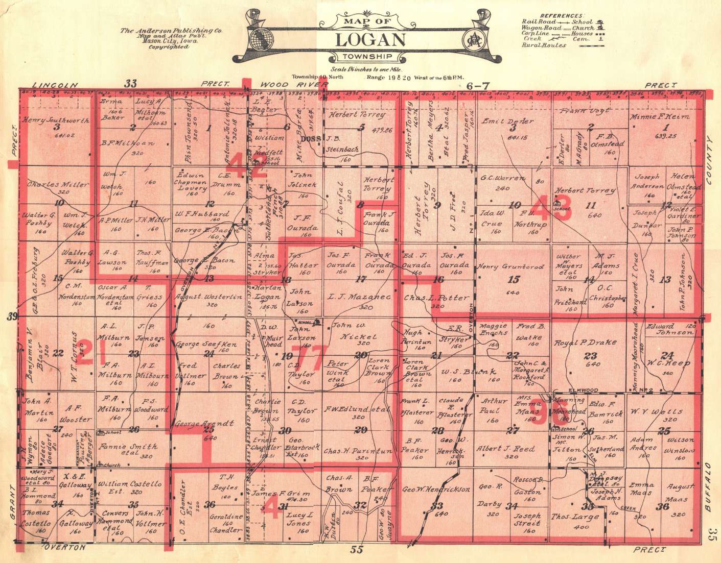
| LOGAN | " " | 10 | " | 19-20 W. of 6 P.M. | 35 | 34 |
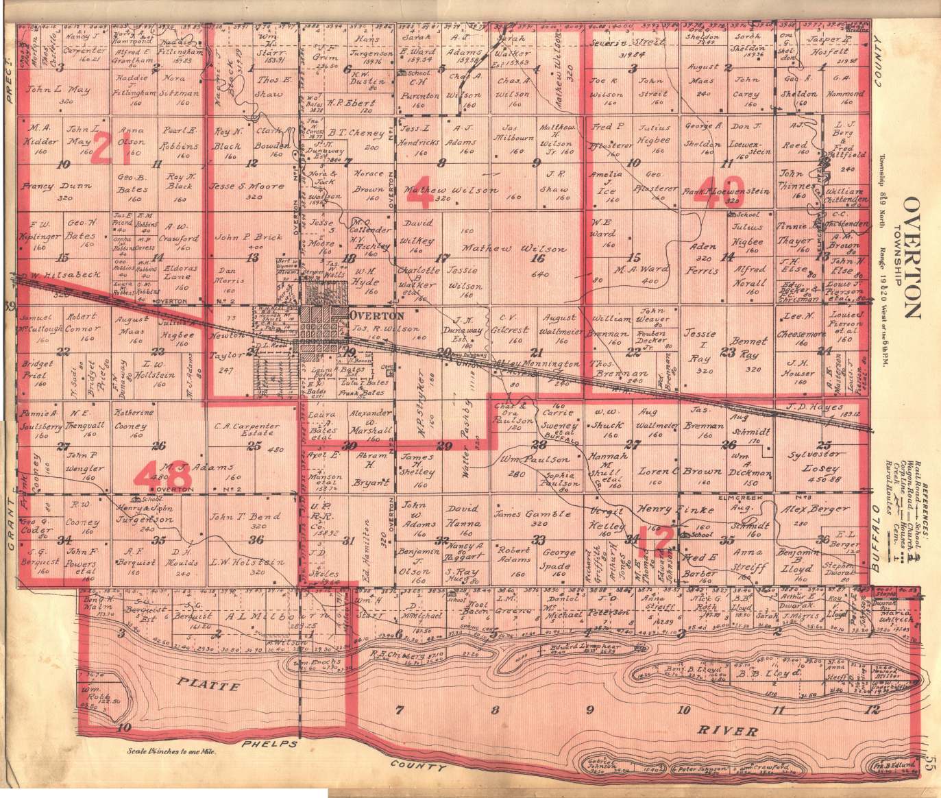
| OVERTON | " " | 8-9 | " | 19-20 W. of 6 P.M. | 55 | 54 |
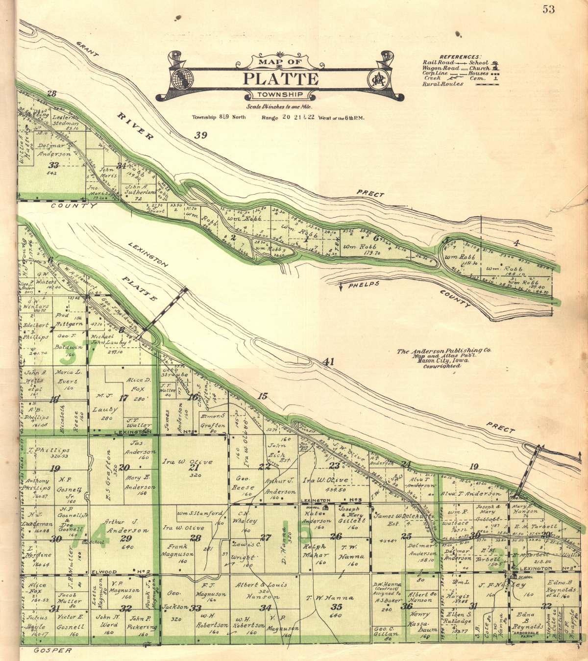
| PLATTE | " " | 8-9 | " | 20-21-22 W. of 6 P.M. | 53 | 50 |
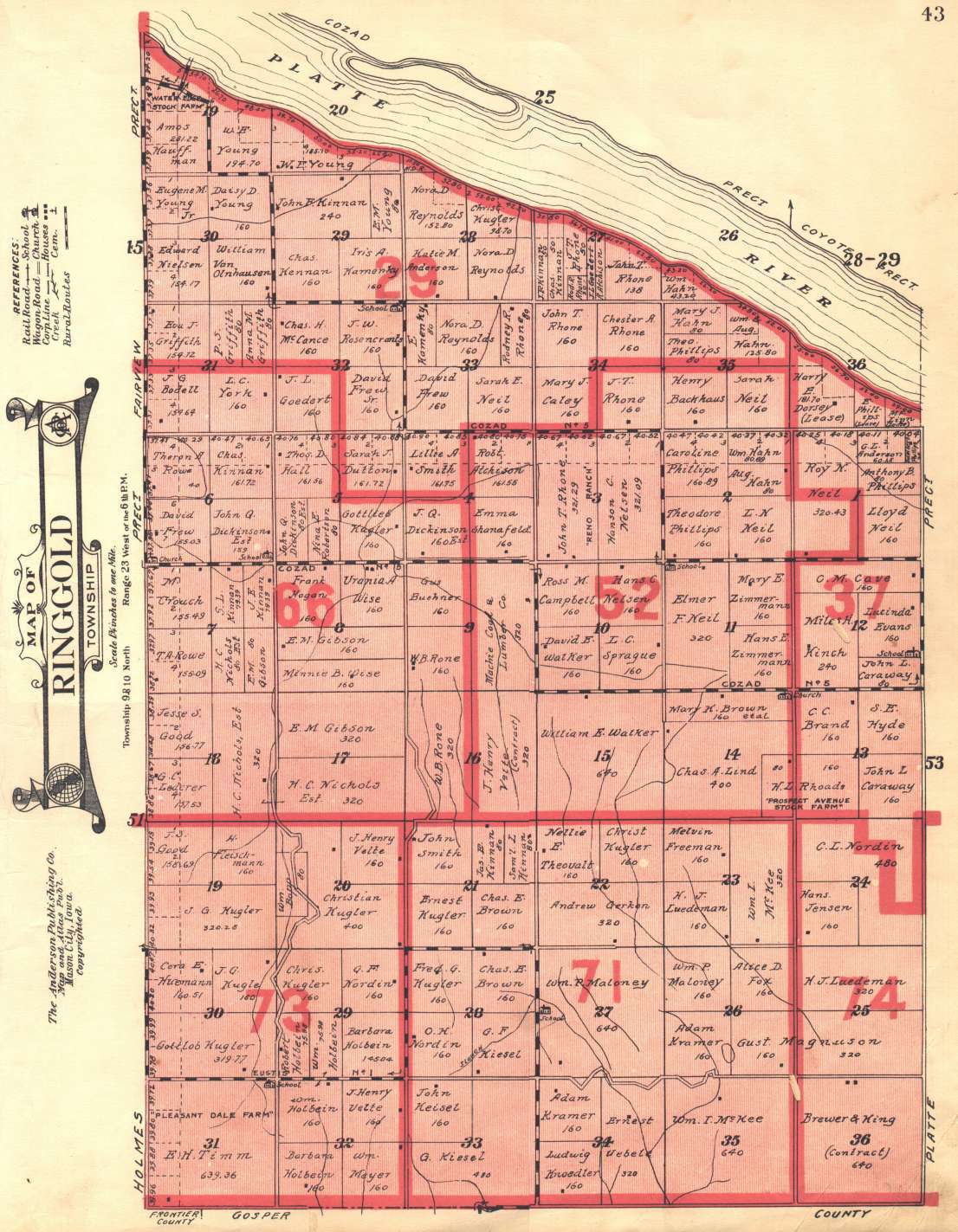
| RINGGOLD | " " | 9-10 | " | 23 W. of 6 P.M. | 43 | 42 |
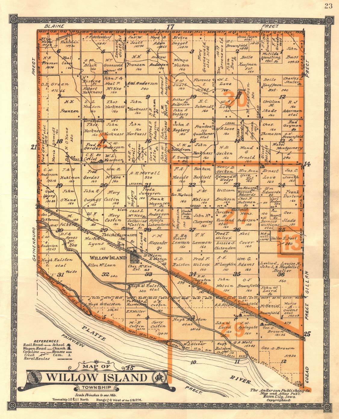
| WILLOW ISLAND | " " | 10-11 | " | 24 W. of 6 P.M. | 23 | 22 |
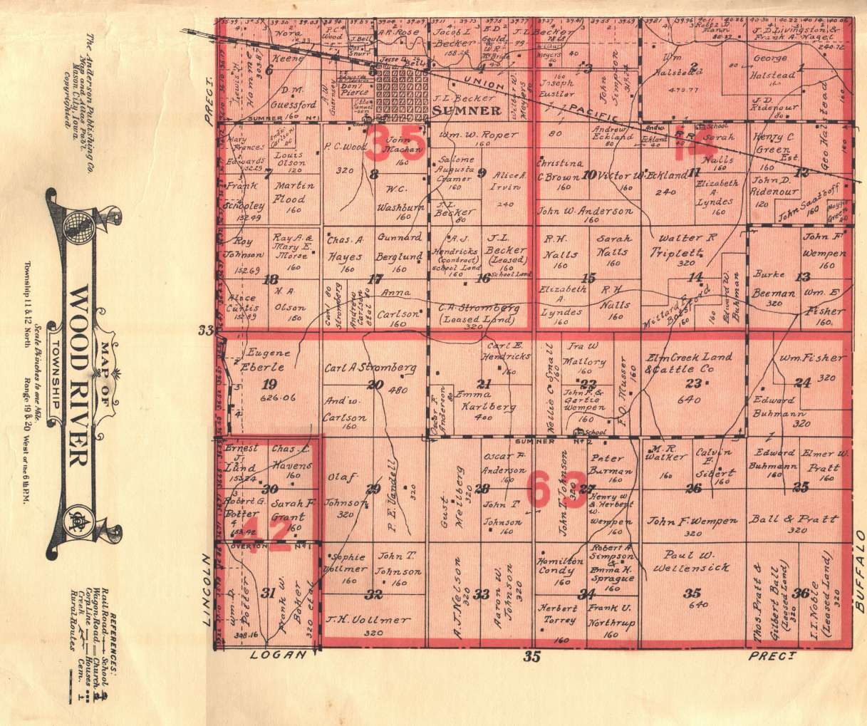
| WOOD RIVER | " " | 11-12 | " | 19-20 W. of 6 P.M. | _6-_7 | _5 |
| STATE MAP OF NEBRASKA | 58-59 | |||||
| GAZETTEER OF TOWNS SHOWING POPULATIONS (Nebraska) | 57 & 60 | |||||
| UNITED STATES MAP (includes Index of Towns and Cities) | 62-63 | |||||
| MAP OF THE WORLD (includes Panama Canal and Portraits) | 66-67 | |||||
| U.S. SURVEY MAP | 70-71 | |||||
 Contact Connie Snyder, Dawson County Coordinator.
| Home | Queries | Resources | History | Search |