Cornelius Shuler
6 A 13 1/2 po.s
/
Frederick
John B. Floyd Esquire, Governor of the Commonwealth of Virginia:
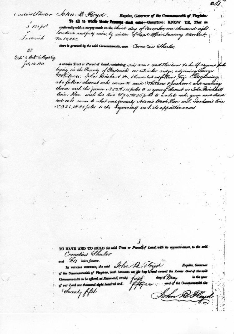
To all whom these Presents shall come -- Greeting: KNOW YE, That in
conformity with a survey made on the third day of November, one thousand
eight
Hundred and forty nine, by virtue of Land Office Treasury
Warrant,
No. 10,855,
there is granted by the said Commonwealth,
unto Cornelius Shuler
Exd.
Delr. to Richd. E. Byrd Esq.
July
14, 1851
a certain Tract or Parcel of Land, containing six acres
and thirteen &a half square
poles lying in the County of Frederick on
Timber ridge, adjoining George
WHITACRE, John RINEHART &c, & bounded
as follows, Viz: Beginning
at a fallen chesnut oak, corner to said
WHITACRE & JACKSONS and running
thence with the former N. 52, E. 115
poles to a young chesnut in John RINEHARTS
line, Then with his line
S. 24. W. 36 poles to a white oak, gum and dead
red oak corner to
what was formerly ADAM'S tract. Then with JACKSON'S line
S. 63 1/2 W.
85 poles to the beginning with its appurtenances.
To HAVE AND TO HOLD
the said Tract or Parcel of Land, with its appurtenances, to the said
Cornelius SHULER
and his heirs forever.
IN WITNESS WHEREOF,
the said John B. FLOYD Esquire, Governor
of the Commonwealth of
Virginia, hath hereunto set his hand, and caused the Lesser Seal of the
said Commonwealth to be affixed, at Richmond, on the first day of May in
the year
of our Lord one thousand eight hundred and fifty one and of
the Commonwealth the
Seventy fifth
John B. Floyd

390 (middle of page)
SHULER, Cornelius
1 May 1851
Cornelius Shuler
A Po. 13 1/2
Frederick Co.
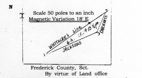
Scale 50
poles to an inch
Magnetic Variation 18'E

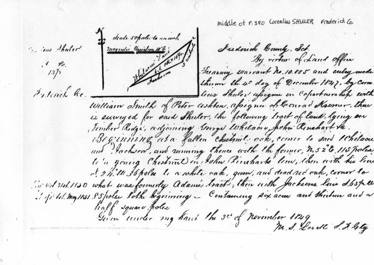
Frederick County, Sct.
By virtue of Land office
Treasury
warrant No. 10.885 and entry made
thereon the 4th day of December
1847, by Corne-
lius SHULER assignee in Copartnership with
William
SMITH of Peter ASHTON, assignee of Conrad KREMER. there
is surveyed
for said SHULER, the following tract of land, lying on
Timber Ridge,
adjoining George WHITACRE, John RINEHART &c.
Beginning at a fallen
chestnut oak, corner to said WHITACRE
and JACKSON, and running thence
with the former, N. 52 o E 115 poles
to a young Chestnut in John
RINEHARTS line, then with his line
S. 24 o W 35 poles to a white oak,
gum, and dead red oak, corner to
what was formerly ADAM's tract, then
with JACKSON's line S. 63 1/2 W.
85 poles to the beginning ~~
Containing six acres and thirteen and a half square poles
Given
under my hand the 3rd of November 1849
M.S. LOVETT S.F. Cty
Rec Oct. 31st 1850
??? 1st May 1851

If you have questions, contributions, or problems with this site, email:
Coordinator - Rebecca Maloney
State Coordinator: Jeff Kemp
Asst. State Coordinators:
If you have questions or problems with this site, email the County Coordinator. Please to not ask for specfic research on your family. I am unable to do your personal research.