|
C L Mile Marker 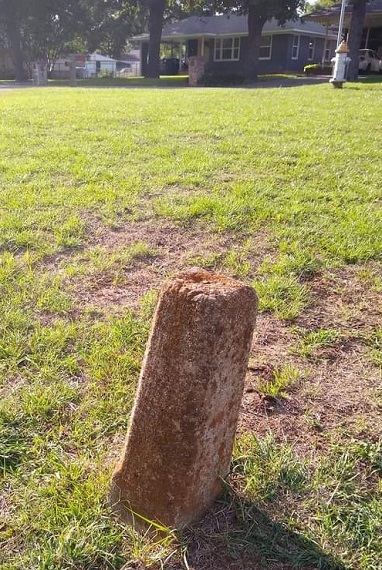
"King of Trails" highway marker 1633 S. Scullin Ave. (at the corner of S. Armstrong) Denison, Texas Located on South Scullin and West Hanna. Frisco Road went from Sherman to Denison. The house in the background is 905 W. Hanna St., the second house from the corner of Hanna St. & Scullin Ave. Editor's Note: "King of Trails" is the English translation of Camino Real. Frisco Road was probably named for the Frisco Railroad, aka St. Louis - San Francisco Railway, parallel to the railroad tracks or because the road ran from Sherman to Frisco, Texas through Collin and Denton counties. Frisco, Texas was originally named "Emerson" but was renamed for the railroad in 1904. The road itself was for foot traffic, wagon traffic, or automobile traffic. 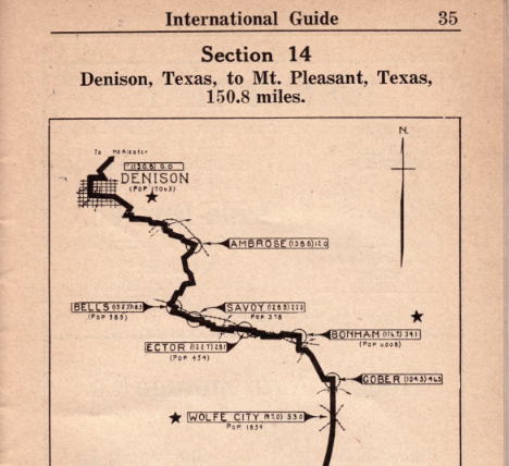
International Guide, 1923 Showing what is probably Hwy. 69 This
route to Sherman would take you down Frisco Road, which if off Texoma
Parkway; then past Sherman to Howe, McKinney, and Dallas.
Apparently in the 1920s the road then was called Ro ute 805,
according to the book. It was not as straight a road as it is
now. The 1920s route took you from Denison to Dallas and vice
versa. It appears that the book is describing the current Hwy. 5.
"King of Trails," "Jefferson Highway," and a few more are all names ffor different stretches of Hwy. 75 which extends northward to Canada. (Official Auto Blue Book, 1920, vol.7) 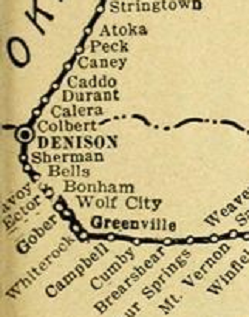
Jefferson Highway 
Mile Markers Trails & Roads Copyright © 2026, TXGenWeb. If you find any of Grayson County TXGenWeb links inoperable, please send me a message. |