|
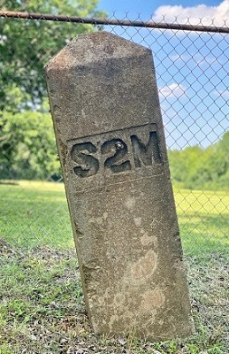
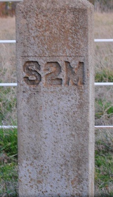
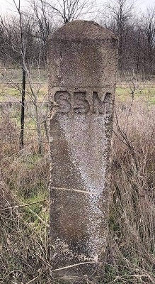
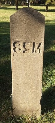
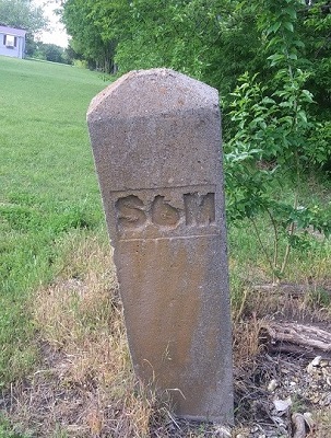
Mile Markers Grayson County, Texas Mile
markers, aka milestones, were concrete pillars placed along a road, railway, canal or boundaries at
intervals of one mile in the early 1900s, to indicate the distance in miles to or from a given point.
The mileage is the distance from a fixed beginning point
- the courthouse in Sherman. In 1924 the State Highway
Department instituted a system where permanent concrete mileposts were
placed on state highways. The mileposts are up to 5' tall and 4" thick or more.
Cars would stop and honk their horns to alert any horses and carriages that were in the area. In the United States the numbers along the highway usually measure the distance to the southern or western state line. Often the exits are numbered according to the nearest milepost.

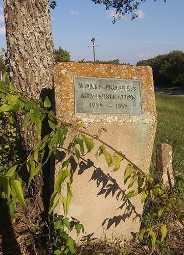
In the 1930s, the Works Progress Administration (WPA) likely paved the road and straightened it. This was part of the New Deal to provide jobs on public projects during the Great Depression. Lying near the WPA marker is what appears to be a survey stone.
"King of Trails highway marker 1633 S. Scullin Ave., Denison, Texas Located on South Scullin & West Hanna. Frisco Road went from Sherman to Denison. Editor's
Note: "King of Trails" is the English translation of Comaino
Real. Frisco Road was probably named for the Frisco Railroad, aka
St. Louis-San Francisco Railway, which was parallel to the railroad tracks or because the road ran from Sherman to Frisco, Texas, passing through Collin & Denison counties. Frisco, Texas was originally name 'Emerson' but was renamed for the railroad in 1904. The road itself was for foot traffic, wagon traffic, or automobile traffic. 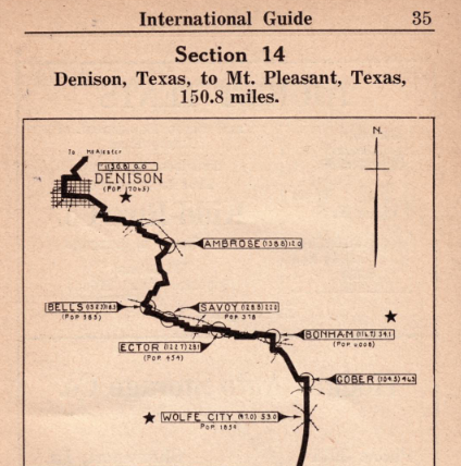
International Guide, 1923 Showing what is probably Hwy. 69 This
route to Sherman would take you down Frisco Road, which if off Texoma
Parkway; then past Sherman to Howe, McKinney, and Dallas.
Apparently in the 1920s the road then was called Route 805,
according to the book. It was not as straight a road as it is
now. The 1920s
route took you from Denison to Dallas and vice versa. It appears that the book is describing the current Hwy. 5. "King of Trails," "Jefferson Highway," and a few more are all names for different stretches of Hwy. 75 which extends northward to Canada. (Official Auto Blue Book, 1920, vol.7) 
Jefferson Highway

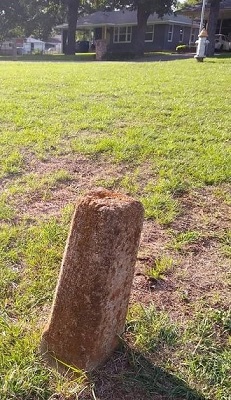
The mile marker at the intersection of King & Crockett Streets in Sherman was destroyed. This 1946 survey stone was put in its place. 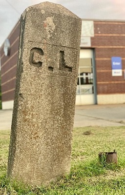
City Limit Mile Marker This mile marker is located at the corner of Houston & Tolbert Streets in Sherman. GPS 33.6328836, -96.6270532  

Trails & Roads Copyright © 2026, TXGenWeb. If you find any of Grayson County, TXGenWeb links inoperable, please send me a message. |