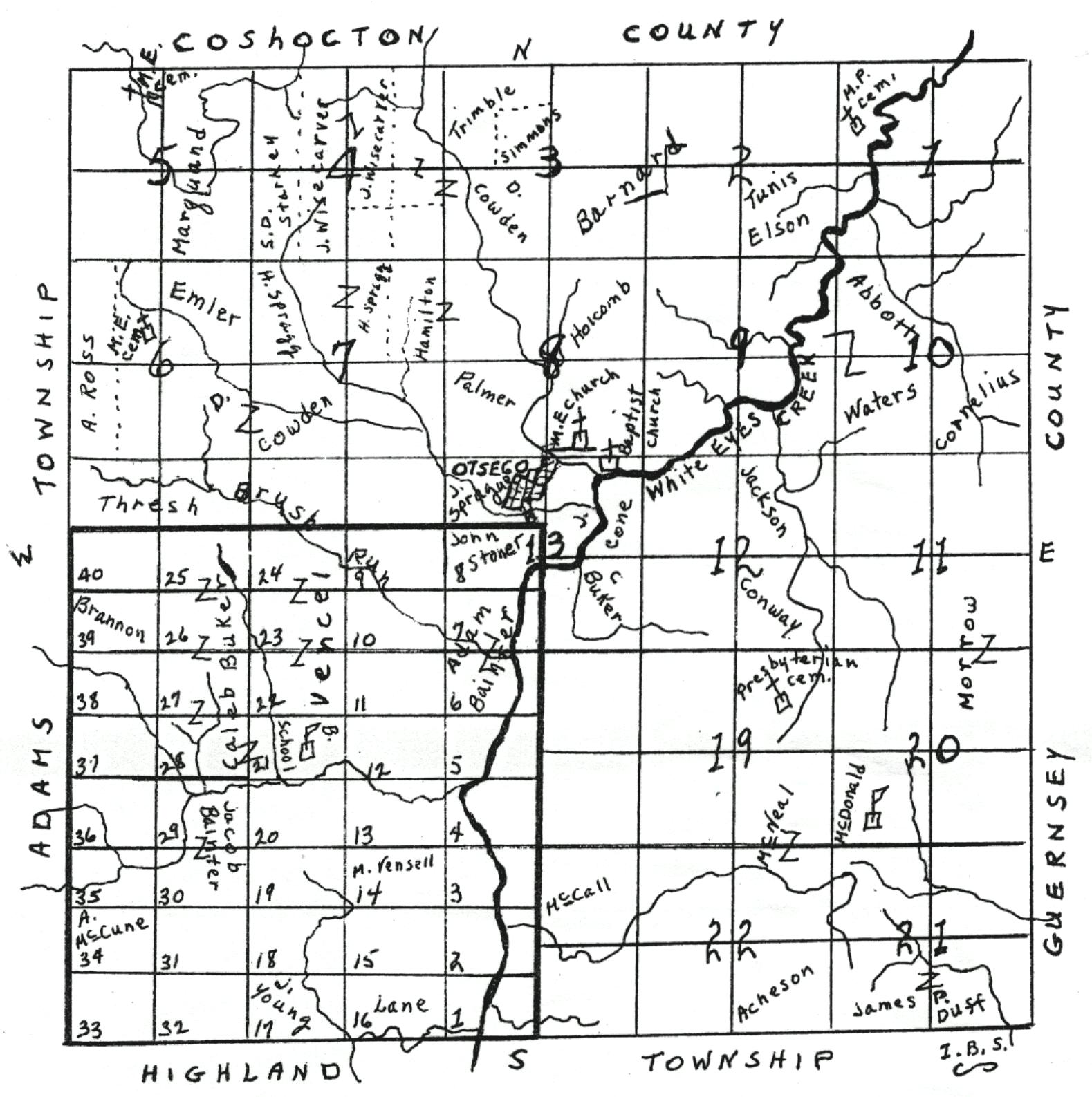
This map shows the early homesteaders in Monroe Township and the location of the 25 sections as the township was originally laid out.
© 1997 - 2006. Denny Shirer