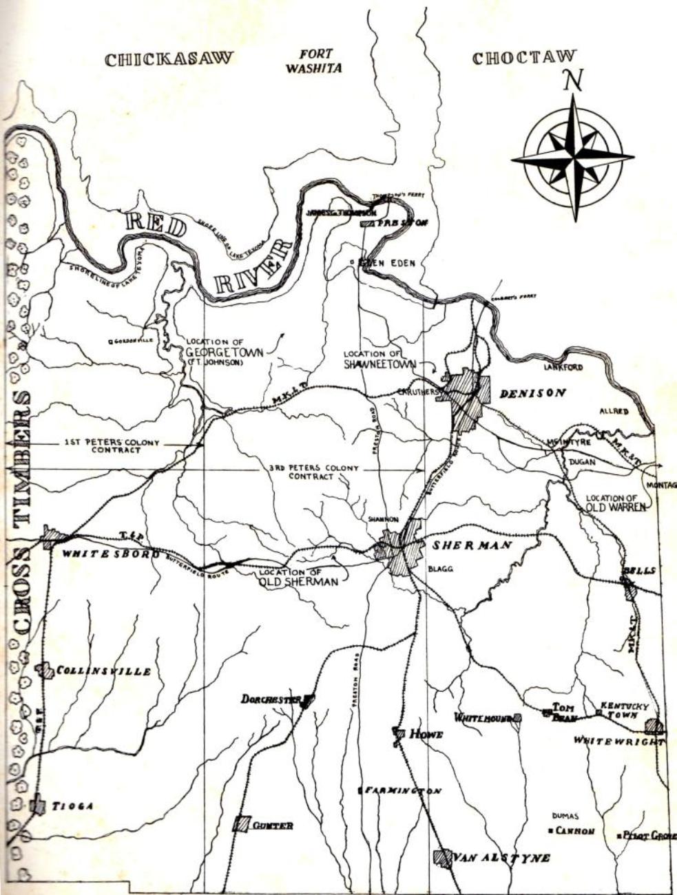
1st Peter's Colony
3rd Peter's Colony
Shawneetown
Glen Eden
Fort Washita
Fort Warren
Denison Daily News
May 27, 1873
Grayson County, situated on the northern line of Texas, on the Red River, adjoining the Chickasaw and Choctaw nations, was organized in 1846. The county covers an area of 960 square miles.
This county, for about 4 miles along the Red River, is heavily timbered, the baland is equally divided between prairie and timber. The soil's black waxy and black sandy, of highest fertility, ranging in depth from 3 to 10 feet.
Timber, such as hickory, white oak, ash, walnut, cottonwood, post oak, bois d'arc, pecan and other varieties is in abundance; wheat oats, corn rye, barley, Irisn and sweet potatoes, cotton, tobacco, sorghum cane, castor beans, broom corn, and all kinds of garden vegetables and fruits do well. Corn, wheat and cotton are the principal crops. Small fruits all produce well, while grapes seem to prosper here better than in any portion of the Union.
contributor unknown
Maps
Copyright © 2024, TXGenWeb.
If you find any of Grayson County, TXGenWeb links inoperable, please send me a message.