|
Magnolia Park Addition Denison, Texas March 28, 1919 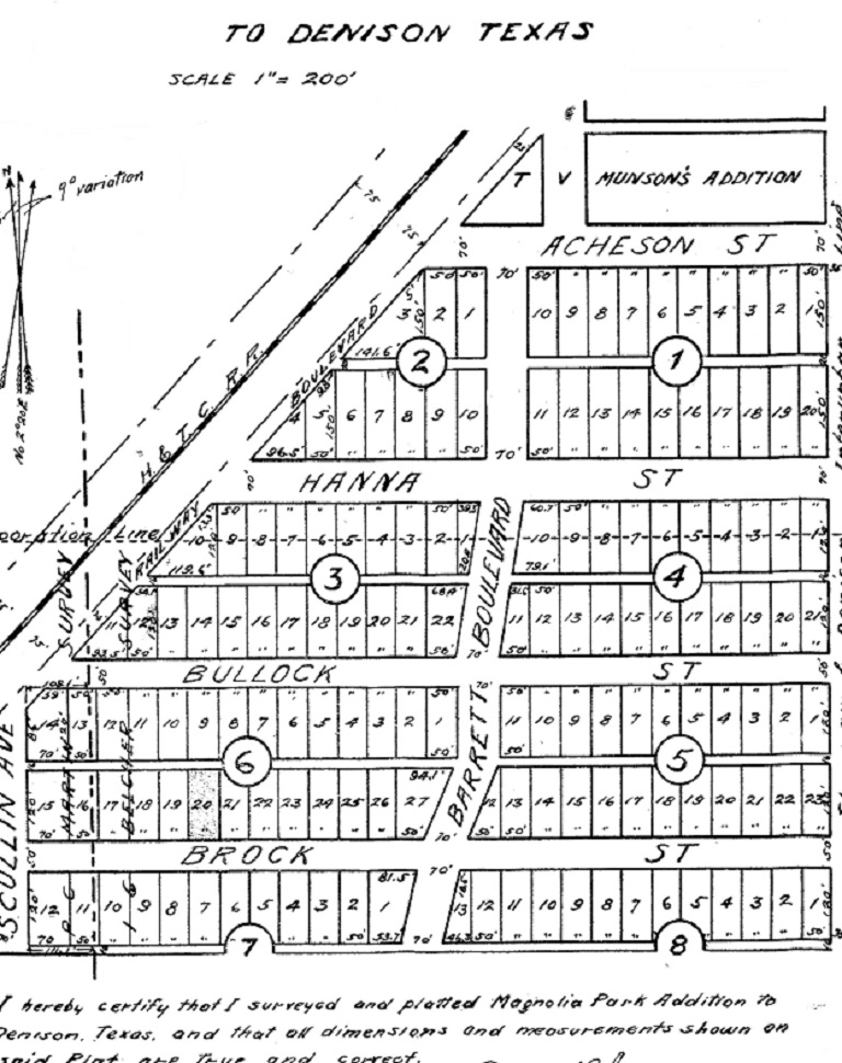
Courtesy of Mark Grams Sherman & Denison Interurban line ran along Mirick Avenue.
The Houston & Texas Central Railroad shown at top left. "Corporation Line" in upper left, between Hanna & Bullock, was the city limits of Denison. 
Plats are created before
the houses exist. They map out where to put houses. This plat is Magnolia,
named after the rows of magnolias planted by T. V. Munson. This plat was
created after Munson's [horticulture business] was abandoned. Fannin was the
through street before this plat. Fannin is one of the oldest roads, going all
the way to the northeast corner of Sherman. Before this map, Mirick dead-ended
at Acheson.
T. V. Munson had from Acheson to Star under cultivation. After T. V. Munson was gone, vineyards were cultivated where Champion Cooler stands now and going south towards Spur 503.The street is called Vine Lane. It is possible that some of the wild vines growing in some of the vacant lots in that area are descendants of the hybrids. - - - Doug Hoover Denison Maps Copyright © 2024, TXGenWeb. If you find any of Grayson County TXGenWeb links inoperable, please send me a message. |