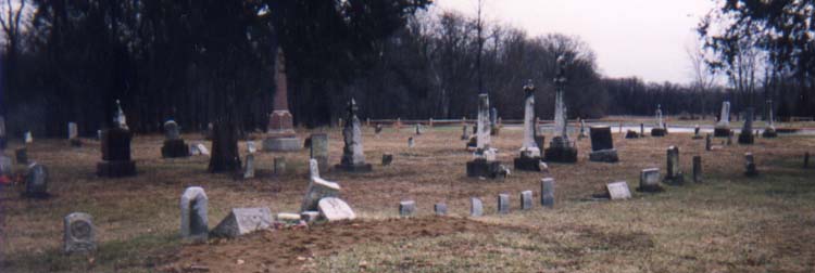
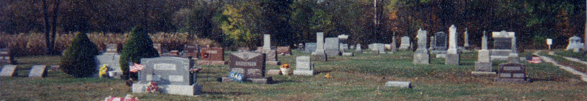
Defiance County Cemeteries
---------------------------------------------------------------------------------
Ayersville (aka Pleasant Bend Cemetery)
In Highland Twp.on the west side of Fruit Ridge Rd (CR178) one mile north of Ayersville.
GPS Coordinates: 41.2518500, -84.2883800
------------------------------------------------------------------------------------------------------------------
Battenburg
Located in Adam Twp on the west side of Adams Ridge Rd (CR176).
It is 3.75 miles north of Jewell.
GPS Coordinates: 41.3840010, -84.2748520
------------------------------------------------------------------------------------------------------------------
Bethlehem Lutheran
In Adams Twp, 2499 Adams-Ridge Road at Youngman Rd
GPS Coordinates: 41.4050120, -84.2608930
------------------------------------------------------------------------------------------------------------------
Bethlehem Lutheran (aka Okolona Cemetery)
Located at 30997 Gerken Rd
GPS Coordinates: 41.3702100, -84.2291200
------------------------------------------------------------------------------------------------------------------
Blair
In Delaware Twp. Back a lane off Roland Rd (CR129), half mile east of US127
and 1 mile south of Sherwood.
------------------------------------------------------------------------------------------------------------------
Blue
Located towards the river on a lane at the end of Jacobs Rd.
The cemetery was read in 1978 and checked again in 1997. Possibly on private property.
------------------------------------------------------------------------------------------------------------------
Brunersburg
In Noble Twp., on the west side of Christy Rd, about 0.2 mile north of SR15.
GPS Coordinates: 41.3078003, -84.3818970

------------------------------------------------------------------------------------------------------------------
Catholic (Historic)
This cemetery was located on the northeast corner of the intersection of River St
and Baltimore St (SR424). The location is now the site of the Defiance
City Municipal Water Works. Most remains were moved to Old Riverside Cemetery.
GPS Coordinates: 41.2780560, -84.3847220
------------------------------------------------------------------------------------------------------------------
Clinker
In Tiffin Twp. on State Route 15, between Shick Rd and Trinity Rd, 7 miles northwest of
Defiance. It is on a hill overlooking Mud Creek, containing about 3 acres, but many of the stones
are broken and no longer standing. It is connected with the Olive Branch Church across
the road from the cemetery.
GPS Coordinates: 41.3419991, -84.4473038
------------------------------------------------------------------------------------------------------------
Colby
In Mark Twp. on the north side of CR.A, west of Openlander Rd (TR124).
GPS Coordinates: 41.2532997, -84.5952988
------------------------------------------------------------------------------------------------------------------
Cromley (aka Auglaize Cemetery)
In Defiance Twp.south side of SR111, south of Singer Rd.,
about 4 miles south of the city of Defiance.
GPS Coordinates: 41.2305984, -84.4197006
------------------------------------------------------------------------------------------------------------------
Defiance Co. Children's Home
In Tiffin Twp., The Defiance County Children's Home was in operation from
Nov. 25, 1884 to Oct. 13, 1914.
GPS Coordinates: 41.3461480, -84.4210910
------------------------------------------------------------------------------------------------------------------
Defiance Co. Home Cemetery
Cemetery of the old Defiance County Home, Evansport, Defiance County, which no longer exists.
There is a stone and dirt lane that leads back to it.
GPS Coordinates: 41.3403810, -84.4216870
------------------------------------------------------------------------------------------------------------------
Doll
In Washington Twp. on the west side of Mulligan's Bluff Rd.(TR138), about a quarter mile south
of Bostater Rd (TR90).
GPS Coordinates: 41.3809319, -84.4963684
------------------------------------------------------------------------------------------------------------------
Domersville (aka Chase)
On the West side of Domersville Rd (CR175) just South of Coressel Rd.(CR83)
GPS Coordinates: 41.3821983, -84.3244019
------------------------------------------------------------------------------------------------------------------
Doud
At the corner of The Bend Rd and Bostater Rd. Re-dedicated by Defiance County in 2000.
GPS Coordinates: 41.3811680, -84.5161110
------------------------------------------------------------------------------------------------------------------
Edson's Graveyard
Location could not be found.
GPS coordinates not available.
------------------------------------------------------------------------------------------------------------------
New Evansport
In Tiffin Twp. One mile south of Evansport on the west side of Evansport Rd (CR150),
north of Rethmel Rd. GPS Coordinates: 41.4075012, -84.3964005
------------------------------------------------------------------------------------------------------------------
*Old Evansport Cemetery
In Tiffin Twp. On the east side of Evansport Rd., (CR150), north of Rethmel Rd.GPS Coordinates: 41.4075012, -84.3964005
------------------------------------------------------------------------------------------------------------------
Farmer
In Farmer Twp. On the west side of Cemetery Rd (TR102), about a half mile north of SR2.
GPS Coordinates: 41.3903008, -84.6410980
------------------------------------------------------------------------------------------------------------------
Forest Home (aka Hicksville Union)
In Hicksville Twp. On SR18 just north of Hicksville.
The old section is on the south side of the road, and the new section on the north side.
GPS Coordinates: 41.3022003, -84.7750015
------------------------------------------------------------------------------------------------------------------
Fort Defiance Burial Ground
Located in the Old Fort Defiance Park at the junction of Fort St. and Washington Ave.
GPS Coordinates: 41.2875340, -84.3575200
------------------------------------------------------------------------------------------------------------------
Foster
On south side of Carter Rd. 1/4 mile west of SR66.
GPS Coordinates: 41.2533730, -84.3629700
------------------------------------------------------------------------------------------------------------------
Frazee
In the city of Defiance, South off SR66 West of Ginter Rd. on Chippewa Dr.
This hollowed ground is surrounded by a little fence.
There is one monument with the names of all buried there listed.
GPS Coordinates: 41.2646690, -84.3752090
------------------------------------------------------------------------------------------------------------------
Funk (aka Mock Cemetery)
In Washington Twp. On the west side of The Bend Rd (TR134), about 2.75 miles south of
Ney at Bradshaw Rd (TR64).
GPS Coordinates: 41.3396988, -84.5164032
------------------------------------------------------------------------------------------------------------------
Glore
In Delaware Twp., North of CR424, near the intersection with Gier Rd.(CR132)
GPS Coordinates: 41.2639008, -84.5342026
------------------------------------------------------------------------------------------------------------------
Hale-Wellman
In Highland Twp Section 17, in a field west of Fullmer Rd, south of Bowman Rd one-third mile.
No longer in use.
GPS Coordinates: 41.2200090, -84.3154720
------------------------------------------------------------------------------------------------------------------
Hicksville Amish
South of Huber Rd., on Hicksville-Edgerton Rd., east side of the road.
GPS Coordinates: 41.3363920, -84.7655710
------------------------------------------------------------------------------------------------------------------
Hicksville Christian
3672 Buckskin Road (CR58), Hicksville, Defiance County, Ohio, 43526
GPS Coordinates: 41.3231700, -84.7543660
------------------------------------------------------------------------------------------------------------------
Hicksville Cemetery
It was located on E. High St near the CSX RR tracks. The last burial occured in 1870 and
some graves were moved to Forest Home Cemetery.
GPS Coordinates: 41.2963360, -84.7579760
------------------------------------------------------------------------------------------------------------------
Hill
In Richland Twp. West side of Kepler Rd., 0.2 miles South of SR281 East of Defiance
GPS Coordinates: 41.2242012, -84.2743988
------------------------------------------------------------------------------------------------------------------
Hire
On the east side of Weichman Rd., north of E. 2nd St. east of Defiance, OH
GPS Coordinates: 41.2797012, -84.2956009
------------------------------------------------------------------------------------------------------------------
Hoeltzel-Moon (aka Hoetzel Cemetery)
In Highland Twp., near the corner of Porter and Deshler Roads, southeast of Defiance and
Southwest of Ayersville. The home and landowner here mows and takes care of the cemetery.
He welcomes people that come to visit the cemetery.
GPS Coordinates: 41.2017000, -84.3213700
------------------------------------------------------------------------------------------------------------------
Hohenberger
In Richland Twp.On the west side of Harris Rd., 0.2 miles North of Standley Rd.
GPS Coordinates: 41.2728004, -84.2705994
------------------------------------------------------------------------------------------------------------------
Huse
On the east side of Weichman Rd., north of E. 2nd St. east of Defiance, OH
GPS Coordinates: 41.2851982, -84.2464981
------------------------------------------------------------------------------------------------------------------
Independence
In Richland Twp. At the NE corner of junction SR424 and Adam Ridge Rd (CR176)
GPS Coordinates: 41.2980995, -84.3019028
------------------------------------------------------------------------------------------------------------------
John Miller Sanford Family Cemetery
This is an old, historic, family cemetery located on private property
approximately 4 miles south of Defiance, OH on State Rt 15, on the bank of
North Powell Creek west of Porter Road (TR170). The last burial in this cemetery was
in the late 1880's. This cemetery is not open to the public.
GPS Coordinates: 41.1972170, -84.3300540
------------------------------------------------------------------------------------------------------------------
Kahlo / Kahol
In Defiance Twp., On East bank of Auglaize River, West side of Summit St., South of
Hopkins St., about 200ft north of its intersection with Crowe St.
GPS Coordinates: 41.2789001, -84.3563995
------------------------------------------------------------------------------------------------------------------
Kent / Kemp
In Farmer Twp. Back a lane off Seevers Road (TR75), about half mile west of SR 2.
GPS Coordinates: 41.3703003, -84.6802979
------------------------------------------------------------------------------------------------------------------
Kibble
In Tiffin Twp. On the east side of Trinity Rd (CR147), about a quarter mile north of Blosser Rd.
GPS Coordinates: 41.3586769, -84.4374390
------------------------------------------------------------------------------------------------------------------
Liggett Scouts Burial Ground
War of 1812 burial site. The Bend, Defiance County, OH
GPS Coordinates: 41.2761100, -84.5154500
------------------------------------------------------------------------------------------------------------------
Lintz
In Washington Twp., On the south side of Vollmer Rd (TR77), about a half mile south of Ney.
GPS Coordinates: 41.3760986, -84.5402985
------------------------------------------------------------------------------------------------------------------
Lost Creek
In Farmer Twp. At the corner of SR2 and Blosser Rd southwest of Farmer.
GPS Coordinates: 41.3553000, -84.6700000
------------------------------------------------------------------------------------------------------------------
Upper Lost Creek (aka Old Presbyterian)
Located In Farmer Twp on SR249 on the north side of the road, 0.4 miles northwest
of Hicksville and 2 miles west of Farmer near Rosedale Rd
GPS Coordinates: 41.3840000, -84.6700000
------------------------------------------------------------------------------------------------------------------
Mansfield
In Highland Twp. On the east side of Schubert Rd (CR196), about 0.3 mile south of SR15.
GPS Coordinates: 41.1833000, -84.3238983
------------------------------------------------------------------------------------------------------------------
Marysdale Catholic
In Tiffin Twp. On Glenburg Rd (TR143) just south of SR15.
GPS Coordinates: 41.3499985, -84.4580994
------------------------------------------------------------------------------------------------------------------
McCauley
In Tiffin Twp. On the west side of Evansport Rd (CR150), about four miles south of Evansport at Kammeyer Rd.
GPS Coordinates: 41.3697014, -84.4203033
------------------------------------------------------------------------------------------------------------------
Metz-Tittle
In Adams Twp. On the east side of Independence Rd. North of Behrens Rd.
GPS Coordinates: 41.3669014, -84.2857971
------------------------------------------------------------------------------------------------------------------
Moats
In Delaware Twp. North side of Mud Creek Rd. about a quarter mile west of The Bend Rd.
GPS Coordinates: 41.3330420, -84.5194530
------------------------------------------------------------------------------------------------------------------
Myers
In Highland Twp. On the east side of SR 14, 4 about a half miles south of Defiance.
GPS Coordinates: 41.2168999, -84.3352966
------------------------------------------------------------------------------------------------------------------
New Saint John's Methodist
Located in Mark Township on the west side of Openlander Road (TR124),
one mile north of SR 18.GPS Coordinates: 41.3092003, -84.5931015
------------------------------------------------------------------------------------------------------------------
*Old Saint John's Methodist
In Tiffin Twp. On the north side of Gruber Rd., East of Stever Rd.
GPS Coordinates: 41.3878700, -84.3943100
------------------------------------------------------------------------------------------------------------------
Ney
Take SR15 North to Doud Rd from Ney, then turn east on Doud Rd.
The cemetery is about 200 feet from the intersection on the left.
GPS Coordinates: 41.3856010, -84.5271988
------------------------------------------------------------------------------------------------------------------
Noble and Tiffin
In Noble Twp. On the bank of the Tiffin River, end of Kencig Rd., 0.1 mile west of Stever Rd.
GPS Coordinates: 41.3280983, -84.4044037
------------------------------------------------------------------------------------------------------------------
Peter
On the north side of Jewell Rd between the Henry-Defiance County Line and Hammond Rd.
GPS Coordinates: 41.3291626, -84.2569809
------------------------------------------------------------------------------------------------------------------
Pioneer
In Historic Auglaize Village. Under an old, very large oak tree. The cemetery plot has
white corner posts and chains around it and is completely engulfed in ground cover.
All but one marker (Robin Corpes) is pretty much illegible.
GPS Coordinates: 41.2641200, -84.4404200
------------------------------------------------------------------------------------------------------------------
Poplar Ridge
In Adams Twp. On the east side of Adams Ridge Rd, north of Banner School Rd.
GPS Coordinates: 41.3596992, -84.2947006
------------------------------------------------------------------------------------------------------------------
Presbyterian (Historic)
In Defiance Twp., east side of Washington St, west back of the Auglaize River.
The location is now a parking lot of the First Presbyterian Church.
Some remains were moved to Old Riverside Cemetery about 1847.
GPS Coordinates: 41.2829850, -84.3591420
------------------------------------------------------------------------------------------------------------------
Riverside (aka Auglaize)
Located in Defiance Twp on the southeast side of S. Clinton St, 1.1 mile southwest of
CR424 in Defiance. GPS Coordinates: 41.2714005, -84.3786011
------------------------------------------------------------------------------------------------------------------
Riverview Memory Gardens
29231 CR424 at Overly Rd.
GPS Coordinates: 41.2938995, -84.2583008
------------------------------------------------------------------------------------------------------------------
Rohn
Back a lane from CR424 between Young and Overly Rds.
GPS Coordinates: 41.2963982, -84.2643967
------------------------------------------------------------------------------------------------------------------
Saint Marks Lutheran
25950 Nagel Rd, Defiance, OH. East of Defiance, on the north side of the Maumee River.
GPS Coordinates: 41.4129240, -84.3257920
------------------------------------------------------------------------------------------------------------------
Saint Michaels Catholic
Cemetery located behind St. Michaels Catholic Church, at the corner of Moser & Behrens Rds.
There is a map and alphabetized listing of families in a large brick sign at
the side of the cemetery by the church & parking lot.
GPS Coordinates: 41.3631060, -84.3060610
------------------------------------------------------------------------------------------------------------------
Saint Stephens Lutheran (New Bavaria)
Located in Highland Twp, on the west side of New Bavaria Rd (CR23) south of
Schatz Rd (CRF). It is 2.5 miles east of Ayersville.
------------------------------------------------------------------------------------------------------------------
Saint Stephens Old
Located in Highland Twp on the north side of Steinmaiser road (CR22),
2 miles northeast of Ayersville.
GPS Coordinates: 41.2458687, -84.2483139
------------------------------------------------------------------------------------------------------------------
Sherwood
In Delaware Twp. on the east side of 127 in Sherwood.
GPS Coordinates: 41.2900009, -84.5507965
------------------------------------------------------------------------------------------------------------------
Six Corners
In Hicksville Twp. On the the south side of SR2, 3 miles northeast of Hicksville.
GPS Coordinates: 41.3213997, -84.7153015
------------------------------------------------------------------------------------------------------------------
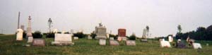
Spindler
In Mark Twp. On the the west side of Breininger Rd., about 0.3 miles south of Jericho Rd.
GPS Coordinates: 41.2625008, -84.6697006

Spindler Cemetery Photo submitted by Carol Schuster, May 6, 2002
------------------------------------------------------------------------------------------------------------------
Stykeman-Minsel Cemetery
Located in Independence, section 16 on SR424 East.
Large areas had no stones leaving a person to think that many were missing.
A number of canal workers are supposed to be buried here, dying from small pox.
Source: Defiance County Cemetery Records. This may account for no monuments.
GPS Coordinates: 41.2308006, -84.3630981
------------------------------------------------------------------------------------------------------------------
*Tamarack (aka Hard Corners))
In Milford Twp. on the south side of Scott Rd (CR100), 300 feet east of
Cicero Rd (CR115). SE of Edgerton and W of Williams Center.
GPS Coordinates: 41.4117012, -84.7089005
------------------------------------------------------------------------------------------------------------------
Taylor
In Defiance Twp. on the west side of SR66 between Watson Rd and Bowman Rd (TR12).
4 miles south of Defiance.
GPS Coordinates: 41.2308006, -84.3630981
------------------------------------------------------------------------------------------------------------------
*Trinity (aka Emanuel Lutheran)
On the west side of St. Rt. 15, just north of Beerbower Rd.; 1.5 miles North of Ney.
The cemetery is associated with Trinity Evangelical Lutheran Church in Bryan, Williams Co., OH
GPS Coordinates: 41.4016991, -84.5353012
------------------------------------------------------------------------------------------------------------------
Tuttle (aka Shoemaker, Riek, Reek)
The cemetery is located on the north side of CR424 about 0.5 miles east of its intersection
with Krouse Road (CR146). The cemetery is 2 acres in size.
GPS Coordinates: 41.2756004, -84.4475021
------------------------------------------------------------------------------------------------------------------
Worthington (aka: Worthington Colored Cemetery, The Old Negro Cemetery)
The first 'Colored' cemetery in northwest 'Ohio Country', and the only
colored cemetery in Defiance County Ohio. Worthington Cemetery was founded by and named
after Archibald Worthington, a pioneer, man of color who - even before the Civil War - owned
a section of land in Highland Township. The Cemetery was built by him, on his land, for 'his' people;
no one but colored persons were ever buried there. Most interments were purportedly slaves who'd
been freed before the War. Interments began ~1855, before the Civil War, and continued until the 1890's,
after the death of Worthington. Most of the white slab markers are buried in the ground and farmed over.
Only a dozen or so remain above ground of the 50 or more original graves. The land is currently owned
by Ayeresville Water & Sewer. 1/4-mile east of State Route 15 on a mud road, 2 miles south of
the city limits of Defiance, Ohio; in Section 7 of Highland Twp; 40 rods back off the mud
road to the north, almost in the center of a wheat field. GPS Coordinates: 41.2271860, -84.3318520
------------------------------------------------------------------------------------------------------------------
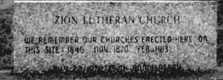
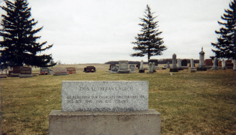
*Zion Lutheran
On the east side of Cicero Rd., and Williams-Defiance County Line Rd.
GPS Coordinates: 41.4261017, -84.7099991
------------------------------------------------------------------------------------------------------------------
The following additions were submitted by
Richard E. Sewell, April 18, 2001
Clinker Cemetery on SR #15 near Schick Rd and Fish & Game Office in Noble Twp.
Brunersburg Cemetery off of Christy Rd in Tiffin Twp (I think), Defiance Co, OH
Also the Webb Cemetery off Stever Rd or #153. Possibly in Tiffin Twp.