
Maps
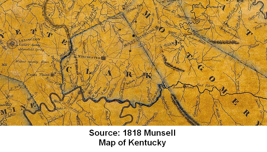
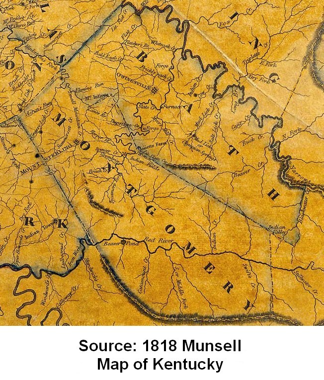
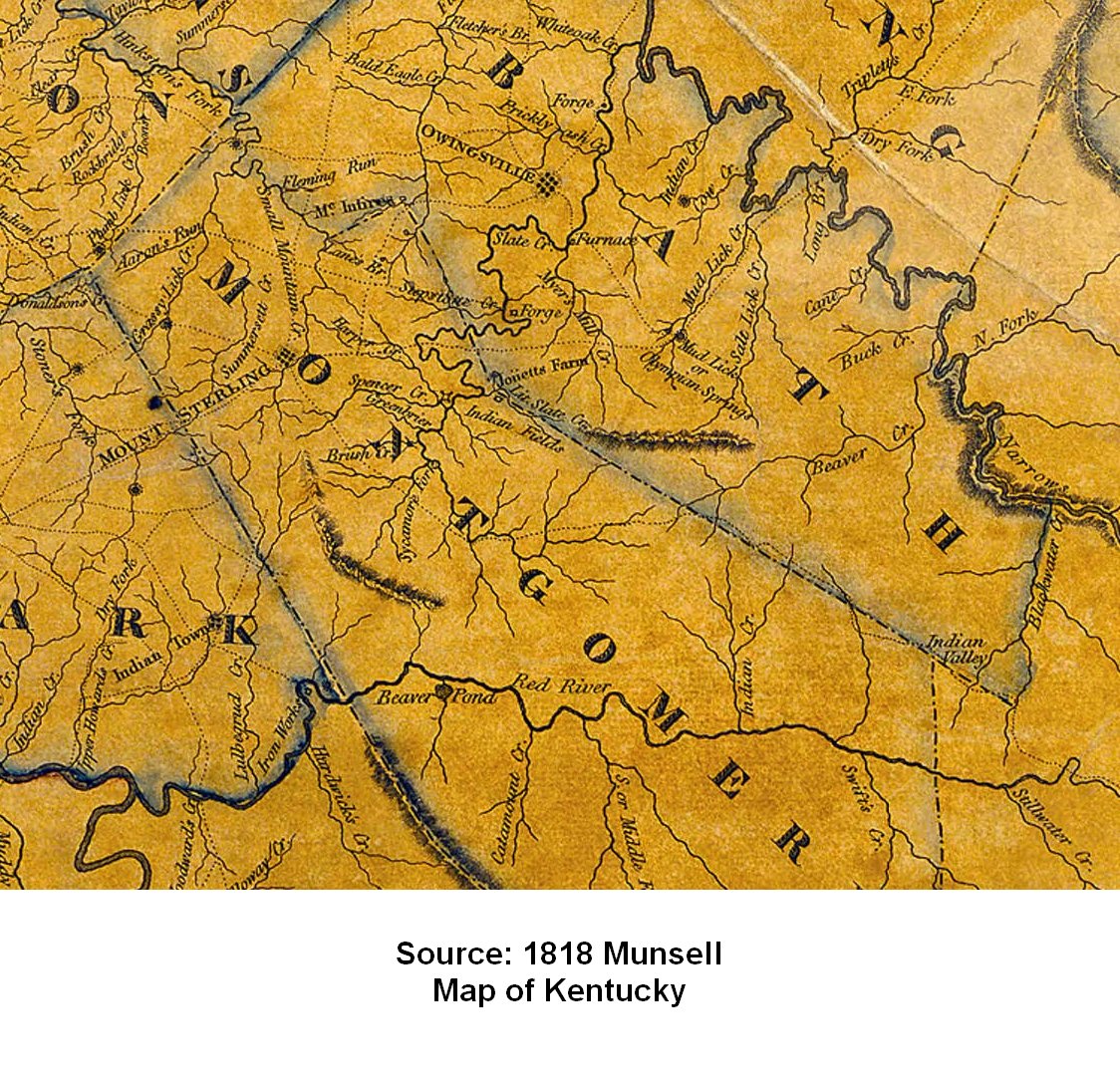
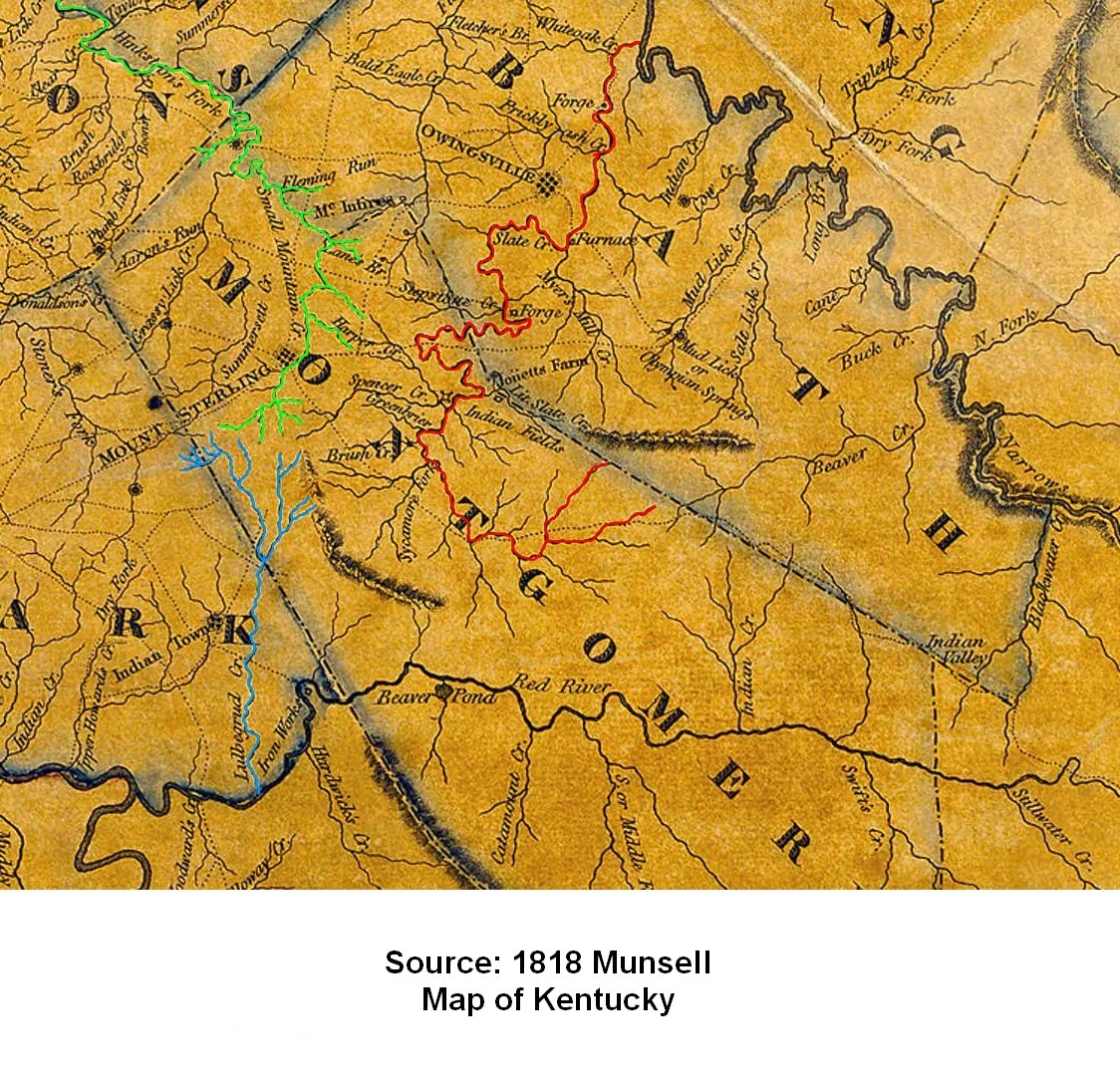
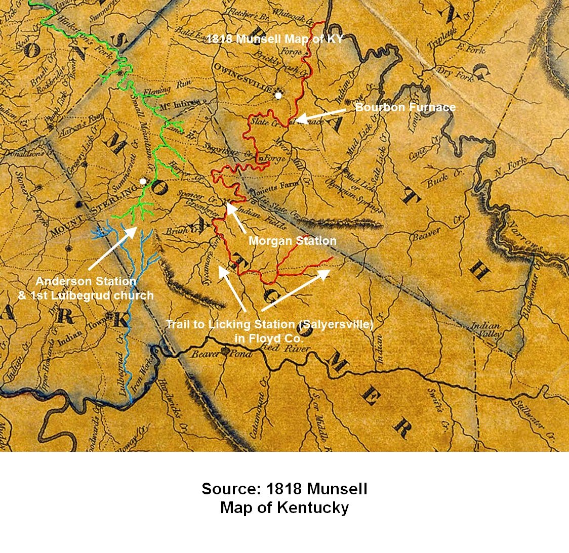
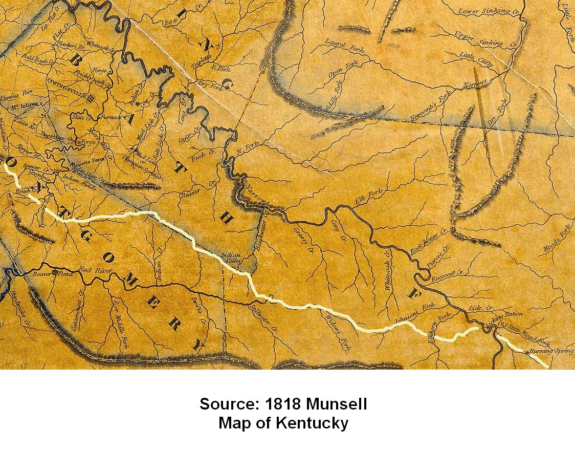
1818This high resolution map of Kentucky published by cartographer Dr. Luke Munsell in 1818 shows creeks, state roads and other features.
- Fayette-Clark-Montgomery section
- Montgomery-Bath section
- Montgomery-Bath section closeup
- List of places in Montgomery-Bath section
- Montgomery-Bath section with Hinkston, Slate and Lulbegrud creeks highlighted
- Montgomery-Bath section with some features identified
- Old State Road between Mt. Sterling and Licking Station (Salyersville) highlighted
Source: Kentucky Historical Society at this location.
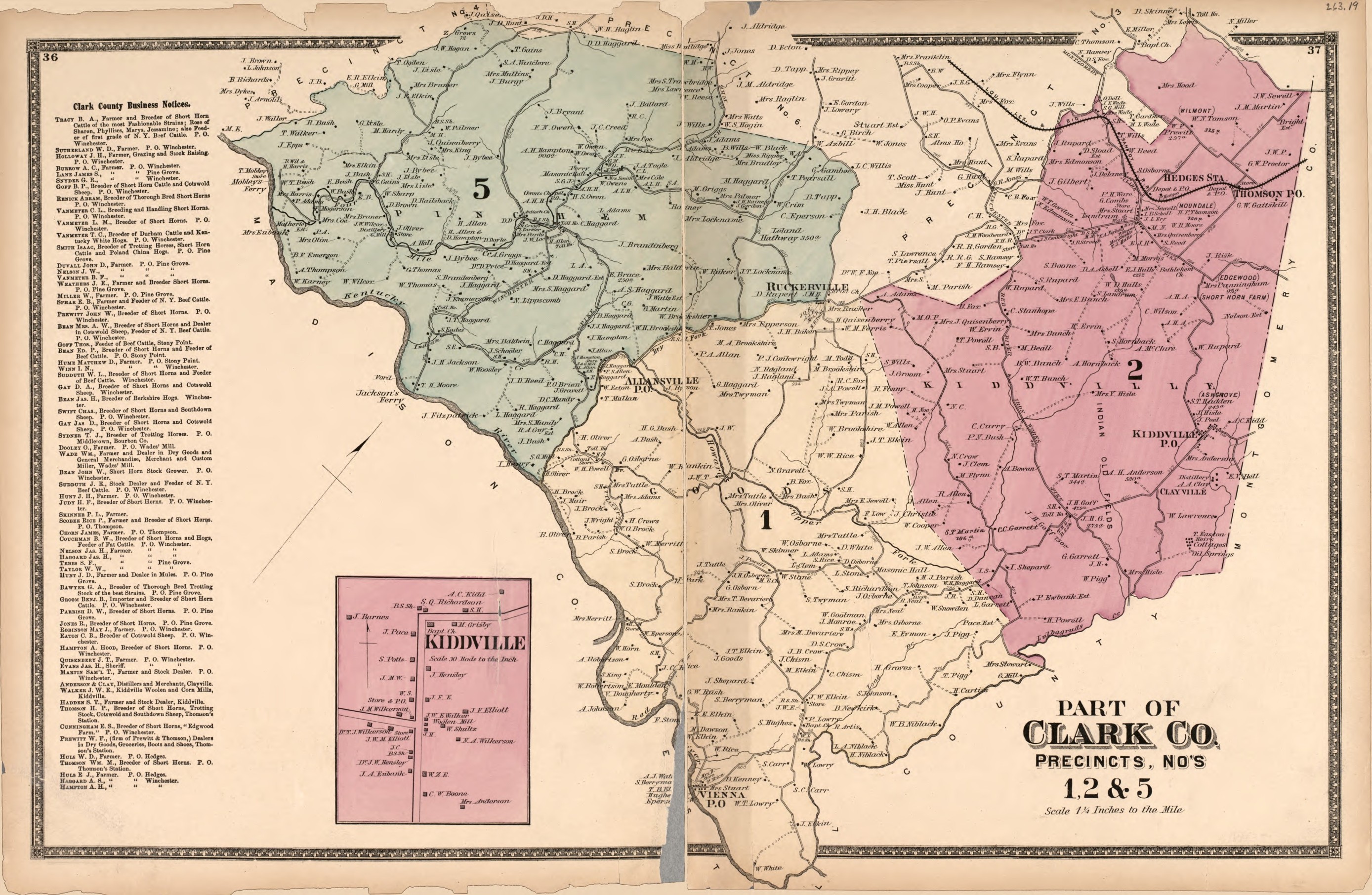
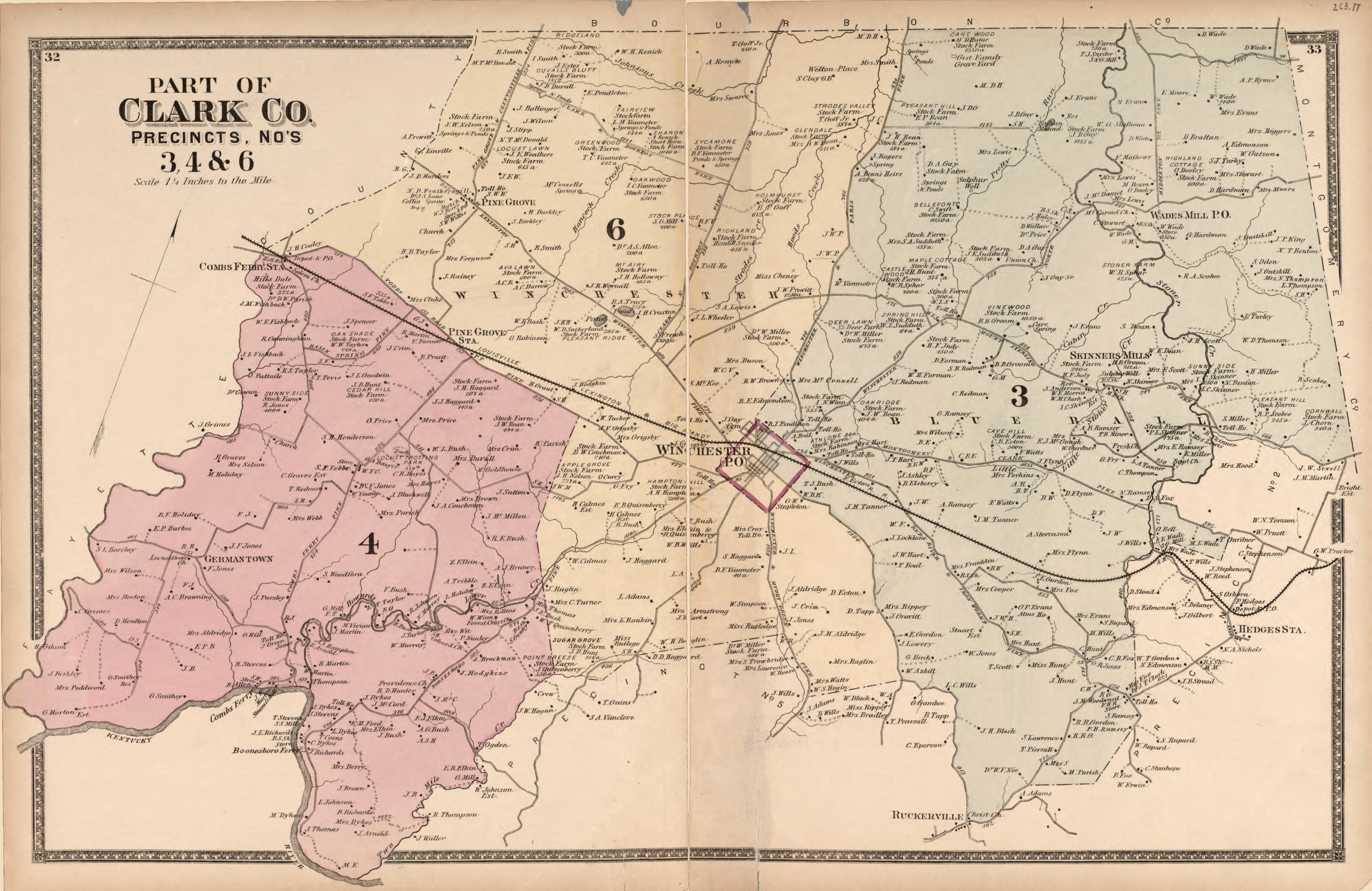
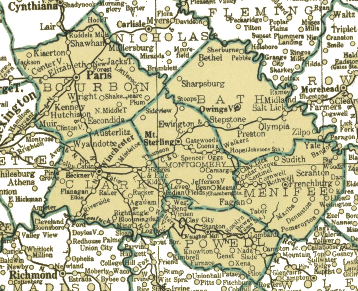
1877
Some researchers may be interested in this 1877 map of Clark County showing land owners, since Montgomery was formed from Clark.
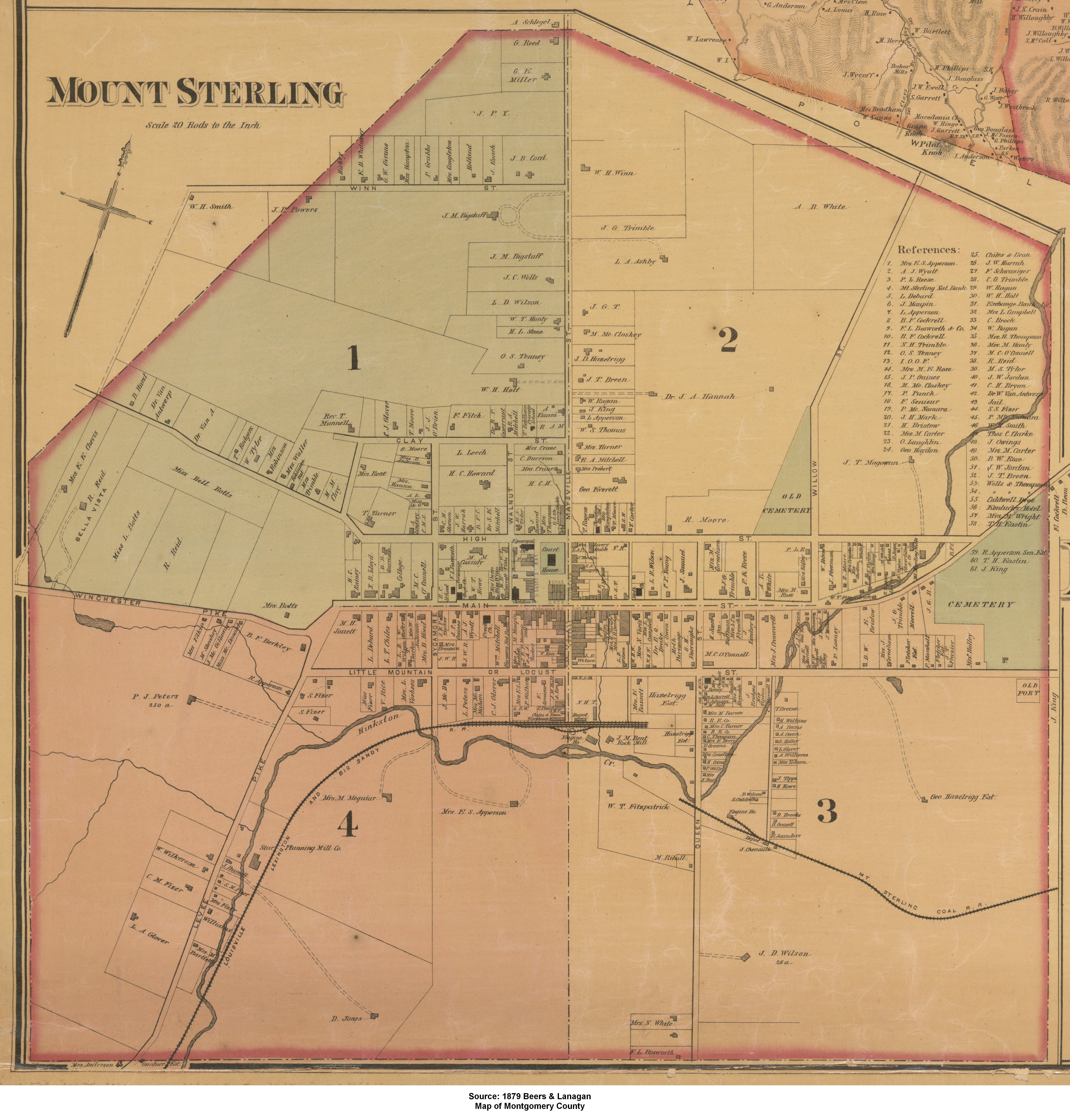
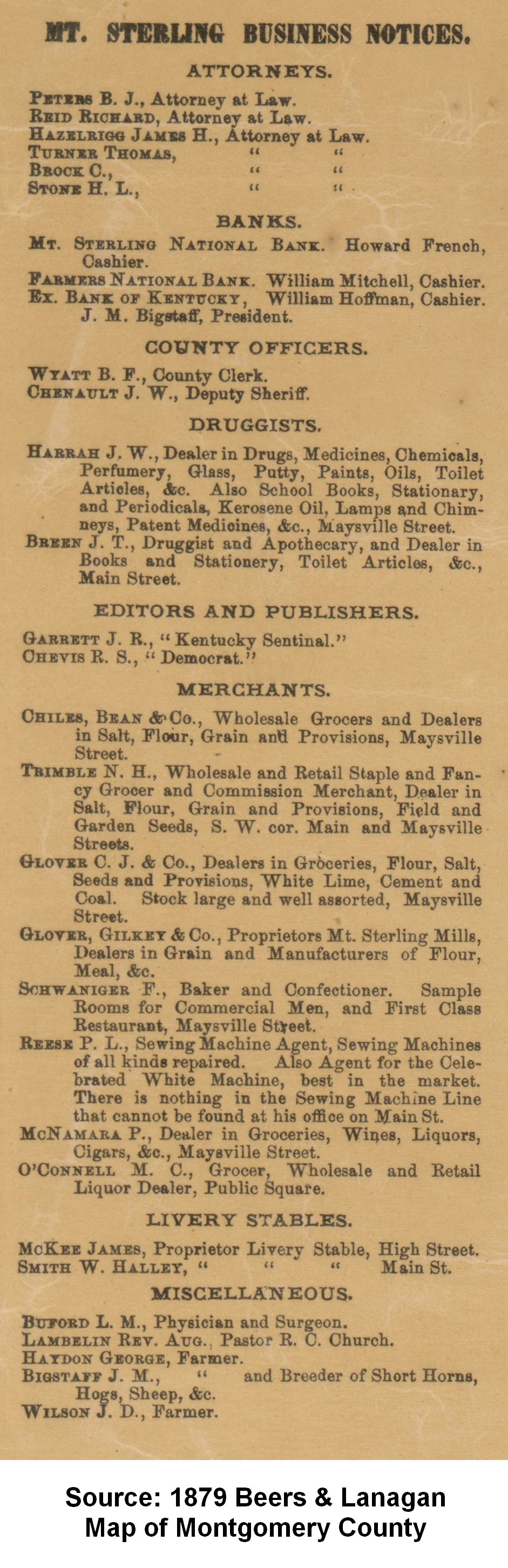
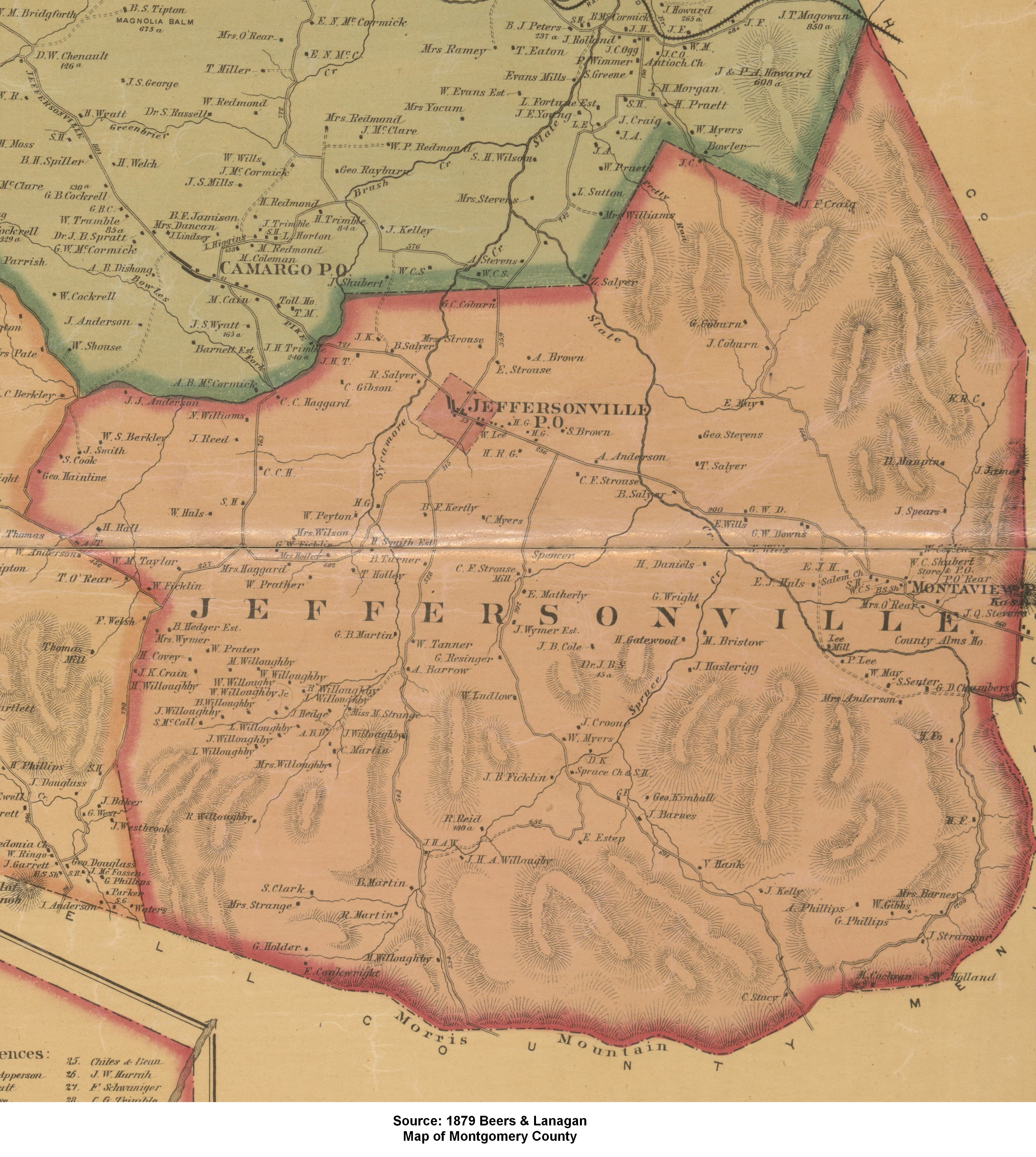
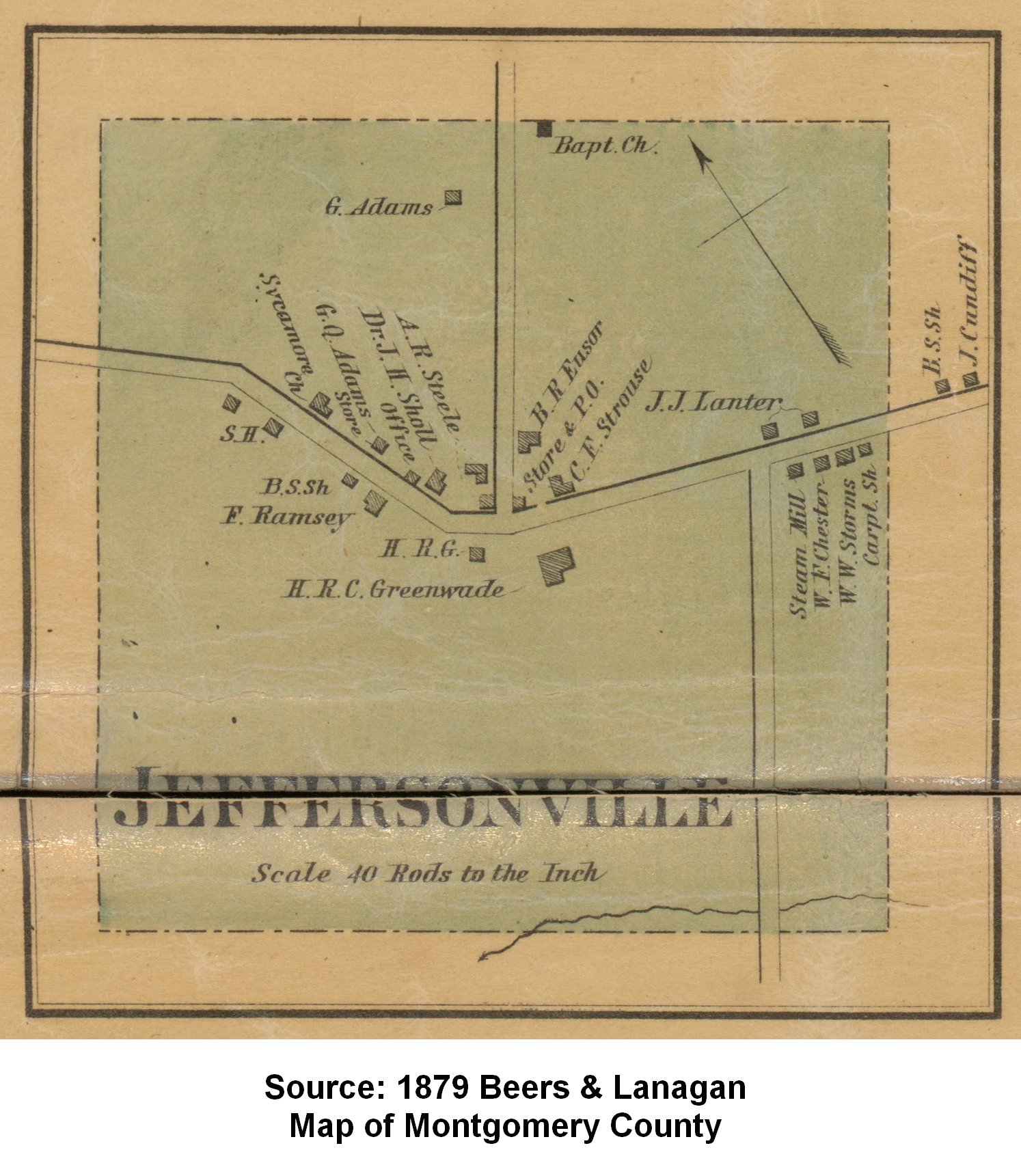
1879
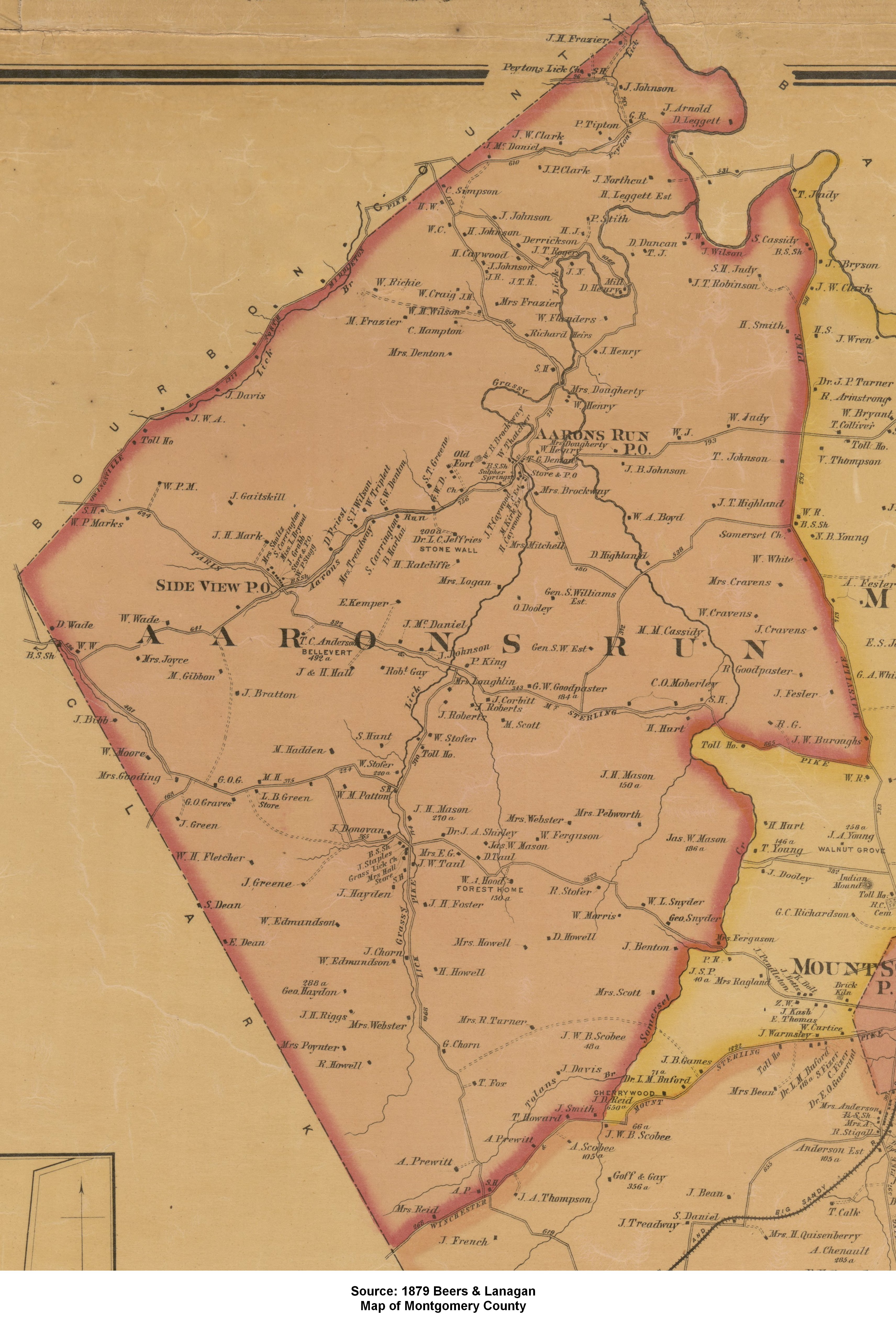
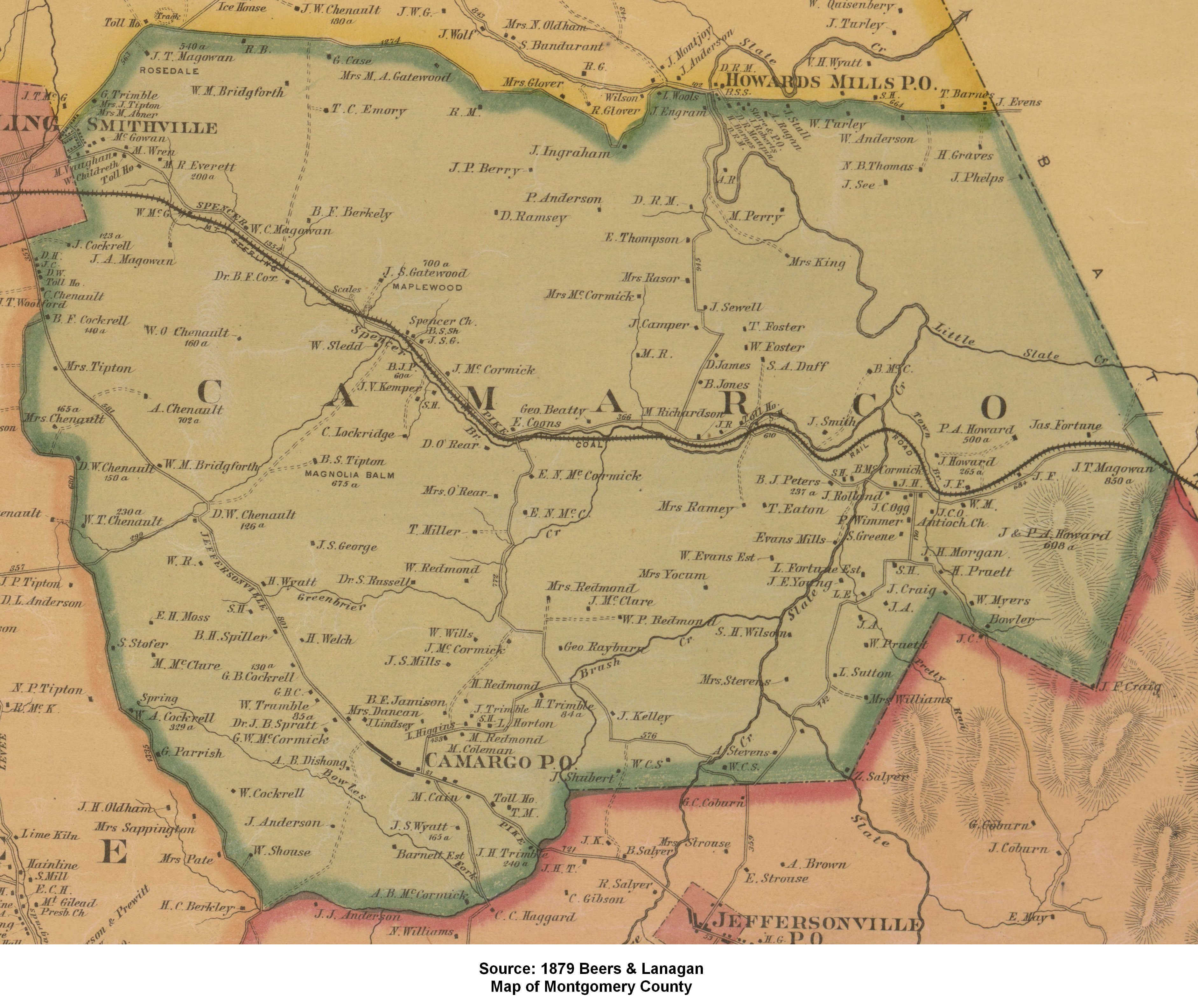
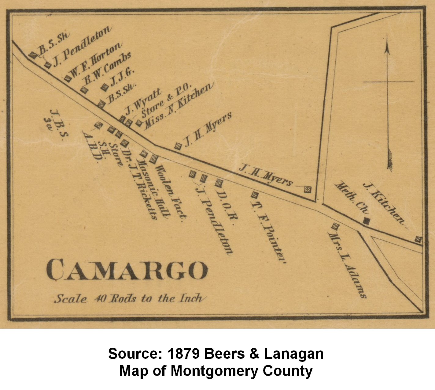
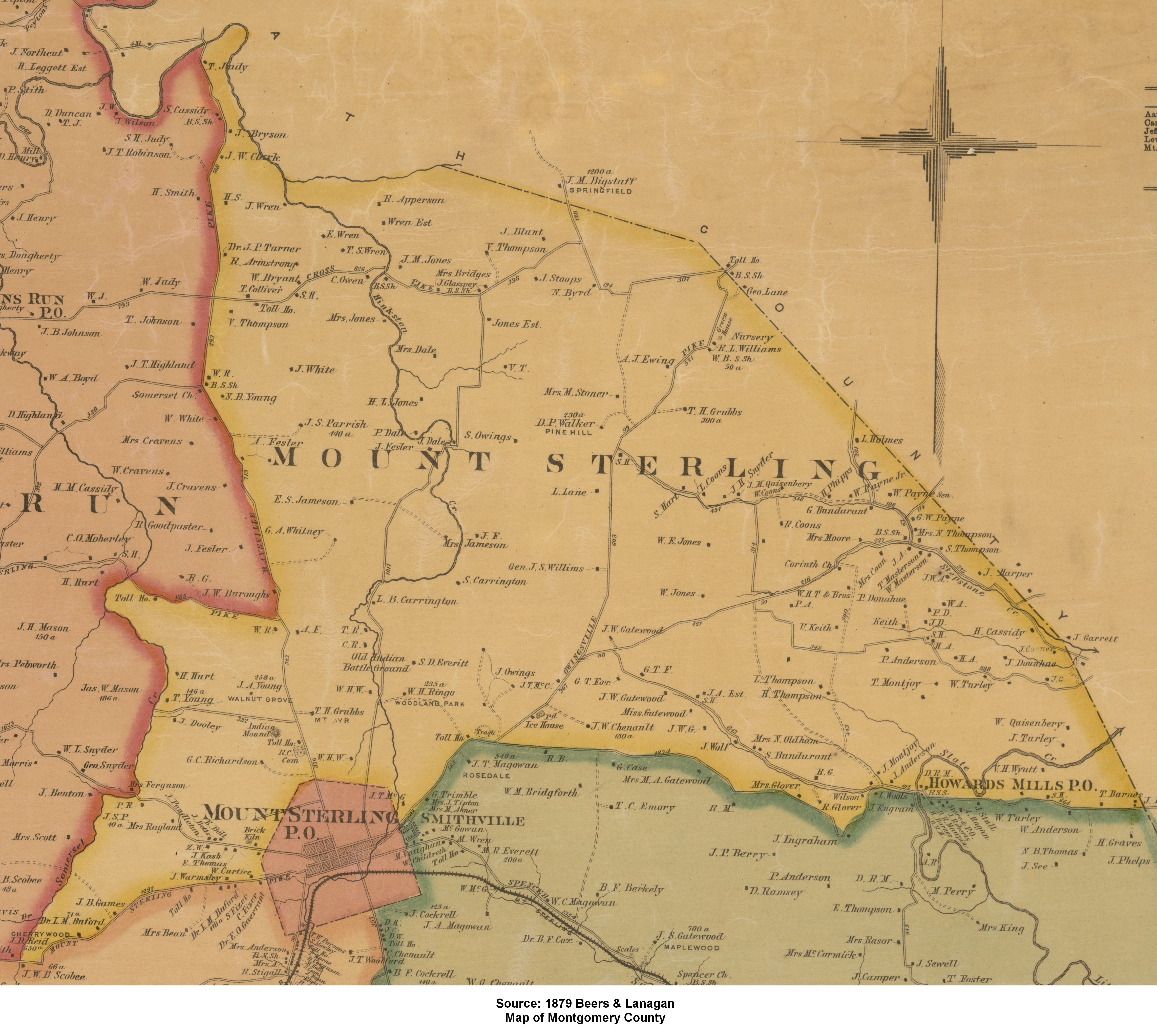
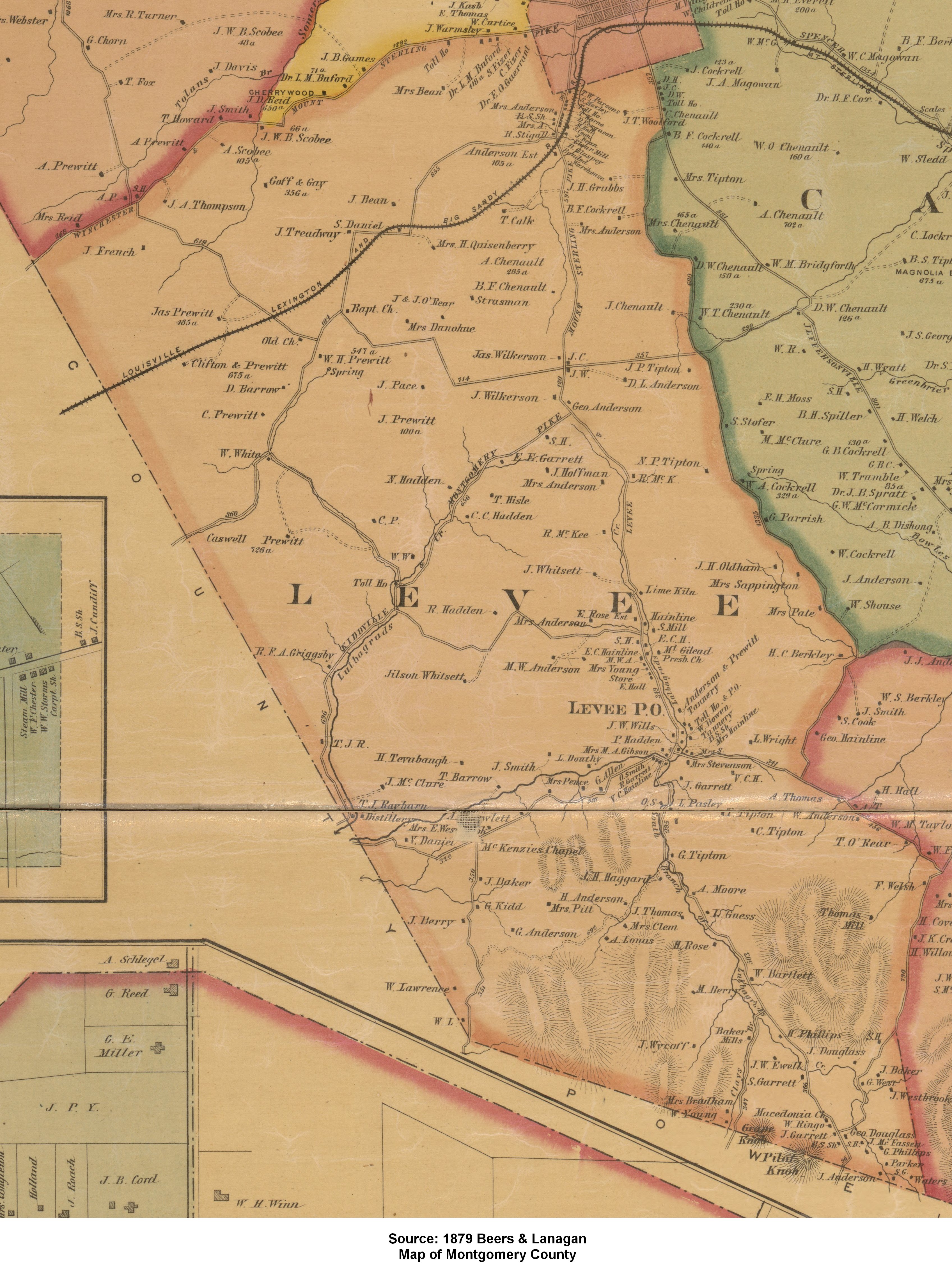
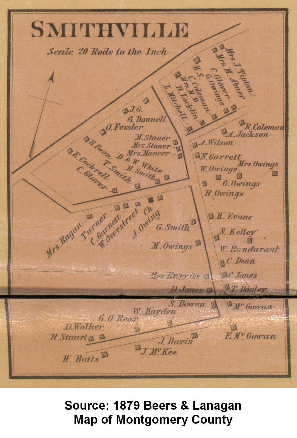
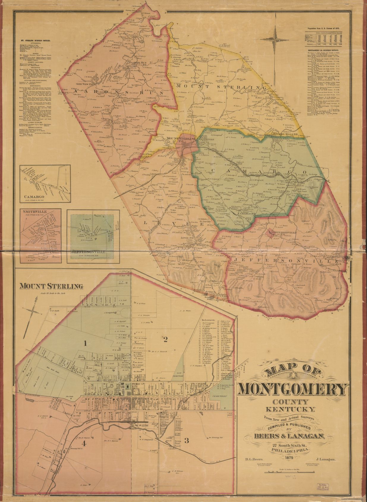
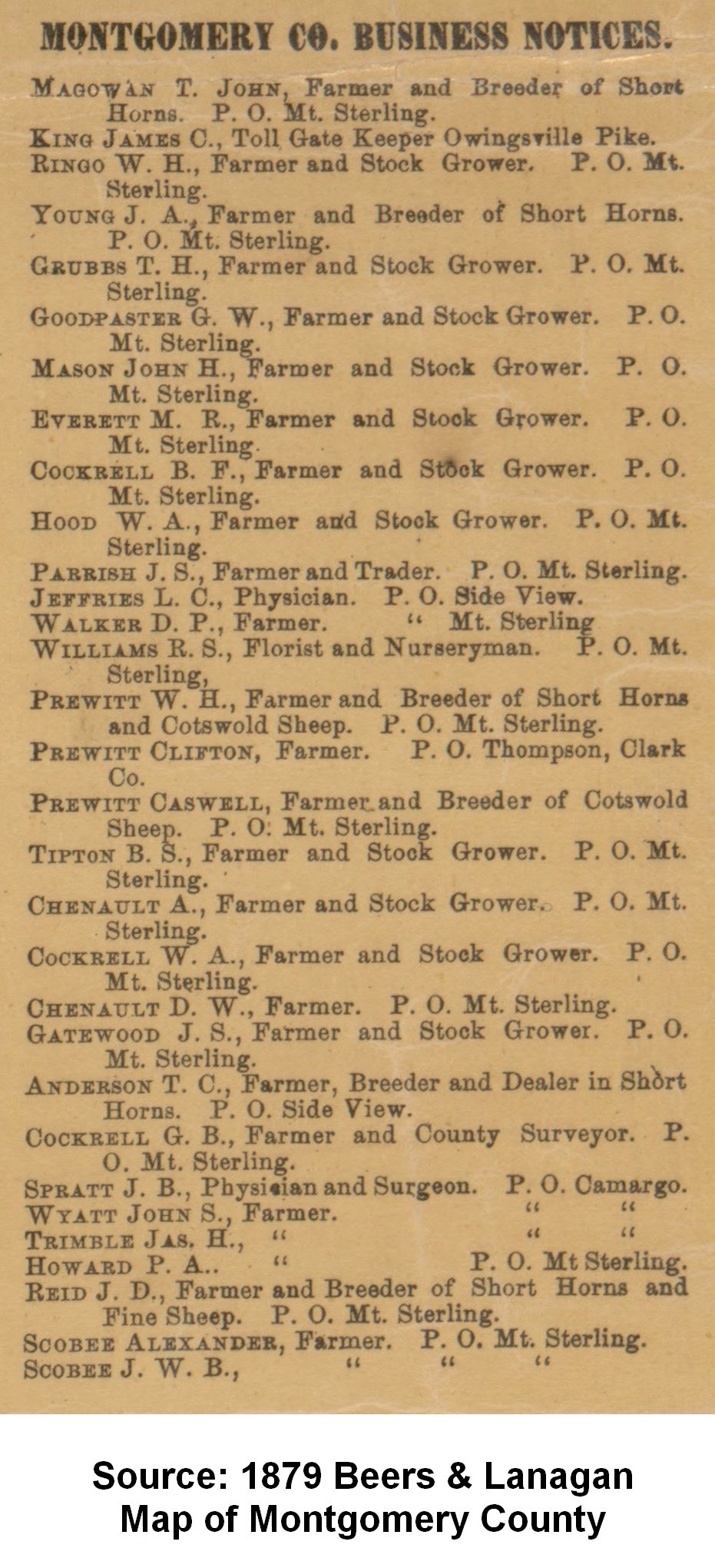
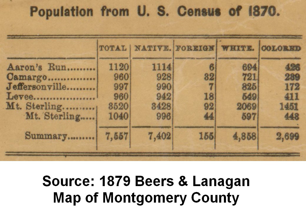
A high resolution map of Montgomery County compiled and published by Beers & Lanagan, Philadelphia, PA in 1879 showing land owners and places of interest. Note: the information shown on such maps is typically several years old by the time the map is drawn and published.
- Aarons Run Precinct
- Camargo Precinct
- Camargo Town
- Mt. Sterling Precinct
- Mt. Sterling Town
- Mt. Sterling Businesses
- Jeffersonville Precinct
- Jeffersonville Town
- Levee Precinct
- Smithville Town
- Montgomery County (full map - small)
- Montgomery County Businesses
- Population
Source: Library of Congress at this location.
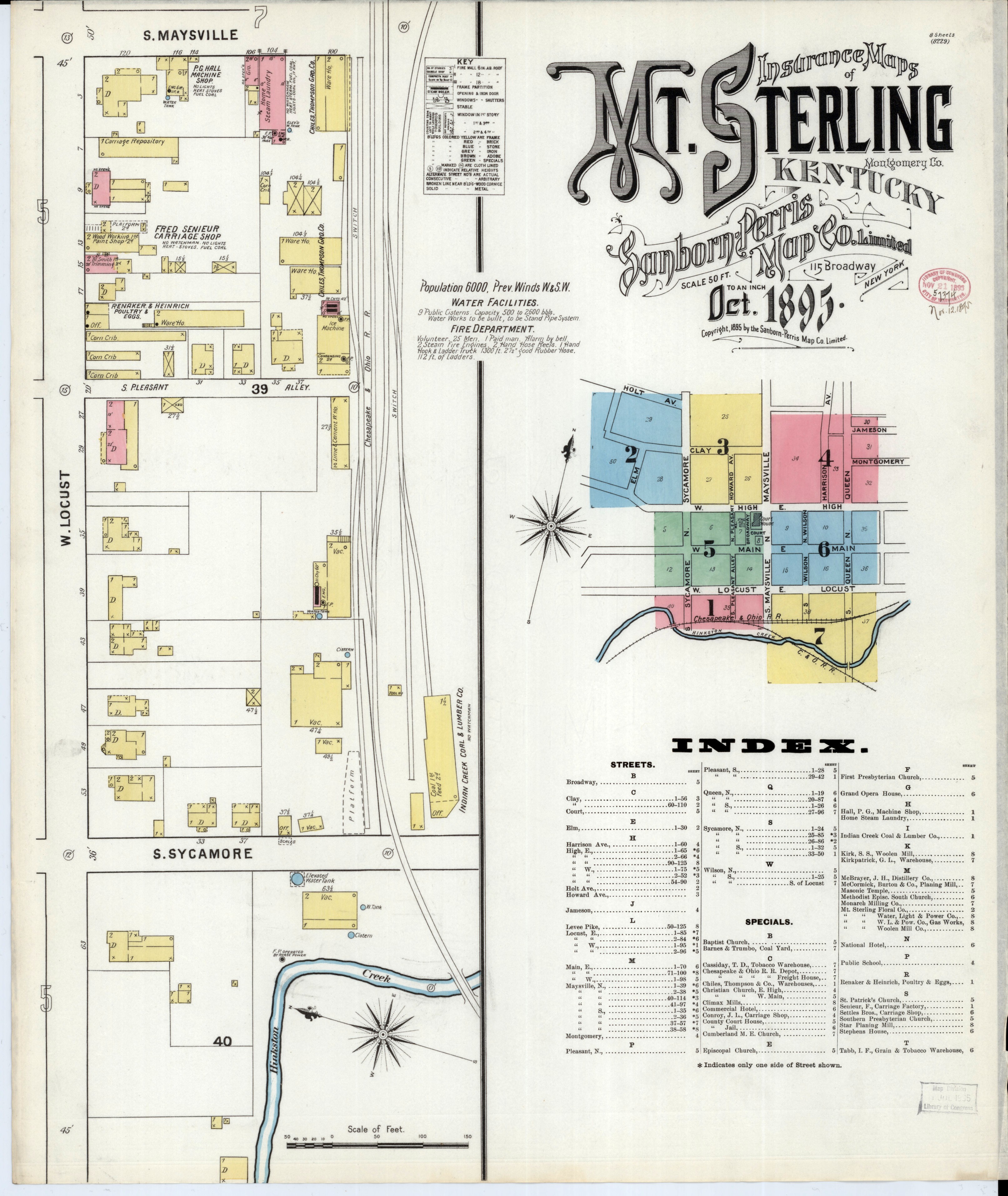
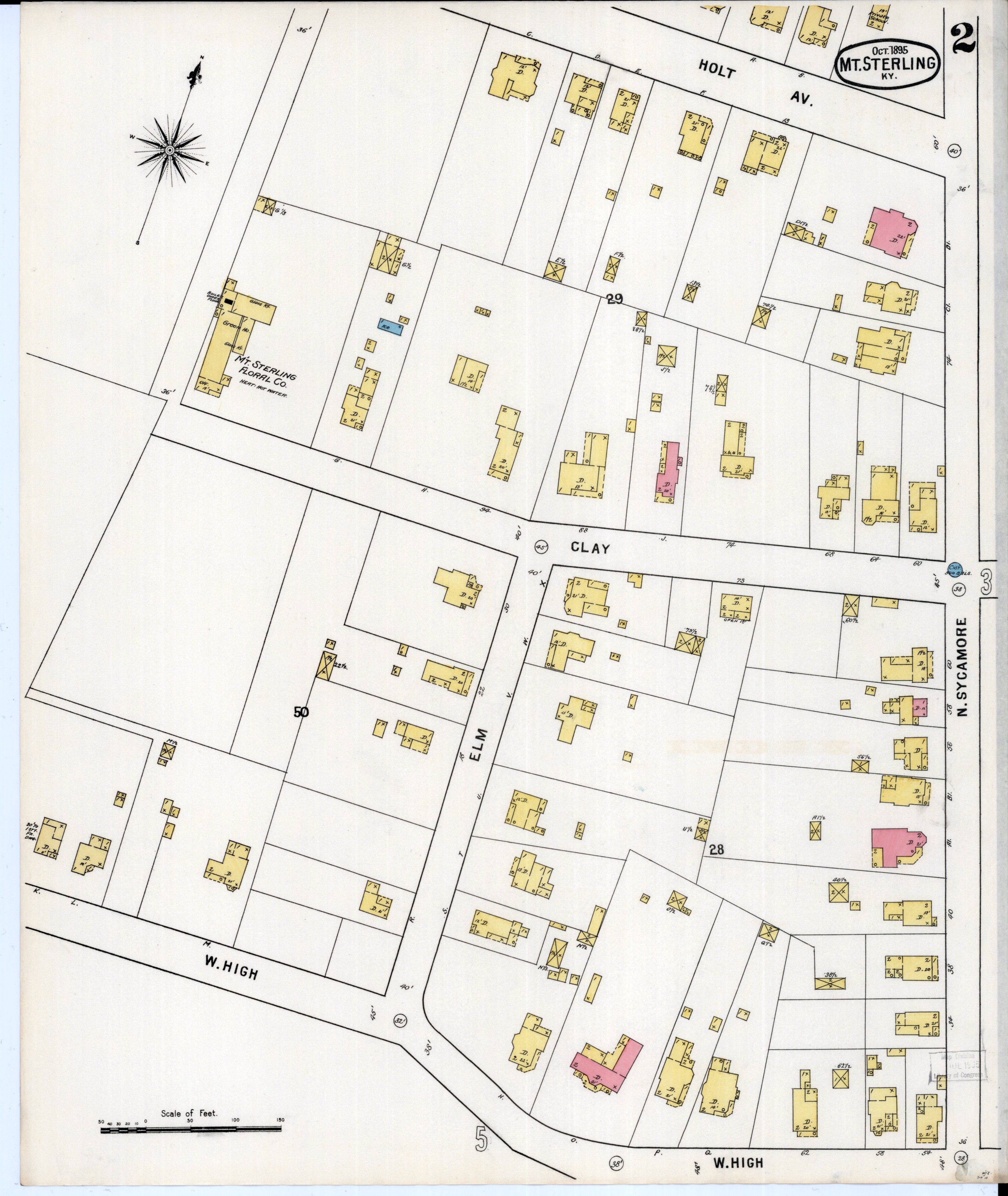
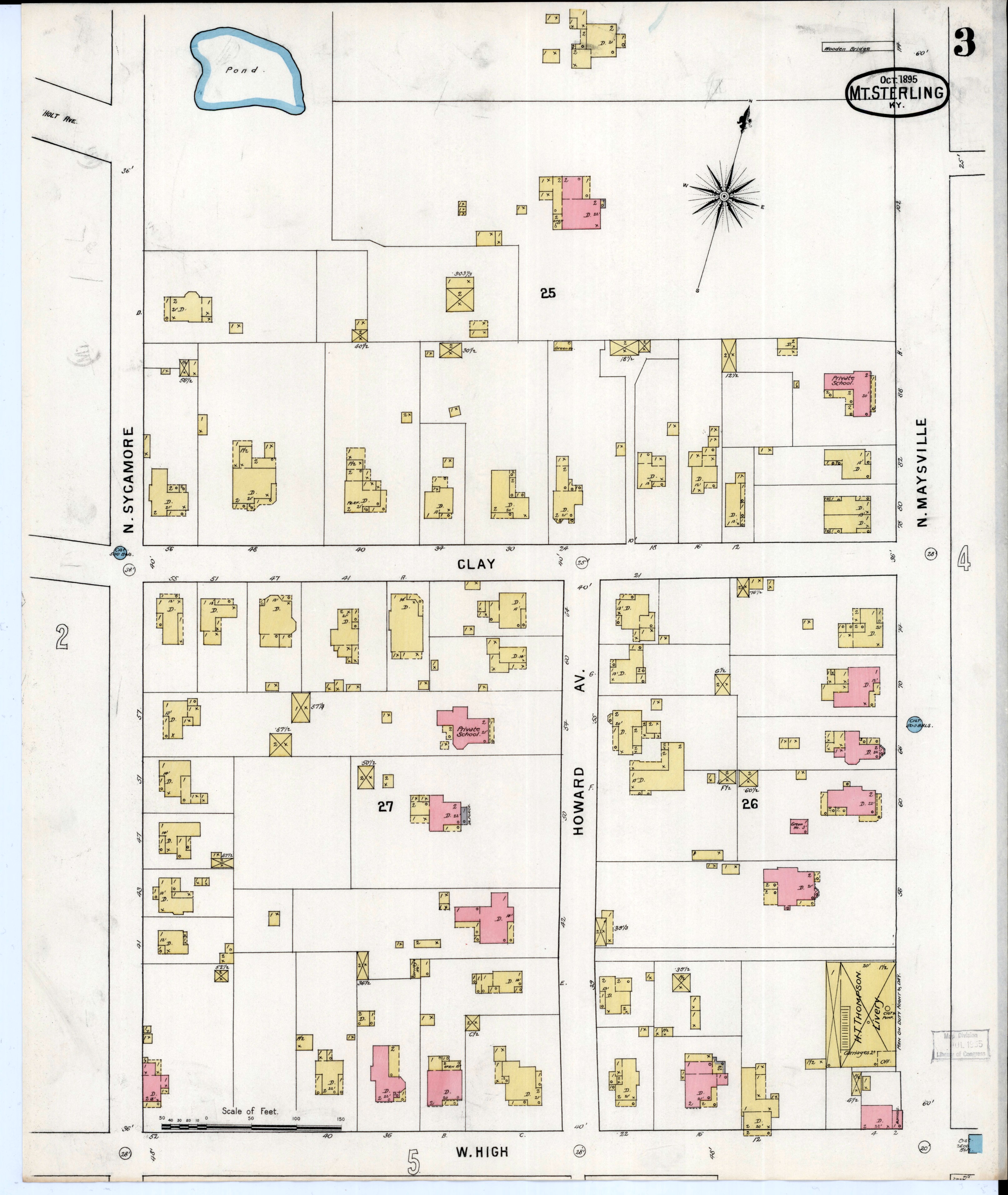
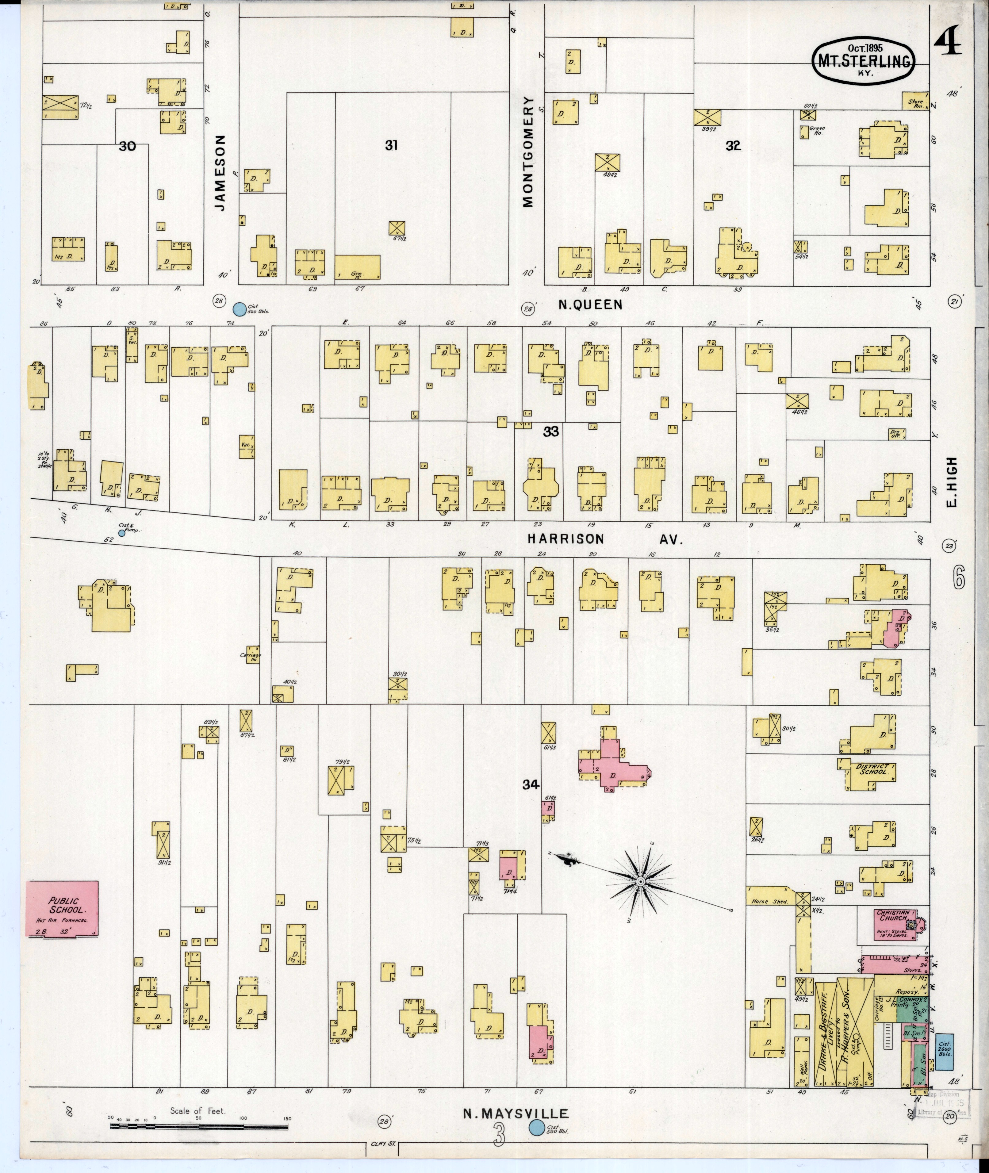
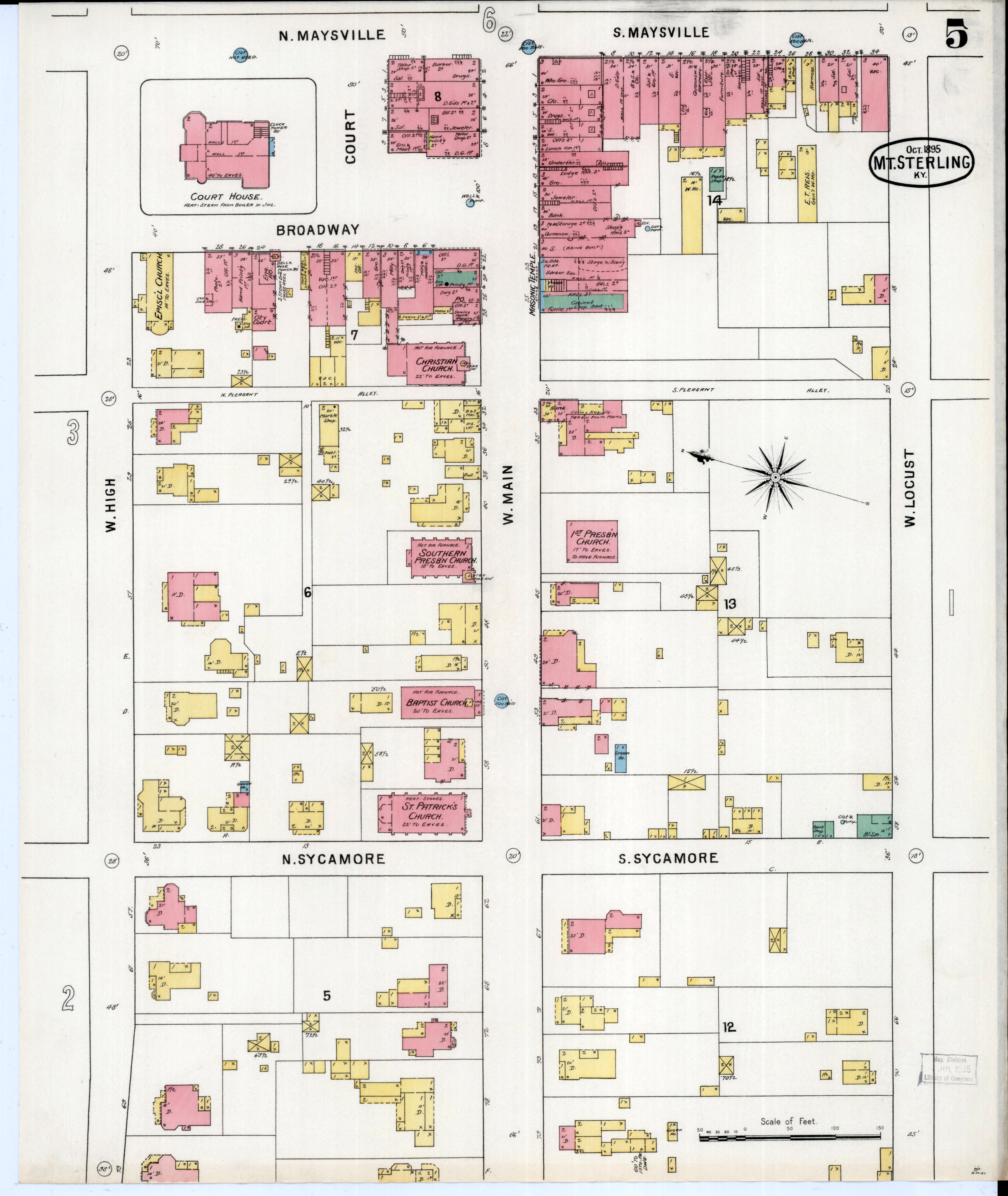
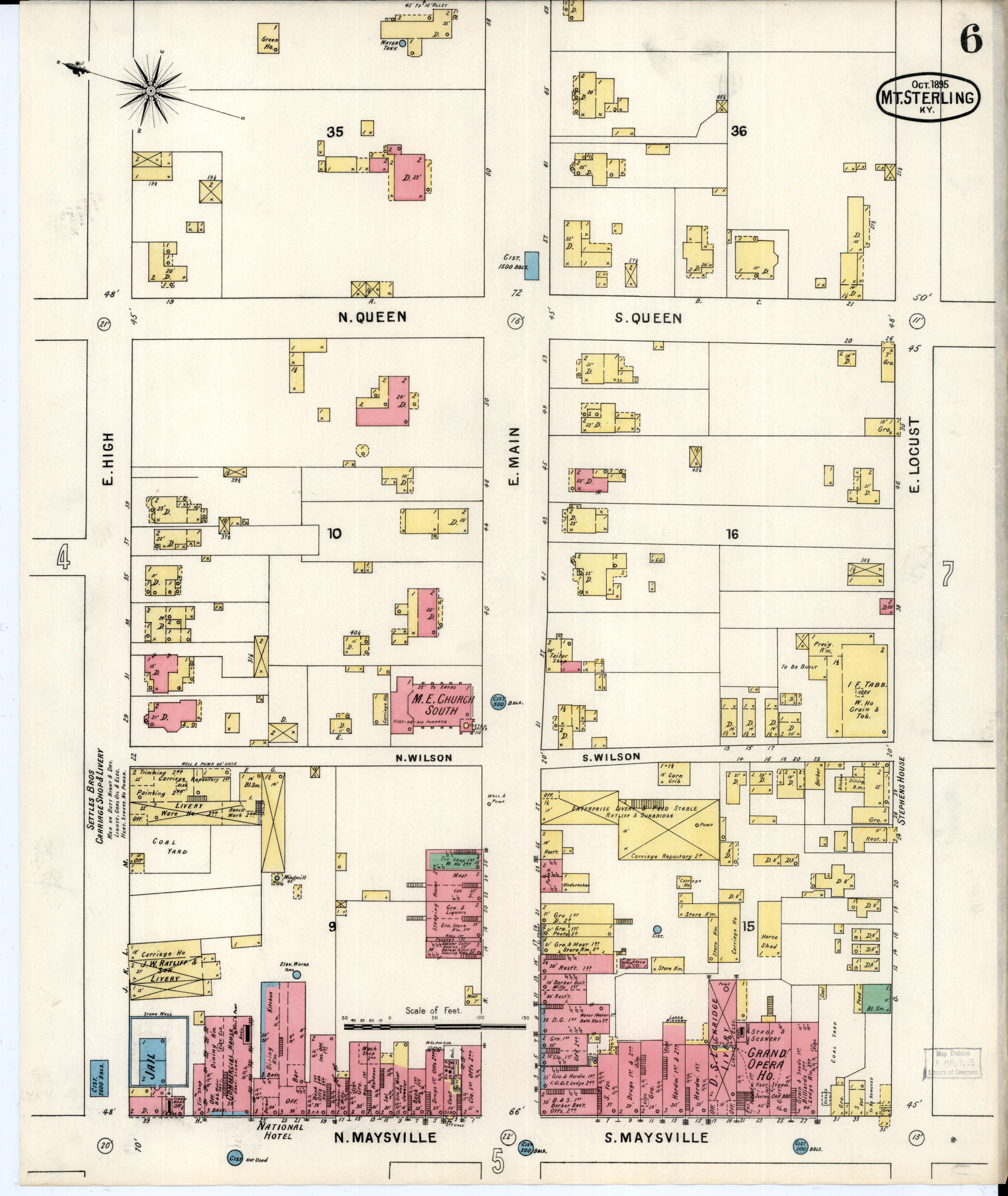
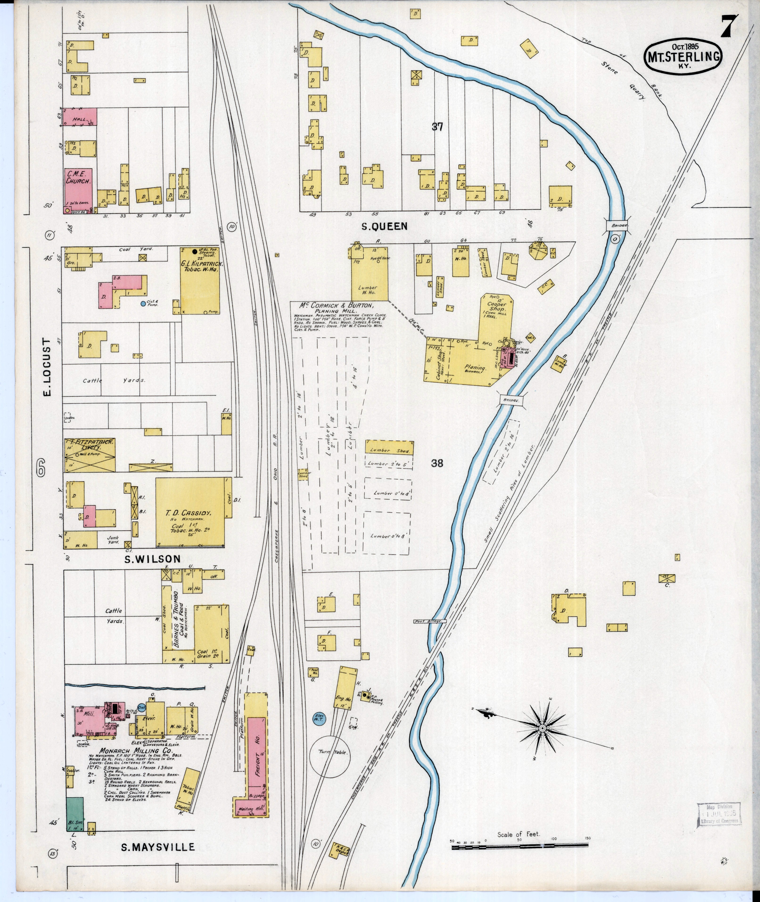
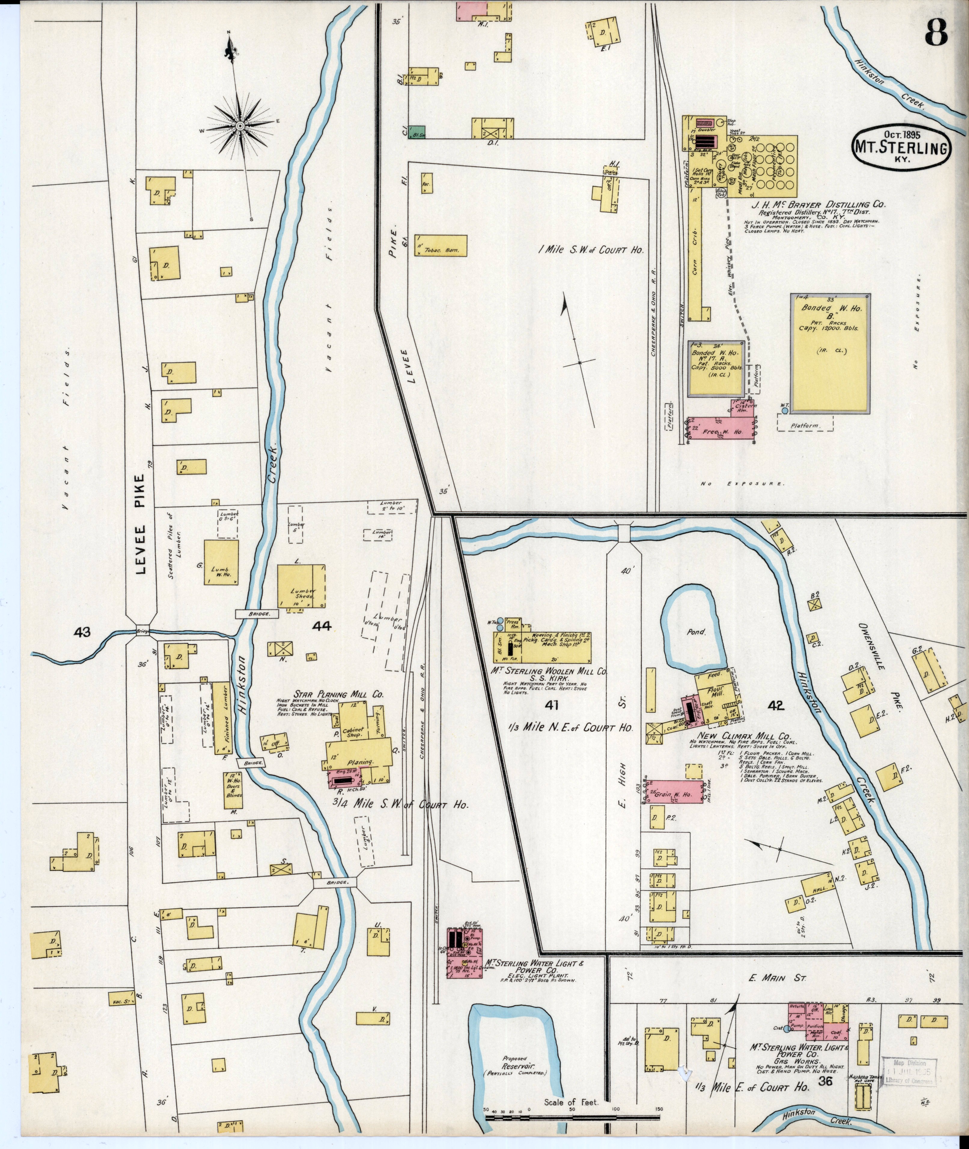
1895
Sanborn Insurance maps of downtown Mt. Sterling, showing businesses, buildings, factories, etc.
Mt. Sterling page 1, Mt. Sterling page 2, Mt. Sterling page 3, Mt. Sterling page 4, Mt. Sterling page 5,
Mt. Sterling page 6, Mt. Sterling page 7, Mt. Sterling page 8
1937
Note: If your browser doesn't permit you to view PDF files online, you may need to download this file and view offline using Adobe Reader or a similar program. You can download a free version of Adobe Reader here.
1948
- Montgomery County and its adjoining counties Bath, Bourbon, Clark, Menifee and Powell have been cropped from Hammond's Complete Map of Kentucky published in 1948. Many of the communities shown are no longer marked with road signs or shown on any maps of this area. NOTE: those are not highways between towns. This is a railroad map.
Contacts

| Marvin Allen |
| Suzanne Shephard |
| Jeff Kemp |